California State Route 12
| ||||
|---|---|---|---|---|
 | ||||
| Route information | ||||
| Defined by Streets and Highways Code § 312 | ||||
| Maintained by Caltrans | ||||
| Length: | 140.64 mi[1] (226.34 km) | |||
| Existed: | 1934[2] – present | |||
| Major junctions | ||||
| West end: |
| |||
|
| ||||
| East end: |
| |||
| Highway system | ||||
| ||||

State Route 12 (SR 12) is a state highway in the U.S. state of California that travels in an east–west direction from Sebastopol in Sonoma County to State Route 49 just north of San Andreas in Calaveras County. It is constructed to freeway standards from the Fulton Road/South Wright Road stoplight in Santa Rosa, to its partial interchange with Farmers Lane (also in Santa Rosa).
Route description
State Route 12 is part of the California Freeway and Expressway System[3] and is eligible for the State Scenic Highway System,[4] however, it is only designated as a scenic highway from its intersection with Danielli Avenue east of Santa Rosa to its junction with London Way near Agua Caliente.[5]
SR 12 has been designated by various state laws and through local usage as the Valley of the Moon Scenic Route (the portion running through Sonoma County, though the first sign with this name is at the intersection of Farmers Lane and Fourth Street in Santa Rosa);[6] Luther Burbank Memorial Highway from Santa Rosa to Sebastopol (after botanist Luther Burbank).[7] SR 12 is also known as Sonoma Highway between Santa Rosa and the west side of the city of Sonoma; Broadway between Sonoma Plaza and its junction with SR 121 in Schellville; Carneros Highway for the length of its concurrency with 121 between Schellville and its junction and the north end of its concurrency with SR 29 near Napa;[8] Jameson Canyon Road from where its concurrency with SR 29 ends in American Canyon to its junction with I-80 in Cordelia; and Rio Vista Highway from I-80 to SR 160 east of Rio Vista,[9][10] and informally as "Blood Alley" from Lodi to Fairfield.[11] The segment through Lodi to the overlap with SR 99 is on Kettleman Lane.[12]
There are six segments that are overlaps with other highways: in the Napa and Sonoma valleys with SR 121, in the southern Napa Valley with SR 29, a short overlap with I-80 at Cordelia Junction in Fairfield, another short overlap with SR 99 in Lodi, and overlaps with SR 88 and SR 26 in the Sierra foothills. The highway is mainly two lane rural highway, with the exception of short segments in Santa Rosa and Fairfield/Suisun City, the overlaps with I-80 and SR 99, and segments within developed areas, such as Santa Rosa and Lodi.[12][13]
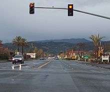
SR 12 begins in the west at its junction with SR 116 in Sebastopol. After passing east through Santa Rosa on a mix of freeway, surface street, and expressway, it turns south into the Sonoma Valley, passing the Jack London State Historic Park at Glen Ellen. It winds through Sonoma on surface streets, where the historic Vallejo Estate and Sonoma Mission, both part of the Sonoma State Historic Park, are.[12][13]
South of Sonoma, SR 12 turns east, joining SR 121 for nearly nine miles, then turns south briefly as it leaves SR 121 and joins the four-lane expressway SR 29 to cross the Napa River. Four miles after joining SR 29 it splits off towards the east on Jameson Canyon Road; this section is also the 1928 re-alignment of the Lincoln Highway, the first road across America. After a brief merge with Interstate 80, SR 12 branches off to the east as an expressway through Fairfield and Suisun City. East of Suisun it becomes two lanes again and crosses south of Travis Air Force Base, through rolling fields with numerous wind turbines. Just past Braid's Bridge is the Western Railway Museum. At Rio Vista, SR 12 crosses the Helen Madere Memorial Bridge over the Sacramento River, entering the California Delta.[12][13]
This stretch of the river has twice been the site of much-publicized inland excursions by humpback whales, presumably veering off course while making their annual migrations along the Pacific coast. In 1985 Humphrey the whale swam about as far as the Rio Vista Bridge. In 2007 a humpback mother and calf dubbed Delta and Dawn circled for several days just upstream of the bridge, seemingly reluctant to pass under it again after having spent the previous three or four weeks upriver near Sacramento.
From the Sacramento River to the junction with Interstate 5, SR 12 crosses several of the waterways of the California Delta and the low-lying fields between them. Through Lodi it becomes a wide four lane business route. After another brief merger with another freeway, this time SR 99, SR 12 heads east into the Sierra foothills (with shared segments with SR 88 and SR 26) before ending at the junction with SR 49 just north of San Andreas.[12][13]
History

Before the 1964 renumbering, this route was signed as Sign Route 12 for most of its length. However, SR 12 was designated as Legislative Route 51 (LR 51) from SR 116 to SR 121 before the 1964 renumbering. Portions of the route from SR 29 to I-80 ran concurrently with State Route 29 or with State Route 37; this was also LR 8 and a former routing of US 40. The portion from I-80 to then-US 99 was designated as LR 53 in 1919; from US 99 to SR 49, it was designated as LR 24.[14]
In 1976, the discontinuity resulting from the concurrency with State Route 84 was removed.[14]
Future
Plans call for a western extension of its western terminus to State Route 1 near Bodega Bay.[15] Plans also called for Route 12 to be built as a freeway from Farmers Lane to Melita Road, in Santa Rosa, however this project was delayed due to community opposition.
Major intersections
Except where prefixed with a letter, postmiles were measured on the road as it was in 1964, based on the alignment that existed at the time, and do not necessarily reflect current mileage. R reflects a realignment in the route since then, M indicates a second realignment, L refers an overlap due to a correction or change, and T indicates postmiles classified as temporary (for a full list of prefixes, see the list of postmile definitions).[16] Segments that remain unconstructed or have been relinquished to local control may be omitted. The numbers reset at county lines; the start and end postmiles in each county are given in the county column.
| County | Location | Postmile [16][17][18] | Exit [19] | Destinations | Notes |
|---|---|---|---|---|---|
| Sonoma SON 9.12-41.36 | Sebastopol | 9.12 | Bodega Avenue – Bodega Bay | Continuation beyond SR 116 | |
| 9.12 | West end of SR 12 | ||||
| Santa Rosa | R12.94 | Fulton Road, Wright Road | |||
| | West end of freeway | ||||
| R14.45 | 5 | Stony Point Road | |||
| R15.30 | 6 | Dutton Avenue | |||
| R16.04 | 7A | Signed as exits 7A (south) and 7B (north) westbound; US 101 exits 488B | |||
| R16.63 | 7B | South E Street – Downtown Santa Rosa | Signed as exit 7C westbound | ||
| | East end of freeway | ||||
| T17.53 | Farmers Lane | ||||
| Schellville | 41.36 7.44[N 1] | West end of SR 121 overlap | |||
| Napa NAP 0.00-3.31 | Napa | R4.47[N 1] R8.66[N 2] | East end of SR 121 overlap; west end of SR 29 overlap | ||
| | R6.20[N 2] | ||||
| | 4.71 0.00[N 2] | East end of SR 29 overlap | |||
| Solano SOL 0.00-26.41 | Fairfield | R2.79 R11.98[N 3] | West end of I-80 overlap; westbound exit and eastbound entrance; I-80 east exit 39/Red Top Road, west exit 39B | ||
| | West end of freeway on I-80 | ||||
| 12.74[N 3] | 40 | Green Valley Road | Westbound exit is part of exit 41 | ||
| 12.84[N 3] | 40 | I-680 north exits 17A-B | |||
| 13.49[N 3] | 41 | Suisun Valley Road, Pittman Road | |||
| 15.82[N 3] L1.80 | East end of I-80 overlap; eastbound exit and westbound entrance; I-80 west exit 43 | ||||
| L2.22 | 56 | ||||
| | East end of freeway | ||||
| Suisun City | R4.47 | 58A | Webster Street, Jackson Street – Fairfield | Interchange | |
| R4.57 | 58B | Main Street – Suisun City Business District | Interchange | ||
| | 19.17 | ||||
| Rio Vista | 26.28 | Interchange | |||
| Solano–Sacramento county line | Rio Vista city limit | Rio Vista Bridge over the Sacramento River | |||
| Sacramento SAC 0.00-6.20 | | 0.57 | |||
| San Joaquin SJ 0.00-27.64 | | 10.17 | Interchange; I-5 exit 485 | ||
| | 10.30 | ||||
| Lodi | 15.16 | ||||
| 16.93 | |||||
| 17.95 | Former US 50 / US 99 | ||||
| 18.07 29.50[N 4] | Interchange; west end of SR 99 overlap; SR 99 north exit 264B, south exit 264B | ||||
| | West end of freeway on SR 99 | ||||
| | East end of freeway on SR 99 | ||||
| 30.97[N 4] 18.08 | Interchange; east end of SR 99 overlap; SR 99 exit 266 | ||||
| | L23.29 L12.24[N 5] | West end of SR 88 overlap | |||
| Lockeford | 14.08[N 5] | ||||
| Clements | 19.17[N 5] 23.17 | East end of SR 88 overlap | |||
| Calaveras CAL 0.00-18.20 | Valley Springs | 9.93 | West end of SR 26 overlap | ||
| | 13.87 | East end of SR 26 overlap | |||
| | 18.20 | East end of SR 12 | |||
1.000 mi = 1.609 km; 1.000 km = 0.621 mi
| |||||
- 1 2 Indicates that the postmile represents the distance along SR 121 rather than SR 12.
- 1 2 3 Indicates that the postmile represents the distance along SR 29 rather than SR 12.
- 1 2 3 4 5 Indicates that the postmile represents the distance along I-80 rather than SR 12.
- 1 2 Indicates that the postmile represents the distance along SR 99 rather than SR 12.
- 1 2 3 Indicates that the postmile represents the distance along SR 88 rather than SR 12.
See also
References
- ↑ "January 1, 2006 California Log of Bridges on State Highways". Dot.ca.gov. Retrieved 2011-11-28.
- ↑ "California Highways: State Route 12". Cahighways.org. Retrieved 2011-11-28.
- ↑ "CA Codes (shc:250-257)". Leginfo.ca.gov. Retrieved 2011-11-28.
- ↑ "CA Codes (shc:260-284)". Leginfo.ca.gov. Retrieved 2011-11-28.
- ↑ California Department of Transportation, Officially Designated Scenic Highways Archived December 8, 2009, at the Wayback Machine., accessed 2010-01-03
- ↑ "Archived copy". Archived from the original on 2016-07-09. Retrieved 2006-03-21.
- ↑ 2007 Named Freeways, Highways, Structures and Other Appurtenances in California (PDF). Caltrans. pp. 122–123. Retrieved 2007-03-28.
- ↑ "Archived copy". Archived from the original on 2016-05-22. Retrieved 2012-09-28.
- ↑ California Highway Patrol: CADWEB Name from CHP traffic reports. Archived on Google cache on 2007-09-24. Accessed on 2007-10-01.
- ↑ Google (2007-10-01). "map of Route 12 showing Rio Vista Highway name from I-80 to SR 160" (Map). Google Maps. Google. Retrieved 2007-10-01.
- ↑ Deaths on Highway 12. San Joaquin Record All Eyes on Blood Alley. Recordnet.com. Accessed on 2008-05-12.
- 1 2 3 4 5 California State Automobile Association map Gold Country, 7-05 edition
- 1 2 3 4 California State Automobile Association map San Francisco Bay, 1-09 edition
- 1 2 "California Highways (www.cahighways.org): Routes 9 through 16". www.cahighways.org. Retrieved 2011-11-28.
- ↑ Democrat: County OKs bypass around Forestville Archived March 7, 2012, at the Wayback Machine., accessed 2010-06-15
- 1 2 California Department of Transportation. "State Truck Route List". Sacramento: California Department of Transportation. Archived from the original (XLS file) on June 30, 2015. Retrieved June 30, 2015.
- ↑ California Department of Transportation, Log of Bridges on State Highways Archived November 5, 2016, at the Wayback Machine., July 2007
- ↑ California Department of Transportation, All Traffic Volumes on CSHS, 2005 and 2006
- ↑ California Department of Transportation, California Numbered Exit Uniform System, State Route 12 Freeway Interchanges, Interstate 80 Freeway Interchanges, Retrieved on 2009-02-05.
External links
- California @ AARoads.com – State Route 12
- Caltrans: Route 12 highway conditions
- California Highways: Route 12
| Wikimedia Commons has media related to California State Route 12. |