Exeter, California
| Exeter, California | |
|---|---|
| City | |
|
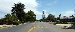
CA Hwy 65 through Exeter | |
| Motto: Citrus Capital of the World[1] | |
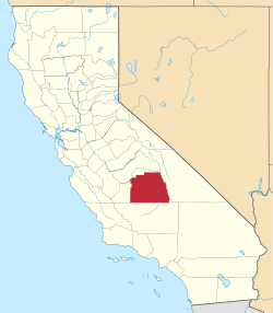
 Location in Tulare County and the state of California | |
 Exeter, California Location in the United States | |
| Coordinates: 36°17′39″N 119°8′34″W / 36.29417°N 119.14278°WCoordinates: 36°17′39″N 119°8′34″W / 36.29417°N 119.14278°W | |
| Country |
|
| State |
|
| County | Tulare |
| Incorporated | March 2, 1911[2] |
| Government | |
| • Type | Council-Manager |
| • City council[3] |
Gary Standley, Mayor Teresa Boyce Dale Sally Mary Waterman Gordon Gerdes |
| • City manager | Randy Groom[3] |
| Area[4] | |
| • Total | 2.463 sq mi (6.379 km2) |
| • Land | 2.463 sq mi (6.379 km2) |
| • Water | 0 sq mi (0 km2) 0% |
| Elevation | 390 ft (119 m) |
| Population (April 1, 2010) | |
| • Total | 10,334 |
| • Density | 4,200/sq mi (1,600/km2) |
| Time zone | Pacific (UTC-8) |
| • Summer (DST) | PDT (UTC-7) |
| ZIP code | 93221 |
| Area code | 559 |
| FIPS code | 06-23126 |
| GNIS feature ID | 1652707 |
| Website |
www |
Exeter is a city in Tulare County, California, United States. It is situated in the San Joaquin Valley near the foothills of the Sierra Nevada Mountain Range. The population was 10,334 at the 2010 census.
Exeter is located on State Highway 65, 2 miles (3.2 km) south of Highway 198 and 15 miles (24 km) east of Highway 99. Exeter is within a 3 to 4 hour drive of both Los Angeles and San Francisco, and 30 minutes from the entrance to Sequoia National Park.
The public school system in Exeter consists of: Exeter Union High School (9-12), the Wilson Middle School (6-8), Rocky Hill Elementary (K-5), Lincoln Elementary (K-5) and Kaweah High School (a continuation high school). The 1999-2000 enrollment was: grades K-8, 1,936 and grades 9-12, 1101 students.
History

Before the arrival of European settlers, Yokuts settled around an area in an oak forest two miles north of Exeter. This oak forest was later the site of a Spanish Jesuit Mission, and was subsequently abandoned before the 1830s. The current town site was a plain that possessed elk, antelope, frogs, and deer.[1] Rocky Hill, to the east of the city, offered shelter to native tribes when the plain flooded. Several caves on the hill contain petroglyphs, though some of the most important of these were destroyed by local vandals/looters and poorly managed and unsupervised steer.
The town site traces its roots to the construction of a railroad line through the San Joaquin Valley, by 1888 a line passed through the area. A representative of the Southern Pacific Railroad, D.W. Parkhurst, purchased the land from an early settler, John Firebaugh, and formed the town which he named after his own hometown of Exeter, England.[1]

The damming of the Kaweah valley during the 1930s provided a reliable source of water for agriculture. Cattle ranching grew at the beginning of the 20th century, led by the Gill Cattle Company, which opened in the late 1800s and was once the largest such business in the United States.[1] The town incorporated in 1911. In October, 1929, Exeter was the site of a large Anti-Filipino race riot. A mob stormed a Filipino work camp, bludgeoning 50 Filipino laborers and burning their camp to the ground. This race-riot sparked a wave of Anti-Filipino hatred. In 2006 the Exeter city of commerce officially apologized for such actions and offered restitution to survivors.[5]
Professional artists depicting the history of the area have painted huge murals on exterior walls throughout the downtown area. There are currently 28 murals in this outdoor art gallery.[6]
Demographics
| Historical population | |||
|---|---|---|---|
| Census | Pop. | %± | |
| 1920 | 1,852 | — | |
| 1930 | 2,685 | 45.0% | |
| 1940 | 3,883 | 44.6% | |
| 1950 | 4,078 | 5.0% | |
| 1960 | 4,264 | 4.6% | |
| 1970 | 4,475 | 4.9% | |
| 1980 | 5,606 | 25.3% | |
| 1990 | 7,276 | 29.8% | |
| 2000 | 9,168 | 26.0% | |
| 2010 | 10,334 | 12.7% | |
| Est. 2015 | 10,548 | [7] | 2.1% |
2010
The 2010 United States Census[9] reported that Exeter had a population of 10,334. The population density was 4,195.6 people per square mile (1,619.9/km²). The racial makeup of Exeter was 7,150 (69.2%) White, 67 (0.6%) African American, 171 (1.7%) Native American, 138 (1.3%) Asian, 8 (0.1%) Pacific Islander, 2,416 (23.4%) from other races, and 384 (3.7%) from two or more races. Hispanic or Latino of any race were 4,703 persons (45.5%).
The Census reported that 10,261 people (99.3% of the population) lived in households, 57 (0.6%) lived in non-institutionalized group quarters, and 16 (0.2%) were institutionalized.
There were 3,378 households, out of which 1,552 (45.9%) had children under the age of 18 living in them, 1,801 (53.3%) were opposite-sex married couples living together, 575 (17.0%) had a female householder with no husband present, 227 (6.7%) had a male householder with no wife present. There were 233 (6.9%) unmarried opposite-sex partnerships, and 12 (0.4%) same-sex married couples or partnerships. 652 households (19.3%) were made up of individuals and 313 (9.3%) had someone living alone who was 65 years of age or older. The average household size was 3.04. There were 2,603 families (77.1% of all households); the average family size was 3.45.
The population was spread out with 3,285 people (31.8%) under the age of 18, 1,020 people (9.9%) aged 18 to 24, 2,586 people (25.0%) aged 25 to 44, 2,255 people (21.8%) aged 45 to 64, and 1,188 people (11.5%) who were 65 years of age or older. The median age was 31.2 years. For every 100 females there were 94.5 males. For every 100 females age 18 and over, there were 90.4 males.
There were 3,600 housing units at an average density of 1,461.6 per square mile (564.3/km²), of which 2,036 (60.3%) were owner-occupied, and 1,342 (39.7%) were occupied by renters. The homeowner vacancy rate was 3.4%; the rental vacancy rate was 6.3%. 6,111 people (59.1% of the population) lived in owner-occupied housing units and 4,150 people (40.2%) lived in rental housing units.
2000
As of the census[10] of 2000, there were 9,168 people, 3,001 households, and 2,325 families residing in the city. The population density was 4,110.9 people per square mile (1,587.3/km²). There were 3,168 housing units at an average density of 1,420.5 per square mile (548.5/km²). The racial makeup of the city was 69.73% White, 0.69% African American, 1.47% Native American, 1.30% Asian, 0.04% Pacific Islander, 23.20% from other races, and 3.57% from two or more races. Hispanic or Latino of any race were 38.25% of the population.
There were 3,001 households out of which 45.1% had children under the age of 18 living with them, 55.6% were married couples living together, 15.6% had a female householder with no husband present, and 22.5% were non-families. 18.8% of all households were made up of individuals and 9.9% had someone living alone who was 65 years of age or older. The average household size was 3.02 and the average family size was 3.43.

In the city the population was spread out with 33.7% under the age of 18, 10.1% from 18 to 24, 26.8% from 25 to 44, 18.2% from 45 to 64, and 11.1% who were 65 years of age or older. The median age was 30 years. For every 100 females there were 92.9 males. For every 100 females age 18 and over, there were 89.9 males.
The median income for a household in the city was $33,738, and the median income for a family was $37,033. Males had a median income of $32,308 versus $27,371 for females. The per capita income for the city was $13,795. About 14.2% of families and 19.4% of the population were below the poverty line, including 24.8% of those under age 18 and 12.0% of those age 65 or over.
Kenny Guinn, former governor of Nevada, was raised here as a child. Robert List, former governor of Nevada, was raised in Exeter, too.
 |
Ivanhoe | Woodlake | Lake Kaweah | |
| Visalia | |
Sequoia National Park | ||
| ||||
| | ||||
| Tulare | Lindsay | Sequoia National Park |
| Exeter, California | ||||||||||||||||||||||||||||||||||||||||||||||||||||||||||||
|---|---|---|---|---|---|---|---|---|---|---|---|---|---|---|---|---|---|---|---|---|---|---|---|---|---|---|---|---|---|---|---|---|---|---|---|---|---|---|---|---|---|---|---|---|---|---|---|---|---|---|---|---|---|---|---|---|---|---|---|---|
| Climate chart (explanation) | ||||||||||||||||||||||||||||||||||||||||||||||||||||||||||||
| ||||||||||||||||||||||||||||||||||||||||||||||||||||||||||||
| ||||||||||||||||||||||||||||||||||||||||||||||||||||||||||||
Economy
Major employers in Exeter include Waterman Industries, Svenhard’s Swedish Bakery and Peninsula Packaging.[11]
Geography
Exeter is located at 36°17′39″N 119°8′34″W / 36.29417°N 119.14278°W (36.294213, -119.142746).[12]
According to the United States Census Bureau, the city has a total area of 2.5 square miles (6.5 km2), all of it land.
Climate
- July is the average warmest month.
- The highest recorded temperature was 114 °F in 2007.
- On average, the coolest month is December.
- The lowest recorded temperature was 17 °F in 1990.
- The maximum average precipitation occurs in March.
Government
In the California State Legislature, Exeter is in the 16th Senate District, represented by Republican Jean Fuller, and in the 26th Assembly District, represented by Republican Devon Mathis.[13]
In the United States House of Representatives, Exeter is in California's 22nd congressional district, represented by Republican Devin Nunes[14]
The current mayor is Gary Standley[3]
Tourism
Due to Exeter's close proximity to the Sequoia National Forrest, Exeter receives a large number of tourists each year. Exeter is known for it's 26 murals, that represents it's rich agricultural history. In addition to the murals, Exeter's downtown district is home to many antique shops along with quaint cafes.
Notable people
References
- 1 2 3 4 , City of Exeter, Accessed August 6, 2009.
- ↑ "California Cities by Incorporation Date" (Word). California Association of Local Agency Formation Commissions. Retrieved August 25, 2014.
- 1 2 3 "City Council". City of Exeter. Retrieved May 14, 2015.
- ↑ "2010 Census U.S. Gazetteer Files – Places – California". United States Census Bureau.
- ↑ "Racial Hatred Once Flared on Central Coast". The Weekend Pinnacle Online. Retrieved 2010-06-06.
- ↑ Exeter’s Mural Guide, Exeter Chamber of Commerce, Accessed August 6, 2009.
- ↑ "Annual Estimates of the Resident Population for Incorporated Places: April 1, 2010 to July 1, 2015". Retrieved July 2, 2016.
- ↑ "Census of Population and Housing". Census.gov. Retrieved June 4, 2015.
- ↑ "2010 Census Interactive Population Search: CA - Exeter city". U.S. Census Bureau. Retrieved July 12, 2014.
- ↑ "American FactFinder". United States Census Bureau. Retrieved 2008-01-31.
- ↑ Tulare Valley Economic Development Corporation Major Employers
- ↑ "US Gazetteer files: 2010, 2000, and 1990". United States Census Bureau. 2011-02-12. Retrieved 2011-04-23.
- ↑ "Statewide Database". Regents of the University of California. Retrieved May 14, 2015.
- ↑ "California's 22nd Congressional District - Representatives & District Map". Civic Impulse, LLC. Retrieved October 5, 2014.
External links
| Wikivoyage has a travel guide for Exeter, California. |
- Exeter Chamber of Commerce
- Official website
- Exeter Police Department
- Exeter's murals
- Foothill-Sun Gazette Newspaper
- Exeter Public Schools