California protected areas

According to the California Protected Areas Database (CPAD), in the state of California, United States, there are over 14,000 inventoried protected areas administered by public agencies and non-profits. In addition, there are private conservation areas and other easements.[1] They include almost one-third of California's scenic coastline, including coastal wetlands, estuaries, beaches, and dune systems. The California State Parks system alone has 270 units and covers 1.3 million acres (5,300 km2), with over 280 miles (450 km) of coastline, 625 miles (1,006 km) of lake and river frontage, nearly 18,000 campsites, and 3,000 miles (5,000 km) of hiking, biking, and equestrian trails.
Obtaining an accurate total of all protected land in California and elsewhere is a complex task. Many parcels have inholdings, private lands within the protected areas, which may or may not be accounted for when calculating total area. Also, occasionally one parcel of land is included in two or more inventories. Over 90% of Yosemite National Park for example, is listed both as wilderness by the National Wilderness Preservation System, and as national park land by the National Park Service. The Cosumnes River Preserve is an extreme example, owned and managed by a handful of public agencies and private landowners, including the Bureau of Land Management, the County of Sacramento and The Nature Conservancy. Despite the difficulties, the CPAD gives the total area of protected land at 49,000,000 acres (200,000 km2), or 46.7% of the state (not including easements); a considerable amount for the most populous state in the country.
National Park System
The U.S. National Park System controls a large and diverse group of California parks, monuments, recreation areas and other units which in total exceed 6,240,000 acres (25,300 km2).[2] The best known is Yosemite National Park, noted for several iconic natural features including Yosemite Falls, El Capitan and Half Dome, which is displayed on the reverse side of the California state quarter. Other prominent parks are the Kings Canyon-Sequoia National Park complex, Redwood National Park, Channel Islands National Park, Joshua Tree National Park and the largest, Death Valley National Park. The NPS also administers the Manzanar National Historic Site in Inyo County.
National parks |
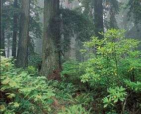
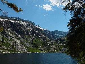
 Yosemite Valley in Yosemite National Park |
National monuments(administered by the NPS)
|
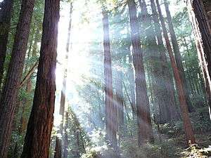 Old-growth forest at Muir Woods National Monument |
National recreation areas |
 Yucca plant near coast of Santa Monica Mountains National Recreation Area |
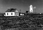
National seashores |
 Palomarin Beach at Point Reyes National Seashore |
National preserves |
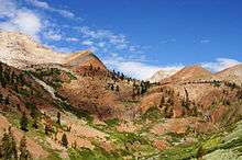
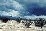
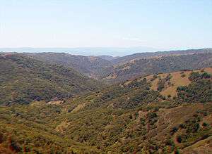
 Castle Peaks in Mojave National Preserve |
National Landscape Conservation System
The Bureau of Land Management’s National Landscape Conservation System (NLCS) includes over 850 federally recognized areas and in California, manages 15,500,000 acres (63,000 km2) of public lands, nearly 15% of the state's land area.[3] The National Landscape Conservation System is composed of several types of units: national monuments (distinct from the same-named units within the National Park System), national conservation areas, forest reserves, outstanding natural areas, national scenic and historic trails, wilderness, wilderness study areas, and others.
National monuments(administered by the BLM)
|
National conservation areas
|
||
Forest reserves |
Outstanding natural areas |
||
National scenic and historic trails |
 Golden Trout Wilderness along the Pacific Crest Trail |
Wilderness and wilderness study areasTotal BLM-managed wilderness land in California is 3,725,230 acres (15,075.5 km2).[4] |


National Marine Sanctuaries

The National Marine Sanctuary System is managed by the Office of Marine Sanctuaries, of the National Oceanic and Atmospheric Administration.
California has four of the thirteen U.S. National Marine Sanctuaries:
- Channel Islands National Marine Sanctuary
- Cordell Bank National Marine Sanctuary
- Gulf of the Farallones National Marine Sanctuary
- Monterey Bay National Marine Sanctuary- one of the largest in the world at 5,300 square miles (14,000 km2).[5]
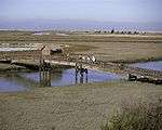
National Wildlife Refuges
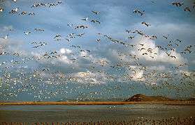
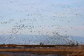
National Wildlife Refuge (NWR) is a designation for certain protected areas of the United States managed by the United States Fish and Wildlife Service. The National Wildlife Refuge System is an extensive system of public lands and waters set aside to conserve America's fish, wildlife and plants. Many of the state's refuges are important stops and destinations for millions of migrating birds along the Pacific Flyway corridor. One, the Butte Sink Wildlife Management Area, has the highest density of waterfowl in the world.[6] There are 38 units in the refuge system in California, including both wildlife refuges and wildlife management areas, divided into 9 different regional areas. Combined the areas equal about 440,000 acres (1,800 km2).
Hopper Mountain NWR Complex |
 Bobcat at the Blue Ridge National Wildlife Refuge |
San Diego NWR Complex
|
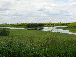
 Arroyo toad at the San Diego National Wildlife Refuge |
Humboldt Bay NWR Complex |
San Francisco Bay NWR Complex |
||
Kern NWR Complex |
 Black-necked stilt at the Kern National Wildlife Refuge |
San Luis NWR Complex |
|
Klamath Basin NWR Complex |
Sonny Bono Salton Sea NWR Complex |
||
Sacramento NWR Complex |
Other refuges |

Wild and Scenic rivers
| Rivers designated as Wild and Scenic are administered by one of four federal land management agencies: The Bureau of Land Management, The National Park Service, The U.S. Fish and Wildlife Service or The U.S. Forest Service.[7] There are 22 rivers in California with portions designated as Wild and Scenic, with 23 designations in all (the American River has two separate designations, one for the North Fork, and one for the Lower section).[8] |  Rafting on the Kern River | ||
|
National Wilderness Preservation System
There are 149 wilderness areas in California totaling just over 15,000,000 acres (61,000 km2).[9] The largest is Death Valley Wilderness at 3,055,413 acres (12,364.82 km2), the largest federally designated wilderness in the continental United States, and the smallest is the Rocks and Islands Wilderness at 5 acres (20,000 m2). The wilderness areas are managed by the US Forest Service, Bureau of Land Management, US Fish and Wildlife Service and the National Park Service. It should be noted that rarely, if ever, are designated wilderness areas stand alone protected areas, and thus their areas are, in all likelihood, already accounted for in the various agencies' inventories.
National Forests
| California has 17 U.S. National Forests, one special management unit (Lake Tahoe) and parts of 3 other National Forests. Total combined area of the forests is 20,061,888 acres (81,187.58 km2) and covers over 19% of the state. The largest forest entirely within the state is Shasta-Trinity National Forest, at 2,209,832 acres (8,942.87 km2), the smallest is Cleveland National Forest at 460,000 acres (1,900 km2). The Lake Tahoe Basin Management Unit is not precisely a national forest in the conventional sense. Instead the Forest Service manages the land with particular attention paid to Lake Tahoe and its relationship with the forests surrounding it, with emphasis on erosion control management and watershed restoration, among other more conventional forest management activities. It is the smallest of the Forest Service units in California, with 191,000 acres (770 km2) in its jurisdiction split between California and Nevada. | 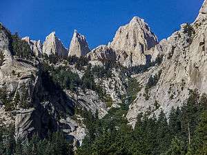 The Inyo National Forest contains Mount Whitney, the highest point in California. | |
|
|
State parks

The California Department of Parks and Recreation maintains over 270 protected areas, which include almost one-third of California's scenic coastline, including coastal wetlands, estuaries, beaches, and dune systems. The state parks system covers 1.3 million acres (5,300 km2), with over 280 miles (450 km) of coastline, 625 miles (1,006 km) of lake and river frontage, nearly 18,000 campsites; and 3,000 miles (5,000 km) of hiking, biking, and equestrian trails.[10] The largest is Anza-Borrego State Park at 600,000 acres (2,400 km2), making it one of the largest state parks in the country. The smallest, Watts Towers, owned by the State Park system but managed by the Los Angeles Cultural Affairs Department,[11] is a mere 0.1-acre (400 m2).
State wilderness areas
- Boney Mountain State Wilderness Area
- Mount San Jacinto State Wilderness
- Orestimba State Wilderness, officially called
the Henry W. Coe State Wilderness - Santa Rosa Mountains State Wilderness
- Sinkyone Wilderness State Park
- West Waddell Creek State Wilderness Area, a 5,900 acres (24 km2)
section of Big Basin State Park
Additionally, 386,000 acres (1,560 km2) of Anza-Borrego State Park have been designated as wilderness.[12]
Department of Fish and Game Protected Areas
The California Department of Fish and Game (DFG), through its seven regional divisions,[13] manages more than 700 protected areas statewide, totaling 1,119,360 acres (4,529.9 km2).[14] They are broadly categorized as:
- 110 wildlife areas,[15] designed to give the public easier access to wildlife while preserving habitats.
- 123 ecological reserves,[16] which protect rare terrestrial species and habitats.
- 11 marine reserves, which do the same for sea-dwelling species and habitats.
Municipal parks

Most cities and counties in California, as in elsewhere, own and operate open spaces of various types, the most recognizable being the city and county park. By far the largest inventory of protected land held by a municipal agency belongs to the Los Angeles Department of Water and Power, with just over 400,000 acres (1,600 km2) in its jurisdiction.[17] The largest city park in the state is Mission Trails Regional Park in San Diego at 5,800 acres (23 km2), although there are several county and regional parks that are larger. Total land owned by municipal agencies is roughly 1,500,000 acres (6,100 km2) acres.
Privately owned preserves

In addition to the many public lands are about 550,000 acres (2,200 km2)of privately owned preserves. The Wildlands Conservancy is the largest owner of protected lands with 145,371 acres (588.30 km2). The Nature Conservancy has been involved in over 100 projects in the state since 1958.[18] Many are eventually transferred to public agencies, but the Conservancy still owns and maintains several substantial preserves, including the Gray Davis/Dye Creek Preserve, Vina Plains Preserve, McCloud River Preserve, Cosumnes River Preserve, Santa Cruz Island, Irvine Ranch Wildlands and the Santa Rosa Plateau Ecological Reserve. The largest private preserve is the 93,000 acres (380 km2) Wind Wolves Preserve owned by the aforementioned Wildlands Conservancy.[19] In total, there are many dozens of land trust and conservation organizations active in California, with thousands of acres preserved on public and private lands through their efforts.[20] A few that operate entirely or substantially in the state are the Peninsula Open Space Trust, the Northern Sierra Partnership, the Sempervirens Fund, the Sacramento Valley Conservancy and the Wilderness Land Trust.
Largest land owners of protected lands
The 20 largest landholders, according to the CPAD 2015b Statistics Report:
| Agency | Total lands owned (in acres)* |
|
U.S. Forest Service |
20,712,272 |
| *These numbers may not correspond exactly with those reported directly from the agencies. | |
References
- ↑ California Protected Areas Database
- ↑ "NPS Public Use Statistics Office: Acreage Reports". National Park Service. Retrieved 2010-04-22.
- ↑ http://www.blm.gov/ca/st/en.html BLM-California website.
- ↑ BLM California data page.
- ↑ National Marine Sanctuary System, NOAA website.
- ↑ "Butte Sink Wildlife Management Area". U.S. Fish & Wildlife Service. Retrieved 2010-04-24.
- ↑ "Interagency Wild & Scenic Rivers Council". Wild & Scenic Rivers Council. Retrieved 2010-04-21.
- ↑ "Designated Wild & Scenic Rivers". Wild & Scenic Rivers Council. Retrieved 2010-04-21.
- ↑ "Wilderness areas in California". Retrieved 2009-10-03.
- ↑ "A State Park System is Born". California State Parks. Retrieved 2007-10-07.
- ↑ "Watts Towers of Simon Rodia SHP". California State Parks. Retrieved 2010-05-17.
- ↑ "State Designated Wilderness Programs in the United States" (PDF). International Journal of Wilderness. Retrieved 2010-04-24.
- ↑ "DFG Regions". California Department of Fish and Game (DFG) website. Retrieved 2008-02-19.
- ↑ "Lands Inventory Fact Sheet". California DFG website. Retrieved 2008-02-19.
- ↑ "Wildlife Areas". California DFG website. Retrieved 2008-02-19.
- ↑ "Ecological Reserves". California DFG website. Retrieved 2008-02-19.
- ↑ "CPAD Release notes". GreenInfo Network. Retrieved 2010-05-17.
- ↑ "The Nature Conservancy in California". The Nature Conservancy. Retrieved 2010-04-24.
- ↑ "Wind Wolves Preserve". Wildlands Conservancy. Archived from the original on 2016-03-02. Retrieved 2016-09-07.
- ↑ "California Member Land Trusts". The California Council of Land Trusts. Retrieved 2016-09-07.