| [3] |
Name on the Register[4] |
Image |
Date listed[5] |
Location |
City or town |
Description |
|---|
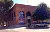
| 1 |
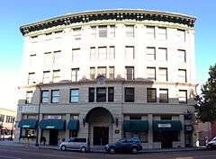
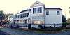
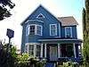
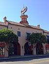
Bank of Italy |
|
000000001985-07-18-0000July 18, 1985
(#85001591) |
628 Central Ave.
37°44′08″N 121°25′28″W / 37.735556°N 121.424444°W / 37.735556; -121.424444 (Bank of Italy) |
Tracy |
|
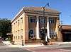
| 2 |
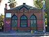
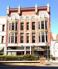
Bank of Tracy |
|
000000001980-06-03-0000June 3, 1980
(#80000851) |
803 Central Ave.
37°44′13″N 121°25′29″W / 37.736944°N 121.424722°W / 37.736944; -121.424722 (Bank of Tracy) |
Tracy |
|
| 3 |
Cole's Five Cypress Farm |
Upload image |
000000001988-05-25-0000May 25, 1988
(#88000578) |
11221 E. Eight Mile Rd.
38°03′39″N 121°10′57″W / 38.060833°N 121.1825°W / 38.060833; -121.1825 (Cole's Five Cypress Farm) |
Stockton |
|
| 4 |
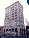
Commercial and Savings Bank |
|
000000001980-11-25-0000November 25, 1980
(#80000849) |
343 Main St.
37°57′13″N 121°17′01″W / 37.953611°N 121.283611°W / 37.953611; -121.283611 (Commercial and Savings Bank) |
Stockton |
|
| 5 |
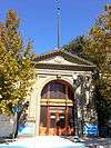
El Dorado Elementary School |
|
000000001977-08-15-0000August 15, 1977
(#77000335) |
1525 Pacific Avenue[6]
37°58′02″N 121°17′54″W / 37.967222°N 121.298333°W / 37.967222; -121.298333 (El Dorado Elementary School) |
Stockton |
Now used as the Stockton School for Adults
|
| 6 |
Elks Building |
|
000000001980-06-03-0000June 3, 1980
(#80004606) |
42 N. Sutter St.
37°57′48″N 121°17′05″W / 37.963333°N 121.284722°W / 37.963333; -121.284722 (Elks Building) |
Stockton |
|
| 7 |
Farmer's and Merchant's Bank |
|
000000001980-10-09-0000October 9, 1980
(#80000850) |
11 S. San Joaquin St.
37°57′11″N 121°17′12″W / 37.953056°N 121.286667°W / 37.953056; -121.286667 (Farmer's and Merchant's Bank) |
Stockton |
|
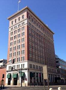
| 8 |
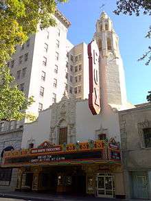
Fox California Theater |
|
000000001979-06-27-0000June 27, 1979
(#79000540) |
242 E. Main St.
37°57′09″N 121°17′12″W / 37.9525°N 121.286667°W / 37.9525; -121.286667 (Fox California Theater) |
Stockton |
|
| 9 |
Wong K. Gew Mansion |
|
000000001978-09-20-0000September 20, 1978
(#78000761) |
345 W. Clay St.
37°56′21″N 121°17′29″W / 37.939167°N 121.291389°W / 37.939167; -121.291389 (Wong K. Gew Mansion) |
Stockton |
|
| 10 |
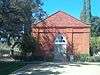
Harmony Grove Church |
|
000000002011-01-03-0000January 3, 2011
(#10001103) |
11455 E. Locke Rd.
38°08′50″N 121°10′34″W / 38.147222°N 121.176111°W / 38.147222; -121.176111 (Harmony Grove Church) |
Lockeford |
|
| 11 |
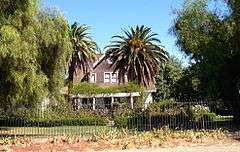
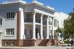
Benjamin Holt House |
|
000000001982-03-02-0000March 2, 1982
(#82002254) |
548 Park St.
37°57′37″N 121°17′04″W / 37.960278°N 121.284444°W / 37.960278; -121.284444 (Benjamin Holt House) |
Stockton |
|
| 12 |
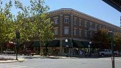
Hotel Lodi |
|
000000001995-09-29-0000September 29, 1995
(#95001140) |
5 S. School St.
38°08′02″N 121°16′24″W / 38.133889°N 121.273333°W / 38.133889; -121.273333 (Hotel Lodi) |
Lodi |
|
| 13 |
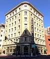
Hotel Stockton |
|
000000001981-04-01-0000April 1, 1981
(#81000174) |
133 E. Weber Ave.
37°57′15″N 121°17′18″W / 37.954167°N 121.288333°W / 37.954167; -121.288333 (Hotel Stockton) |
Stockton |
|
| 14 |
I.O.O.F. Hall |
|
000000001982-04-22-0000April 22, 1982
(#82002257) |
Main St.
38°09′17″N 121°17′59″W / 38.154722°N 121.299722°W / 38.154722; -121.299722 (I.O.O.F. Hall) |
Woodbridge |
|
| 15 |
IOOF Lodge No. 355 |
Upload image |
000000002007-03-01-0000March 1, 2007
(#07000085) |
18819 East CA 88
38°11′30″N 121°05′06″W / 38.191667°N 121.085°W / 38.191667; -121.085 (IOOF Lodge No. 355) |
Clements |
|
| 16 |
Locke House and Barn |
Upload image |
000000001972-06-19-0000June 19, 1972
(#72000252) |
19960 W. Elliott Rd.
38°09′53″N 121°08′59″W / 38.164722°N 121.149722°W / 38.164722; -121.149722 (Locke House and Barn) |
Lockeford |
|
| 17 |
Locke's Meat Market |
Upload image |
000000001982-02-19-0000February 19, 1982
(#82002253) |
13480 CA 88
38°09′48″N 121°08′57″W / 38.163333°N 121.149167°W / 38.163333; -121.149167 (Locke's Meat Market) |
Lockeford |
|
| 18 |
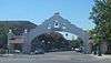
Lodi Arch |
|
000000001980-09-17-0000September 17, 1980
(#80000848) |
Pine St.
38°08′03″N 121°16′15″W / 38.134167°N 121.270833°W / 38.134167; -121.270833 (Lodi Arch) |
Lodi |
|
| 19 |
Morse-Skinner Ranch House |
Upload image |
000000001986-08-21-0000August 21, 1986
(#86001878) |
13063 N. CA 99
38°05′51″N 121°15′35″W / 38.0975°N 121.259722°W / 38.0975; -121.259722 (Morse-Skinner Ranch House) |
Lodi |
|
| 20 |
Nippon Hospital |
|
000000001978-09-18-0000September 18, 1978
(#78000762) |
25 S. Commerce St.
37°57′07″N 121°17′30″W / 37.951944°N 121.291667°W / 37.951944; -121.291667 (Nippon Hospital) |
Stockton |
|
| 21 |
John Ohm House |
|
000000001982-02-04-0000February 4, 1982
(#82002256) |
31524 S. Kasson Rd.
37°40′04″N 121°15′39″W / 37.667778°N 121.260833°W / 37.667778; -121.260833 (John Ohm House) |
Tracy |
|
| 22 |
Old Weber School |
|
000000001973-07-16-0000July 16, 1973
(#73000445) |
55 W. Flora St.
37°57′38″N 121°17′36″W / 37.960556°N 121.293333°W / 37.960556; -121.293333 (Old Weber School) |
Stockton |
|
| 23 |
Philomathean Clubhouse |
|
000000002009-01-05-0000January 5, 2009
(#08001278) |
1000 North Hunter Street
37°57′47″N 121°17′28″W / 37.963056°N 121.291111°W / 37.963056; -121.291111 (Philomathean Clubhouse) |
Stockton |
|
| 24 |
Moses Rodgers House |
|
000000001978-04-26-0000April 26, 1978
(#78000763) |
921 S. San Joaquin St.
37°56′37″N 121°17′02″W / 37.943611°N 121.283889°W / 37.943611; -121.283889 (Moses Rodgers House) |
Stockton |
|
| 25 |
Sperry Office Building |
|
000000001982-02-19-0000February 19, 1982
(#82002255) |
146 W. Weber Ave.
37°57′10″N 121°17′35″W / 37.952778°N 121.293056°W / 37.952778; -121.293056 (Sperry Office Building) |
Stockton |
|
| 26 |
Sperry Union Flour Mill |
|
000000001979-01-31-0000January 31, 1979
(#79000541) |
445 W. Weber
37°57′11″N 121°17′44″W / 37.953056°N 121.295556°W / 37.953056; -121.295556 (Sperry Union Flour Mill) |
Stockton |
|
| 27 |
Stockton Savings and Loan Society Bank |
|
000000001978-10-19-0000October 19, 1978
(#78000764) |
301 E. Main St.
37°57′13″N 121°17′09″W / 37.953611°N 121.285833°W / 37.953611; -121.285833 (Stockton Savings and Loan Society Bank) |
Stockton |
|
| 28 |
Terminous Culling Chute |
Upload image |
000000001984-04-19-0000April 19, 1984
(#84001189) |
14900 W. CA 12
38°06′35″N 121°29′57″W / 38.109722°N 121.499167°W / 38.109722; -121.499167 (Terminous Culling Chute) |
Lodi |
|
| 29 |
Tracy City Hall and Jail |
|
000000001979-10-18-0000October 18, 1979
(#79000542) |
25 W. 7th St.
37°44′09″N 121°25′31″W / 37.735833°N 121.425278°W / 37.735833; -121.425278 (Tracy City Hall and Jail) |
Tracy |
|
| 30 |
Tracy Inn |
|
000000001980-10-31-0000October 31, 1980
(#80000852) |
24 W. 11th St.
37°44′22″N 121°25′31″W / 37.739444°N 121.425278°W / 37.739444; -121.425278 (Tracy Inn) |
Tracy |
|
| 31 |
Tretheway Block |
|
000000001982-10-29-0000October 29, 1982
(#82000987) |
229 E. Weber St.
37°57′06″N 121°17′14″W / 37.951667°N 121.287222°W / 37.951667; -121.287222 (Tretheway Block) |
Stockton |
|
| 32 |
U.S. Post Office |
|
000000001983-02-10-0000February 10, 1983
(#83001236) |
401 N. San Joaquin St.
37°57′27″N 121°17′17″W / 37.9575°N 121.288056°W / 37.9575; -121.288056 (U.S. Post Office) |
Stockton |
|
| 33 |
West Side Bank |
|
000000001978-12-12-0000December 12, 1978
(#78000765) |
47 W. 6th St.
37°44′06″N 121°25′32″W / 37.735°N 121.425556°W / 37.735; -121.425556 (West Side Bank) |
Tracy |
|
| 34 |
Woman's Club of Lodi |
|
000000001988-05-20-0000May 20, 1988
(#88000555) |
325 W. Pine St.
38°08′05″N 121°16′34″W / 38.134722°N 121.276111°W / 38.134722; -121.276111 (Woman's Club of Lodi) |
Lodi |
|
| 35 |
Woodbridge Masonic Lodge No. 131 |
|
000000001989-04-20-0000April 20, 1989
(#89000318) |
1040 Augusta St.
38°09′14″N 121°18′03″W / 38.153889°N 121.300833°W / 38.153889; -121.300833 (Woodbridge Masonic Lodge No. 131) |
Woodbridge |
|

.jpg)

.JPG)
.JPG)
.jpg)