California
| California state symbols | |
|---|---|
|
| |
|
| |
| Living insignia | |
| Amphibian | California red-legged frog |
| Bird | California quail |
| Fish | Golden trout |
| Flower | California poppy |
| Grass | Purple needlegrass |
| Insect | California dogface butterfly |
| Mammal | California grizzly bear (State animal)[1] |
| Reptile | Desert tortoise |
| Tree | California redwood |
| Inanimate insignia | |
| Colors | Blue & gold [11] |
| Dance | West Coast Swing |
| Folk dance | Square dance |
| Fossil | Sabre-toothed cat |
| Gemstone | Benitoite |
| Mineral | Native gold |
| Motto | Eureka[1] |
| Nickname | The Golden State |
| Rock | Serpentine |
| Soil | San Joaquin |
| Song | "I Love You, California" |
| Tartan | California State Tartan |
| State route marker | |
 | |
| State quarter | |
|
Released in 2005 | |
| Lists of United States state symbols | |
California (![]() i/ˌkælᵻˈfɔːrnjə/ KAL-ə-FORN-yə, /ˌkælᵻˈfɔːrniə/ KAL-ə-FAWR-nee-ə) is the most populous state in the United States and the third most extensive by area. Geographically located in the western part of the U.S., California is bordered by the other U.S. states of Oregon to the north, Nevada to the east, and Arizona to the southeast. California shares an international border with the Mexican state of Baja California to the south and the Pacific Ocean is on the state's western coastline. The state capital is Sacramento. Los Angeles is California's most populous city, and the country's second largest after New York City. The state also has the nation's most populous county, Los Angeles County, and its largest county by area, San Bernardino County.
i/ˌkælᵻˈfɔːrnjə/ KAL-ə-FORN-yə, /ˌkælᵻˈfɔːrniə/ KAL-ə-FAWR-nee-ə) is the most populous state in the United States and the third most extensive by area. Geographically located in the western part of the U.S., California is bordered by the other U.S. states of Oregon to the north, Nevada to the east, and Arizona to the southeast. California shares an international border with the Mexican state of Baja California to the south and the Pacific Ocean is on the state's western coastline. The state capital is Sacramento. Los Angeles is California's most populous city, and the country's second largest after New York City. The state also has the nation's most populous county, Los Angeles County, and its largest county by area, San Bernardino County.
California's diverse geography ranges from the Pacific Coast in the west to the Sierra Nevada mountain range in the east; and from the redwood–Douglas fir forests in the northwest to the Mojave Desert in the southeast. The Central Valley, a major agricultural area, dominates the state's center. Because of California's location along the Pacific Ring of Fire, about 37,000 earthquakes are recorded each year, but most are too small to be felt.[12]
What is now California was first settled by various Native American tribes before being explored by a number of European expeditions during the 16th and 17th centuries. The Spanish Empire then claimed it as part of Alta California in their New Spain colony. The area became a part of Mexico in 1821 following its successful war for independence, but was ceded to the United States in 1848 after the Mexican–American War. The western portion of Alta California then was organized as the State of California, and admitted as the 31st state on September 9, 1850. The California Gold Rush starting in 1848 led to dramatic social and demographic changes, with large-scale emigration from the east and abroad with an accompanying economic boom.
If it were a country, California would be the 6th largest economy in the world[13] and the 35th most populous. It is also regarded as a global trendsetter in both popular culture and politics, and is the birthplace of the film industry, the hippie counterculture, the Internet,[14] and the personal computer, among others. Fifty-eight percent of the state's economy is centered on finance, government, real estate services, technology, and professional, scientific and technical business services.[15] The San Francisco Bay Area has the nation's highest median household income by metropolitan area, and is the headquarters of three of the world's largest 20 firms by revenue, Chevron, Apple, and McKesson.[16] Although it only accounts for 1.5 percent of the state's economy,[15] California's agriculture industry has the highest output of any U.S. state.[17]
Etymology
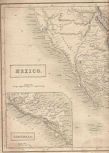
The word California originally referred to the Baja California Peninsula of Mexico; it was later extended to the entire region composed of the current United States states of California, Nevada, and Utah, and parts of Arizona, New Mexico, Texas and Wyoming.
The name California is surmised by some writers to have derived from a fictional paradise peopled by Black Amazons and ruled by Queen Calafia,[18][19] who fought alongside Muslims and whose name was chosen to echo the title of a Muslim leader, the Caliph, fictionally implying that California was the Caliphate.[20] The story of Calafia is recorded in a 1510 work The Adventures of Esplandián, written as a sequel to Amadis de Gaula by Spanish adventure writer Garci Rodríguez de Montalvo.[21][22][23] The kingdom of Queen Calafia, according to Montalvo, was said to be a remote land inhabited by griffins and other strange beasts, and rich in gold.
Know ye that at the right hand of the Indies there is an island called California, very close to that part of the Terrestrial Paradise, which was inhabited by black women without a single man among them, and they lived in the manner of Amazons. They were robust of body with strong passionate hearts and great virtue. The island itself is one of the wildest in the world on account of the bold and craggy rocks.
When Spanish explorer Francisco de Ulloa was exploring the western coast of North America, his initial surveys of the Baja California Peninsula led him to believe that it was an island rather than part of the larger continent, so he dubbed the "island" after the mythical island in Montalvo's writing.[25]
Shortened forms of the state's name include CA, Cal., Calif. and US-CA.
History
Pre-contact
Settled by successive waves of arrivals during the last 10,000 years, California was one of the most culturally and linguistically diverse areas in pre-Columbian North America. Various estimates of the native population range from 100,000 to 300,000.[26] The Indigenous peoples of California included more than 70 distinct groups of Native Americans, ranging from large, settled populations living on the coast to groups in the interior. California groups also were diverse in their political organization with bands, tribes, villages, and on the resource-rich coasts, large chiefdoms, such as the Chumash, Pomo and Salinan. Trade, intermarriage and military alliances fostered many social and economic relationships among the diverse groups.
16th, 17th and 18th centuries
The first European effort to explore the coast as far north as the Russian River was a Spanish sailing expedition, led by Portuguese captain Juan Rodríguez Cabrillo, in 1542. Some 37 years later English explorer Francis Drake also explored and claimed an undefined portion of the California coast in 1579. Spanish traders made unintended visits with the Manila galleons on their return trips from the Philippines beginning in 1565.[27] The first Asians to set foot on what would be the United States occurred in 1587, when Filipino sailors arrived in Spanish ships at Morro Bay.[28] Sebastián Vizcaíno explored and mapped the coast of California in 1602 for New Spain.
Despite the on-the-ground explorations of California in the 16th century, Rodríguez's idea of California as an island persisted. That depiction appeared on many European maps well into the 18th century.[29]
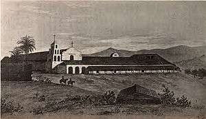
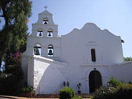
After the Portolà expedition of 1769–70, Spanish missionaries began setting up 21 California Missions on or near the coast of Alta (Upper) California, beginning in San Diego. During the same period, Spanish military forces built several forts (presidios) and three small towns (pueblos). Two of the pueblos grew into the cities of Los Angeles and San Jose. The Spanish colonization brought the genocide of the indigenous Californian peoples.
19th century
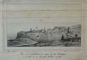
Imperial Russia explored the California coast and established a trading post at Fort Ross. Its early 19th-century coastal settlements north of San Francisco Bay constituted the southernmost Russian colony in North America and were spread over an area stretching from Point Arena to Tomales Bay.[31]
In 1821 the Mexican War of Independence gave Mexico (including California) independence from Spain; for the next 25 years, Alta California remained a remote northern province of the nation of Mexico.
Cattle ranches, or ranchos, emerged as the dominant institutions of Mexican California. After Mexican independence from Spain, the chain of missions became the property of the Mexican government and were secularized by 1834.[32] The ranchos developed under ownership by Californios (Spanish-speaking Californians) who had received land grants, and traded cowhides and tallow with Boston merchants.
From the 1820s, trappers and settlers from the United States and Canada arrived in Northern California. These new arrivals used the Siskiyou Trail, California Trail, Oregon Trail and Old Spanish Trail to cross the rugged mountains and harsh deserts in and surrounding California.
Between 1831 and 1836, California experienced a series of revolts against Mexico;[33] this culminated in the 1836 California revolt led by Juan Bautista Alvarado, which ended after Mexico appointed him governor of the department.[34] The revolt, which had momentarily declared California an independent state, was successful with the assistance of American and British residents of California,[35] including Isaac Graham;[36] after 1840, 100 of those residents who did not have passports were arrested, leading to the Graham affair in 1840.[35]
One of the largest ranchers in California was John Marsh. After failing to obtain justice against squatters on his land from the Mexican courts, he determined that California should become part of the United States. Marsh conducted a letter-writing campaign espousing the California climate, soil and other reasons to settle there, as well as the best route to follow, which became known as "Marsh's route." His letters were read, reread, passed around, and printed in newspapers throughout the country, and started the first wagon trains rolling to California.[37] He invited immigrants to stay on his ranch until they could get settled, and assisted in their obtaining passports.[38]
After ushering in the period of organized emigration to California, Marsh helped end the rule of the last Mexican governor of California, thereby paving the way to California's ultimate acquisition by the United States.[39]
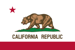
In 1846 settlers rebelled against Mexican rule during the Bear Flag Revolt. Afterwards, rebels raised the Bear Flag (featuring a bear, a star, a red stripe and the words "California Republic") at Sonoma. The Republic's only president was William B. Ide,[40] who played a pivotal role during the Bear Flag Revolt.
The California Republic was short lived;[41] the same year marked the outbreak of the Mexican–American War (1846–48).[42] When Commodore John D. Sloat of the United States Navy sailed into Monterey Bay and began the military occupation of California by the United States, Northern California capitulated in less than a month to the United States forces.[43] After a series of defensive battles in Southern California, the Treaty of Cahuenga was signed by the Californios on January 13, 1847, securing American control in California.[44]
Following the Treaty of Guadalupe Hidalgo that ended the war, the western territory of Alta California, became the United States state of California, and Arizona, Nevada, Colorado and Utah became United States Territories. The lightly populated lower region of California, the Baja Peninsula, remained in the possession of Mexico.
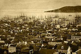
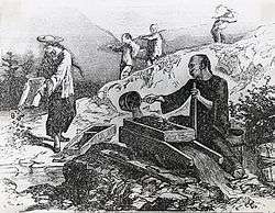
In 1846 the non-native population of California was estimated to be no more than 8,000, plus about 100,000 Native Americans down from about 300,000 before Hispanic settlement in 1769.[45] After gold was discovered in 1848, the population burgeoned with United States citizens, Europeans, Chinese and other immigrants during the great California Gold Rush. By 1854 over 300,000 settlers had come.[46] Between 1847 and 1870, the population of San Francisco increased from 500 to 150,000.[47] On September 9, 1850, as part of the Compromise of 1850, California was admitted to the United States undivided as a free state, denying the expansion of slavery to the Pacific Coast.
California's native population precipitously declined, above all, from Eurasian diseases to which they had no natural immunity.[48] As in other states, the native inhabitants were forcibly removed from their lands by incoming miners, ranchers, and farmers. And although California entered the union as a free state, the "loitering or orphaned Indians" were de facto enslaved by Mexican and Anglo-American masters under the 1853 Act for the Government and Protection of Indians.[49] There were massacres in which hundreds of indigenous people were killed. Between 1850 and 1860, California paid around 1.5 million dollars (some 250,000 of which was reimbursed by the federal government)[50] to hire militias whose purpose was to protect settlers from the indigenous populations. In later decades, the native population was placed in reservations and rancherias, which were often small and isolated and without enough natural resources or funding from the government to sustain the populations living on them.[49] As a result, the rise of California was a calamity for the native inhabitants. Several scholars and Native American activists, including Benjamin Madley and Ed Castillo, have described the actions of the California government as a genocide.[51]
The seat of government for California under Spanish and later Mexican rule was located at Monterey from 1777 until 1845.[32] Pio Pico, last Mexican governor of Alta California, moved the capital to Los Angeles in 1845. The United States consulate was also located in Monterey, under consul Thomas O. Larkin.
In 1849, the Constitutional Convention was first held in Monterey. Among the tasks was a decision on a location for the new state capital. The first legislative sessions were held in San Jose (1850–1851). Subsequent locations included Vallejo (1852–1853), and nearby Benicia (1853–1854); these locations eventually proved to be inadequate as well. The capital has been located in Sacramento since 1854[52] with only a short break in 1861 when legislative sessions were held in San Francisco due to flooding in Sacramento.
Initially, travel between California and the rest of the continental United States was time consuming and dangerous. A more direct connection came in 1869 with the completion of the First Transcontinental Railroad through Donner Pass in the Sierra Nevada mountains. Once completed, hundreds of thousands of United States citizens came west, where new Californians were discovering that land in the state, if irrigated during the dry summer months, was extremely well suited to fruit cultivation and agriculture in general. Vast expanses of wheat, other cereal crops, vegetable crops, cotton, and nut and fruit trees were grown (including oranges in Southern California), and the foundation was laid for the state's prodigious agricultural production in the Central Valley and elsewhere.
20th century
Migration to California accelerated during the early 20th century with the completion of major transcontinental highways like the Lincoln Highway and Route 66. In the period from 1900 to 1965, the population grew from fewer than one million to become the most populous state in the Union. In 1940, the Census Bureau reported California's population as 6.0% Hispanic, 2.4% Asian, and 89.5% non-Hispanic white.[53]
To meet the population's needs, major engineering feats like the California and Los Angeles Aqueducts; the Oroville and Shasta Dams; and the Bay and Golden Gate Bridges were built across the state. The state government also adopted the California Master Plan for Higher Education in 1960 to develop a highly efficient system of public education.
Meanwhile, attracted to the mild Mediterranean climate, cheap land, and the state's wide variety of geography, filmmakers established the studio system in Hollywood in the 1920s. California manufactured 8.7 percent of total United States military armaments produced during World War II, ranking third (behind New York and Michigan) among the 48 states.[54] After World War II, California's economy greatly expanded due to strong aerospace and defense industries,[55] whose size decreased following the end of the Cold War.[55][56] Stanford University and its Dean of Engineering Frederick Terman began encouraging faculty and graduates to stay in California instead of leaving the state, and develop a high-tech region in the area now known as Silicon Valley.[57] As a result of these efforts, California is regarded as a world center of the entertainment and music industries, of technology, engineering, and the aerospace industry, and as the United States center of agricultural production.[58] Just before the "Dot Com Bust" California had the 5th largest economy in the world among nations.[59] Yet since 1991, and starting in the late 1980s in Southern California, California has seen a net loss of domestic migrants most years. This is often referred to by the media as the California exodus.[60]
However, during the 20th century, two great disasters happened in California. The 1906 San Francisco earthquake and 1928 St. Francis Dam flood remain the deadliest in U.S history.[61]
Geography


California is the 3rd largest state in the United States in area, after Alaska and Texas.[63] California is often geographically bisected into two regions, Southern California, comprising the 10 southernmost counties,[64][65] and Northern California, comprising the 48 northernmost counties.[66][67]
In the middle of the state lies the California Central Valley, bounded by the Sierra Nevada in the east, the coastal mountain ranges in the west, the Cascade Range to the north and by the Tehachapi Mountains in the south. The Central Valley is California's productive agricultural heartland.
Divided in two by the Sacramento-San Joaquin River Delta, the northern portion, the Sacramento Valley serves as the watershed of the Sacramento River, while the southern portion, the San Joaquin Valley is the watershed for the San Joaquin River. Both valleys derive their names from the rivers that flow through them. With dredging, the Sacramento and the San Joaquin Rivers have remained deep enough for several inland cities to be seaports.
The Sacramento-San Joaquin River Delta is a critical water supply hub for the state. Water is diverted from the delta and through an extensive network of pumps and canals that traverse nearly the length of the state, to the Central Valley and the State Water Projects and other needs. Water from the Delta provides drinking water for nearly 23 million people, almost two-thirds of the state's population as well as water for farmers on the west side of the San Joaquin Valley.
The Channel Islands are located off the Southern coast.
California was once considered to be an island due to the way maps were drawn, as late as the 1700's.[68]
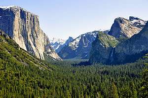
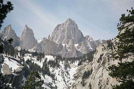
The Sierra Nevada (Spanish for "snowy range") includes the highest peak in the contiguous 48 states, Mount Whitney, at 14,505 feet (4,421 m).[5][6][7] The range embraces Yosemite Valley, famous for its glacially carved domes, and Sequoia National Park, home to the giant sequoia trees, the largest living organisms on Earth, and the deep freshwater lake, Lake Tahoe, the largest lake in the state by volume.
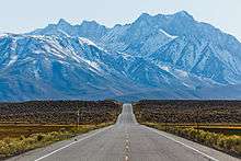
To the east of the Sierra Nevada are Owens Valley and Mono Lake, an essential migratory bird habitat. In the western part of the state is Clear Lake, the largest freshwater lake by area entirely in California. Though Lake Tahoe is larger, it is divided by the California/Nevada border. The Sierra Nevada falls to Arctic temperatures in winter and has several dozen small glaciers, including Palisade Glacier, the southernmost glacier in the United States.
About 45 percent of the state's total surface area is covered by forests,[69] and California's diversity of pine species is unmatched by any other state. California contains more forestland than any other state except Alaska. Many of the trees in the California White Mountains are the oldest in the world; an individual bristlecone pine is over 5,000 years old.[70][71]
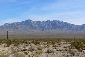
In the south is a large inland salt lake, the Salton Sea. The south-central desert is called the Mojave; to the northeast of the Mojave lies Death Valley, which contains the lowest and hottest place in North America, the Badwater Basin at −279 feet (−85 m).[9] The horizontal distance from the bottom of Death Valley to the top of Mount Whitney is less than 90 miles (140 km). Indeed, almost all of southeastern California is arid, hot desert, with routine extreme high temperatures during the summer. The southeastern border of California with Arizona is entirely formed by the Colorado River, from which the southern part of the state gets about half of its water.
California contains both the highest point (Mount Whitney) and the lowest point (Death Valley) in the contiguous United States.
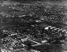
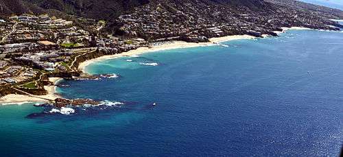
A majority of California's cities are located in either the San Francisco Bay Area or the Sacramento metropolitan area in Northern California; or the Los Angeles area, the Riverside-San Bernardino-Inland Empire, or the San Diego metropolitan area in Southern California. The Los Angeles Area, the Bay Area, and the San Diego metropolitan area are among several major metropolitan areas along the California coast.
As part of the Ring of Fire, California is subject to tsunamis, floods, droughts, Santa Ana winds, wildfires, landslides on steep terrain, and has several volcanoes. It has many earthquakes due to several faults running through the state, in particular the San Andreas Fault.
Climate
Although most of the state has a Mediterranean climate, due to the state's large size, the climate ranges from subarctic to subtropical. The cool California Current offshore often creates summer fog near the coast. Farther inland, there are colder winters and hotter summers. The maritime moderation results in the shoreline summertime temperatures of Los Angeles and San Francisco being the coolest of all major metropolitan areas of the United States and uniquely cool compared to areas on the same latitude in the interior and on the east coast of the North American continent. Even the San Diego shoreline bordering Mexico is cooler in summer than most areas in the contiguous United States. Just a few miles inland, summer temperature extremes are significantly higher, with downtown Los Angeles being several degrees warmer than at the coast. The same microclimate phenomenon is seen in the climate of the Bay Area, where areas sheltered from the sea experience significantly hotter summers than nearby areas that are close to the ocean.
Northern parts of the state have more rain than the south. California's mountain ranges also influence the climate: some of the rainiest parts of the state are west-facing mountain slopes. Northwestern California has a temperate climate, and the Central Valley has a Mediterranean climate but with greater temperature extremes than the coast. The high mountains, including the Sierra Nevada, have an alpine climate with snow in winter and mild to moderate heat in summer.
California's mountains produce rain shadows on the eastern side, creating extensive deserts. The higher elevation deserts of eastern California have hot summers and cold winters, while the low deserts east of the Southern California mountains have hot summers and nearly frostless mild winters. Death Valley, a desert with large expanses below sea level, is considered the hottest location in the world; the highest temperature in the world,[72][73] 134 °F (56.7 °C), was recorded there on July 10, 1913. The lowest temperature in California was −45 °F (−43 °C) in 1937 in Boca.
The table below lists average temperatures for August and December in a selection of places throughout the state; some highly populated and some not. This includes the relatively cool summers of the Humboldt Bay region around Eureka, the extreme heat of Death Valley, and the mountain climate of Mammoth in the Sierra Nevadas.
| Location | August (°F) |
August (°C) |
December (°F) |
December (°C) |
Annual Precipitation (mm/in) |
|---|---|---|---|---|---|
| Downtown Los Angeles | 84/64 | 29/18 | 67/47 | 20/8 | 377/15 |
| LAX/LA Beaches | 75/65 | 23/18 | 64/48 | 18/9 | 326/13 |
| San Jose | 82/58 | 27/14 | 58/42 | 14/5 | 401/16 |
| San Francisco | 68/55 | 20/12 | 57/46 | 14/8 | 538/21 |
| San Diego | 76/66 | 24/19 | 64/48 | 18/9 | 262/10 |
| Oakland | 73/57 | 23/14 | 58/44 | 14/7 | 588/23 |
| Sacramento | 91/58 | 33/14 | 54/38 | 12/3 | 469/18 |
| Fresno | 97/66 | 36/19 | 55/38 | 12/3 | 292/11 |
| Riverside | 96/64 | 35/18 | 68/41 | 21/5 | 260/10 |
| Eureka | 62/53 | 16/11 | 55/42 | 12/5 | 960/38 |
Ecology
California is one of the richest and most diverse parts of the world, and includes some of the most endangered ecological communities. California is part of the Nearctic ecozone and spans a number of terrestrial ecoregions.[75]
California's large number of endemic species includes relict species, which have died out elsewhere, such as the Catalina ironwood (Lyonothamnus floribundus). Many other endemics originated through differentiation or adaptive radiation, whereby multiple species develop from a common ancestor to take advantage of diverse ecological conditions such as the California lilac (Ceanothus). Many California endemics have become endangered, as urbanization, logging, overgrazing, and the introduction of exotic species have encroached on their habitat.
Flora and fauna
California boasts several superlatives in its collection of flora: the largest trees, the tallest trees, and the oldest trees. California's native grasses are perennial plants.[76] After European contact, these were generally replaced by invasive species of European annual grasses; and, in modern times, California's hills turn a characteristic golden-brown in summer.[77]
Because California has the greatest diversity of climate and terrain, the state has six life zones which are the lower Sonoran (desert); upper Sonoran (foothill regions and some coastal lands), transition (coastal areas and moist northeastern counties); and the Canadian, Hudsonian, and Arctic Zones, comprising the state's highest elevations.[78]
Plant life in the dry climate of the lower Sonoran zone contains a diversity of native cactus, mesquite, and paloverde. The Joshua tree is found in the Mojave Desert. Flowering plants include the dwarf desert poppy and a variety of asters. Fremont cottonwood and valley oak thrive in the Central Valley. The upper Sonoran zone includes the chaparral belt, characterized by forests of small shrubs, stunted trees, and herbaceous plants. Nemophila, mint, Phacelia, Viola, and the California poppy (Eschscholzia californica) – the state flower – also flourish in this zone, along with the lupine, more species of which occur here than anywhere else in the world.[78]
The transition zone includes most of California's forests with the redwood (Sequoia sempervirens) and the "big tree" or giant sequoia (Sequoiadendron giganteum), among the oldest living things on earth (some are said to have lived at least 4,000 years). Tanbark oak, California laurel, sugar pine, madrona, broad-leaved maple, and Douglas-fir also grow here. Forest floors are covered with swordfern, alumnroot, barrenwort, and trillium, and there are thickets of huckleberry, azalea, elder, and wild currant. Characteristic wild flowers include varieties of mariposa, tulip, and tiger and leopard lilies.[79]
_--_2012_--_18.jpg)
The high elevations of the Canadian zone allow the Jeffrey pine, red fir, and lodgepole pine to thrive. Brushy areas are abundant with dwarf manzanita and ceanothus; the unique Sierra puffball is also found here. Right below the timberline, in the Hudsonian zone, the whitebark, foxtail, and silver pines grow. At about 10,500 feet (3,200 m), begins the Arctic zone, a treeless region whose flora include a number of wildflowers, including Sierra primrose, yellow columbine, alpine buttercup, and alpine shooting star.[78][80]
Common plants that have been introduced to the state include the eucalyptus, acacia, pepper tree, geranium, and Scotch broom. The species that are federally classified as endangered are the Contra Costa wallflower, Antioch Dunes evening primrose, Solano grass, San Clemente Island larkspur, salt marsh bird's beak, McDonald's rock-cress, and Santa Barbara Island liveforever. As of December 1997, 85 plant species were listed as threatened or endangered.[78]
In the deserts of the lower Sonoran zone, the mammals include the jackrabbit, kangaroo rat, squirrel, and opossum. Common birds include the owl, roadrunner, cactus wren, and various species of hawk. The area's reptilian life include the sidewinder viper, desert tortoise, and horned toad. The upper Sonoran zone boasts mammals such as the antelope, brown-footed woodrat, and ring-tailed cat. Birds unique to this zone are the California thrasher, bushtit, and California condor.[78][81][82][83]
In the transition zone, there are Colombian black-tailed deer, black bears, gray foxes, cougars, bobcats, and Roosevelt elk. Reptiles such as the garter snakes and rattlesnakes inhabit the zone. In addition, amphibians such as the water puppy and redwood salamander are common too. Birds such as the kingfisher, chickadee, towhee, and hummingbird thrive here as well.[78][84]
The Canadian zone mammals include the mountain weasel, snowshoe hare, and several species of chipmunks. Conspicuous birds include the blue-fronted jay, Sierra chickadee. Sierra hermit thrush, water ouzel, and Townsend's solitaire. As one ascends into the Hudsonian zone, birds become scarcer. While the Sierra rosy finch is the only bird native to the high Arctic region, other bird species such as the hummingbird and Clark's nutcracker. Principal mammals found in this region include the Sierra coney, white-tailed jackrabbit, and the bighorn sheep. As of April 2003, the bighorn sheep was listed as endangered by the US Fish and Wildlife Service. The fauna found throughout several zones are the mule deer, coyote, mountain lion, northern flicker, and several species of hawk and sparrow.[78]
Aquatic life in California thrives, from the state's mountain lakes and streams to the rocky Pacific coastline. Numerous trout species are found, among them rainbow, golden, and cutthroat. Migratory species of salmon are common as well. Deep-sea life forms include sea bass, yellowfin tuna, barracuda, and several types of whale. Native to the cliffs of northern California are seals, sea lions, and many types of shorebirds, including migratory species.[78]
As of April 2003, 118 California animals were on the federal endangered list; 181 plants were listed as endangered or threatened. Endangered animals include the San Joaquin kitfox, Point Arena mountain beaver, Pacific pocket mouse, salt marsh harvest mouse, Morro Bay kangaroo rat (and five other species of kangaroo rat), Amargosa vole, California least tern, California condor, loggerhead shrike, San Clemente sage sparrow, San Francisco garter snake, five species of salamander, three species of chub, and two species of pupfish. Eleven butterflies are also endangered[85] and two that are threatened are on the federal list. Among threatened animals are the coastal California gnatcatcher, Paiute cutthroat trout, southern sea otter, and northern spotted owl. California has a total of 290,821 acres (1,176.91 km2) of National Wildlife Refuges.[78] As of September 2010, 123 California animals were listed as either endangered or threatened on the federal list provided by the US Fish & Wildlife Service.[86] Also, as of the same year, 178 species of California plants were listed either as endangered or threatened on this federal list.[86]
Rivers
The vast majority of rivers in California are dammed as part of two massive water projects: the Central Valley Project, providing water to the agricultural central valley, the California State Water Project diverting water from northern to southern California. The state's coasts, rivers, and other bodies of water are regulated by the California Coastal Commission.
The two most prominent rivers within California are the Sacramento River and the San Joaquin River, which drain the Central Valley and the west slope of the Sierra Nevada and flow to the Pacific Ocean through San Francisco Bay. Several major tributaries feed into the Sacramento and the San Joaquin, including the Pit River, the Tuolumne River, and the Feather River.
The Eel River and Salinas River each drain portions of the California coast, north and south of San Francisco Bay, respectively, and the Eel River is the largest river in the state to remain in its natural un-dammed state. The Mojave River is the primary watercourse in the Mojave Desert, and the Santa Ana River drains much of the Transverse Ranges as it bisects Southern California. Some other important rivers are the Klamath River and the Trinity River in the far north coast, and the Colorado River on the southeast border with Arizona.
Regions

|
Demographics

Population
| Historical population | |||
|---|---|---|---|
| Census | Pop. | %± | |
| 1850 | 92,597 | — | |
| 1860 | 379,994 | 310.4% | |
| 1870 | 560,247 | 47.4% | |
| 1880 | 864,694 | 54.3% | |
| 1890 | 1,213,398 | 40.3% | |
| 1900 | 1,485,053 | 22.4% | |
| 1910 | 2,377,549 | 60.1% | |
| 1920 | 3,426,861 | 44.1% | |
| 1930 | 5,677,251 | 65.7% | |
| 1940 | 6,907,387 | 21.7% | |
| 1950 | 10,586,223 | 53.3% | |
| 1960 | 15,717,204 | 48.5% | |
| 1970 | 19,953,134 | 27.0% | |
| 1980 | 23,667,902 | 18.6% | |
| 1990 | 29,760,021 | 25.7% | |
| 2000 | 33,871,648 | 13.8% | |
| 2010 | 37,253,956 | 10.0% | |
| Est. 2015 | 39,144,818 | 5.1% | |
| Sources: 1790–1990, 2000, 2010, 2014[87][88][89] Chart does not include Indigenous population figures. Studies indicate that the Native American population in California in 1850 was close to 150,000 before declining to 15,000 by 1900.[4][49][90] | |||
The United States Census Bureau estimates that the population of California was 39,144,818 on July 1, 2015, a 5.08% increase since the 2010 United States Census.[4] Between 2000 and 2009, there was a natural increase of 3,090,016 (5,058,440 births minus 2,179,958 deaths).[91] During this time period, international migration produced a net increase of 1,816,633 people while domestic migration produced a net decrease of 1,509,708, resulting in a net in-migration of 306,925 people.[91] The state of California's own statistics show a population of 38,292,687 for January 1, 2009.[92] However, according to the Manhattan Institute for Policy Research, since 1990 almost 3.4 million Californians have moved to other states, with most leaving to Texas, Nevada, and Arizona.[93]
California is the 2nd-most populous subnational entity in the Western Hemisphere and the Americas, with a population second to that of the state of São Paulo in Brazil.[94] California's population is greater than that of all but 34 countries of the world.[95][96] The Greater Los Angeles Area is the 2nd-largest metropolitan area in the United States, after the New York metropolitan area, while Los Angeles, with nearly half the population of New York, is the 2nd-largest city in the United States. Also, Los Angeles County has held the title of most populous United States county for decades, and it alone is more populous than 42 United States states.[97][98] Including Los Angeles, four of the top 15 most populous cities in the U.S. are in California: Los Angeles (2nd), San Diego (8th), San Jose (10th), and San Francisco (13th). The center of population of California is located in the town of Buttonwillow, Kern County.[note 1]
Population centers
The state has 482 incorporated cities and towns; of which 460 are cities and 22 are towns. Under California law, the terms "city" and "town" are explicitly interchangeable; the name of an incorporated municipality in the state can either be "City of (Name)" or "Town of (Name)".[100]
Sacramento became California's first incorporated city on February 27, 1850.[101] San Jose, San Diego and Benicia tied for California's second incorporated city, each receiving incorporation on March 27, 1850.[102][103][104] Jurupa Valley became the state's most recent and 482nd incorporated municipality on July 1, 2011.[105][106]
The majority of these cities and towns are within one of five metropolitan areas: the Los Angeles Metropolitan Area, the San Francisco Bay Area, the Riverside-San Bernardino Area, the San Diego metropolitan area and the Sacramento metropolitan area.
| | |||||||||
|---|---|---|---|---|---|---|---|---|---|
| Rank | Name | County | Pop. | ||||||
.jpg) Los Angeles 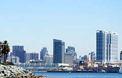 San Diego |
1 | Los Angeles | Los Angeles | 3,928,864 |  San Jose 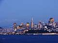 San Francisco | ||||
| 2 | San Diego | San Diego | 1,381,069 | ||||||
| 3 | San Jose | Santa Clara | 1,015,785 | ||||||
| 4 | San Francisco | San Francisco | 852,469 | ||||||
| 5 | Fresno | Fresno | 515,986 | ||||||
| 6 | Sacramento | Sacramento | 485,199 | ||||||
| 7 | Long Beach | Los Angeles | 473,577 | ||||||
| 8 | Oakland | Alameda | 413,775 | ||||||
| 9 | Bakersfield | Kern | 368,759 | ||||||
| 10 | Anaheim | Orange | 346,997 | ||||||
Migration
Starting in the year 2010, for the first time since the California Gold Rush, California-born residents make up the majority of the state's population.[108] Along with the rest of the United States, California's immigration pattern has also shifted over the course of the late 2000s-early 2010s.[109] Immigration from Latin American countries has dropped significantly with most immigrants now coming from Asia.[110] In total for 2011, there were 277,304 immigrants. 57% came from Asian countries vs. 22% from Latin American countries.[110] Net immigration from Mexico, previously the most common country of origin for new immigrants has dropped to zero/less than zero, since more Mexican nationals are departing for their home country than immigrating.[109] As a result it is estimated that Hispanic citizens will constitute 49% of the population by 2060, instead of the previously projected 2050, due primarily to domestic births.[109][111]
The state's population of undocumented immigrants has been shrinking in recent years, due to increased enforcement and decreased job opportunities for lower-skilled workers.[112] The number of migrants arrested attempting to cross the Mexican border in the Southwest plunged from a high of 1.1 million in 2005 to just 367,000 in 2011.[113] Despite these recent trends, illegal aliens constituted an estimated 7.3 percent of the state's population, the third highest percentage of any state in the country,[114][note 2] totaling nearly 2.6 million.[115] In particular, illegal immigrants tended to be concentrated in Los Angeles, Monterey, San Benito, Imperial, and Napa Counties – the latter four of which have significant agricultural industries that depend on manual labor.[116] More than half of illegal immigrants originate from Mexico.[115]
National origins
According to the United States Census Bureau in 2015 the population self-identifies as (alone or in combination):[117]
- 72.9% White
- 14.7% Asian
- 6.5% Black or African American
- 3.8% Two or More Races
- 1.7% Native American and Alaska Native
- 0.5% Native Hawaiian or Pacific Islander
By ethnicity, in 2015 the population was 61.2% non-Hispanic (of any race) and 38.8% Hispanic or Latino (of any race).[117]
As of 2011, 75.1% of California's population younger than age 1 were minorities, meaning that they had at least one parent who was not non-Hispanic white (white Hispanics are counted as minorities).[118]
In terms of total numbers, California has the largest population of White Americans in the United States, an estimated 22,200,000 residents. The state has the 5th largest population of African Americans in the United States, an estimated 2,250,000 residents. California's Asian American population is estimated at 4.4 million, constituting a third of the nation's total. California's Native American population of 285,000 is the most of any state.[119]
According to estimates from 2011, California has the largest minority population in the United States by numbers, making up 60% of the state population.[89] Over the past 25 years, the population of non-Hispanic whites has declined, while Hispanic and Asian populations have grown. Between 1970 and 2011, non-Hispanic whites declined from 80% of the State's population to 40%, while Hispanics grew from 32% in 2000 to 38% in 2011.[120] It is currently projected that Hispanics will rise to 49% of the population by 2060, primarily due to domestic births rather than immigration.[111] With the decline of immigration from Latin America, Asian Americans now constitute the fastest growing racial/ethnic group in California; this growth primarily driven by immigration from China, India and the Philippines, respectively.[121]
|
| ||||||||||||||||||||||||||||||||||||||||||||||||||||||||||||||||||||||||||||||||||||||||||||||||||||||||||||||||||||||||||||||||||||||||||||||||||||||||||||||||||||||||||||||||||||||||||||||||||||||||||||||||||||||||||||||||||||||||||||||||||||||||||||||||||||||||||||||||||||||||||||||||||||||||||||||||||||||||||||||||||||||||||||||||||||||||||||||||||||||||||||||||||
Languages
| Language | Percentage of population (as of 2010)[126] |
|---|---|
| Spanish | 28.46% (9,696,638 speakers) |
| Tagalog | 2.20% (749,047) |
| Chinese | 1.60% (544,008) |
| Vietnamese | 1.43% (486,577) |
| Korean | 1.08% (368,693) |
| Cantonese | 0.66% (226,149) |
| Mandarin | 0.54% (184,594) |
| Armenian | 0.52% (177,048) |
| Persian | 0.52% (176,366) |
| Japanese | 0.43% (146,494) |
| Russian | 0.42% (141,718) |
| Hindi | 0.38% (129,183) |
| Arabic | 0.38% (128,747) |
| French | 0.36% (123,956) |
| German | 0.34% (114,974) |
| Punjabi | 0.31% (103,998) |
English serves as California's de jure and de facto official language. In 2010, the Modern Language Association of America estimated that 57.02% (19,429,309) of California residents age 5 and older spoke only English at home, while 42.98% spoke another primary language at home. According to the 2007 American Community Survey, 73% of people who speak a language other than English at home are able to speak English well or very well, with 9.8% not speaking English at all.[2] Unlike most United States States, California law enshrines English as its official language (rather than it being simply the most commonly used), since the passage of Proposition 63 by California voters. Various government agencies do, and are often required to, furnish documents in the various languages needed to reach their intended audiences.[127][128][129]
In total, 16 languages other than English were spoken as primary languages at home by more than 100,000 persons, more than any other state in the nation. New York State, in second place, had 9 languages other than English spoken by more than 100,000 persons.[130] The most common language spoken besides English was Spanish, spoken by 28.46% (9,696,638) of the population.[111][109] With Asia contributing most of California's new immigrants, California had the highest concentration nationwide of Vietnamese and Chinese speakers, the second highest concentration of Korean, and the third highest concentration of Tagalog speakers.[2]
California has historically been one of the most linguistically diverse areas in the world, with more than 70 indigenous languages derived from 64 root languages in 6 language families.[131][132] A survey conducted between 2007 and 2009 identified 23 different indigenous languages of Mexico that are spoken among California farmworkers.[133] All of California's indigenous languages are endangered, although there are now efforts toward language revitalization.[note 3]
As a result of the state's increasing diversity and migration from other areas across the country and around the globe, linguists began noticing a noteworthy set of emerging characteristics of spoken English in California since the late 20th century. This dialect, known as California English, has a vowel shift and several other phonological processes that are different from the dialects used in other regions of the country.[134]
Culture
.jpg)
The culture of California is a Western culture and most clearly has its modern roots in the culture of the United States, but also, historically, many Hispanic influences. As a border and coastal state, Californian culture has been greatly influenced by several large immigrant populations, especially those from Latin America and Asia.[135]
California has long been a subject of interest in the public mind and has often been promoted by its boosters as a kind of paradise. In the early 20th century, fueled by the efforts of state and local boosters, many Americans saw the Golden State as an ideal resort destination, sunny and dry all year round with easy access to the ocean and mountains. In the 1960s, popular music groups such as The Beach Boys promoted the image of Californians as laid-back, tanned beach-goers.
The California Gold Rush of the 1850s is still seen as a symbol of California's economic style, which tends to generate technology, social, entertainment, and economic fads and booms and related busts.
Religion
The largest religious denominations by number of adherents as a percentage of California's population in 2014 were the Catholic Church with 28 percent; Evangelical Protestants with 20 percent; and Mainline Protestants with 10 percent. Those unaffiliated with any religion represented 27 percent of the population. The breakdown of other religions is 1% Muslim, 2% Hindu and 2% Buddhist.[136] This is a change from 2008, when the population identified their religion with the Catholic Church with 31 percent; Evangelical Protestants with 18 percent; and Mainline Protestants with 14 percent. In 2008, those unaffiliated with any religion represented 21 percent of the population. The breakdown of other religions in 2008 was 0.5% Muslim, 1% Hindu and 2% Buddhist.[137] The American Jewish Year Book placed the total Jewish population of California at about 1,194,190 in 2006.[138] According to the Association of Religion Data Archives (ARDA) the largest denominations by adherents in 2010 were the Roman Catholic Church with 10,233,334; The Church of Jesus Christ of Latter-day Saints with 763,818; and the Southern Baptist Convention with 489,953.[139]
The first priests to come to California were Roman Catholic missionaries from Spain. Roman Catholics founded 21 missions along the California coast, as well as the cities of Los Angeles and San Francisco. California continues to have a large Roman Catholic population due to the large numbers of Mexicans and Central Americans living within its borders. California has twelve dioceses and two archdioceses, the Archdiocese of Los Angeles and the Archdiocese of San Francisco, the former being the largest archdiocese in the United States.
A Pew Research Center survey revealed that California is somewhat less religious than the rest of the US: 62 percent of Californians say they are "absolutely certain" of their belief in God, while in the nation 71 percent say so. The survey also revealed 48 percent of Californians say religion is "very important", compared to 56 percent nationally.[140]
Sports
California has twenty major professional sports league franchises, far more than any other state. The San Francisco Bay Area has seven major league teams spread in its three major cities: San Francisco, San Jose, and Oakland. While the Greater Los Angeles Area is home to ten major league franchises. San Diego has two major league teams, and Sacramento has one. The NFL Super Bowl has been hosted in California 11 times at four different stadiums: Los Angeles Memorial Coliseum, the Rose Bowl, Stanford Stadium, and San Diego's Qualcomm Stadium. A twelfth, Super Bowl 50, was held at Levi's Stadium in Santa Clara on February 7, 2016.[141]
California has long had many respected collegiate sports programs. California is home to the oldest college bowl game, the annual Rose Bowl, among others.
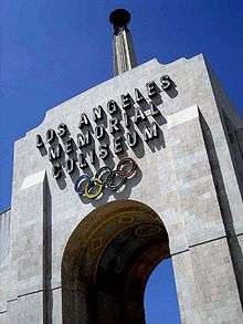
California is the only US state to have hosted both the Summer and Winter Olympics. The 1932 and 1984 Summer Olympics were held in Los Angeles. Squaw Valley Ski Resort in the Lake Tahoe region hosted the 1960 Winter Olympics. Multiple games during the 1994 FIFA World Cup took place in California, with the Rose Bowl hosting eight matches including the final, while Stanford Stadium hosted six matches.
Below is a list of major league sports teams in California:
| Club | Sport | League |
|---|---|---|
| Los Angeles Rams | American football | National Football League (NFL) |
| Oakland Raiders | American football | National Football League |
| San Diego Chargers | American football | National Football League |
| San Francisco 49ers | American football | National Football League |
| Los Angeles Dodgers | Baseball | Major League Baseball (MLB) |
| Los Angeles Angels of Anaheim | Baseball | Major League Baseball |
| Oakland Athletics | Baseball | Major League Baseball |
| San Diego Padres | Baseball | Major League Baseball |
| San Francisco Giants | Baseball | Major League Baseball |
| Golden State Warriors | Basketball | National Basketball Association (NBA) |
| Los Angeles Clippers | Basketball | National Basketball Association |
| Los Angeles Lakers | Basketball | National Basketball Association |
| Sacramento Kings | Basketball | National Basketball Association |
| Los Angeles Sparks | Basketball | Women's National Basketball Association (WNBA) |
| Anaheim Ducks | Ice hockey | National Hockey League (NHL) |
| Los Angeles Kings | Ice hockey | National Hockey League |
| San Jose Sharks | Ice hockey | National Hockey League |
| Los Angeles Galaxy | Soccer | Major League Soccer (MLS) |
| San Jose Earthquakes | Soccer | Major League Soccer |
| Los Angeles Football Club | Soccer | Major League Soccer |
Education
Public secondary education consists of high schools that teach elective courses in trades, languages, and liberal arts with tracks for gifted, college-bound and industrial arts students. California's public educational system is supported by a unique constitutional amendment that requires a minimum annual funding level for grades K–12 and community colleges that grows with the economy and student enrollment figures.[142]
California had over 6.2 million school students in the 2005–06 school year. Funding and staffing levels in California schools lag behind other states. In expenditure per pupil, California ranked 29th (of the 50 states and the District of Columbia) in 2005–06. In teaching staff expenditure per pupil, California ranked 49th of 51. In overall teacher-pupil ratio, California was also 49th, with 21 students per teacher. Only Arizona and Utah were lower.[143]
A 2007 study concluded that California's public school system was "broken" in that it suffered from over-regulation.[144]
California's public postsecondary education offers three separate systems:
- The research university system in the state is the University of California (UC), a public university system. As of fall 2011, the University of California had a combined student body of 234,464 students.[145] There are ten general UC campuses, and a number of specialized campuses in the UC system. The system was originally intended to accept the top one-eighth of California high school students, but several of the schools have become even more selective. The UC system was originally given exclusive authority in awarding Ph.Ds, but this has since changed and the CSU is also able to award several Doctoral degrees.
- The California State University (CSU) system has almost 430,000 students, making it the largest university system in the United States. The CSU was originally intended to accept the top one-third of California high school students, but several of the schools have become much more selective. The CSU was originally set up to award only bachelor's and master's degrees, but has since been granted the authority to award several Doctoral degrees.
- The California Community Colleges System provides lower division coursework as well as basic skills and workforce training. It is the largest network of higher education in the US, composed of 112 colleges serving a student population of over 2.6 million.
California is also home to such notable private universities as Stanford University, the University of Southern California, the California Institute of Technology, and the Claremont Colleges. California has hundreds of other private colleges and universities, including many religious and special-purpose institutions.
Economy
.svg.png)
The economy of California is large enough to be comparable to that of the largest of countries. As of 2016, the gross state product (GSP) is about $2.514 trillion, the largest in the United States.[148] California is responsible for 13.9 percent of the United States' approximate $18.1 trillion gross domestic product (GDP).[148] California's GSP is larger than the GDP of all but 5 countries in dollar terms (the United States, China, Japan, Germany, and the United Kingdom),[149][150] larger than Brazil, France, Russia, Italy, India, Canada, Australia, Spain and Turkey. In Purchasing Power Parity,[151] it is larger than all but 10 countries (the United States, China, India, Japan, Germany, Russia, Brazil, France, the United Kingdom, and Indonesia), larger than Italy, Mexico, Spain, South Korea, Saudi Arabia, Canada and Turkey.[152]
The five largest sectors of employment in California are trade, transportation, and utilities; government; professional and business services; education and health services; and leisure and hospitality. In output, the five largest sectors are financial services, followed by trade, transportation, and utilities; education and health services; government; and manufacturing.[153] As of September 2016, California has an unemployment rate of 5.5%.
California's economy is dependent on trade and international related commerce accounts for about one-quarter of the state's economy. In 2008, California exported $144 billion worth of goods, up from $134 billion in 2007 and $127 billion in 2006.[154] Computers and electronic products are California's top export, accounting for 42 percent of all the state's exports in 2008.[154]
Agriculture is an important sector in California's economy. Farming-related sales more than quadrupled over the past three decades, from $7.3 billion in 1974 to nearly $31 billion in 2004.[155] This increase has occurred despite a 15 percent decline in acreage devoted to farming during the period, and water supply suffering from chronic instability. Factors contributing to the growth in sales-per-acre include more intensive use of active farmlands and technological improvements in crop production.[155] In 2008, California's 81,500 farms and ranches generated $36.2 billion products revenue.[156] In 2011, that number grew to $43.5 billion products revenue.[157] The Agriculture sector accounts for two percent of the state's GDP and employs around three percent of its total workforce.[158] According to the USDA in 2011, the three largest California agricultural products by value were milk and cream, shelled almonds, and grapes.[159]
Per capita GDP in 2007 was $38,956, ranking eleventh in the nation.[160] Per capita income varies widely by geographic region and profession. The Central Valley is the most impoverished, with migrant farm workers making less than minimum wage. According to a 2005 report by the Congressional Research Service, the San Joaquin Valley was characterized as one of the most economically depressed regions in the United States, on par with the region of Appalachia.[161] California has a poverty rate of 23.5%, the highest of any state in the country.[162] Many coastal cities include some of the wealthiest per-capita areas in the United States The high-technology sectors in Northern California, specifically Silicon Valley, in Santa Clara and San Mateo counties, have emerged from the economic downturn caused by the dot-com bust.
.png)
In 2010, there were more than 663,000 millionaires in the state, more than any other state in the nation.[163] In 2010, California residents were ranked first among the states with the best average credit score of 754.[164]
State finances
.svg.png)
State spending increased from $56 billion in 1998 to $127 billion in 2011.[165][166] California, with 12% of the United States population, has one-third of the nation's welfare recipients.[167] California has the third highest per capita spending on welfare among the states, as well as the highest spending on welfare at $6.67 billion.[168] In January 2011 the California's total debt was at least $265 billion.[169] On June 27, 2013, Governor Jerry Brown signed a balanced budget (no deficit) for the state, its first in decades; however the state's debt remains at $132 billion.[170][171]
With the passage of Proposition 30 in 2012, California now levies a 13.3% maximum marginal income tax rate with ten tax brackets, ranging from 1% at the bottom tax bracket of $0 annual individual income to 13.3% for annual individual income over $1,000,000. California has a state sales tax of 7.5%, though local governments can and do levy additional sales taxes. Many of these taxes are temporary for a seven-year period (as stipulated in Proposition 30) and afterwards will revert to a previous maximum marginal income tax bracket of 10.3% and state sales tax rate of 7.25%.[172]
All real property is taxable annually; the tax is based on the property's fair market value at the time of purchase or new construction. Property tax increases are capped at 2% per year (see Proposition 13).
Infrastructure
Energy
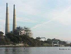
Because it is the most populous United States state, California is one of the country's largest users of energy. However because of its high energy rates, conservation mandates, mild weather in the largest population centers and strong environmental movement, its per capita energy use is one of the smallest of any United States state.[173] Due to the high electricity demand, California imports more electricity than any other state, primarily hydroelectric power from states in the Pacific Northwest (via Path 15 and Path 66) and coal- and natural gas-fired production from the desert Southwest via Path 46.[174]
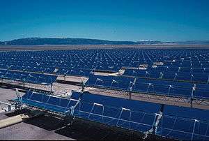
As a result of the state's strong environmental movement, California has some of the most aggressive renewable energy goals in the United States, with a target for California to obtain a third of its electricity from renewables by 2020.[175] Currently, several solar power plants such as the Solar Energy Generating Systems facility are located in the Mojave Desert. California's wind farms include Altamont Pass, San Gorgonio Pass, and Tehachapi Pass. Several dams across the state provide hydro-electric power. It would be possible to convert the total supply to 100% renewable energy, including heating, cooling and mobility, by 2050.[176]
The state's crude oil and natural gas deposits are located in the Central Valley and along the coast, including the large Midway-Sunset Oil Field. Natural gas-fired power plants typically account for more than one-half of state electricity generation.
California is also home to two major nuclear power plants: Diablo Canyon and San Onofre, the latter having been shut down in 2013. Also voters banned the approval of new nuclear power plants since the late 1970s because of concerns over radioactive waste disposal.[177][note 4] In addition, several cities such as Oakland, Berkeley and Davis have declared themselves as nuclear-free zones.
Transportation
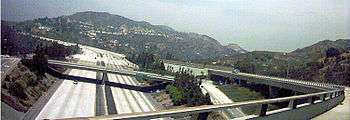
California's vast terrain is connected by an extensive system of controlled-access highways ('freeways'), limited-access roads ('expressways'), and highways. California is known for its car culture, giving California's cities a reputation for severe traffic congestion. Construction and maintenance of state roads and statewide transportation planning are primarily the responsibility of the California Department of Transportation, nicknamed "Caltrans". The rapidly growing population of the state is straining all of its transportation networks, and California has some of the worst roads in the United States.[179][180] The Reason Foundation's 19th Annual Report on the Performance of State Highway Systems ranked California's highways the third-worst of any state, with Alaska second, and Rhode Island first.[181]
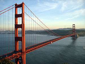
The state has been a pioneer in road construction. One of the state's more visible landmarks, the Golden Gate Bridge, was once the longest suspension bridge main span in the world at 4,200 feet (1,300 m) when it opened in 1937. With its orange paint and panoramic views of the bay, this highway bridge is a popular tourist attraction and also accommodates pedestrians and bicyclists. The San Francisco–Oakland Bay Bridge (often abbreviated the "Bay Bridge"), completed in 1936, transports about 280,000 vehicles per day on two-decks. Its two sections meet at Yerba Buena Island through the world's largest diameter transportation bore tunnel, at 76 feet (23 m) wide by 58 feet (18 m) high.[182] The Arroyo Seco Parkway, connecting Los Angeles and Pasadena, opened in 1940 as the first freeway in the Western United States.[183] It was later extended south to the Four Level Interchange in downtown Los Angeles, regarded as the first stack interchange ever built.[184]
Los Angeles International Airport (LAX), the 6th busiest airport in the world, and San Francisco International Airport (SFO), the 21st busiest airport in the world, are major hubs for trans-Pacific and transcontinental traffic. There are about a dozen important commercial airports and many more general aviation airports throughout the state.
California also has several important seaports. The giant seaport complex formed by the Port of Los Angeles and the Port of Long Beach in Southern California is the largest in the country and responsible for handling about a fourth of all container cargo traffic in the United States. The Port of Oakland, fourth largest in the nation, also handles trade entering from the Pacific Rim to the rest of the country. The Port of Stockton is the easternmost port on the west coast of the United States.[185]
The California Highway Patrol is the largest statewide police agency in the United States in employment with over 10,000 employees. They are responsible for providing any police-sanctioned service to anyone on California's state maintained highways and on state property.
The California Department of Motor Vehicles is by far the largest in North America. By the end of 2009, the California DMV had 26,555,006 driver's licenses and ID cards on file.[186] In 2010, there were 1.17 million new vehicle registrations in force.[187]
Intercity rail travel is provided by Amtrak California, which manages the three busiest intercity rail lines in the United States outside the Northeast Corridor, all of which are funded by Caltrans. This service is becoming increasingly popular over flying and ridership is continuing to set records, especially on the LAX-SFO route.[188] Integrated subway and light rail networks are found in Los Angeles (Metro Rail) and San Francisco (MUNI Metro). Light rail systems are also found in San Jose (VTA), San Diego (San Diego Trolley), Sacramento (RT Light Rail), and Northern San Diego County (Sprinter). Furthermore, commuter rail networks serve the San Francisco Bay Area (ACE, BART, Caltrain), Greater Los Angeles (Metrolink), and San Diego County (Coaster).
The California High-Speed Rail Authority was created in 1996 by the state to implement an extensive 700 miles (1,100 km) rail system. Construction was approved by the voters during the November 2008 general election, a $9.95 billion state bond will go toward its construction.[189] Nearly all counties operate bus lines, and many cities operate their own city bus lines as well. Intercity bus travel is provided by Greyhound and Amtrak Thruway Coach.
Water
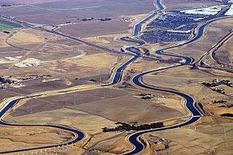
California's interconnected water system is the world's largest, managing over 40,000,000 acre feet (49 km3) of water per year, centered on six main systems of aqueducts and infrastructure projects.[190] Water use and conservation in California is a politically divisive issue, as the state experiences periodic droughts and has to balance the demands of its large agricultural and urban sectors, especially in the arid southern portion of the state. The state's widespread redistribution of water also invites the frequent scorn of environmentalists.
The California Water Wars, a conflict between Los Angeles and the Owens Valley over water rights, is one of the most well-known examples of the struggle to secure adequate water supplies.[191] Former California Governor Arnold Schwarzenegger said: "We've been in crisis for quite some time because we're now 38 million people and not anymore 18 million people like we were in the late 60s. So it developed into a battle between environmentalists and farmers and between the south and the north and between rural and urban. And everyone has been fighting for the last four decades about water."[192]
Government and politics
Government

The state's capital is Sacramento.
California is organized into three branches of government – the executive branch consisting of the Governor and the other independently elected constitutional officers; the legislative branch consisting of the Assembly and Senate; and the judicial branch consisting of the Supreme Court of California and lower courts. The state also allows ballot propositions: direct participation of the electorate by initiative, referendum, recall, and ratification. Before the passage of California Proposition 14 (2010), California allowed each political party to choose whether to have a closed primary or a primary where only party members and independents vote. After June 8, 2010 when Proposition 14 was approved, excepting only the United States President and county central committee offices,[193] all candidates in the primary elections are listed on the ballot with their preferred party affiliation, but they are not the official nominee of that party.[194] At the primary election, the two candidates with the top votes will advance to the general election regardless of party affiliation.[194] If at a special primary election, one candidate receives more than 50% of all the votes cast, they are elected to fill the vacancy and no special general election will be held.[194]
- Executive branch
The California executive branch consists of the Governor of California and seven other elected constitutional officers: Lieutenant Governor, Attorney General, Secretary of State, State Controller, State Treasurer, Insurance Commissioner, and State Superintendent of Public Instruction. They serve four-year terms and may be re-elected only once.[195]
- Legislative branch
The California State Legislature consists of a 40-member Senate and 80-member Assembly. Senators serve four-year terms and Assembly members two. Members of the Assembly are subject to term limits of three terms, and members of the Senate are subject to term limits of two terms.
- Judicial branch
California's legal system is explicitly based upon English common law[196] (as is the case with all other states except Louisiana) but carries a few features from Spanish civil law, such as community property. California's prison population grew from 25,000 in 1980 to over 170,000 in 2007.[197] Capital punishment is a legal form of punishment and the state has the largest "Death Row" population in the country (though Texas is far more active in carrying out executions).
California's judiciary system is the largest in the United States (with a total of 1,600 judges, while the federal system has only about 840). At the apex is the seven Justices of the Supreme Court of California, while the California Courts of Appeal serve as the primary appellate courts and the California Superior Courts serve as the primary trial courts. Justices of the Supreme Court and Courts of Appeal are appointed by the Governor, but are subject to retention by the electorate every 12 years. The administration of the state's court system is controlled by the Judicial Council, composed of the Chief Justice of the California Supreme Court, 14 judicial officers, four representatives from the State Bar of California, and one member from each house of the state legislature.
Local government
Counties
California is divided into 58 counties. Per Article 11, Section 1, of the Constitution of California, they are the legal subdivisions of the state. The county government provides countywide services such as law enforcement, jails, elections and voter registration, vital records, property assessment and records, tax collection, public health, health care, social services, libraries, flood control, fire protection, animal control, agricultural regulations, building inspections, ambulance services, and education departments in charge of maintaining statewide standards.[198][199] In addition, the county serves as the local government for all unincorporated areas. Each county is governed by an elected board of supervisors.[200]
City and town governments
Incorporated cities and towns in California are either charter or general-law municipalities.[100] General-law municipalities owe their existence to state law and are consequently governed by it; charter municipalities are governed by their own city or town charters. Municipalities incorporated in the 19th century tend to be charter municipalities. All ten of the state's most populous cities are charter cities. Most small cities have a council-manager form of government, where the elected city council appoints a city manager to supervise the operations of the city. Some larger cities have a directly-elected mayor who oversees the city government. In many council-manager cities, the city council selects one of its members as a mayor, sometimes rotating through the council membership—but this type of mayoral position is primarily ceremonial.
The Government of San Francisco is the only consolidated city-county in California, where both the city and county governments have been merged into one unified jurisdiction. The San Francisco Board of Supervisors also acts as the city council and the Mayor of San Francisco also serves as the county administrative officer.
School districts and special districts
About 1,102 school districts, independent of cities and counties, handle California's public education.[201] California school districts may be organized as elementary districts, high school districts, unified school districts combining elementary and high school grades, or community college districts.[201]
There are about 3,400 special districts in California.[202] A special district, defined by California Government Code § 16271(d) as "any agency of the state for the local performance of governmental or proprietary functions within limited boundaries", provides a limited range of services within a defined geographic area. The geographic area of a special district can spread across multiple cities or counties, or could consist of only a portion of one. Most of California's special districts are single-purpose districts, and provide one service.
Federal representation
The state of California sends 53 members to the House of Representatives,[203] the nation's largest congressional state delegation. Consequently California also has the largest number of electoral votes in national presidential elections, with 55. California's U.S. Senators are Dianne Feinstein, a native and former mayor of San Francisco, and Barbara Boxer, a former congresswoman from Marin County. As of the beginning of the 114th Congress this is the current longest continuous representation of a state by the same senators, dating from Boxer's accession in 1993.[204]
Politics
| California registered voters as of January 5, 2016[205] | |||||
|---|---|---|---|---|---|
| Party | Number of Voters | Percentage | |||
| Democratic | 7,438,655 | 43.1% | |||
| Republican | 4,767,259 | 27.62% | |||
| No Party Preference | 4,141,860 | 24% | |||
| American Independent | 472,019 | 2.73% | |||
| Libertarian | 120,578 | 0.7% | |||
| Green | 102,688 | 0.59% | |||
| Peace and Freedom | 75,579 | 0.44% | |||
| Other | 140,775 | 0.82% | |||
| Total | 17,259,413 | 100% | |||
| Year | Republican | Democratic |
|---|---|---|
| 2016 | 32.14% 4,196,371 | 61.44% 8,524,069 |
| 2012 | 37.12% 4,839,958 | 60.24% 7,854,285 |
| 2008 | 36.91% 5,011,781 | 60.94% 8,274,473 |
| 2004 | 44.36% 5,509,826 | 54.40% 6,745,485 |
| 2000 | 41.65% 4,567,429 | 53.45% 5,861,203 |
| 1996 | 38.21% 3,828,380 | 51.10% 5,119,835 |
| 1992 | 32.61% 3,630,574 | 46.01% 5,121,325 |
| 1988 | 51.13% 5,054,917 | 47.56% 4,702,233 |
| 1984 | 57.51% 5,467,009 | 41.27% 3,922,519 |
| 1980 | 52.69% 4,524,858 | 35.91% 3,083,661 |
| 1976 | 49.35% 3,882,244 | 47.57% 3,742,284 |
| 1972 | 55.01% 4,602,096 | 41.54% 3,475,847 |
| 1968 | 47.82% 3,467,664 | 44.74% 3,244,318 |
| 1964 | 40.79% 2,879,108 | 59.11% 4,171,877 |
| 1960 | 50.10% 3,259,722 | 49.55% 3,224,099 |
California has an idiosyncratic political culture compared to the rest of the country, and is sometimes regarded as a trendsetter.[207] In socio-cultural mores and national politics, Californians are perceived as more liberal than other Americans, especially those who live in the inland states.
Among the political idiosyncrasies and trendsetting, California was the second state to recall their state governor, the second state to legalize abortion, and the only state to ban marriage for gay couples twice by voters (including Proposition 8 in 2008). Voters also passed Proposition 71 in 2004 to fund stem cell research, and Proposition 14 in 2010 to completely change the state's primary election process. California has also experienced disputes over water rights; and a tax revolt, culminating with the passage of Proposition 13 in 1978, limiting state property taxes.
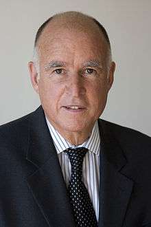
The state's trend towards the Democratic Party and away from the Republican Party can be seen in state elections. From 1899 to 1939, California had Republican governors. Since 1990, California has generally elected Democratic candidates to federal, state and local offices, including current Governor Jerry Brown; however, the state has elected Republican Governors, though many of its Republican Governors, such as Arnold Schwarzenegger, tend to be considered moderate Republicans and more centrist than the national party.
The Democrats also now hold a majority in both houses of the state legislature. There are 56 Democrats and 24 Republicans in the Assembly; and 26 Democrats and 12 Republicans in the Senate.
The trend towards the Democratic Party is most obvious in presidential elections; Republicans have not won California's electoral votes since 1988. Additionally, both the state's current Democratic United States Senators, Dianne Feinstein and Barbara Boxer, have held onto their seats since they were first elected in 1992.
In the United States House, the Democrats held a 34–19 edge in the CA delegation of the 110th United States Congress in 2007. As the result of gerrymandering, the districts in California were usually dominated by one or the other party, and few districts were considered competitive. In 2008, Californians passed Proposition 20 to empower a 14-member independent citizen commission to redraw districts for both local politicians and Congress. After the 2012 elections, when the new system took effect, Democrats gained 4 seats and held a 38–15 majority in the delegation.
In general, Democratic strength is centered in the populous coastal regions of the Los Angeles metropolitan area and the San Francisco Bay Area. Republican strength is still greatest in eastern parts of the state. Orange County also remains mostly Republican. One study ranked Berkeley, Oakland, Inglewood and San Francisco in the top 20 most liberal American cities; and Bakersfield, Orange, Escondido, Garden Grove, and Simi Valley in the top 20 most conservative cities.[208]
In October 2012, out of the 23,802,577 people eligible to vote, 18,245,970 people were registered to vote.[209] Of the people registered, the three largest registered groups were Democrats (7,966,422), Republicans (5,356,608), and Decline to State (3,820,545).[209] Los Angeles County had the largest number of registered Democrats (2,430,612) and Republicans (1,037,031) of any county in the state.[209]
LGBT

California is considered generally liberal in its policies regarding the LGBT community, and the rights of lesbian, gay, bisexual, and transgender people have received greater recognition since 1960 at both the state and municipal level. California is home to a number of gay villages such as the Castro District in San Francisco, Hillcrest in San Diego, and West Hollywood. Through the Domestic Partnership Act of 1999, California became the first state in the United States to recognize same-sex relationships in any legal capacity. In 2000, voters passed Proposition 22, which restricted state recognition of marriage to opposite-sex couples. This was struck down by the California Supreme Court in May 2008, effectively legalizing same-sex marriage; however, this was overruled later that same year when California voters passed Proposition 8. After further judicial cases, in 2013 the U.S. Supreme Court rendered the law void, allowing same-sex marriages in California to resume.
Armed forces

%2C_USS_Nimitz_(CVN_68)_and_USS_Carl_Vinson_(CVN_70)_are_pierside_at_Naval_Air_Station_North_Island.jpg)
In California, as of 2009, the U.S. Department of Defense had a total of 117,806 active duty servicemembers of which 88,370 were Sailors or Marines, 18,339 were Airmen, and 11,097 were Soldiers, with 61,365 Department of Defense civilian employees. Additionally, there were a total of 57,792 Reservists and Guardsman in California.[210]
In 2010, Los Angeles County was the largest origin of military recruits in the United States by county, with 1,437 individuals enlisting in the military.[211] However, as of 2002, Californians were relatively under-represented in the military as a proportion to its population.[212]
In 2000, California, had 2,569,340 veterans of United States military service: 504,010 served in World War II, 301,034 in the Korean War, 754,682 during the Vietnam War, and 278,003 during 1990–2000 (including the Persian Gulf War).[213] As of 2010, there were 1,942,775 veterans living in California, of which 1,457,875 served during a period of armed conflict, and just over four thousand served before World War II (the largest population of this group of any state).[214]
California's military forces consist of the Army and Air National Guard, the naval and state military reserve (militia), and the California Cadet Corps.
Foreign relations
California has a twinning arrangement with ![]() Catalonia, Spain[215]
Catalonia, Spain[215]
See also
- Index of California-related articles
- Outline of California – organized list of topics about California
- Timeline of the far future
Notes
- ↑ The coordinates of the center of population are at 35°27′31″N 119°21′19″W / 35.458606°N 119.355165°W.[99]
- ↑ behind Nevada and Arizona
- ↑ The following are a list of the indigenous languages: Root languages of California: Athabaskan Family: Hupa, Mattole, Lassik, Wailaki, Sinkyone, Cahto, Tolowa, Nongatl, Wiyot, Chilula; Hokan Family: Pomo, Shasta, Karok, Chimiriko; Algonquian Family: Whilkut, Yurok; Yukian Family: Wappo; Penutian Family: Modok, Wintu, Nomlaki, Konkow, Maidu, Patwin, Nisenan, Miwok, Coast Miwok, Lake Miwok, Ohlone, Northern Valley Yokuts, Southern Valley Yokuts, Foothill Yokuts; Hokan Family: Esselen, Salinan, Chumash, Ipai, Tipai, Yuma, Halchichoma, Mohave; Uto-Aztecan Family: Mono Paiute, Monache, Owens Valley Paiute, Tubatulabal, Panamint Shoshone, Kawaisu, Kitanemuk, Tataviam, Gabrielino, Juaneno, Luiseno, Cuipeno, Cahuilla, Serrano, Chemehuevi
- ↑ Minnesota also has a moratorium on construction of nuclear power plants, which has been in place since 1994.[178]
References
- 1 2 3 "Government Code Section 420-429.8". State of California Legislative Council. Retrieved December 24, 2009.
- 1 2 3 Hyon B. Shin; Robert A. Kominski (April 2010). "Language Use in the United States: 2007" (PDF). United States Census Bureau. United States Department of Commerce. Retrieved May 27, 2013.
- 1 2 3 "Appendix Table A for Figures 5A-5H. Percentage Speaking a Language Other Than English at Home by English-Speaking Ability by State: 2007". Language Use in the United States: 2007 (ACS-12): Appendix Tables. United States Census Bureau. 2007. Retrieved May 26, 2013.
- 1 2 3 "U.S. Census population estimates, State Totals. Table 1. Annual Estimates of the Resident Population for the United States, Regions, States, and Puerto Rico: April 1, 2010 to July 1, 2015" (CSV). U.S. Census Bureau. December 23, 2015. Retrieved December 23, 2015.
- 1 2 "Whitney". NGS data sheet. U.S. National Geodetic Survey. Retrieved October 20, 2011.
- 1 2 "Elevations and Distances in the United States". United States Geological Survey. 2001. Archived from the original on October 15, 2011. Retrieved October 21, 2011.
- 1 2 Elevation adjusted to North American Vertical Datum of 1988.
- ↑ The summit of Mount Whitney is the highest point in the Contiguous United States.
- 1 2 "USGS National Elevation Dataset (NED) 1 meter Downloadable Data Collection from The National Map 3D Elevation Program (3DEP) - National Geospatial Data Asset (NGDA) National Elevation Data Set (NED)". United States Geological Survey. September 21, 2015. Retrieved September 22, 2015.
- ↑ Coté, John (December 31, 2010). "Lt. Gov.-elect Gavin Newsom to be sworn in by Jan. 10". San Francisco Chronicle. Hearst Newspapers. Retrieved January 3, 2010.
- ↑ "Government Code Section 424". State of California Legislative Council. Retrieved July 25, 2014.
- ↑ "Frequently Asked Questions". Seismo.berkeley.edu. Retrieved April 22, 2011.
- ↑ Alison Vekshin (June 14, 2016). "California Overtakes France to Become Sixth-Largest Economy". Bloomberg. Retrieved June 14, 2016.
Jason Hanna (January 13, 2012). "Report: California slips to world's 9th largest economy". CNN. Retrieved May 31, 2013.
Guy Adams (May 16, 2012). "California, the ninth largest economy in the world, resorts to austerity". Independent. London. Retrieved May 31, 2013.
"California Economy Slips To Ninth Largest, Behind Brazil". The Huffington Post. Associated Press. January 12, 2012. Retrieved May 31, 2013.
"2013 Cal Facts". Legislative Analyst's Office. State of California. January 2, 2013. Retrieved May 31, 2013.California's Economy Is Ninth-Largest in the World
Kasler, Dale (July 7, 2014). "California has world's 8th largest economy, beating Russia, Italy". Sacramento Bee. Retrieved July 7, 2014. - ↑ "Happy 25th anniversary, World Wide Web". CalWatchdog.com.
- 1 2 "California Gross domestic product (GDP) (millions of current dollars)". U.S. Department of Commerce, Bureau of Economic Analysis. Retrieved July 19, 2015.
- ↑ "2015 Fortune Global 500". Fortune. 2015. Retrieved March 7, 2016.
- ↑ "Fruits and Vegetables, America Eats, from Life in the USA: The Complete Guide for Immigrants and Americans". Life in the USA. Retrieved August 23, 2011.
- ↑ Putnam, Ruth (1917). "Appendix A: Etymology of the Word "California": Surmises and Usage". In Herbert Ingram Priestley. California: the name. Berkeley: University of California. pp. 356–361.
- ↑ Vogeley, Nancy (April 20, 2001). "How Chivalry Formed the Myth of California". Modern Language Quarterly. University of Washington. 62 (2): 165–188. doi:10.1215/00267929-62-2-165.
- ↑ Forsyth, Mark (2011). The Etymologicon: A Circular Stroll Through the Hidden Connections of the English Language. New York NY: Penguin Group/Berkley Books. p. 223. ISBN 978-0-425-26079-1.
- ↑ Gudde, Erwin G. and William Bright. 2004. California Place Names: The Origin and Etymology of Current Geographical Names. pp. 59–60
- ↑ Lavender, David (1987). California: Land of New Beginnings. University of Nebraska Press. p. 27. ISBN 0-8032-7924-8. OCLC 15315566.
- ↑ "Online Etymology Dictionary". Etymonline.com. June 24, 1957. Retrieved July 2, 2010.
- ↑ Putnam, 1917, p. 306
- ↑ Strange But True, Tooele Transcript-Bulletin, August 11, 2016, p. C3
- ↑ Starr 2007, p. 13.
- ↑ "Page 1580 of the 1778 edition of Encyclopædia Britannica (second edition)". Hyzercreek.com. July 15, 2011. Retrieved October 28, 2011.
Carlson, Jon D. (2011). Myths, State Expansion, and the Birth of Globalization: A Comparative Perspective. Palgrave Macmillan. p. 40. ISBN 978-1-137-01045-2. Retrieved August 21, 2014.
Brooke Hoover, Mildred; Kyle, Douglas E., eds. (1990). Historic Spots in California. Stanford University Press. p. 359. ISBN 978-0-8047-1734-2. Retrieved August 21, 2014. - ↑ Tillman, Linda C.; Scheurich, James Joseph (August 21, 2013). The Handbook of Research on Educational Leadership for Equity and Diversity. Routledge. p. 202. ISBN 978-1-135-12843-2.
Huping Ling (April 29, 2009). Asian America: Forming New Communities, Expanding Boundaries. Rutgers University Press. p. 109. ISBN 978-0-8135-4867-8. - ↑ "California as an Island in Maps - Online Exhibits". Stanford University Libraries. Retrieved June 15, 2016.
- ↑ source: Encyclopædia Britannica 7th edition, 1842, "Mexico"
- ↑ Historical Atlas of California
- 1 2 "Introduction". Early History of the California Coast. National Park Service. Retrieved August 26, 2012.
- ↑ Altman, Linda Jacobs (2005). California. Marshall Cavendish. p. 117. ISBN 978-0-7614-1737-8. Retrieved March 16, 2013.
Testimonios: Early California Through the Eyes of Women, 1815–1848. Heyday. 2006. p. 425. ISBN 978-1-59714-033-1. Retrieved March 16, 2013. - ↑ Starr, Kevin (2007). California: A History. Modern Library. pp. 17–. ISBN 978-0-8129-7753-0.
Hoover, Mildred Brooke; Kyle, Douglas E., eds. (2002). Historic Spots in California. Historic Spots in California. p. 316. ISBN 978-0-8047-7817-6. Retrieved March 16, 2013.
Conway, J.D. (2003). Monterey: Presidio, Pueblo, and Port. Arcadia Publishing. The Making of America Series. pp. 53–55. ISBN 978-0-7385-2423-8. Retrieved March 16, 2013. - 1 2 Billington, Ray Allen; Ridge, Martin (2001). Westward Expansion: A History of the American Frontier. University of New Mexico Press. p. 203. ISBN 978-0-8263-1981-4. Retrieved February 16, 2013.
- ↑ Hart, James David (1987). A Companion to California. University of California Press. p. 315. ISBN 978-0-520-05544-5. Retrieved March 16, 2013.
Harlow, Neal (1989). California Conquered: The Annexation of a Mexican Province, 1846–1850. University of California Press. p. 27. ISBN 978-0-520-06605-2. Retrieved March 16, 2013. - ↑ Lyman, George D. and John Marsh, Pioneer: The Life Story of a Trail-Blazer on Six Frontiers, pp. 237–39, The Chautauqua Press, Chautauqua, New York, 1931.
- ↑ Lyman and Marsh, pp. ix, 209, 231, 238–39, 246–51, 266–67, 268–71.
- ↑ Lyman and Marsh, pp. 250–62.
- ↑ "William B. Ide Adobe SHP". California State Parks. Retrieved December 25, 2009.
- ↑ "Bear Flag Revolt". History.com. 2015. Retrieved June 5, 2015.
"The United States and California". Early California History: An Overview. Library of Congress. 1998. Retrieved June 5, 2015. - ↑ "The U.S. Mexican War". The Border. KPBS. 1999. Retrieved June 5, 2015.
Matthew Kachur; Jon Sterngass (July 1, 2006). The Mexican-American War. World Almanac Library. pp. 25–26. ISBN 978-0-8368-7290-3.
Thomas M. Leonard (2001). James K. Polk: A Clear and Unquestionable Destiny. Rowman & Littlefield. pp. 141–143. ISBN 978-0-8420-2647-5. - ↑ Spencer Tucker (Militärhistoriker) (2013). The Encyclopedia of the Mexican-American War: A Political, Social, and Military History. ABC-CLIO. pp. 55–56. ISBN 978-1-85109-853-8.
- ↑ The Quarterly. Historical Society of Southern California. 1907. pp. 199–201.
Hunt Janin; Ursula Carlson (April 20, 2015). The California Campaigns of the U.S.-Mexican War, 1846–1848. McFarland. pp. 149–151. ISBN 978-1-4766-2093-0. - ↑ Osborne, Thomas J. (November 29, 2012). Pacific Eldorado: A History of Greater California. Wiley. ISBN 978-1-118-29217-4.
- ↑ "California Gold Rush, 1848–1864". Learn California.org, a site designed for the California Secretary of State. Retrieved July 22, 2008.
- ↑ "1870 Fast Facts". U.S. Census Bureau.
- ↑ "Destruction of the California Indians". California Secretary of State. Retrieved April 15, 2012.
- 1 2 3 "INDIANS of CALIFORNIA – American Period". Cabrillo.edu. Retrieved March 21, 2012.
- ↑ "California Militia and Expeditions Against the Indians, 1850–1859". Militarymuseum.org. Retrieved March 21, 2012.
- ↑ see also Benjamin Madley, American Genocide: The California Indian Catastrophe, 1846–1873, Yale University Press, 2012.
- ↑ Wilson, Dotson; Ebbert, Brian S. (2006). California's Legislature (PDF) (2006 ed.). Sacramento: California State Assembly. OCLC 70700867.
- ↑ "California – Race and Hispanic Origin: 1850 to 1990". U.S. Census Bureau. Archived from the original on December 24, 2014.
- ↑ Peck, Merton J. & Scherer, Frederic M. The Weapons Acquisition Process: An Economic Analysis (1962) Harvard Business School p. 111
- 1 2 Bill Watkins (October 10, 2012). "How California Lost its Mojo". Fox and Hound Daily. Retrieved June 25, 2013.
Nancy Kleniewski; Alexander R. Thomas (March 1, 2010). Cities, Change, and Conflict: A Political Economy of Urban Life. Cengage Learning. pp. 91–92. ISBN 978-0-495-81222-7. Retrieved June 26, 2013. - ↑ Rosa Maria Moller (May 2008). "Aerospace States' Incentives to Attract The Industry" (PDF). library.ca.gov. California Research Bureau. pp. 24–25. Retrieved June 25, 2013.
Robert A. Kleinhenz; Kimberly Ritter-Martinez; Rafael De Anda; Elizabeth Avila (August 2012). "The Aerospace Industry in Southern California" (PDF). laedc.org. p. 10. Retrieved June 25, 2013.In 1987, California accounted for one in four aerospace jobs nationally, and in Los Angeles County, the share was one in ten. Following the collapse of the Soviet Union and the end of the Cold War, the Department of Defense (DOD) sharply curtailed procurement spending. In 1995, DOD spending fell below $50 billion for the first time since 1982. Nowhere in the country were the changes in Pentagon outlays more apparent than in Southern California.
Eric John Heikkila; Rafael Pizarro (January 1, 2002). Southern California and the World. Greenwood Publishing Group. p. 18. ISBN 978-0-275-97112-0. Retrieved June 25, 2013.
James Flanigan (2009). Smile Southern California, You're the Center of the Universe: The Economy and People of a Global Region. Stanford University Press. p. 25. ISBN 978-0-8047-5625-9. Retrieved June 25, 2013. - ↑ Markoff, John (April 17, 2009). "Searching for Silicon Valley". The New York Times. Retrieved February 26, 2011.
- ↑ Saul Bernard Cohen (2003). Geopolitics of the World System. Rowman & Littlefield. pp. 115–116. ISBN 978-0-8476-9907-0.
- ↑ Clark Davis; David Igler (August 1, 2002). The Human Tradition in California. Rowman & Littlefield Publishers. p. 11. ISBN 978-1-4616-4431-6.
Treanor, Jill (July 17, 2001). "Pink slip season in Silicon Valley". The Guardian. United Kingdom. Retrieved April 22, 2015.This micro-economy - the world's fifth largest economy in its own right - started to feel the pain of the new technology meltdown first.
- ↑ Taylor, Lisa (March 30, 1997). "Getting Out: The Great California Exodus : Remember us? We left Southern California looking for cheaper housing, employment opportunities and a better way of life. Well ... We're Ba-aack!". Los Angeles Times. Retrieved April 22, 2015.
- ↑ Shepard Krech, III; J. R. McNeill; Carolyn Merchant (2004). Encyclopedia of world environmental history: O-Z, Index. Taylor & Francis Group. pp. 540–. ISBN 978-0-415-93734-4. Retrieved November 23, 2012.
- ↑ Riedel, Monique (2009). Best Easy Day Hikes Ventura. Falcon Guides. Pages 35–38. ISBN 978-0-7627-5121-1.
- ↑ "2000 Census of Population and Housing" (PDF). US Census Bureau. April 2004. p. 29. Retrieved December 25, 2009.
- ↑ "Figures Show California's Motoring Supremacy". Touring Topics. Los Angeles, California: Automobile Club of Southern California. 8 (2): 38–9. March 1916.
- ↑ Cooley, Timothy J. (2014). Surfing about Music. University of California Press. p. 46. ISBN 978-0-520-95721-3.
- ↑ Morgan, Neil (April 19, 1963). "Westward Tilt: Northern California". Lodi News-Sentinel. Lodi, California. Retrieved September 7, 2014.
- ↑ John E. Kent, eds. (1917). Kent Guide Manual (Harrison Narcotic Law) and Progessional Registry. San Francisco: The Service Press. p. 6.
- ↑ "unknown facts".
- ↑ Laaksonen-Craig, Susanna; Goldman, George; McKillop, William (2003). Forestry, Forest Products, and Forest Products Consumption in California (PDF). Davis, California: University of California – Division of Agriculture and Natural Resources. p. 1. ISBN 978-1-60107-248-1.
- ↑ Lanner, RM (2007). The Bristlecone Book. Mountain Press. p. 14. ISBN 978-0-87842-538-9.
- ↑ "Oldlist". Rocky Mountain Tree Ring Research. Retrieved January 8, 2013.
- ↑ El Fadli, KI; et al. (September 2012). "World Meteorological Organization Assessment of the Purported World Record 58°C Temperature Extreme at El Azizia, Libya (13 September 1922)". Bulletin of the American Meteorological Society. 94 (2): 199. doi:10.1175/BAMS-D-12-00093.1. (The 136.4 °F (58 °C), claimed by 'Aziziya, Libya, on September 13, 1922, has been officially deemed invalid by the World Meteorological Organization.)
- ↑ "World Meteorological Organization World Weather / Climate Extremes Archive". Archived from the original on January 4, 2013. Retrieved January 10, 2013.
- ↑ "California climate averages". Weatherbase. Retrieved November 11, 2015.
- ↑ "Checklist of the Scarabaeoidea of the Nearctic Realm" (PDF). digitalcommons.unl.edu (University of Nebraska State: Papers in Entomology). 2003. Retrieved October 5, 2010.
- ↑ David Elstein (May 2004). "Restoring California's Native Grasses". Agricultural Research magazine. 52 (5): 17. Retrieved December 25, 2009.
- ↑ "The California Invasive Species List" (PDF). iscc.ca.gov (California Invasive Species Advisory Committee). April 21, 2010. Retrieved October 5, 2010.
- 1 2 3 4 5 6 7 8 9 "California: flora and fauna". city-data.com. 2010. Retrieved September 7, 2010.
- ↑ "Sequoia sempervirens (D. Don) Endl.". fed.us (U.S. Forest Service). Retrieved October 7, 2010.
- ↑ "Life Zones of the Central Sierra Nevada". sierrahistorical.org. Archived from the original on March 1, 2012. Retrieved October 5, 2010.
- ↑ "California Condor". The Cornell Lab of Ornithology. 2009. Retrieved October 3, 2010.
- ↑ "CalPhotos: Browse Mammal Common Names". calphotos.berkeley.edu (BSCIT University of California, Berkeley). October 2, 2010. Retrieved October 3, 2010.
- ↑ "Quail Ridge Reserve: UC Davis Natural Reserve System". nrs.ucdavis.edu (University of California at Davis: Natural Reserve System). April 5, 2007. Retrieved October 5, 2010.
- ↑ "Black-tailed Deer of California". westernhunter.com. 2000. Retrieved October 7, 2010.
- ↑ "California's Endangered Insects - Formally Listed Insects". berkeley.edu. Retrieved August 25, 2015.
- 1 2 "U.S. Fish & Wildlife Service: Species Reports: Listings and occurrences for California". ecos.fws.gov. September 7, 2010. Retrieved September 7, 2010.
- ↑ "CALIFORNIA GREW BY 356,000 RESIDENTS IN 2013" (PDF). Archived from the original (PDF) on May 2, 2014. Retrieved September 26, 2016.
- ↑ "1990 Census of Population and Housing, Unit Counts,United States, 1990 CPH-2-1" (PDF). Population and Housing Unit Counts, Population Estimates 1790–1990, pages 26–27. United States Census Bureau, U.S. Department of Commerce Economics and Statistics Administration. August 20, 1993. Retrieved January 1, 2012.
- 1 2 "California QuickFacts from the US Census Bureau:". US Census Bureau. Retrieved December 26, 2009.
- ↑ "American Indian Civics Project: Indians of Northern California: A Case Study of Federal, State, and Vigilante Intervention, 1850–1860". Americanindiantah.com. Retrieved March 21, 2012.
- 1 2 "Table 4. Cumulative Estimates of the Components of Resident Population Change for the United States, Regions, States, and Puerto Rico: April 1, 2000 to July 1, 2009" (CSV). US Census Bureau. December 22, 2009. Retrieved December 26, 2009.
- ↑ "E-4 Population Estimates for Cities, Counties and the State, 2001–2009, with 2000 Benchmark.". Sacramento, California: State of California, Department of Finance. May 2009. Archived from the original on November 22, 2009. Retrieved December 24, 2009.
- ↑ Gray, Tom; Scardamalia, Robert (September 2012). "The Great California Exodus: A Closer Look". Manhattan-institute.org. Retrieved April 30, 2013.
- ↑ "Censo 2010: população do Brasil é de 190.732.694 pessoas". Retrieved September 19, 2011.
- ↑ "International Database – County Rankings". US Census Bureau. Retrieved December 26, 2009.
- ↑ "Table A.1. Total Population by Sex in 2009 and Sex Ratio by Country in 2009" (PDF). World Population Prospects: The 2008 Edition, Highlights. United Nations, Department of Economic and Social Affairs, Population Division. 2009. pp. 31–35. Archived from the original (PDF) on December 29, 2010. Retrieved December 26, 2009.
- ↑ "About Los Angeles County Department of Public Social Services". Los Angeles County Department of Public Social Services. December 2005. Archived from the original on April 17, 2010. Retrieved December 26, 2009.
- ↑ Barrett, Beth (September 19, 2003). "Baby Slump In L.A. County". Los Angeles Daily News. Los Angeles Newspaper Group. pp. N4. Archived from the original on July 15, 2010. Retrieved December 26, 2009.
- ↑ "Population and Population Centers by State: 2000". United States Census 2000. US Census Bureau Geography Division. May 20, 2002. Archived from the original (TXT) on June 22, 2013. Retrieved December 26, 2009.
- 1 2 "CA Codes (gov:34500-34504)". California State Senate. Retrieved January 29, 2010.
- ↑ "Instant City: Sacramento". California State Library. Archived from the original on January 28, 2010. Retrieved January 29, 2010.
- ↑ "San Jose at a Glance". City of San Jose. Retrieved January 29, 2010.
- ↑ "A History of San Diego Government". City of San Diego. Archived from the original on May 28, 2010. Retrieved January 29, 2010.
- ↑ "California State Parks: 1846 to 1854". California State Parks. May 23, 2007. Retrieved January 29, 2010.
- ↑ "Jurupa Valley Becomes California's 482nd City". League of California Cities. March 11, 2011. Archived from the original on May 6, 2012. Retrieved August 21, 2011.
- ↑ Stokley, Sandra (June 14, 2011). "JURUPA VALLEY: Rushing to meet a July 1 incorporation". The Press-Enterprise. Retrieved August 21, 2011.
- ↑ "California (USA): State, Major Cities, Towns & Places". City Population. February 19, 2011. Retrieved July 13, 2015.
- ↑ Teresa Watanabe; Hector Becerra (April 1, 2010). "Native-born Californians regain majority status". Los Angeles Times. Retrieved January 19, 2013.
- 1 2 3 4 "Net Migration from Mexico Falls to Zero—and Perhaps Less" (PDF). Pew Hispanic Center. Retrieved July 19, 2015.
- 1 2 Stephen Magagnini; Phillip Reese (January 17, 2013). "Census shows Asians eclipse Latino arrivals to California". Sacramento Bee. Archived from the original on January 18, 2013. Retrieved January 19, 2013.
- 1 2 3 "Latino mojo". The Economist. June 20, 2015.
- ↑ "Unauthorized Immigrants: 11.1 Million in 2011". Pew Research Center's Hispanic Trends Project. December 6, 2012. Retrieved August 25, 2015.
- ↑ California's Illegal Immigrant Shortage, Bloomberg BusinessWeek, May 3, 2012
- ↑ Slevin, Peter (April 30, 2010). "New Arizona law puts police in 'tenuous' spot". The Washington Post. Washington, DC. pp. A4.
- 1 2 Michael Gardner (April 19, 2011). "Cutting services to illegal immigrants isn't easy". U-T San Diego. Retrieved April 22, 2011.
- ↑ Johnson, Hans; Hill, Laura (July 2011). "Illegal Immigration" (PDF). Publications. Public Policy Institute of California. Retrieved January 15, 2013.
- 1 2 2015 U.S. Census QuickFacts, United States Census Bureau, 2015.
- ↑ Exner, Rich. "Americans under age 1 now mostly minorities, but not in Ohio: Statistical Snapshot". cleveland.com. Advance Ohio. Retrieved September 20, 2016.
- ↑ "California – ACS Demographic and Housing Estimates: 2006–2008". American Fact Finder. US Census Bureau. Archived from the original on April 30, 2011. Retrieved March 8, 2016.
- ↑ "Whites in state 'below the replacement' level". San Francisco Chronicle. June 5, 2010.
- ↑ Wendell Cox. "ASIANS: AMERICA'S FASTEST GROWING MINORITY". NewsGeography. Retrieved July 19, 2015.
- 1 2 Campbell Gibson; Kay Jung (September 2002). "Historical Census Statistics on Population Totals By Race, 1790 to 1990, and By Hispanic Origin, 1970 to 1990, For The United States, Regions, Divisions, and States". Population Division. United States Census Bureau. Retrieved December 27, 2014.
- ↑ "California: 2000" (PDF). Census 2000 Profile. United States Census Bureau. August 2002. Retrieved December 27, 2014.
- ↑ "Profile of General Population and Housing Characteristics: 2010". 2010 Census Summary File 1. United States Census Bureau. 2010. Retrieved December 27, 2014.
- ↑ "Total Ancestry Reported". 2009–2013 American Community Survey 5-Year Estimates. United States Census Bureau. 2013. Retrieved January 1, 2015.
- ↑ "California". Modern Language Association. Retrieved August 11, 2013.
- ↑ "What other languages is the written or audio test available in?//Driver License and Identification (ID) Card Information". California Department of Motor Vehicles.
- ↑ Wesson, Herb (July 17, 2001). "AB 800 Assembly Bill – Bill Analysis". California State Assembly. p. 3. Retrieved December 27, 2009.
In 1986, California voters amended the state constitution to provide that the: The [sic] Legislature and officials of the State of California shall take all steps necessary to insure that the role of English as the common language of the State of California is preserved and enhanced. The Legislature shall make no law which diminishes or ignores the role of English as the common language of California."
- ↑ Hull, Dana (May 20, 2006). "English already is "official" in California". San Jose Mercury News. San Jose, California.
- ↑ "MLA Data Center". Retrieved August 10, 2013.
- ↑ Native Tribes, Groups, Language Families and Dialects of California in 1770 (Map) (1966 ed.). Coyote Press. Retrieved December 27, 2009.
- ↑ California Indians Root Languages and Tribal Groups (Map) (1994 ed.). California State Parks. Retrieved December 27, 2009.
- ↑ "Indigenous Farmworker Study – Indigenous Mexicans in California Agriculture. Section V. Language and Culture" (PDF). 2013. Retrieved July 1, 2013.
- ↑ Bucholtz, Mary; et all (December 2007). "Hella Nor Cal or Totally So Cal? : The Perceptual Dialectology of California". Journal of English Linguistics. 35 (4): 325–352. doi:10.1177/0075424207307780. Retrieved November 4, 2010.
- ↑ Park, Bborie (December 2003). "A World of Opportunity – Which New Languages Davis Students Would Like to Study and Why" (PDF). UC Davis Student Affairs Research and Information. Retrieved December 27, 2009.
- 1 2 "America's Changing Religious Landscape, Appendix D: Detailed Tables" (PDF). Pew Research Center. May 12, 2015. Retrieved June 5, 2015.
- ↑ "Religious Affiliation by State in the U.S" (PDF). U.S Religious Landscape Study. Pew Research Center. p. 103. Retrieved June 24, 2010.
- ↑ Ira M. Sheskin and Arnold Dashefsky, "Jewish Population of the United States, 2006", American Jewish Year Book 2006, Volume 106
- ↑ "The Association of Religion Data Archives | State Membership Report". thearda.com. Retrieved December 16, 2013.
- ↑ Helfand, Duke (June 24, 2008). "State has a relaxed view on religion – Survey finds Californians are less certain about the existence of God than others in the U.S". Los Angeles Times. Retrieved December 27, 2009.
- ↑ Naranjo, Candice. "The Super Bowl is Coming to Levi's Stadium in 2016". KRON 4. Retrieved March 28, 2014.
- ↑ "Proposition 98 Primer". Legislative Analyst's Office of California. February 2005. Retrieved January 29, 2010.
- ↑ "California Comparison". Education Data Partnership. Retrieved January 29, 2010.
- ↑ Marshall, Carolyn (March 16, 2007). "Report Says Public Schools in California Are 'Broken' – New York Times". The New York Times. California. Retrieved August 23, 2011.
- ↑ "About the University of California".
- ↑ "Regional Economic Accounts (interactive tables)". Bureau of Economic Analysis. Retrieved January 31, 2010.
- ↑ "Country Comparison :: GDP (purchasing power parity)". The World Factbook. Central Intelligence Agency. Retrieved January 31, 2010.
- 1 2 "Widespread But Slower Growth in 2013" (PDF). Bureau of Economic Analysis, U.S. Department of Labor. June 11, 2014. Retrieved June 11, 2014.
- ↑ Comparison between U.S. states and countries by GDP (nominal)
- ↑ "California Poised to Move Up in World Economy Rankings in 2013" (PDF). Center for Continuing Study of the California Economy. July 2013. Retrieved June 14, 2014.
- ↑ "Calif. retains economy that would be 8th largest". Bloomberg BusinessWeek. December 2, 2010. Retrieved September 2, 2012.
- ↑ "GDP, PPP (current international $)". World Bank, International Comparison Program database. Retrieved June 14, 2014.
- ↑ "2011 CalFacts". Lao.ca.gov. Retrieved April 22, 2011.
- 1 2 "Trade Statistics". California Chamber of Commerce. Retrieved January 29, 2010.
- 1 2 "Cal Facts 2006 State Economy". Legislative Analyst's Office of California. August 6, 2007. Retrieved January 29, 2010.
- ↑ "California Agricultural Production Statistics 2009–2010". cdfa.ca.gov (California Department of Food and Agriculture). 2010. Retrieved October 5, 2010.
- ↑ "California Agricultural Production Statistics 2011". cdfa.ca.gov (California Department of Food and Agriculture). 2013. Retrieved May 18, 2013.
- ↑ Venton, Danielle (June 5, 2015). "A Better Way for California to Water Its Farms". Wired. Retrieved June 5, 2015.
- ↑ Vic Tolomeo; Kelly Krug; Doug Flohr; Jason Gibson (October 31, 2012). "California Agricultural Statistics: 2011 Crop Year" (PDF). National Agricultural Statistics Service. United States Department of Agriculture. Retrieved July 1, 2013.
- ↑ "State Personal Income 2006" (Press release). Bureau of Economic Analysis. March 27, 2007. Retrieved January 29, 2010.
- ↑ Cowan, Tadlock (December 12, 2005). "California's San Joaquin Valley: A Region in Transition" (PDF). Congressional Research Service, Library of Congress. p. 2. Retrieved January 29, 2010.
- ↑ Berlinger, Joshua (November 12, 2012). "A New Poverty Calculation Yields Some Surprising Results". Business Insider. Retrieved October 7, 2013.
- ↑ Scott, Walter (May 2, 2010). "Personality Parade". Parade Magazine. p. 2.
- ↑ Bukszpan, Daniel (March 29, 2012). "States With the Best Credit Scores".
- ↑ Nunes, Devin (January 10, 2009). "California's Gold Rush Has Been Reversed". The Wall Street Journal. p. A9. Retrieved January 29, 2010.
- ↑ "California's Brown proposes 'painful' budget cuts". Reuters. January 10, 2011.
- ↑ "California's Greek Tragedy". The Wall Street Journal. March 13, 2012.
Del Beccaro, Thomas (August 19, 2014). "California's Economic Collision Course: Immigration and Water". Forbes. Retrieved August 21, 2014. - ↑ Michael Gardner (July 28, 2012). "Is California the welfare capital?: Delving into why California has such a disproportionate share of the nation's recipients". U-T San Diego. Retrieved August 6, 2012.
- ↑ "How much does California owe?". San Francisco Chronicle. January 19, 2011.
- ↑ Gov. Brown proudly signs balanced state budget. SFGate (June 27, 2013). Retrieved July 29, 2013.
- ↑ "California's current debt load: $132 billion".
- ↑ "California Proposition 30, Sales and Income Tax Increase (2012)". Ballotpedia. Retrieved January 16, 2013.
- ↑ Mufson, Steven (February 17, 2007). "In Energy Conservation, Calif. Sees Light". The Washington Post. Retrieved February 28, 2010.
- ↑ "California – U.S. Energy Information Administration (EIA)". Tonto.eia.doe.gov. October 20, 2011. Retrieved October 28, 2011.
- ↑ California OKs new transmission for renewables Reuters, December 17, 2009.
- ↑ Mark Z. Jacobson et al.: A roadmap for repowering California for all purposes with wind, water, and sunlight. In: Energy 73 (2014), 875–889, doi:10.1016/j.energy.2014.06.099.
- ↑ Doyle, Jim (March 9, 2009). "Nuclear power industry sees opening for revival". San Francisco Chronicle. Hearst Communications. p. A-1. Retrieved January 29, 2010.
- ↑ Brunswick, Mark (April 30, 2009). "Minnesota House says no to new nuclear power plants". Star Tribune. Minnesota: Chris Harte. Archived from the original on October 16, 2012. Retrieved January 29, 2010.
- ↑ Mieszkowski, Katharine (September 2, 2010). "California Is Tops in Worst Roads – Pulse of the Bay". The Bay Citizen. Retrieved April 22, 2011.
- ↑ "A bridge too far gone". The Economist. August 9, 2007.
- ↑ "19th Annual Report on the Performance of State Highway Systems (1984–2008)" (PDF).
- ↑ "The San Francisco – Oakland Bay Bridge Facts at a glance". California Department of Transportation. Retrieved April 5, 2012.
- ↑ Pool, Bob (June 25, 2010). "Pasadena Freeway getting a new look and a new name". Los Angeles Times. Retrieved April 5, 2012.
- ↑ "L.A.'s Famous Four-Level Freeway Interchange, 'The Stack,' Turns 58". KCET. September 22, 2011. Retrieved April 5, 2012.
- ↑ Chawkins, Steve (July 18, 2005). "Stockton Seeking to Capture Battleship". Los Angeles Times. Retrieved October 7, 2016.
- ↑ "State of California - DEPARTMENT OF MOTOR VEHICLES, STATISTICS FOR PUBLICATION, JANUARY THROUGH DECEMBER 2010" (PDF). Archived from the original (PDF) on April 29, 2011. Retrieved February 13, 2011.
- ↑ "California new-car sales up 13.1 percent in 2010". San Jose Mercury News. Retrieved April 22, 2011.
- ↑ Cabanatuan, Michael (January 8, 2011). "Calif. Amtrak ridership rising on state trains". The San Francisco Chronicle.
- ↑ Cabanatuan, Michael (August 17, 2010). "Plan for high-speed rail system released". The San Francisco Chronicle.
- ↑ Hundley, N. (2001). The great thirst: Californians and water. Berkeley, Calif.: University of California Press.
- ↑ Reisner, Marc (1993). Cadillac Desert: The American West and its Disappearing Water. Penguin.
- ↑ "Why California Is Running Dry". CBS News. December 27, 2009.
- ↑ Bowen, Debra. "Voter-Nominated Offices Information" (PDF). California Secretary of State. Archived from the original (PDF) on December 24, 2013. Retrieved March 16, 2014.
- 1 2 3 Bowen, Debra. "Voter-Nominated Offices Information". California Secretary of State. Retrieved March 16, 2014.
- ↑ California Constitution. "Article 5".
- ↑ "California Codes, Civil Code Section 22-22.2". California Civil Codes. Legislative Counsel of the State of California. Retrieved January 29, 2010.
- ↑ Thompson, Don (December 8, 2007). "Calif. Struggles with sentencing reform". USA Today. Retrieved January 29, 2010.
- ↑ Baldassare, Mark (1998). When Government Fails: The Orange County Bankruptcy. Public Policy Institute of California/University of California Press. pp. 67–68. ISBN 0-520-21486-2. LCCN 97032806.
- ↑ Janiskee, Brian P.; Masugi, Ken (2011). Democracy in California: Politics and Government in the Golden State (3rd ed.). Rowman & Littlefield Publishers. p. 105. ISBN 978-1-4422-0338-9. LCCN 2011007585.
- ↑ Baldassare 1998, p. 50.
- 1 2 Individual State Descriptions: 2007 (PDF), 2007 Census of Governments, United States Census Bureau, November 2012, pp. 25–26
- ↑ Mizany, Kimia; Manatt, April. What's So Special About Special Districts? A Citizen's Guide to Special Districts in California (PDF) (3 ed.). California Senate Local Government Committee.
- ↑ "Directory of Representatives". House.gov. Retrieved March 25, 2014.
- ↑ Philip Bump (January 8, 2015). "Barbara Boxer and Dianne Feinstein have served together for 24 years. That's not even close to the Senate Record". The Washington Post. Retrieved August 25, 2015.
- ↑ Report of Registration as of January 5, 2016 Registration by County
- ↑ Leip, David. "Presidential General Election Results Comparison – California". US Election Atlas. Retrieved November 22, 2016.
- ↑ "California Is A Political Trendsetter". CBS News. October 30, 2006. Retrieved February 22, 2011.
- ↑ "Study Ranks America's Most Liberal and Conservative Cities". Bay Area Center for Voting Research. August 16, 2005. Retrieved February 20, 2011.
- 1 2 3 "Voter Registration by County" (PDF). Elections. California Secretary of State. October 22, 2012. Archived from the original (PDF) on January 17, 2013. Retrieved January 12, 2013.
- ↑ "Table 508. Military and Civilian Personnel in Installations: 2009" (PDF). United States Census Bureau. United States Department of Commerce. 2012. Retrieved June 15, 2013.
- ↑ "Military recruitment 2010". National Priorities Project. June 30, 2011. Retrieved June 15, 2013.
- ↑ Segal, David R.; Segal, Mady Wechsler (2004). "America's Military Population" (PDF). Population Bulletin. Population Research Bureau. 59 (4): 10. ISSN 0032-468X. Retrieved June 15, 2013.
- ↑ "California – Armed forces". city-data.com. Retrieved December 26, 2009.
- ↑ "Table 7L: VETPOP2011 Living Veterans By State, Period Of Service, Gender, 2010–2040". Veteran Population. Department of Veterans Affairs. September 30, 2010. Retrieved June 15, 2013.
- ↑ "Senate Concurrent Resolution No. 71". Senate Office of International Relations.
Works cited
- Starr, Kevin (2007). California: A History. Modern Library Chronicles. 23. Random House Digital, Inc. ISBN 978-0-8129-7753-0.
Further reading
- Chartkoff, Joseph L.; Chartkoff, Kerry Kona (1984). The archaeology of California. Stanford: Stanford University Press. ISBN 0-8047-1157-7. OCLC 11351549.
- Fagan, Brian (2003). Before California: An archaeologist looks at our earliest inhabitants. Lanham, MD: Rowman & Littlefield Publishers. ISBN 0-7425-2794-8. OCLC 226025645.
- Hart, James D. (1978). A Companion to California. New York, NY: Oxford University Press. ISBN 0-19-502400-1.
- Matthews, Glenna. The Golden State in the Civil War: Thomas Starr King, the Republican Party, and the Birth of Modern California. New York: Cambridge University Press, 2012.
- Moratto, Michael J.; Fredrickson, David A. (1984). California archaeology. Orlando: Academic Press. ISBN 0-12-506182-X. OCLC 228668979.
External links
- State of California
- California State Guide, from the Library of Congress
-
 Geographic data related to California at OpenStreetMap
 - data.ca.gov: open data portal from California state agencies
- California State Facts from USDA
- California Drought: Farm and Food Impacts from USDA, Economic Research Service
- California at DMOZ
- 1973 documentary featuring aerial views of the California coastline from Mt. Shasta to Los Angeles
- Time-Lapse Tilt-Shift Portrait of California by Ryan and Sheri Killackey
| Preceded by Wisconsin |
List of U.S. states by date of statehood Admitted on September 9, 1850 (31st) |
Succeeded by Minnesota |
 |
Pacific Ocean | |
|
|
| Pacific Ocean | |
| ||
| ||||
| | ||||
| Pacific Ocean |
|
Sacramento (capital) | ||
| Topics |  | |
| Regions |
| |
| Metro regions | ||
| Counties |
| |
| Most populous cities | ||
Coordinates: 37°N 120°W / 37°N 120°W