Vernalis, California
| Vernalis, California | |
|---|---|
| Unincorporated community | |
 Vernalis, California | |
| Coordinates: 37°37′51″N 121°17′14″W / 37.63083°N 121.28722°WCoordinates: 37°37′51″N 121°17′14″W / 37.63083°N 121.28722°W | |
| Country | United States |
| State | California |
| County | San Joaquin |
| Elevation | 105 ft (32 m) |
| Time zone | Pacific (PST) (UTC-8) |
| • Summer (DST) | PDT (UTC-7) |
| ZIP code | 95385 |
| Area code(s) | 209 |
| GNIS feature ID | 252823[1] |
Vernalis is an unincorporated community in San Joaquin County, California, United States. Vernalis is located on California State Route 33 10.5 miles (16.9 km) southeast of Tracy. Vernalis has a post office with ZIP code 95385.[2] The first post office in the area opened under the name of San Joaquin in 1851; that post office closed in 1852, reopened in 1874, and was moved 3 miles (4.8 km) southwest in 1888, after which its name was changed to Vernalis.[3]
References
- ↑ U.S. Geological Survey Geographic Names Information System: Vernalis, California
- ↑ ZIP Code Lookup
- ↑ Durham, David L. (1998). California's Geographic Names: A Gazetteer of Historic and Modern Names of the State. Quill Driver Books. p. 842. ISBN 1-884995-14-4.
Municipalities and communities of San Joaquin County, California, United States | ||
|---|---|---|
| Cities | 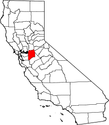 | |
| CDPs | ||
| Unincorporated communities | ||
| Ghost towns |
| |
This article is issued from Wikipedia - version of the 10/29/2016. The text is available under the Creative Commons Attribution/Share Alike but additional terms may apply for the media files.