Victor Valley
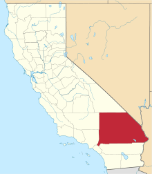
The Victor Valley is a valley in the Mojave Desert and subregion of the Inland Empire, in San Bernardino County, Southern California.
It is located east of the Mojave's Antelope Valley, north of Cajon Pass, San Bernardino Valley, northeast of the San Gabriel Mountains, and northwest of the San Bernardino Mountains, and south of the Barstow area. The Mojave River flows northwards through the Victor Valley, primarily via underground aquifers.
Geography
Cities and towns
The Victor Valley contains four incorporated cities. The largest is Victorville. The rural desert valley region also has 15 unincorporated communities.
The Victor Valley has an estimated population of 390,000. The densest population is within a 10 miles (16 km) radius surrounding Victorville. The total population of the Victor Valley is similar to the City of Oakland in northern California.
Over 100,000 population
- Victorville (population 121,096)
Over 50,000 population
- Hesperia (population 92,147)
- Apple Valley (population 70,924)
Over 20,000 population
- Adelanto (population 31,765)
Under 20,000 population
- Baldy Mesa
- Bell Mountain
- Bryman
- El Mirage
- Helendale
- La Delta
- Lucerne Valley — separate geographic valley to east, part of 'cultural/economic' Victor Valley area.
- Mojave Heights
- Mountain View Acres
- Oak Hills
- Oro Grande
- Phelan
- Pinon Hills
- Silver Lakes
- Spring Valley Lake — neighborhood in Victorville.
Transportation
The Victor Valley Transportation Center is an intermodal transit center in Victorville, that is served by Amtrak, Greyhound, the Victor Valley Transit Authority and military shuttles to Fort Irwin. The center also serves as a Park and Ride facility for carpooling commuters.
Air
- Victorville Airport (Southern California Logistics Airport), charter and general aviation, no commercial passenger services.
Rail transport
Amtrak serves Victorville and Barstow with once-daily trips on the Southwest Chief, and connecting Amtrak California Thruway bus service several times daily.
Road transport
- Interstate 15 — primary freeway through the Victor Valley.
- U.S. Route 395
- Historic U.S. Route 66
- California State Route 18 — Rim of the World Highway
- California State Route 138 — Pearblossom Highway
- Public transportation
Public transportation, provided by the Victor Valley Transit Authority (VVTA), serves most of cities and communities of the Victor Valley area. VVTA offers subsidized tickets for Greyhound Line busses to Barstow and San Bernardino. The Barstow Area Transit serves Barstow and its surrounding communities to the north. The two transit systems connect via the B-V Link service.
The interstate Greyhound Lines transport system busses stops at the Victor Valley Transportation Center.
Government
Political representation includes:
- California's 8th congressional district
- California's 21st State Senate district
- California's 33rd State Assembly district
Education
Attractions
- Victor Valley Museum and Art Gallery — in Apple Valley. [1]
- The California Route 66 Museum — in Victorville.
- Mojave Narrows Regional Park — at the surfacing of the Mojave River, in Victorville.
- The Mall of Victor Valley
- Victor Valley Memorial Park — in Victorville. [2][3][4] Notable buriainclude Nolie Murray, founder of Murray's Dude Ranch,[5] and golfer Lloyd Mangrum.[6]
- Hulaville Forest, site of former folk art environment.
- Nearby summer/winter recreation
- San Gabriel Mountains + Angeles National Forest, including Wrightwood area.
- San Bernardino Mountains + San Bernardino National Forest.
See also
- Mojave Desert topics
References
- ↑ Victor Valley Museum and Art Gallery
- ↑ Victor Valley Memorial Park and Mortuary website
- ↑ Victor Valley Memorial Park
- ↑ U.S. Geological Survey Geographic Names Information System: Victor Valley Memorial Park, 34°31′52″N 117°17′22″W / 34.53111°N 117.28944°W
- ↑ Nolie Murray at Find a Grave
- ↑ Lloyd Mangrum at Find a Grave
| Wikimedia Commons has media related to Victor Valley. |
External links
Coordinates: 34°30′N 117°18′W / 34.5°N 117.3°W
