Greater Hartford
| Greater Hartford Hartford-West Hartford, CT CSA | |
|---|---|
| Metropolitan region | |
|
Hartford skyline | |
 New Britain | |
 West Hartford | |
| Country |
|
| State(s) | |
| Principal cities | |
| Population (2010) | |
| • Total | 1,486,436 (CSA) |
| • Rank | Ranked 37th in the US for Combined Statistical Areas |
| Time zone | EST |
| Area code(s) | 860, 959 |

Greater Hartford is a region located in the U.S. state of Connecticut, centered on the state's capital of Hartford.
This area of Connecticut is different from other parts of the state in that it is not dependent on out-of-state metropolitan areas such as New York City or Boston. It is on the fairly level land of the Connecticut River valley with soil less rocky than that of other areas in the state.
Hartford's role as a focal point for the American insurance industry is known nationally. The vibrant music and arts scene defines the region's culture. The region's economy is closely tied with Springfield, Massachusetts, as Hartford and Springfield are twin cities, only 25 miles apart. The area is served by Bradley International Airport, shared with Springfield. Although contiguous to Springfield's northern border, Westover Metropolitan Airport was briefly marketed as an alternative for Hartford-bound flyers. Hartford is also served by Hartford-Brainard Airport.
The population of Greater Hartford (metropolitan area as defined by the U.S. Census Bureau), had a total population of 1,212,381 (2010 census).
Definitions

Capitol Region
The Capitol Region refers to a specific group of municipalities that the Capitol Region Council of Governments. Since Connecticut dissolved county governments, counties in the state have become purely ceremonial in nature. In place of county governments are local councils composed of the representatives from municipal governments. Other councils that fall within the Greater Hartford area the Central Connecticut Regional Planning Agency and the Lower Connecticut River Valley Council of Governments (formerly known as the Midstate Council of Governments).[1]
New England City and Town Area
New England City and Town Areas (NECTA) are cluster of cities and towns throughout all of New England defined by the Office of Management and Budget. The Hartford-West Hartford-East Hartford, CT Metropolitan NECTA consists of 54 towns, including 25 in Hartford County, 5 in Litchfield County, 6 in Middlesex County, 2 in New London County, 12 in Tolland County, and 4 in Windham County.
Metropolitan Statistical Area
The United States Census Bureau also defines the Hartford-West Hartford-East Hartford, CT Metropolitan Statistical Area (MSA) based on towns as building blocks. The area contains 54 towns of Hartford County, Tolland County, and Middlesex County. The 2015 population estimate for the MSA is 1,211,324[2] and is ranked as the 47th largest metropolitan area by population in the United States. The MSA definition of the area contains a significant portion of the Lower Connecticut River Valley, which is not commonly considered as part of Greater Hartford.
A region very similar to the MSA is covered by the combination of the Hartford Service Delivery Area and the Mid-Connecticut Service Delivery Area, covering 56 towns.[3]
Combined Statistical Area
The Hartford Metropolitan Statistical Area in combined with the Norwich-New London MSA in a larger entity known as the Hartford-West Hartford-East Hartford Metropolitan Statistical Area. As of 2015, the population of the CSA was 1,483,187, ranking it 37 in the nation. Counties included in this definition are:
Municipalities with 100,000 or more inhabitants
Municipalities with 50,000 to 100,000 inhabitants
Municipalities with 10,000 to 50,000 inhabitants
- Avon
- Berlin
- Bloomfield
- Canton
- Clinton
- Colchester
- Coventry
- Cromwell
- East Hampton
- East Lyme
- East Windsor1
- Ellington
- Enfield1
- Farmington
- Glastonbury
- Granby
- Griswold
- Groton
- Ledyard
- Mansfield
- Middletown
- Montville
- Newington
- New London
- Norwich
- Old Saybrook
- Plainville
- Rocky Hill
- Simsbury
- Somers1
- South Windsor
- Southington
- Stafford
- Stonington
- Suffield1
- Tolland
- Vernon
- Waterford
- Wethersfield
- Windsor
- Windsor Locks1
Municipalities with 1,000 to 10,000 inhabitants
Municipalities with fewer than 1,000 inhabitants
^1 Town also included in the Springfield, Massachusetts NECTA
Economy
Notable companies based in Hartford city proper

- Aetna[4]
- Eversource Energy (co-headquarters in Boston)[5]
- The Hartford[6]
- Hartford Steam Boiler Inspection and Insurance Company[7]
- The Phoenix Companies[8]
- Travelers Insurance (home of largest office, headquarters in New York City)[9]
- Virtus Investment Partners[10]
Notable companies based in surrounding towns
- Barnes Group (Bristol)[11]
- Carrier Corporation2 (Farmington)[12]
- Cigna (Bloomfield)[13]
- Colt's Manufacturing Company (West Hartford)[14]
- Connecticut Natural Gas (East Hartford)
- Doosan Fuel Cell America (South Windsor)[15]
- ESPN Inc. (Bristol)[16]
- Gerber Scientific (Tolland)[17]
- Henkel (Rocky Hill, U.S. headquarters)[18]
- Kaman Aircraft (Bloomfield)[19]
- Legrand (West Hartford, U.S. headquarters)[20]
- Otis Elevator2 (Farmington)[12]
- Pratt & Whitney2 (East Hartford)[12]
- Stanadyne (Windsor)[21]
- Stanley Black & Decker (New Britain)[22]
- Systematic Automation (Farmington)[23]
- Trumpf (Farmington, U.S. headquarters)[24]
- United Technologies (Farmington) [12]
- Voya Financial (Windsor, home of largest office, headquarters in New York City)[25]
^2 Division of United Technologies (Otis and Carrier are under the UTC Building & Industrial Systems division)
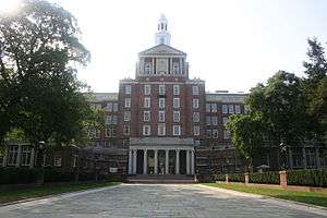
Higher education
Public colleges and universities
Public, four-year universities in the area include:.[26][27]

- Central Connecticut State University (New Britain)
- University of Connecticut (Storrs, main campus)
- University of Connecticut School of Dental Medicine (Farmington)
- University of Connecticut School of Law (Hartford)
- University of Connecticut School of Medicine (Farmington)
Community and technical colleges
Public, two-year community colleges in the area include:[26]
- Asnuntuck Community College (Enfield)
- Capital Community College (Hartford)
- Manchester Community College (Manchester)
- Middlesex Community College (Middletown)
- Tunxis Community College (Farmington)
Private colleges and universities
Private, nonprofit, four-year universities in the area include:[28]

- Goodwin College (East Hartford)
- Hartford Seminary (Hartford)
- Rensselaer at Hartford (Hartford)
- Trinity College (Hartford)
- University of Hartford (West Hartford)
- University of Saint Joseph (West Hartford)
- Wesleyan University (Middletown)
Healthcare
There are numerous hospitals in the Greater Hartford area, including five teaching hospitals (of which, one is a pediatric hospital) and two psychiatric hospitals.
Teaching hospitals

- Connecticut Children's Medical Center (Hartford)
- Hartford Hospital (Hartford)
- The Hospital of Central Connecticut (New Britain and Southington)
- Saint Francis Hospital & Medical Center (Hartford)
- University of Connecticut Health Center, John Dempsey Hospital (Farmington)
All of the above hospitals are affiliated with the University of Connecticut School of Medicine[29]
Psychiatric hospitals
- Connecticut Valley Hospital, owned and operated by the state of Connecticut (Middletown)
- The Institute of Living, a division of Hartford Hospital (Hartford)
Culture and attractions
Performing arts
The Bushnell Center for the Performing Arts is one of the largest indoor performing arts venues in the area. It houses two theaters within the complex: the 2,800-seat Mortensen Hall and the 906-seat Belding Theater. Other theaters in the area include the Hartford Stage and TheatreWorks.
The area is also home to the Xfinity Theatre, a 7,500-seat open-air amphitheater. The lawn outside the theater is capable of holding roughly 22,500 people, bringing total capacity to around 30,000 people.
Conventions and exhibitions
The Connecticut Convention Center is located in downtown Hartford adjacent to the Hartford Marriot Downtown. The facility has more than 140,000 square feet (13,000 m2) of exhibition space, a 40,000-square-foot (4,000 m2) ballroom, and 25,000 square feet (2,300 m2) of space for meetings and conferences. Since 2005, it has hosted ConnectiCon, an annual, multi-genre, pop culture convention.[30]
The New England Air Museum in Windsor Locks also hosts many events, with three large hangars available for use. One of the more popular events held there is FlightSimCon.
In addition, AOPA has held their annual aviation summit in Hartford.[31]
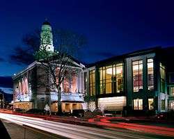
Notable museums
- American Clock & Watch Museum (Bristol)
- Connecticut Historical Society (Hartford)
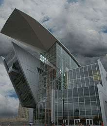
- Connecticut Science Center (Hartford)
- Connecticut State Library, Museum of Connecticut History (Hartford)
- Connecticut Trolley Museum (East Windsor)
- New Britain Museum of American Art (New Britain)
- New England Air Museum (Windsor Locks)
- Old State House (Hartford)
- Wadsworth Atheneum (Hartford)


Sports
Greater Hartford is home to multiple minor league professional sports teams and college teams. There are currently no major league professional sports teams. However, it was home to the Hartford Whalers ice hockey team from 1974 to 1997. The Whalers came to Hartford playing in the World Hockey Association, until they were admitted to the National Hockey League in 1979. In 1997, the team relocated to North Carolina, where they were renamed the Carolina Hurricanes.

Throughout the mid-1990s, the New England Patriots were negotiating with the state of Connecticut for a brand new football stadium located in downtown Hartford to replace the aging Foxboro Stadium where they played. The team eventually made agreed to another proposal that saw Gillette Stadium. With the Patriots no longer in the equation, the state instead decided to construct a smaller football stadium on the former United Technologies-owned airfield in East Hartford. Pratt & Whitney Stadium at Rentschler Field seats approximately 40,000 spectators and is home to the Connecticut Huskies football team.
Professional sports teams
| Club | Sport | League | Venue |
|---|---|---|---|
| Hartford Wolf Pack | Ice Hockey | AHL | XL Center |
| Hartford Yard Goats | Baseball | Eastern League | Dunkin' Donuts Park |
Beginning in 2016, the Rock Cats will relocate to Hartford, where they will be renamed the Hartford Yard Goats and play at Dunkin' Donuts Park.
Collegiate sports teams
Greater Hartford is also home to the Travelers Championship golf tournament (formerly known as the Greater Hartford Open/Buick Championship).
Shopping centers

Major shopping centers in the area include:
- Blue Back Square (West Hartford)
- Enfield Square Mall (Enfield)
- The Shoppes at Buckland Hills (Manchester)
- Westfarms Mall (West Hartford)
Media

The Hartford Courant is the daily broadsheet newspaper serving the Greater Hartford area. Founded in 1764 as the Connecticut Courant, it is generally considered to be the oldest continually published newspaper in the United States. It is owned by Tribune Publishing.
From 1817 to 1976, the area was also served by another daily newspaper, the Hartford Times.
Greater Hartford and Greater New Haven form a single television market. This television market is served by the following broadcast television stations:
English language
Spanish language
Transportation
Interstate highways
Highway transportation in Greater Hartford is primarily run by two mainline Interstates:
There were several plans to expand the highway system (with at least one plan calling for a full beltway). Various plans encountered resistance due to budgetary and environmental concerns. However, some highways were ultimately constructed, if only partially:
 I-291 (serves as the northeastern portion of the partial beltway)
 I-384 (spur route into eastern Connecticut)
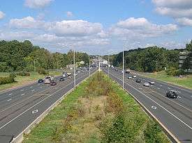


Other expressways

Some state highways also serve as major expressways:
 Route 2
 Route 3 (initially part of the larger I-491 plan)
 Route 9 (serves as the southwestern portion of the partial beltway)
  Route 15
Bus
Public bus transportation is operated by the Hartford division of CTTransit. It provides service to 30 local routes and 12 express routes seven days a week throughout the metropolitan area.[32]
2015 saw the opening of the CTfastrak, a bus rapid transit system that runs from downtown New Britain to Hartford Union Station. The dedicated busway is over 9 miles long and stops at 10 stations.[33][34][35]
Airport

Bradley International Airport (IATA: BDL, ICAO: KBDL, FAA LID: BDL) is located in the town of Windsor Locks, approximately 10 miles from Hartford. Bradley is the second-largest airport in New England (behind Logan International Airport), and was ranked the 55th busiest airport in the United States in 2008.[36][37] Southwest Airlines, Delta Air Lines, JetBlue Airways, and US Airways account for more than half of the airport's passenger traffic.[38][39] The Bradley Airport Connector provides highway access to the airport from Interstate 91.
Bradley is a dual-use civil/military airport, with the Bradley Air National Guard Base serving as the home of the Connecticut Air National Guard 103d Airlift Wing.
Hartford–Brainard Airport (IATA: HFD, ICAO: KHFD, FAA LID: HFD) is a smaller reliever airport located in the southeastern section of Hartford. It is primarily used for general aviation purposes.[40]
Rail

Several Amtrak routes run through the metropolitan area, including the Northeast Regional, Vermonter, as well as a daily shuttle between New Haven and Springfield, Massachusetts.
The Hartford Line is a planned commuter rail service. It will use the same line as the Amtrak shuttle, and will stop at 12 stations along the way. Service is anticipated to begin in late 2016.[41]
Footnotes
References
- ↑ "Regional Planning Organizations (RPOs) in Connecticut". Connecticut Office of Policy and Management. 12 December 2013. Retrieved 15 January 2014.
- ↑ http://factfinder.census.gov/faces/tableservices/jsf/pages/productview.xhtml?src=bkmk
- ↑ CT Dept. of Economic and Community Development Service Delivery Areas
- ↑ "Office Locations and Directions". Aetna.
- ↑ "As it rebrands, Northeast Utilities to keep 2 headquarters". WTNH.
- ↑ "Main Contact Information". The Hartford.
- ↑ "Main Contact Information". Hartford Steam Boiler.
- ↑ "Phoenix Addresses". Phoenix Wealth Management.
- ↑ "Hartford". Travelers.
- ↑ "Contact Us". Virtus Investment Partners.
- ↑ "Contact Us". Barnes Group Inc.
- 1 2 3 4 "Locations". United Technologies.
- ↑ "Cigna Contacts". Cigna.
- ↑ "Contact Us". Colt Manufacturing.
- ↑ "Contact Us". Doosan.
- ↑ "Our Locations". ESPN.
- ↑ "Contact Us". Gerber Technologies.
- ↑ "Henkel Locations". Henkel.
- ↑ "Corporate Office". Kaman Industrial Technologies.
- ↑ "Locations". Legrand.
- ↑ "USA Contact Info". Stanadyne.
- ↑ "Contact Us". Stanley Black & Decker.
- ↑ "Contact Us". Systemic Automation.
- ↑ "TRUMPF Locations in North America". Trumpf.
- ↑ "Voya Financial – At a Glance". ING.
- 1 2 "Colleges & Universities". Connecticut State Colleges & Universities – Board of Regents for Higher Education.
- ↑ . University of Connecticut http://uconn.edu/academics/schools-and-colleges/. Missing or empty
|title=(help) - ↑ "College Profiles". Connecticut Conference of Independent Colleges.
- ↑ Affiliated Hospitals and Clinical Sites, UConn School of Medicine, retrieved 11 December 2014
- ↑ Jennifer Sposato (2010-07-09). "ConnectiCon Brings Thousands to Hartford".
- ↑ http://www.aopa.org/aopa-live?watch=hwMG1uMjpyJnRv6zQJRvbKWVBFr5nkhT
- ↑
- ↑ "What Is CTfastrak". State of Connecticut. Retrieved 18 October 2013.
- ↑ Krafcik, Mike (17 July 2014). "CTFastrak Set To Open In March; Economic Growth Expected Along Busway". WTIC Fox CT. Retrieved 19 July 2014.
- ↑ LaPorte, Mike (5 November 2014). "The Busway to the Future: Insider to CTfastrak before Opening to Public". The Live Wire. Manchester Community College. Retrieved 11 December 2014.
- ↑ Hanseder, Tony. "Hartford Bradley BDL Airport Overview". Retrieved September 20, 2012.
- ↑ "2008 Passenger Boarding Statistics" (PDF). Federal Aviation Administration. Retrieved February 11, 2010.
- ↑ "Hartford, CT Bradley International FACTS". Research and Innovative Technology Administration. Retrieved July 3, 2012.
- ↑ RITA | BTS | Transtats. Transtats.bts.gov. Retrieved on July 15, 2013.
- ↑ FAA Airport Master Record for HFD (Form 5010 PDF), effective 2007-07-05
- ↑ "Gov. Malloy Announced Three New Train Stations as Part of NHHS Rail Program" (Press release). Hartford, Connecticut: State of Connecticut, Office of Governor Dannel P. Malloy. October 24, 2014. Retrieved 2014-10-25.
