Mountain House, San Joaquin County, California
| Mountain House | |
|---|---|
| Census-designated place | |
 Mountain House Position in California. | |
| Coordinates: 37°46′26″N 121°32′39″W / 37.77389°N 121.54417°WCoordinates: 37°46′26″N 121°32′39″W / 37.77389°N 121.54417°W | |
| Country | United States |
| State | California |
| County | San Joaquin |
| Government | |
| • State senator | Cathleen Galgiani (D) |
| • Assemblymember | Susan Eggman (D) |
| • U. S. rep. | Jerry McNerney (D)[1] |
| Area[2] | |
| • Total | 3.192 sq mi (8.268 km2) |
| • Land | 3.192 sq mi (8.268 km2) |
| • Water | 0 sq mi (0 km2) 0% |
| Elevation[3] | 82 ft (25 m) |
| Population (April 1, 2010)[4] | |
| • Total | 9,675 |
| • Density | 3,000/sq mi (1,200/km2) |
| Time zone | Pacific Time Zone (UTC−8) |
| • Summer (DST) | PDT (UTC−7) |
| ZIP codes | 95391 |
| Area code | 209 |
| FIPS code | 06-49582 |
| GNIS feature IDs | 1888888, 2628761 |
| [3] | |
Mountain House is a census-designated place and planned community in San Joaquin County, California. An exurb of the San Francisco Bay Area, Mountain House is 5 miles (8 km) from the City of Tracy near Interstate 205. The community of Mountain House in San Joaquin County lies two miles (3 km) northeast of and borrows the name of Alameda County's historical Mountain House, a halfway stop for forty-niners passing over the Altamont Pass (historic Livermore Pass) on their way to the gold country of the Sierra Nevada foothills located at the base of the Diablo Range on the western edge of California's Central Valley.[5]
In November 2008, the community appeared in nationwide news reports as having the highest percentage of negative equity in the United States – the most homes "under water" (worth less than their mortgage). In 2012, despite a partially outdated land plan and a lack of retail and industrial centers, Mountain House was experiencing economic recovery.[6] In 2010 CDP's population was 9,675.[4] In 2015 population was around 14,000.
History
The Cholbon triblet of the Northern Valley Yokuts were the original inhabitants of the Mountain House area. Their territory ran along Old River a distributary of the San Joaquin River.[7]
In 1849 Thomas Goodall erected a blue denim cloth tent to serve as a midway stopover for gold miners headed from San Francisco to the Sierra Nevada (U.S.) foothills via Altamont Pass. Goodall eventually built an adobe house at the eastern edge of the Diablo Range hills, calling it The Mountain House. Simon Zimmerman later acquired the stop and it became known as Zimmerman's Mountain House, and became a well-known way station stop on the way to Stockton. The last remaining settlement buildings were leveled in 1940.[8] In November 1994, the San Joaquin County Board of Supervisors officially launched the new community of Mountain House two miles to the northeast along Mountain House Creek.
Mountain House was projected to be a small full-fledged city developed over 30-year period by Trimark Communities.[9] The community covers 4,784 acres (1,936.0 ha) in San Joaquin County. The town was planned for 12 distinct neighborhoods including 10 family neighborhoods and two age-restricted neighborhoods each organized around a center containing a neighborhood park, a K-8 school, and a small commercial area.
As of 2013, Mountain House includes the established villages of Altamont, Bethany, Wicklund, Questa and the developing fifth village of Hansen. At the end of 2012 approximately 3,500 homes were in Mountain House.[10] Some 15,500 households or approximately 40,000 people are anticipated when Mountain House is fully completed.[11] Construction began in 2001, but expansion stopped because of the Great Recession. Development accelerated through 2011 and 2012. Questa had six neighborhoods in various stages of completion, and three additional neighborhoods scheduled for 2013 openings. Also completed is Questa's K-8 school and a village park. Mountain House High School opened for the 2014-2015 academic year.[12] All schools are part of Lammersville Unified School District.
Milestones
- November 10, 1994 – Mountain House project approved by San Joaquin County Board of Supervisors
- May 14, 2001 – Trimark breaks ground on Mountain House project
- January 18, 2003 – First home foundation poured
- August 24, 2004 – Wicklund Elementary School opens
- November 6, 2007 – Mountain House votes to form independent Community Services District (CSD)
- December 7, 2007 – The San Joaquin Delta College satellite campus site is annexed to Mountain House CSD through a public-private partnership with developer Gerry N. Kamilos.[13]
- November 2008 – Noted for having the highest percentage of homes "under water" in the U.S.
- August 17, 2009 – Delta College Mountain House Campus opens for classes
- June 8, 2010 – Voters approve unification of Lammersville School District
- January 2011 – 15-year-old resident Thia Megia becomes youngest finalist ever on American Idol
- July 2012 – Mountain House High School breaks ground
- March 2013 – New development announced for Questa and Altamont
- August 2014 – Mountain House High School opens
- June 2015 – Drought conditions place Mountain House water supply at risk[14][15]
Financial downturn
In November 2008, The New York Times reported that Mountain House was the "most underwater community in America" – the ZIP code with the highest amount of negative equity on its homes.[16] With home values decreasing across the nation, Mountain House was described as the worst-hit, with 90% of its homes worth less than the amount their owners owe in mortgages.[16] The average homeowner in Mountain House was reported to be $122,000 in debt.[16] Many local businesses in the 95391 ZIP code were closing because the homeowners were cutting back on their spending.[16]
CalPERS, an agency that manages pensions for California public employees, invested heavily in Mountain House beginning in 2005, purchasing approximately 9,000 residential lots from Shea Homes. By May 2010, the $1.12 billion investment by CalPERS had been reduced to 18% of that figure: $200 million.[17] Even though home values had dropped significantly, CalPERS determined that they would hold on to the investment, counting on a recovery of the housing market.[17]
Economic recovery
An uptick in economic performance at Mountain House was noted in September 2011 by Big Builder, a trade magazine of major land and housing development published by Hanley-Wood.[18]
Acknowledging the New York Times 2008 article that branded Mountain House as the most underwater community in America, the article chronicled a grassroots commitment by residents to keep their neighborhoods looking well-kept by mowing neglected lawns of homes in foreclosure, short sales or abandoned.
This community spirit helped persuade CalPERS to hold onto its Mountain House investment, despite the drawbacks of a 1994-vintage land plan, termed "out of synch with the realities of the post-housing crash world." Helping to balance the challenges of the land plan was the level of established infrastructure and homebuyers motivated by affordable pricing, proximity to job centers and traditional neighborhoods.
In April 2012, Big Builder again reported on the community, noting more robust first-quarter sales, new lot offers, and flexibility for semi-finished and raw land in future development.[6]
Geography
According to the United States Census Bureau, the CDP covers an area of 3.2 square miles (8.3 km²), all of it land. The community is bisected by Mountain House Creek.[19] Mountain House Creek originates south of the Altamount Pass and Interstate 580, flowing northeasterly along and crossing under the interstate, then along Grant Line Road to the intersection with Mountain House Road at the historic Alameda County Mountain House.[20] The creek continues northeastly through the modern residential communities of Mountain House before emptying into the Old River, a distributary of the San Joaquin River.
Demographics
The 2010 United States Census[21] reported that Mountain House had a population of 9,675. The population density was 3,030.8 people per square mile (1,170.2/km²). The racial makeup was 3,467 (35.8%) White, 903 (9.3%) African American, 45 (0.5%) Native American, 3,830 (39.6%) Asian, 71 (0.7%) Pacific Islander, 663 (6.9%) from other races, and 696 (7.2%) from two or more races. Hispanic or Latino of any race were 1,637 persons (16.9%).
The Census reported that 9,675 people (100% of the population) lived in households, 0 (0%) lived in non-institutionalized group quarters, and 0 (0%) were institutionalized.
There were 2,807 households, out of which 1,676 (59.7%) had children under the age of 18 living in them, 1,985 (70.7%) were opposite-sex married couples living together, 227 (8.1%) had a female householder with no husband present, 151 (5.4%) had a male householder with no wife present. There were 186 (6.6%) unmarried opposite-sex partnerships, and 31 (1.1%) same-sex married couples or partnerships. 299 households (10.7%) were made up of individuals and 18 (0.6%) had someone living alone who was 65 years of age or older. The average household size was 3.45. There were 2,363 families (84.2% of all households); the average family size was 3.73.
The population was spread out with 3,351 people (34.6%) under the age of 18, 501 people (5.2%) age 18 to 24, 3,780 people (39.1%) ages 25 to 44, 1,676 people (17.3%) ages 45 to 64, and 367 people (3.8%) who were 65 years of age or older. The median age was 31.4 years. For every 100 females there were 98.9 males. For every 100 females age 18 and over, there were 94.2 males.
There were 3,237 housing units at an average density of 1,014.0 per square mile (391.5/km²), of which 2,205 (78.6%) were owner-occupied, and 602 (21.4%) were occupied by renters. The homeowner vacancy rate was 4.9%; the rental vacancy rate was 5.6%. 7,444 people (76.9% of the population) lived in owner-occupied housing units and 2,231 people (23.1%) lived in rental housing units.
Government
Since 2007, the Community Services District (CSD) serves as Mountain House local government. Its primary duties are handling water, sewer, landscaping and recreation. The CSD Board has five members who are elected by residents. While the CSD Board has no land use or zoning authority, the CSD can advise the county on decisions related to police and fire services, residential and commercial development.[22]
Education
Elementary schools
Students in Mountain House and Lammersville are served by the Lammersville Joint Unified School District.[23] Mountain House has four K-8 elementary schools: Wicklund, Bethany, Questa, and Altamont.
Higher education
Mountain House High School, a new 9-12 campus, is complete. High school students were formerly served by the Tracy Unified School District.[24]
A satellite campus of San Joaquin Delta College opened in August 2009.[25]
Media
The Tracy Press is a weekly newspaper that covers Tracy and Mountain House and has operated since the 19th century. The Record (Stockton) is a daily paper that covers the San Joaquin County area.
Mountain House Matters is a monthly publication that is mailed to each household in town. It is a newspaper for and about Mountain House exclusively. Founded in September 2012 Mountain House Matters focuses on local activities and people. Mountain House Macaroni Kid is a Web site and free weekly e-newsletter that delivers news on the child- and family-friendly events in Mountain House. The URL is www.mountainhouse.macaronikid.com. It is published once a week on Wednesday. Its first edition was published October 2011.
Mountain House is within range of some broadcasters based in the San Francisco Bay Area and the Sacramento metropolitan area.
Transportation
The nearest railway station is in Tracy, operated by Altamont Corridor Express (ACE). Tri Delta Transit provides bus service to Hacienda Business Park and the Dublin/Pleasanton BART station.[26]
References
- ↑ "California's 9th Congressional District - Representatives & District Map". Civic Impulse, LLC. Retrieved October 7, 2014.
- ↑ "2010 Census U.S. Gazetteer Files – Places – California". United States Census Bureau.
- 1 2 "Mountain House Census Designated Place". Geographic Names Information System. United States Geological Survey.
- 1 2 "Mountain House CDP QuickFacts". United States Census Bureau. Retrieved February 23, 2015.
- ↑ Gary Kinst, ed. (July 2008). "Mountain House, in The Traveler, Lincoln Highway Association California Chapter Newsletter" (PDF). Vol. 9 no. 3. Retrieved March 20, 2016.
- 1 2 Caulfied, John (April 19, 2012). "Long Climb Pays Off for Builders at NoCal's Mountain House". BUILDER Online. Washington, D.C.: Hanley Wood Media. Retrieved April 7, 2013.
- ↑ Wallace, William J. (1978). Robert F. Heizer, ed. Northern Valley Yokuts, in Handbook of North American Indians, Volume 8, California. Washington, D.C.: Smithsonian Institution. pp. 462–470. ISBN 9780160045745.
- ↑ History of Tracy, California with Biographical Sketches. Los Angeles: Historic Record Company. 1923.
- ↑ Brinkley, Leslie (August 5, 2004). "New Bay Area Suburb". ABC 7 News. Retrieved August 5, 2004.
- ↑ Torres, Blanca (March 15, 2013). "Where Have Homes Sales Soared By 352% in Three Years?". Retrieved April 7, 2013.
- ↑ "Chapter 3: Land Use". Mountain House Master Plan. pp. 3.2 and 3.12. Retrieved April 7, 2013.
- ↑ "San Francisco Bay Area Buyers Spur New Homebuilding Activity at Mountain House" (Press release). Digital Journal. March 12, 2013. Retrieved April 7, 2013.
- ↑ Johnson, Zachary K (September 26, 2007). "Delta College to extend south". Recordnet.com. Local Media Group, Inc. Retrieved January 13, 2016.
- ↑ "Letter to Mountain House community" (PDF). Mountain House Community Services District. Retrieved June 17, 2015.
- ↑ Stevens, Matt (June 18, 2015). "Master-planned community at risk of losing all water within days". Los Angeles Times.
- 1 2 3 4 Streitfeld, David (November 10, 2008). "A Town Drowns in Debt as Home Values Plunge". The New York Times. Retrieved August 3, 2011.
- 1 2 Kasler, Dale (May 6, 2010). "Fund Held Underwater: CalPERS to wait for Mountain House rebound: City hardest hit in nation by real estate slump". The Modesto Bee. Retrieved August 3, 2011.
- ↑ McManus, John; Yaussi, Sarah (September 2011). "Mountain House? living proof that it's possible to rebuild the American Dream out of the stuff of nightmares.". Big Builder. Retrieved April 7, 2013.
- ↑ "Mountain House Creek". Geographic Names Information System. United States Geological Survey.
- ↑ "Mountain House". Geographic Names Information System. United States Geological Survey.
- ↑ "2010 Census Interactive Population Search: CA - Mountain House CDP". U.S. Census Bureau. Retrieved July 12, 2014.
- ↑ "Five elected in first race for Mountain House board", Stockton Record, November 5, 2008
- ↑ "Voters approve Lammersville school unification". Tracy press. June 8, 2010. Retrieved June 8, 2010.
- ↑ Young, Kevin (February 24, 2011). "Mountain House inches toward high school". Tracy press. Retrieved February 24, 2011.
- ↑ Lafferty, Justin (Aug 17, 2009). "Delta College in Mountain House". Tracy press. Retrieved August 17, 2009.
- ↑ "Mountain House commuters have transportation option", The Record (Stockton), February 4, 2006
Municipalities and communities of San Joaquin County, California, United States | ||
|---|---|---|
| Cities | 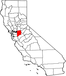 | |
| CDPs | ||
| Unincorporated communities | ||
| Ghost towns |
| |