Berkeley, California
| Berkeley, California | ||
|---|---|---|
| Charter city[1] | ||
| City of Berkeley | ||
|
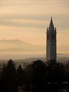
Downtown Berkeley viewed from the Berkeley Hills, with San Francisco in the background | ||
| ||
 Left: Alameda County (highlighted) within California. Right: the City of Berkeley (highlighted) within Alameda County. | ||
| Coordinates: 37°52′18″N 122°16′22″W / 37.87167°N 122.27278°WCoordinates: 37°52′18″N 122°16′22″W / 37.87167°N 122.27278°W | ||
| Country |
| |
| State |
| |
| County |
| |
| Incorporated | April 4, 1878 [2] | |
| Chartered | March 5, 1895 [1] | |
| Government | ||
| • Type | Council-Manager[1] | |
| • Mayor | Tom Bates[3] | |
| • Council members by district number[3] |
| |
| • State senator | Nancy Skinner (D)[4] | |
| • Assemblymember | Tony Thurmond (D)[5] | |
| • U.S. rep. | Barbara Lee (D)[6] | |
| Area[7] | ||
| • Total | 17.696 sq mi (45.833 km2) | |
| • Land | 10.470 sq mi (27.118 km2) | |
| • Water | 7.226 sq mi (18.716 km2) 40.83% | |
| Elevation[8] | 171 ft (52 m) | |
| Population (April 1, 2010)[9] | ||
| • Total | 112,580 | |
| • Estimate (2015)[9] | 120,971 | |
| • Rank | ||
| • Density | 11,554/sq mi (4,461/km2) | |
| Demonym(s) | Berkeleyan | |
| Time zone | Pacific (UTC−8) | |
| • Summer (DST) | PDT (UTC−7) | |
| ZIP codes[10] | 94701–94710, 94712, 94720 | |
| Area code | 510 | |
| FIPS code | 06-06000 | |
| GNIS feature IDs | 1658037, 2409837 | |
| Website |
www | |


Berkeley (/ˈbɜːrkliː/ BURK-lee) is a city on the east shore of San Francisco Bay in northern Alameda County, California. It is named after the 18th-century Anglo-Irish bishop and philosopher George Berkeley. It borders the cities of Oakland and Emeryville to the south and the city of Albany and unincorporated community of Kensington to the north. Its eastern border with Contra Costa County generally follows the ridge of the Berkeley Hills. The 2010 census recorded a population of 112,580.
Berkeley is home to the oldest campus in the University of California system, the University of California, Berkeley, and to the Lawrence Berkeley National Laboratory, which is managed and operated by the University. It also has the Graduate Theological Union, one of the largest religious studies institutions in the world. It is one of the most politically liberal cities in the United States.
History
Early history
The site of today's City of Berkeley was the territory of the Chochenyo/Huchiun band of the Ohlone people when the first Europeans arrived.[11] Evidence of their existence in the area include pits in rock formations, which they used to grind acorns, and a shellmound, now mostly leveled and covered up, along the shoreline of San Francisco Bay at the mouth of Strawberry Creek. Other artifacts were discovered in the 1950s in the downtown area during remodeling of a commercial building, near the upper course of the creek.

The first people of European descent (most of whom were born in America, and many of whom were of mixed ancestry) arrived with the De Anza Expedition in 1776.[12] Today, this is noted by signage on Interstate 80, which runs along the San Francisco Bay shoreline of Berkeley. The De Anza Expedition led to establishment of the Spanish Presidio of San Francisco at the entrance to San Francisco Bay (the Golden Gate), which is due west of Berkeley. Luis Peralta was among the soldiers at the Presidio. For his services to the King of Spain, he was granted a vast stretch of land on the east shore of San Francisco Bay (the contra costa, "opposite shore") for a ranch, including that portion that now comprises the City of Berkeley.
Luis Peralta named his holding "Rancho San Antonio." The primary activity of the ranch was raising cattle for meat and hides, but hunting and farming were also pursued. Eventually, Peralta gave portions of the ranch to each of his four sons. What is now Berkeley lies mostly in the portion that went to Peralta's son Domingo, with a little in the portion that went to another son, Vicente. No artifact survives of the Domingo or Vicente ranches, but their names survive in Berkeley street names (Vicente, Domingo, and Peralta). However, legal title to all land in the City of Berkeley remains based on the original Peralta land grant.
The Peraltas' Rancho San Antonio continued after Alta California passed from Spanish to Mexican sovereignty after the Mexican War of Independence. However, the advent of U.S. sovereignty after the Mexican–American War, and especially, the Gold Rush, saw the Peraltas' lands quickly encroached on by squatters and diminished by dubious legal proceedings. The lands of the brothers Domingo and Vicente were quickly reduced to reservations close to their respective ranch homes. The rest of the land was surveyed and parceled out to various American claimants (See Kellersberger's Map).
Politically, the area that became Berkeley was initially part of a vast Contra Costa County. On March 25, 1853, Alameda County was created from a division within Contra Costa County, as well as from a small portion of Santa Clara County.
The area of Berkeley was at this period mostly a mix of open land, farms and ranches, with a small though busy wharf by the bay. It was not yet "Berkeley," but merely the northern part of the "Oakland Township" subdivision of Alameda County.

Late 19th century
In 1866, Oakland's private College of California looked for a new site. It settled on a location north of Oakland along the foot of the Contra Costa Range (later called the Berkeley Hills) astride Strawberry Creek, at an elevation about 500 feet (150 m) above the bay, commanding a view of the Bay Area and the Pacific Ocean through the Golden Gate.
According to the Centennial Record of the University of California, "In 1866…at Founders' Rock, a group of College of California men watched two ships standing out to sea through the Golden Gate. One of them, Frederick Billings, thought of the lines of the Anglo-Irish Anglican Bishop George Berkeley, 'westward the course of empire takes its way,' and suggested that the town and college site be named for the eighteenth-century Anglo-Irish philosopher."[13] Although the philosopher's name is pronounced "bark-lee," the pronunciation of the city's name has evolved to suit American English as "burk-lee."[14]
The College of California's College Homestead Association planned to raise funds for the new campus by selling off adjacent parcels of land. To this end, they laid out a plat and street grid that became the basis of Berkeley's modern street plan. Their plans fell far short of their desires, and they began a collaboration with the State of California that culminated in 1868 with the creation of the public University of California.
As construction began on the new site, more residences were constructed in the vicinity of the new campus. At the same time, a settlement of residences, saloons, and various industries grew around the wharf area called "Ocean View." A horsecar ran from Temescal in Oakland to the university campus along what is now Telegraph Avenue. The first post office opened in 1872.[15]
By the 1870s, the Transcontinental Railroad reached its terminus in Oakland. In 1876, a branch line of the Central Pacific Railroad, the Berkeley Branch Railroad, was laid from a junction with the mainline called Shellmound (now a part of Emeryville) into what is now downtown Berkeley. That same year, the mainline of the transcontinental railroad into Oakland was re-routed, putting the right-of-way along the bay shore through Ocean View.
There was a strong prohibition movement in Berkeley at this time. In 1876, the city passed the "mile limit law," which forbade sale or public consumption of alcohol within one mile (1.6 km) of the new University of California.[16] Then, in 1899 Berkeley residents voted to make their city an alcohol-free zone. Scientists, scholars and religious leaders spoke vehemently of the dangers of alcohol.[17]
In 1878, the people of Ocean View and the area around the university campus, together with local farmers, incorporated as the Town of Berkeley. The first elected trustees of the town were the slate of Denis Kearney's Workingman's Party, who were particularly favored in the working class area of the former Ocean View, now called "West Berkeley." The area near the university became known for a time as "East Berkeley."
The modern age came quickly to Berkeley, no doubt due to the influence of the university. Electric lights were in use by 1888. The telephone had already come to town. Electric streetcars soon replaced the horsecar. A silent film of one of these early streetcars in Berkeley can be seen at the Library of Congress website: "A Trip To Berkeley, California"
Early 20th century
Berkeley's slow growth ended abruptly with the Great San Francisco earthquake of 1906. The town and other parts of the East Bay escaped serious damage from the massive temblor, and thousands of refugees flowed across the Bay. Among them were most of San Francisco's painters and sculptors, who created between 1907 and 1911 one of the largest art colonies west of Chicago. Artist and critic, Jennie V. Cannon, described the founding of the Berkeley Art Association and the rivalries of competing studios and art clubs.[18]
In 1908, a statewide referendum that proposed moving the California state capital to Berkeley was defeated by a margin of about 33,000 votes.[19] The city named streets around the proposed capitol grounds for California counties. They bear those names today, a legacy of the failed referendum.
In 1909, the citizens of Berkeley adopted a new charter, and the Town of Berkeley became the City of Berkeley. Rapid growth continued up to the Crash of 1929. The Great Depression hit Berkeley hard, but not as hard as many other places in the U.S., thanks in part to the university.
On September 17, 1923, a major fire swept down the hills toward the university campus and the downtown section. Around 640 structures burned before a late afternoon sea breeze stopped its progress, allowing firefighters to put it out.
The next big growth occurred with the advent of World War II, when large numbers of people moved to the Bay Area to work in the many war industries, such as the immense Kaiser Shipyards in nearby Richmond. One who moved out, but played a big role in the outcome of the War was U.C. Professor and Berkeley resident J. Robert Oppenheimer. During the war, an Army base, Camp Ashby, was temporarily sited in Berkeley.
The element berkelium was synthesized utilizing the 60-inch cyclotron at UC Berkeley, and named in 1949, recognizing the university, thus also placing the city's name in the list of elements.
1950s and 1960s
During the 1940s, many African Americans migrated to Berkeley.[20] In 1950, the Census Bureau reported Berkeley's population as 11.7% black and 84.6% white.[21]
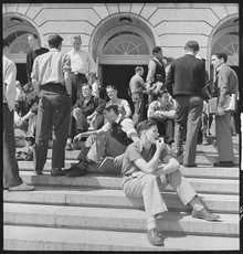
The postwar years brought moderate growth to the city, as events on the U.C. campus began to build up to the recognizable activism of the sixties. In the 1950s, McCarthyism induced the university to demand a loyalty oath from its professors, many of whom refused to sign the oath on the principle of freedom of thought. In 1960, a U.S. House committee (HUAC) came to San Francisco to investigate the influence of communists in the Bay Area. Their presence was met by protesters, including many from the university. Meanwhile, a number of U.C. students became active in the Civil Rights Movement. Finally, in 1964, the university provoked a massive student protest by banning distribution of political literature on campus. This protest became the Free Speech Movement. As the Vietnam War rapidly escalated in the ensuing years, so did student activism at the university, particularly that organized by the Vietnam Day Committee.
Berkeley is strongly identified with the rapid social changes, civic unrest, and political upheaval that characterized the late 1960s. In that period, Berkeley—especially Telegraph Avenue—became a focal point for the hippie movement, which spilled over the Bay from San Francisco. Many hippies were apolitical drop-outs, rather than students, but in the heady atmosphere of Berkeley in 1967–1969 there was considerable overlap between the hippie movement and the radical left. An iconic event in the Berkeley Sixties scene was a conflict over a parcel of university property south of the contiguous campus site that came to be called "People's Park."
The battle over the disposition of People's Park resulted in a month-long occupation of Berkeley by the National Guard on orders of then-Governor Ronald Reagan. In the end, the park remained undeveloped, and remains so today. A spin-off, "People's Park Annex," was established at the same time by activist citizens of Berkeley on a strip of land above the Bay Area Rapid Transit subway construction along Hearst Avenue northwest of the U.C. campus. The land had also been intended for development, but was turned over to the city by BART and is now Ohlone Park.
The era of large public protest in Berkeley waned considerably with the end of the Vietnam War in 1975. While the 1960s were the heyday of liberal activism in Berkeley, it remains one of the most overwhelmingly Democratic cities in the United States.
1970s to present
The Berkeley population declined in the 1970s, partly due to an exodus to the suburbs. Some moved because of the rising cost of living throughout the Bay Area, and others because of the decline and disappearance of many industries in West Berkeley.
From the 1980s to the present, Berkeley housing costs have risen, especially since the mid-1990s. Despite a slow down in 2005–2007, median home prices remain dramatically higher than the rest of the nation.[22]
In 1983, Berkeley's Domestic Partner Task Force was established, which in 1984 made policy recommendation to the school board, which passed domestic partner legislation. The legislation became a model for similar measures nationwide.[23]
In the 1990s, Public Television's Frontline documentary series featured race relations at Berkeley's only public high school, Berkeley High School.[24]
In 2006, the Berkeley Oak Grove Protest began protesting construction of a new sports center annex to Memorial Stadium at the expense of a grove of oak trees on the UC campus. The protest ended in September 2008 after a lengthy court process.
In 2007–08, Berkeley received media attention due to demonstrations against a Marine Corps recruiting office in downtown Berkeley and a series of controversial motions by Berkeley's city council regarding opposition to Marine recruiting. (See Berkeley Marine Corps Recruiting Center controversy.)
During the fall of 2010, the Berkeley Student Food Collective opened after many protests on the UC Berkeley campus due to the proposed opening of the fast food chain Panda Express. Students and community members worked together to open a collectively run grocery store right off of the UC Berkeley campus, where the community can buy local, seasonal, humane, and organic foods. The Berkeley Student Food Collective still operates at 2440 Bancroft Way.
In the Fall of 2011, the nationwide Occupy Wall Street movement came to two Berkeley locations: on the campus of the University of California and as an encampment in Civic Center Park.
On September 18, 2012, Berkeley became what may be the first city in the U.S. to officially proclaim a day recognizing bisexuals September 23, which is known as Celebrate Bisexuality Day.[25]
On September 2, 2014, the city council approved a measure to provide free medical marijuana to low-income patients.[26]
The Measure D soda tax was approved by Berkeley voters on November 4, 2014, the first such tax in the United States.[27]
Berkeley has a higher-than-average crime rate, particularly property crime,[28] though the crime rate has fallen significantly since 2000.[29]
Geography
Berkeley is located at 37°52′18″N 122°16′29″W / 37.87167°N 122.27472°W (37.871775, −122.274603).[30]

According to the United States Census Bureau the city's 17.7 square miles (46 km2) area includes 10.5 square miles (27 km2) of land and 7.2 square miles (19 km2) (40.83%) water, most of it part of San Francisco Bay.
Berkeley borders the cities of Albany, Oakland, and Emeryville and Contra Costa County, including unincorporated Kensington, as well as San Francisco Bay.
Berkeley lies within telephone area code 510 (until September 2, 1991, Berkeley was part of the 415 telephone code that now covers only San Francisco and Marin counties[31]), and the postal ZIP codes are 94701 through 94710, 94712, and 94720 for the University of California campus.
Geology
Most of Berkeley lies on a rolling sedimentary plain that rises gently from sea level to the base of the Berkeley Hills. East of the Hayward Fault along the base of the hills, elevation increases more rapidly. The highest peak along the ridge line above Berkeley is Grizzly Peak, elevation 1,754 feet (535 m). A number of small creeks run from the hills to the Bay through Berkeley: Cerrito, Codornices, Schoolhouse and Strawberry Creeks are the principal streams. Most of these are largely culverted once they reach the plain west of the hills.
The Berkeley Hills are part of the Pacific Coast Ranges, and run in a northwest–southeast alignment. Exposed in the Berkeley Hills are cherts and shales of the Claremont Formation (equivalent to the Monterey Formation), conglomerate and sandstone of the Orinda Formation and lava flows of the Moraga Volcanics. Of similar age to the Moraga Volcanics (extinct), within the Northbrae neighborhood of Berkeley, are outcroppings of erosion resistant rhyolite. These rhyolite formations can be seen in several city parks and in the yards of a number of private residences. Indian Rock Park in the northeastern part of Berkeley near the Arlington/Marin Circle features a large example.
Earthquakes
Berkeley is traversed by the Hayward Fault Zone, a major branch of the San Andreas Fault to the west. No large earthquake has occurred on the Hayward Fault near Berkeley in historic times (except possibly in 1836), but seismologists warn about the geologic record of large tremblors several times in the deeper past. The current assessment is that a Bay Area earthquake of magnitude 6.7 or greater within the next 30 years is likely, with the Hayward Fault having the highest likelihood among faults in the Bay Area of being the epicenter.[32] Moreover, like much of the Bay Area, Berkeley has many areas of some risk to soil liquefaction, with the flat areas closer to the shore at low to high susceptibility.[33]
The 1868 Hayward earthquake did occur on the southern segment of the Hayward Fault[34] in the vicinity of today's city of Hayward (hence, how the fault got its name). This quake destroyed the county seat of Alameda County then located in San Leandro and it subsequently moved to Oakland. It was strongly felt in San Francisco, causing major damage, and experienced by Samuel Clemens (Mark Twain).[35] It was regarded as the "Great San Francisco earthquake" prior to 1906. It produced a furrow in the ground along the fault line in Berkeley, across the grounds of the new State Asylum for the Deaf, Dumb and Blind then under construction, which was noted by one early University of California professor. Though no significant damage was reported to most of the few Berkeley buildings of the time, the 1868 quake did destroy the vulnerable adobe home of Domingo Peralta in north Berkeley.[36]
Today, evidence of the Hayward Fault's "creeping" is visible at various locations in Berkeley. Cracked roadways, sharp jogs in streams, and springs mark the fault's path. However, since it cuts across the base of the hills, the creep is often concealed by or confused with slide activity. Some of the slide activity itself, however, results from movement on the Hayward Fault.
A notorious segment of the Hayward Fault runs lengthwise down the middle of Memorial Stadium at the mouth of Strawberry Canyon on the University of California campus. Photos and measurements[37] show the movement of the fault through the stadium.
Climate
Berkeley has a cool summer Mediterranean climate (type Csb in the Köppen climate classification), with dry summers and wet winters. Berkeley's location directly opposite the Golden Gate ensures that typical eastward fog flow blankets the city more often than its neighbors.[38] The summers are cooler than a typical Mediterranean climate thanks to upwelling ocean currents along the California coast. These help produce cool and foggy nights and mornings.
Winter is punctuated with rainstorms of varying ferocity and duration, but also produces stretches of bright sunny days and clear cold nights. It does not normally snow, though occasionally the hilltops get a dusting. Spring and fall are transitional and intermediate, with some rainfall and variable temperature. Summer typically brings night and morning low clouds or fog, followed by sunny, warm days. The warmest and driest months are typically June through September, with the highest temperatures occurring in September. Mid-summer (July–August) is often a bit cooler due to the sea breezes and fog common then.
Average January temperatures are a maximum of 56.4 °F (13.6 °C) and a minimum of 43.6 °F (6.4 °C). Average September (the warmest month) temperatures are a maximum of 71.7 °F (22.1 °C) and a minimum of 55.9 °F (13.3 °C). In a year, there are an average of 2.9 days with highs of 90.0 °F (32.2 °C) or higher, and an average of 0.8 days with lows of 32 °F (0 °C) or lower. The highest recorded temperature was 107 °F (42 °C) on June 15, 2000 and July 16, 1993, and the lowest recorded temperature was 24 °F (−4 °C) on December 22, 1990.
January is normally the wettest month, averaging 5.13 inches (130 mm) of precipitation. Average annual precipitation is 25.40 inches (645 mm), falling on an average of 63.7 days each year. The most rainfall in one month was 14.49 inches (368 mm) in February 1998. The most rainfall in 24 hours was 6.98 inches (177 mm) on January 4, 1982.[39] As in most of California, the heaviest rainfall years are usually associated with warm water El Niño episodes in the Pacific (e.g., 1982–83; 1997–98), which bring in drenching "pineapple express" storms. In contrast, dry years are often associated with cold Pacific La Niña episodes. Light snow has fallen on rare occasions. Snow has generally fallen every several years on the higher peaks of the Berkeley Hills.[40]
In the late spring and early fall, strong offshore winds of sinking air typically develop, bringing heat and dryness to the area. In the spring, this is not usually a problem as vegetation is still moist from winter rains, but extreme dryness prevails by the fall, creating a danger of wildfires. In September 1923 a major fire swept through the neighborhoods north of the university campus, stopping just short of downtown. (See 1923 Berkeley fire). On October 20, 1991, gusty, hot winds fanned a conflagration along the Berkeley–Oakland border, killing 25 people and injuring 150, as well as destroying 2,449 single-family dwellings and 437 apartment and condominium units. (See 1991 Oakland firestorm)
| Climate data for Berkeley, California (1981–2010) | |||||||||||||
|---|---|---|---|---|---|---|---|---|---|---|---|---|---|
| Month | Jan | Feb | Mar | Apr | May | Jun | Jul | Aug | Sep | Oct | Nov | Dec | Year |
| Record high °F (°C) | 77 (25) |
80 (27) |
87 (31) |
95 (35) |
101 (38) |
107 (42) |
107 (42) |
104 (40) |
106 (41) |
99 (37) |
86 (30) |
80 (27) |
107 (42) |
| Average high °F (°C) | 58.4 (14.7) |
61.6 (16.4) |
64.2 (17.9) |
66.8 (19.3) |
69.7 (20.9) |
73.2 (22.9) |
73.9 (23.3) |
74.3 (23.5) |
74.8 (23.8) |
72.5 (22.5) |
64.8 (18.2) |
58.6 (14.8) |
67.8 (19.9) |
| Average low °F (°C) | 42.0 (5.6) |
44.2 (6.8) |
45.7 (7.6) |
46.5 (8.1) |
49.4 (9.7) |
51.7 (10.9) |
53.0 (11.7) |
53.9 (12.2) |
53.4 (11.9) |
51.5 (10.8) |
46.6 (8.1) |
42.6 (5.9) |
48.4 (9.1) |
| Record low °F (°C) | 25 (−4) |
29 (−2) |
33 (1) |
36 (2) |
36 (2) |
40 (4) |
40 (4) |
42 (6) |
38 (3) |
38 (3) |
33 (1) |
25 (−4) |
25 (−4) |
| Average precipitation inches (mm) | 4.98 (126.5) |
5.21 (132.3) |
3.86 (98) |
1.66 (42.2) |
0.86 (21.8) |
0.15 (3.8) |
0.01 (0.3) |
0.06 (1.5) |
0.24 (6.1) |
1.37 (34.8) |
3.30 (83.8) |
5.04 (128) |
26.74 (679.2) |
| Source: Western Regional Climate Center[41] | |||||||||||||
Demographics
| Historical population | |||
|---|---|---|---|
| Census | Pop. | %± | |
| 1890 | 5,101 | — | |
| 1900 | 13,214 | 159.0% | |
| 1910 | 40,434 | 206.0% | |
| 1920 | 56,036 | 38.6% | |
| 1930 | 82,109 | 46.5% | |
| 1940 | 85,547 | 4.2% | |
| 1950 | 113,805 | 33.0% | |
| 1960 | 111,268 | −2.2% | |
| 1970 | 114,091 | 2.5% | |
| 1980 | 103,328 | −9.4% | |
| 1990 | 102,724 | −0.6% | |
| 2000 | 102,743 | 0.0% | |
| 2010 | 112,580 | 9.6% | |
| Est. 2015 | 120,971 | [42] | 7.5% |
The 2010 United States Census[44] reported that Berkeley had a population of 112,580. The population density was 10,752 people per square mile of land area (4,104/km²). The racial makeup of Berkeley was 66,996 (59.5%) White, 11,241 (10.0%) Black or African American, 479 (0.4%) Native American, 21,690 (19.3%) Asian (8.4% Chinese, 2.4% Indian, 2.1% Korean, 1.6% Japanese, 1.5% Filipino, 1.0% Vietnamese), 186 (0.2%) Pacific Islander, 4,994 (4.4%) from other races, and 6,994 (6.2%) from two or more races. Hispanic or Latino of any race were 12,209 persons (10.8%). 6.8% of the city's population was of Mexican ancestry.
The Census reported that 99,731 people (88.6% of the population) lived in households, 12,430 (11.0%) lived in non-institutionalized group quarters, and 419 (0.4%) were institutionalized.
There were 46,029 households, out of which 8,467 (18.4%) had children under the age of 18 living in them, 13,569 (29.5%) were opposite-sex married couples living together, 3,855 (8.4%) had a female householder with no husband present, 1,368 (3.0%) had a male householder with no wife present. There were 2,931 (6.4%) unmarried opposite-sex partnerships, and 961 (2.1%) same-sex married couples or partnerships. 16,904 households (36.7%) were made up of individuals and 4,578 (9.9%) had someone living alone who was 65 years of age or older. The average household size was 2.17. There were 18,792 families (40.8% of all households); the average family size was 2.81. There were 49,454 housing units at an average density of 2,794.6 per square mile (1,079.0/km²), of which 18,846 (40.9%) were owner-occupied, and 27,183 (59.1%) were occupied by renters. The homeowner vacancy rate was 1.0%; the rental vacancy rate was 4.5%. 45,096 people (40.1% of the population) lived in owner-occupied housing units and 54,635 people (48.5%) lived in rental housing units.
The population was spread out with 13,872 people (12.3%) under the age of 18, 30,295 people (26.9%) aged 18 to 24, 30,231 people (26.9%) aged 25 to 44, 25,006 people (22.2%) aged 45 to 64, and 13,176 people (11.7%) who were 65 years of age or older. The median age was 31.0 years. For every 100 females there were 95.6 males. For every 100 females age 18 and over, there were 94.2 males.
According to the 2011 American Community Survey 5-Year estimate, the median income for a household in the city was $60,908, and the median income for a family was $102,976.[45] Males had a median income of $67,476 versus $57,319 for females. The per capita income for the city was $38,896. About 7.2% of families and 18.3% of the population were below the poverty line, including 13.2% of those under age 18 and 9.2% of those age 65 or over.
| Demographic profile[46] | 2010 |
|---|---|
| Total Population | 112,580 – 100.0% |
| One Race | 105,586 – 93.8% |
| Not Hispanic or Latino | 100,371 – 89.2% |
| White alone | 61,539 – 54.7% |
| Black or African American alone | 10,896 – 9.7% |
| American Indian and Alaska Native alone | 228 – 0.2% |
| Asian alone | 21,499 – 19.1% |
| Native Hawaiian and Other Pacific Islander alone | 170 – 0.2% |
| Some other race alone | 503 – 0.4% |
| Two or more races alone | 5,536 – 4.9% |
| Hispanic or Latino (of any race) | 12,209 – 10.8% |
Transportation
Berkeley is served by Amtrak (Capitol Corridor), AC Transit, BART (Ashby, Downtown Berkeley Station and North Berkeley) and bus shuttles operated by major employers including UC Berkeley and Lawrence Berkeley National Laboratory. The Eastshore Freeway (Interstate 80 and Interstate 580) runs along the bay shoreline. Each day there is an influx of thousands of cars into the city by commuting UC faculty, staff and students, making parking for more than a few hours an expensive proposition.
Berkeley has one of the highest rates of bicycle and pedestrian commuting in the nation. Berkeley is the safest city of its size in California for pedestrians and cyclists, considering the number of injuries per pedestrian and cyclist, rather than per capita.[47]
Berkeley has modified its original grid roadway structure through use of diverters and barriers, moving most traffic out of neighborhoods and onto arterial streets (visitors often find this confusing, because the diverters are not shown on all maps). Berkeley maintains a separate grid of arterial streets for bicycles, called Bicycle Boulevards, with bike lanes and lower amounts of car traffic than the major streets they often parallel.
Berkeley hosts car sharing networks run by City CarShare, Uhaul Car Share, and Zipcar. Rather than owning (and parking) their own cars, members share a group of cars parked nearby. Web- and telephone-based reservation systems keep track of hours and charges. Several "pods" (points of departure where cars are kept) exist throughout the city, in several downtown locations, at the Ashby and North Berkeley BART stations, and at various other locations in Berkeley (and other cities in the region). Using alternative transportation is encouraged.
Berkeley has had recurring problems with parking meter vandalism. In 1999, over 2,400 Berkeley meters were jammed, smashed, or sawed apart.[48] Starting in 2005 and continuing into 2006, Berkeley began to phase out mechanical meters in favor of more centralized electronic meters.
Transportation history
The first commuter service to San Francisco was provided by the Central Pacific's Berkeley Branch Railroad, a standard gauge steam railroad, which terminated in downtown Berkeley, and connected in Emeryville (at a locale then known as "Shellmound") with trains to the Oakland ferry pier as well as with the Central Pacific main line starting in 1876. The Berkeley Branch line was extended from Shattuck and University to Vine Street ("Berryman's Station") in 1878. Starting in 1882, Berkeley trains ran directly to the Oakland Pier.[49] In the 1880s, Southern Pacific assumed operations of the Berkeley Branch. In 1911, Southern Pacific electrified this line and the several others it constructed in Berkeley, creating its East Bay Electric Lines division. The huge and heavy cars specially built for these lines were called the "Red Trains" or the "Big Red Cars." The Shattuck line was extended and connected with two other Berkeley lines (the Ninth Street Line and the California Street line) at Solano and Colusa (the "Colusa Wye"). At this time, the Northbrae Tunnel and Rose Street Undercrossing were constructed, both of which still exist. (The Rose Street Undercrossing is not accessible to the public, being situated between what is now two backyards.) The fourth Berkeley line was the Ellsworth St. line to the university campus. The last Red Trains ran in July 1941.[50]
The first electric rail service in Berkeley was provided by several small streetcar companies starting in 1891. Most of these were eventually bought up by the Key System of Francis "Borax" Smith who added lines and improved equipment. The Key System's streetcars were operated by its East Bay Street Railways division. Principal lines in Berkeley ran on Euclid, The Arlington, College, Telegraph, Shattuck, San Pablo, University, and Grove (today's Martin Luther King Jr. Way). The last streetcars ran in 1948, replaced by buses.
The first electric commuter interurban-type trains to San Francisco from Berkeley were put in operation by the Key System in 1903, several years before the Southern Pacific electrified its steam commuter lines. Like the SP, Key trains ran to a pier serviced by the Key's own fleet of ferryboats, which also docked at the Ferry Building in San Francisco. After the Bay Bridge was built, the Key trains ran to the Transbay Terminal in San Francisco, sharing tracks on the lower deck of the Bay Bridge with the SP's red trains and the Sacramento Northern Railroad. It was at this time that the Key trains acquired their letter designations, which were later preserved by Key's public successor, AC Transit. Today's F bus is the successor of the F train. Likewise, the E, G and the H. Before the Bridge, these lines were simply the Shattuck Avenue Line, the Claremont Line, the Westbrae Line, and the Sacramento Street Line, respectively.
After the Southern Pacific abandoned transbay service in 1941, the Key System acquired the rights to use its tracks and catenary on Shattuck north of Dwight Way and through the Northbrae Tunnel to The Alameda for the F-train. The SP tracks along Monterey Avenue as far as Colusa had been acquired by the Key System in 1933 for the H-train, but were abandoned in 1941. The Key System trains stopped running in April 1958.[51] In 1963, the Northbrae Tunnel was opened to auto traffic.
Economy
Top employers
According to the city's 2013 Comprehensive Annual Financial Report,[52] the top employers in the city are:
| # | Employer | # of Employees |
|---|---|---|
| 1 | University of California, Berkeley | 14,245 |
| 2 | Lawrence Berkeley National Laboratory | 4,200 |
| 3 | Alta Bates Summit Medical Center | 2,517 |
| 4 | City of Berkeley | 1,451 |
| 5 | Berkeley Unified School District | 1,166 |
| 6 | Bayer | 1,132 |
| 7 | Kaiser Permanente | 557 |
| 8 | Pacific Steel | 533 |
| 9 | Berkeley Bowl | 471 |
| 10 | Berkeley City College | 260 |
- Former employers of note include the State of California Health Department (900 in 1988, 600 in 2001), now the California Department of Public Health and the California Department of Health Care Services.[53][54]
Businesses
Berkeley is the location of a number of nationally prominent businesses, many of which have been pioneers in their areas of operation. Notable businesses include Chez Panisse, birthplace of California cuisine, Peet's Coffee's original store, the Claremont Resort, punk rock haven 924 Gilman, and Saul Zaentz's Fantasy Studios. Notable former businesses include pioneer bookseller Cody's Books, The Nature Company, and the Berkeley Co-op.
Places
Major streets
- Shattuck Avenue passes through several neighborhoods, including the downtown business district in Berkeley. It is named for Francis K. Shattuck, one of Berkeley's earliest influential citizens.
- University Avenue runs from Berkeley's bayshore and marina to the University of California campus.
- Ashby Avenue (Highway 13), which also runs from Berkeley's bayshore to the hills, connects with the Warren Freeway and Highway 24 leading to the Caldecott Tunnel, named for a former Berkeley mayor.
- San Pablo Avenue (Highway 123) runs north–south through West Berkeley, connecting Oakland and Emeryville to the south and Albany to the north.
- Telegraph Avenue, which runs north-south from the university campus to Oakland, historically the site of much of the hippie culture of Berkeley.
- Martin Luther King Jr. Way, which until 1984 was called Grove St, runs north-south a few blocks west of Shattuck Avenue, connecting Oakland and the freeways to the south with the neighborhoods and other communities to the north.
- Solano Avenue, a major street for shopping and restaurants, runs east-west near the north end of Berkeley, continuing into Albany.
Freeways
- The Eastshore Freeway (I-80 and I-580) runs along Berkeley's bayshore with exits at Ashby Avenue, University Avenue and Gilman Street.
Bicycle and pedestrian paths
- Ohlone Greenway
- San Francisco Bay Trail
- Berkeley I-80 bridge – opened in 2002, an arch-suspension bridge spanning Interstate 80, for bicycles and pedestrians only, giving access from the city at the foot of Addison Street to the San Francisco Bay Trail, the Eastshore State Park and the Berkeley Marina.
- Berkeley's Network of Historic Pathways – Berkeley has a network of historic pathways that link the winding neighborhoods found in the hills and offer panoramic lookouts over the East Bay. A complete guide to the pathways may be found at Berkeley Path Wanderers Association website.[55]
Neighborhoods
Berkeley has a number of distinct neighborhoods. Surrounding the University of California campus are the most densely populated parts of the city. West of the campus is Downtown Berkeley, the city's traditional commercial core; home of the civic center, the city's only public high school, the busiest BART station in Berkeley, as well as a major transfer point for AC Transit buses. South of the campus is the Southside neighborhood, mainly a student ghetto, where much of the university's student housing is located. The busiest stretch of Telegraph Avenue is in this neighborhood. North of the campus is the quieter Northside neighborhood, the location of the Graduate Theological Union.
Farther from the university campus, the influence of the university quickly becomes less visible. Most of Berkeley's neighborhoods are primarily made up of detached houses, often with separate in-law units in the rear, although larger apartment buildings are also common in many neighborhoods. Commercial activities are concentrated along the major avenues and at important intersections.
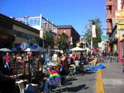
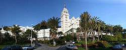
In the southeastern corner of the city is the Claremont District, home to the Claremont Hotel; and the Elmwood District, with a small shopping area on College Avenue. West of Elmwood is South Berkeley, known for its weekend flea market at the Ashby Station.
West of (and including) San Pablo Avenue, a major commercial corridor, is West Berkeley, the historic commercial center of the city, and the former unincorporated town of Ocean View. West Berkeley contains the remnants of Berkeley's industrial area, much of which has been replaced by retail and office uses, as well as residential live/work loft space, with the decline of manufacturing in the United States. The areas of South and West Berkeley are in the midst of redevelopment. Some residents have opposed redevelopment in this area. Along the shoreline of San Francisco Bay at the foot of University Avenue is the Berkeley Marina. Nearby is Berkeley's Aquatic Park, featuring an artificial linear lagoon of San Francisco Bay.
North of Downtown is the North Berkeley neighborhood, which has been nicknamed the "Gourmet Ghetto" because of the concentration of well-known restaurants and other food-related businesses. West of North Berkeley is Westbrae, a small neighborhood through which part of the Ohlone Greenway runs. Meanwhile, further north of North Berkeley are Northbrae, a master-planned subdivision from the early 20th century, and Thousand Oaks. Above these last three neighborhoods, on the western slopes of the Berkeley Hills are the neighborhoods of Cragmont and La Loma Park, notable for their dramatic views, winding streets, and numerous public stairways and paths.
Points of interest

- University of California, Berkeley
- Berkeley Art Museum and Pacific Film Archive
- Berkeley Marina
- Berkeley History Center (1931 Center St.)
- Berkeley Public Library (Shattuck Avenue at Kittridge Street)
- Berkeley Repertory Theatre
- Berkeley Rose Garden
- Cloyne Court Hotel, a member of the Berkeley Student Cooperative
- Hearst Greek Theatre (home of the annual Berkeley Jazz Festival)
- Judah L. Magnes Museum
- Lawrence Berkeley National Laboratory
- Lawrence Hall of Science
- Regional Parks Botanic Garden
- Tilden Regional Park
- University of California Botanical Garden
- The Campanile (Sather Tower) in the University of California, Berkeley campus.
- Telegraph Avenue and People's Park, both known as centers of the counterculture of the 1960s.
- The Berkeley Free Clinic, a free clinic operating since 1969.
- The Edible Schoolyard is a one-acre garden at Martin Luther King Middle School (Berkeley)
- Berkeley High School
Parks and recreation
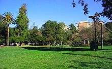
The city has many parks, and promotes greenery and the environment. The city has planted trees for years and is a leader in the nationwide effort to re-tree urban areas. Tilden Regional Park, lies east of the city, occupying the upper extent of Wildcat Canyon between the Berkeley Hills and the San Pablo Ridge. The city is also heavily involved in creek restoration and wetlands restoration, including a planned daylighting of Strawberry Creek along Center Street. The Berkeley Marina and East Shore State Park flank its shoreline at San Francisco Bay and organizations like the Urban Creeks Council and Friends of the Five Creeks the former of which is headquartered in Berkeley support the riparian areas in the town and coastlines as well. César Chávez Park, near the Berkeley Marina, was built at the former site of the city dump.
Landmarks and historic districts
165 buildings in Berkeley are designated as local landmarks or local structures of merit. Of these, 49 are listed in the National Register of Historic Places, including:
- Berkeley High School (the city's only public high school) and the Berkeley Community Theatre, which is on its campus.[56]
- Berkeley Women's City Club, now Berkeley City Club – Julia Morgan (1929–30)
- First Church of Christ, Scientist – Bernard Maybeck (1910)
- St. John's Presbyterian Church – Julia Morgan (1910), now the Berkeley Playhouse
- Studio Building – architect not recorded, built for Frederick H. Dakin (1905)
- William R. Thorsen House, now Sigma Phi Society Chapter House – Charles Sumner Greene & Henry Mather Greene (1908–10)
.JPG)
Historic Districts listed in the National Register of Historic Places:
- George C. Edwards Stadium – Located at intersection of Bancroft Way and Fulton Street on University of California, Berkeley campus (80 acres (32 ha), 3 buildings, 4 structures, 3 objects; added 1993).
- Site of the Clark Kerr Campus, UC Berkeley – until 1980, this location housed the State Asylum for the Deaf, Dumb and Blind, also known as The California Schools for the Deaf and Blind – Bounded by Dwight Way, the city line, Derby Street, and Warring Street (500 acres (2.0 km2), 20 buildings; added 1982). The school was closed in 1980 and the Clark Kerr Campus was opened in 1986.
See List of Berkeley Landmarks, Structures of Merit, and Historic Districts

Arts and culture
Berkeley is home to the Chilean-American community's La Peña Cultural Center, the largest cultural center for this community in the United States. The Freight and Salvage is the oldest established full-time folk and traditional music venue west of the Mississippi River.[57]
Annual events
- Jewish Music Festival[58] – March
- Cal Day University of California, Berkeley Open House[59] – April
- Berkeley Arts Festival[60] – April and May
- Himalayan Fair[61] – May
- Berkeley Juggling and Unicycling Festival[62] – July or August
- Berkeley Kite Festival[63] – July
- The Solano Avenue Stroll[64] – Solano Avenue, Berkeley and Albany, September
Education
Colleges and universities
University of California, Berkeley's main campus is in the city limits.
The Graduate Theological Union, a consortium of nine independent theological schools, is located a block north of the University of California Berkeley's main campus. The Graduate Theological Union has the largest number of students and faculty of any religious studies doctoral program in the United States.[65] In addition to more theological schools, Zaytuna College, a newly established Muslim liberal arts college, has taken 'Holy Hill' as its new home. Wright Institute, a psychology graduate school, is located in Berkeley. Berkeley City College is a community college in the Peralta Community College District.
Primary and secondary schools

The Berkeley Unified School District operates public schools.
The first public school in Berkeley was the Ocean View School, now the site of the Berkeley Adult School located at Virginia Street and San Pablo Avenue. The public schools today are administered by the Berkeley Unified School District. In the 1960s, Berkeley was one of the earliest US cities to voluntarily desegregate, utilizing a system of buses, still in use. The city has one public high school, Berkeley High School (BHS). Established in 1880, BHS currently has over 3,000 students. The Berkeley High campus was designated a historic district by the National Register of Historic Places on January 7, 2008.[66] Saint Mary's College High School, a Catholic school, has its street address in Berkeley, although most of the grounds and buildings are actually in neighboring Albany. Berkeley has 11 elementary schools and three middle schools.
There is also the Bay Area Technology School, the only school in the whole Bay Area to offer a technology- and science-based curriculum, with connections to leading universities.
The school district is managed by the Berkeley Board of Education, which consists of five members (who serve four-year terms) and two student directors. The current members are:[67]
- President Judy Appel
- Vice President Beatriz Levya-Cutler
- Director Karen Hemphill
- Director Josh Daniels
- Director Ty Alper
Public libraries
Berkeley Public Library serves as the municipal library. University of California, Berkeley Libraries operates the University of California Berkeley libraries.
Government
Berkeley has a council–manager government.[1] The mayor is elected at large for a four-year term and is the ceremonial head of the city and the chair of the city council. The Berkeley City Council is composed of the mayor and eight council members elected by district who each serve four-year terms. Districts 2, 3, 5 and 6 hold their elections in years divisible by four while Districts 1, 4, 7 and 8 hold theirs in even-numbered years not divisible by four. The city council appoints a city manager, who is the chief executive of the city. Additionally, the city voters directly elect an independent City Auditor and a Rent Stabilization Board. The current councilmembers are:[3]
- Mayor (at-large district): Tom Bates
- District 1: Linda Maio
- District 2: Darryl Moore
- District 3: Maxwell Anderson
- District 4: Jesse Arreguín
- District 5: Laurie Capitelli
- District 6: Susan Wengraf
- District 7: Kriss Worthington
- District 8: Lori Droste
Most of the University housing is located in District 7 (although Foothill and Clark Kerr are in Districts 6 and 8, respectively). Districts 4 and 7 are majority-student.
Berkeley is also part of Alameda County, for which the Government of Alameda County is defined and authorized under the California Constitution, California law, and the Charter of the County of Alameda.[68] The county government provides countywide services, such as elections and voter registration, law enforcement, jails, vital records, property records, tax collection, public health, and social services. The county government is primarily composed of the elected five-member Board of Supervisors, other elected offices including the Sheriff/Coroner, the District Attorney, Assessor, Auditor-Controller/County Clerk/Recorder, and Treasurer/Tax Collector, and numerous county departments and entities under the supervision of the County Administrator.
Notable people
Notable individuals who were born in and/or have lived in Berkeley include actors Ben Affleck and Andy Samberg, Billie Joe Armstrong, lead singer of the punk rock band Green Day, and Lil B.
Sister cities
Berkeley has 14 sister cities:[69]
-
 Asmara, Eritrea
 -
 Blackfeet Nation, Montana, United States
 - Yurok Tribe, California, United States
-
 City of Djibouti, Djibouti
 -
 Sakai, Osaka, Japan
 -
 Gao, Mali
 -
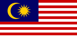 Uma Bawang, Malaysia (1991)[70]
 -
 Dmitrov, Russia
 -
 Jena, Germany
 - Ulan-Ude, Buryatia, Russia
-
 San Antonio Los Ranchos, El Salvador
 -
 Oukasie, South Africa
 -
 Yondó, Colombia
 -
 Palma Soriano, Cuba
 -
 León, Nicaragua
See also
References
- 1 2 3 4 "Structure of Berkeley Government". City Clerk. City of Berkeley. Retrieved 13 June 2016.
- ↑ "California Cities by Incorporation Date". California Association of Local Agency Formation Commissions. Archived from the original (Word) on November 3, 2014. Retrieved March 27, 2013.
- 1 2 3 "Elected Officials Home". City of Berkeley. Retrieved December 29, 2014.
- ↑ "Senators". State of California. Retrieved March 18, 2013.
- ↑ "Members Assembly". State of California. Retrieved March 18, 2013.
- ↑ "California's 13th Congressional District - Representatives & District Map". Civic Impulse, LLC. Retrieved March 9, 2013.
- ↑ "2010 Census U.S. Gazetteer Files – Places – California". United States Census Bureau.
- ↑ "Berkeley". Geographic Names Information System. United States Geological Survey. Retrieved February 8, 2015.
- 1 2 . United States Census Bureau http://www.census.gov. Retrieved March 13, 2015. Missing or empty
|title=(help), using 2015 American Community Survey 1-Year Estimates for population estimates - ↑ "ZIP Code(tm) Lookup". United States Postal Service. Retrieved November 24, 2014.
- ↑ Golla, Victor (2011). California Indian Languages. Berkeley, California: University of California Press. p. 380. ISBN 978-0-520-26667-4.
- ↑ National Park Service. "Juan Bautista de Anza". Borrego Springs Chamber of Commerce.
- ↑ Stadtman, Verne, ed. (1967). The Centennial Record of the University of California. Regents of the University of California. p. 114.
- ↑ "George Berkeley – Biography". European Graduate School. Archived from the original on February 25, 2013.
- ↑ Durham, David L. (1998). California's Geographic Names: A Gazetteer of Historic and Modern Names of the State. Clovis, Calif.: Word Dancer Press. p. 601. ISBN 1-884995-14-4.
- ↑ Berkeley Gazette. 1900 April 9
- ↑ Berkeley 1900: Daily Life at the Turn of the Century, by Richard Schwartz. 2000. page 187
- ↑ Edwards, Robert W. (2012). Jennie V. Cannon: The Untold History of the Carmel and Berkeley Art Colonies, Vol. 1. Oakland, Calif.: East Bay Heritage Project. pp. 72–105. ISBN 9781467545679. An online facsimile of the entire text of Vol. 1 is posted on the Traditional Fine Arts Organization website (http://www.tfaoi.com/aa/10aa/10aa557.htm).
- ↑ Exactly Opposite the Golden Gate, edited by Phil McCardle, published 1983 by the Berkeley Historical Society, p.251
- ↑ "Berkeley, A City in History" Archived January 2, 2014, at the Wayback Machine.. Berkeley Public Library.
- ↑ "California – Race and Hispanic Origin for Selected Cities and Other Places: Earliest Census to 1990". U.S. Census Bureau.
- ↑ , "The median home value in Berkeley is 84.3% greater than the California average and 290.1% greater than the National average."
- ↑ Joe Garofoli (December 12, 2012). "Ethel Manheimer, Berkeley activist, dies". SFGate. Retrieved January 1, 2013.
- ↑ "School Colors". Frontline. Retrieved 2 July 2015.
- ↑ "Berkeley becomes first US city to declare Bisexual Pride Day, support 'marginalized' group". The Washington Post. Retrieved September 19, 2012.
- ↑ "Berkeley Pushes a Boundary on Medical Marijuana". The New York Times. Retrieved 21 January 2015.
- ↑ Archived May 9, 2015, at the Wayback Machine.
- ↑ "Berkeley CA crime rates and statistics - NeighborhoodScout". neighborhoodscout.com. Retrieved August 25, 2015.
- ↑ "Crime in Berkeley, California (CA): murders, rapes, robberies, assaults, burglaries, thefts, auto thefts, arson, law enforcement employees, police officers, crime map". city-data.com. Retrieved August 25, 2015.
- ↑ "US Gazetteer files: 2010, 2000, and 1990". United States Census Bureau. 2011-02-12. Retrieved 2011-04-23.
- ↑ Fabisch, M.P. (June 6, 1990). "Revised Date for Split of 415 (California) Numbering Plan Area" (PDF). BellCore Letter. Retrieved June 1, 2011.
- ↑ "2008 Bay Area Earthquake Probabilities". USGS. USGS. Retrieved 2015-06-26.
- ↑ "U.S. Geological Survey Liquefaction Hazard Maps". U.S. Geological Survey. USGS. Retrieved 2015-02-18.
- ↑ "Earthquake in San Francisco and Neighboring Places". The New York Times. October 22, 1868.
- ↑ "Roughing It". Etext.virginia.edu. Retrieved 2014-01-27.
- ↑ Lawson, A. C. (ed.), The California Earthquake of April 18, 1906, 1908, Reprinted 1969 by the Carnegie Institution of Washington. This is a comprehensive report on the 1906 earthquake, published by the State Earthquake Investigation Commission, and comprises two volumes and an atlas. It contains a discussion of the 1868 Hayward Fault earthquake and its effects, and includes a number of photos taken by Lawson himself of damage in Berkeley caused by the 1906 quake. The report is available from the USGS. "The California Earthquake of April 18, 1906". Earthquake.usgs.gov.
- ↑
- ↑ "Jane Houston Jones. ''San Francisco Weather – Weird and Wacky''. SJAA Ephemeris July 2001". Ephemeris.sjaa.net. July 19, 2007. Retrieved November 12, 2013.
- ↑ "Climatography of the United States : No. 20 : 1971-2000" (PDF). Cdo.ncdc.noaa.gov. Retrieved 21 January 2015.
- ↑ Western Regional Climate Center Web site
- ↑ "Berkeley, California". Western Regional Climate Center. Retrieved December 8, 2012.
- ↑ "Annual Estimates of the Resident Population for Incorporated Places: April 1, 2010 to July 1, 2015". Retrieved July 2, 2016.
- ↑ "Census of Population and Housing". Census.gov. Archived from the original on April 22, 2013. Retrieved June 4, 2015.
- ↑ "2010 Census Interactive Population Search: CA - Berkeley city". U.S. Census Bureau. Retrieved July 12, 2014.
- ↑ "2007–2011 American Community Survey 5-Year Estimates". Factfinder2.census.gov. Archived from the original on September 16, 2013.
- ↑ "Demographic Profile Bay Area Census". Bayareacensus.ca.gov. Retrieved 21 January 2015.
- ↑ Bicycle and Pedestrian Safety in Berkeley, City of Berkeley.
- ↑ "Chicanery tops meters in Berkeley", San Francisco Chronicle.
- ↑ Berkeley Gazette, January 22, 1903
- ↑ Ford, Robert S. (1977). Red Trains in the East Bay: The History of the Southern Pacific Transbay Train and Ferry System. Interurbans Specials. 65. Glendale, California: Interurban Press. ISBN 0-916374-27-0.
- ↑ Demoro, Harre W. (1985). The Key Route: Transbay Commuting by Train and Ferry, Part 1. Interurbans Specials. 95. Glendale, California: Interurban Press. ISBN 0-916374-66-1.
- ↑ "list of current and past City of Berkeley CAFR's". Ci.berkeley.ca.us. Retrieved June 19, 2014.
- ↑ Berkeley Inside Out, Malcolm Margolin. Heyday Books (1989) p. 104
- ↑ "CDHS has reorganized". Dhs.ca.gov. Retrieved January 1, 2013.
- ↑ "Berkeley Path Wanderers Association". Berkeleypaths.org. Retrieved January 21, 2015.
- ↑ "Berkeley High". Berkeleyheritage.com. Retrieved November 12, 2013.
- ↑ Addison St – Freight and Salvage Aug09 – City of Berkeley, CA. Ci.berkeley.ca.us. Retrieved on 2013-07-15.
- ↑ "jewishmusicfestival.org". jewishmusicfestival.org. Retrieved 2014-01-27.
- ↑ "UC Berkeley | Cal Day 2013 | Share". Berkeley.edu. Retrieved 2014-01-27.
- ↑ "berkeleyartsfestival.com". berkeleyartsfestival.com. Retrieved 2014-01-27.
- ↑ "himalayanfair.net". himalayanfair.net. Archived from the original on January 20, 2014. Retrieved 2014-01-27.
- ↑ "2011 Berkeley Juggling & Unicycle Festival". Berkeleyjuggling.org. Retrieved 2014-01-27.
- ↑ "Berkeley Kite Festival website". Highlinekites.com. July 28, 2013. Retrieved November 12, 2013.
- ↑ "Solano Avenue Stroll website". Solanoavenueassn.org. November 6, 2007. Retrieved November 12, 2013.
- ↑ "A Data-Based Assessment of Research-Doctorate Programs in the United States". Nap.edu. Retrieved January 1, 2013.
- ↑ Berkeley Daily Planet, January 22–24, 2008
- ↑ "School Board Members". Berkeley Unified School District. Retrieved April 9, 2015.
- ↑ California Government Code § 23004
- ↑ Sister cities designated by Sister Cities International, Inc. (SCI). Retrieved on May 3, 2007.
- ↑ "Berkeley's Borneo Project Aims to Restore Lands by Teaching Mapping By MATTHEW ARTZ". The Berkeley Daily Planet. Retrieved 2014-02-07.
Further reading
- Exactly Opposite the Golden Gate, edited by Phil McCardle. Berkeley Historical Society, 1983
- Berkeley: The Life and Spirit of a Remarkable Town, Ellen Weis, photographs by Kiran Singh. Berkeley: Frog, Ltd. 2004 ISBN 1-58394-093-6
- Berkeley Inside/Out, Don Pitcher, history sections by Malcolm Margolin. Berkeley: Heyday Books. 1989 ISBN 0-930588-33-9
- A Heartbreaking Work of Staggering Genius, by Dave Eggers.
External links
| Wikimedia Commons has media related to Berkeley, California. |
| Wikivoyage has a travel guide for Berkeley, California. |
- Official website
- U.S. Geological Survey Geographic Names Information System: Berkeley, California
- Berkeley Historical Society website
- Finding Aid to City of Berkeley Records, The Bancroft Library
- Berkeley Daily Gazette, Google news archive. —PDFs of 8,057 issues, dating from 1911 to 1946.
-
 "Berkeley, a city of Alameda county, California, U.S.A.". Encyclopædia Britannica (11th ed.). 1911.
 |
Albany | El Cerrito, Kensington | | |
| |
Orinda Moraga | |||
| ||||
| | ||||
| Emeryville | Oakland | Piedmont |
Municipalities and communities of Alameda County, California, United States | ||
|---|---|---|
| Cities |  | |
| CDPs | ||
| Unincorporated communities | ||
| Former settlements | ||
| Bodies of water |
| |
|---|---|---|
| Counties | ||
| Major cities | ||
| Cities and towns 100k–250k | ||
| Cities and towns 50k–99k | ||
| Cities and towns 25k-50k | ||
| Cities and towns 10k–25k |
| |
| Sub-regions | ||
| |
^* Mayor selected from city council
|
