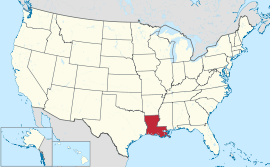
Louisiana
| State of Louisiana État de Louisiane (French) | |||||
|---|---|---|---|---|---|
| |||||
|
Nickname(s): Bayou State • Child of the Mississippi Creole State • Pelican State (official) Sportsman's Paradise • Sugar State • The Boot | |||||
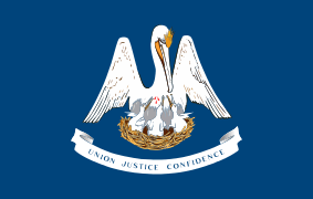
| Motto(s): Union, Justice, Confidence | |||||
 | |||||
| Official language | No official language | ||||
| Spoken languages |
As of 2007
| ||||
| Demonym | Louisianian | ||||
| Capital | Baton Rouge | ||||
| Largest city | New Orleans[1][2][3] | ||||
| Largest metro | Greater New Orleans | ||||
| Area | |||||
| • Total |
50,000 sq mi (135,382 km2) | ||||
| • Width | 130 miles (210 km) | ||||
| • Length | 379 miles (610 km) | ||||
| • % water | 15 | ||||
| • Latitude | 28° 56′ N to 33° 01′ N | ||||
| • Longitude | 88° 49′ W to 94° 03′ W | ||||
| Population | |||||
| • Total | 4,670,724 (2015 est)[4] | ||||
| • Density |
105/sq mi (40.5/km2) Ranked 24th | ||||
| Elevation | |||||
| • Highest point |
Driskill Mountain[5][6] 535 ft (163 m) | ||||
| • Mean | 100 ft (30 m) | ||||
| • Lowest point |
New Orleans[5][6] −8 ft (−2.5 m) | ||||
| Before statehood | Territory of Orleans | ||||
| Admission to Union | April 30, 1812 (18th) | ||||
| Governor | John Bel Edwards (D) | ||||
| Lieutenant Governor | Billy Nungesser (R) | ||||
| Legislature | |||||
| • Upper house | State Senate | ||||
| • Lower house | House of Representatives | ||||
| U.S. Senators |
David Vitter (R) Bill Cassidy (R) | ||||
| U.S. House delegation | 5 Republicans, 1 Democrat (list) | ||||
| Time zone | Central: UTC −6/−5 | ||||
| ISO 3166 | US-LA | ||||
| Abbreviations | LA, La. | ||||
| Website |
louisiana | ||||
| Louisiana state symbols | |
|---|---|
|
| |
|
| |
| Living insignia | |
| Bird | Brown pelican |
| Dog breed | Catahoula Leopard Dog |
| Fish | White perch |
| Flower | Magnolia |
| Insect | Honeybee |
| Mammal | Black bear |
| Reptile | Alligator |
| Tree | Bald cypress |
| Inanimate insignia | |
| Beverage | Milk |
| Fossil | Petrified palmwood |
| Gemstone | Agate |
| Instrument | Diatonic accordion |
| Motto | Union, Justice, Confidence |
| Song |
"Give Me Louisiana" "You Are My Sunshine" "State March Song" "Gifts of the Earth" |
| State route marker | |
 | |
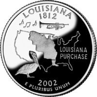
| State quarter | |
|
Released in 2002 | |
| Lists of United States state symbols | |
Louisiana (![]() i/luːˌiːziˈænə/ or
i/luːˌiːziˈænə/ or ![]() i/ˌluːziˈænə/; French: État de Louisiane, [lwizjan]; Louisiana Creole: Léta de la Lwizyàn) is a state located in the southern region of the United States. Louisiana is the 31st most extensive and the 25th most populous of the 50 United States. Its capital is Baton Rouge and largest city is New Orleans. Louisiana is the only state in the U.S. with political subdivisions termed parishes, which are the local government's equivalent to counties. The largest parish by population is East Baton Rouge Parish, and the largest by land area is Plaquemines. Louisiana is bordered by Arkansas to the north, Mississippi to the east, Texas to the west, and the Gulf of Mexico to the south.
i/ˌluːziˈænə/; French: État de Louisiane, [lwizjan]; Louisiana Creole: Léta de la Lwizyàn) is a state located in the southern region of the United States. Louisiana is the 31st most extensive and the 25th most populous of the 50 United States. Its capital is Baton Rouge and largest city is New Orleans. Louisiana is the only state in the U.S. with political subdivisions termed parishes, which are the local government's equivalent to counties. The largest parish by population is East Baton Rouge Parish, and the largest by land area is Plaquemines. Louisiana is bordered by Arkansas to the north, Mississippi to the east, Texas to the west, and the Gulf of Mexico to the south.
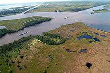
Much of the state's lands were formed from sediment washed down the Mississippi River, leaving enormous deltas and vast areas of coastal marsh and swamp.[7] These contain a rich southern biota; typical examples include birds such as ibis and egrets. There are also many species of tree frogs, and fish such as sturgeon and paddlefish. In more elevated areas, fire is a natural process in the landscape, and has produced extensive areas of longleaf pine forest and wet savannas. These support an exceptionally large number of plant species, including many species of orchids and carnivorous plants.[7] Louisiana has more Native American tribes than any other southern state, including four that are federally recognized, ten that are state recognized, and four that have not yet received recognition.[8]
Some Louisiana urban environments have a multicultural, multilingual heritage, being so strongly influenced by a mixture of 18th-century French, Spanish, Native American, and African cultures that they are considered to be exceptional in the US. Before the American purchase of the territory in 1803, the current Louisiana State had been both a French colony and for a brief period, a Spanish one. In addition, colonists imported numerous African people as slaves in the 18th century. Many came from peoples of the same region of West Africa, thus concentrating their culture. In the post-Civil War environment, Anglo-Americans increased the pressure for Anglicization, and in 1921, English was for a time made the sole language of instruction in Louisiana schools before a policy of multilingualism was revived in 1974.[9][10] There has never been an official language in Louisiana, and the state constitution enumerates "the right of the people to preserve, foster, and promote their respective historic, linguistic, and cultural origins," whether English, French, Spanish, or otherwise.[9]
Etymology
Louisiana was named after Louis XIV, King of France from 1643 to 1715. When René-Robert Cavelier, Sieur de La Salle claimed the territory drained by the Mississippi River for France, he named it La Louisiane.[11] The suffix -ana (or -ane) is a Latin suffix that can refer to "information relating to a particular individual, subject, or place." Thus, roughly, Louis + ana carries the idea of "related to Louis." Once part of the French Colonial Empire, the Louisiana Territory stretched from present-day Mobile Bay to just north of the present-day Canada–United States border, and included a small part of what is now southwestern Canada.
Geology
The Gulf of Mexico did not exist 250 million years ago when there was but one supercontinent, Pangea. As Pangea split apart, the Atlantic Ocean and Gulf of Mexico opened. Louisiana slowly developed, over millions of years, from water into land, and from north to south.[7] The oldest rocks are exposed in the north, in areas such as the Kisatchie National Forest. The oldest rocks date back to the early Tertiary Era, some 60 million years ago. The history of the formation of these rocks can be found in D. Spearing's Roadside Geology of Louisiana.[12]
The youngest parts of the state were formed during the last 7,500 years as successive deltas of the Mississippi River: the Maringouin, Teche, St. Bernard, Lafourche, the modern Mississippi, and now the Atchafalaya.[13] The sediments were carried from north to south by the Mississippi River.
In between the Tertiary rocks of the north, and the relatively new sediments along the coast, is a vast belt known as the Pleistocene Terraces. Their age and distribution can be largely related to the rise and fall of sea levels during past ice ages. In general, the northern terraces have had sufficient time for rivers to cut deep channels, while the newer terraces tend to be much flatter.[14]
Salt domes are also found in Louisiana. Their origin can be traced back to the early Gulf of Mexico, when the shallow ocean had high rates of evaporation. There are several hundred salt domes in the state; one of the most familiar is Avery Island.[15] Salt domes are important not only as a source of salt; they also serve as underground traps for oil and gas.[16]
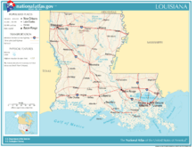
Geography
.jpg)

Louisiana is bordered to the west by Texas; to the north by Arkansas; to the east by the state of Mississippi; and to the south by the Gulf of Mexico. The surface of the state may properly be divided into two parts, the uplands of the north, and the alluvial along the coast.
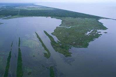
The alluvial region includes low swamp lands, coastal marshlands and beaches, and barrier islands that cover about 20,000 square miles (52,000 km2). This area lies principally along the Gulf of Mexico and the Mississippi River, which traverses the state from north to south for a distance of about 600 miles (1,000 km) and empties into the Gulf of Mexico; the Red River; the Ouachita River and its branches; and other minor streams (some of which are called bayous).
The breadth of the alluvial region along the Mississippi is from 10 to 60 miles (15 to 100 km), and along the other rivers, the alluvial region averages about 10 miles (15 km) across. The Mississippi River flows along a ridge formed by its own natural deposits (known as a levee), from which the lands decline toward a river beyond at an average fall of six feet per mile (3 m/km). The alluvial lands along other streams present similar features.
The higher and contiguous hill lands of the north and northwestern part of the state have an area of more than 25,000 square miles (65,000 km2). They consist of prairie and woodlands. The elevations above sea level range from 10 feet (3 m) at the coast and swamp lands to 50 and 60 feet (15–18 m) at the prairie and alluvial lands. In the uplands and hills, the elevations rise to Driskill Mountain, the highest point in the state at only 535 feet (163 m) above sea level.
Besides the waterways already named, there are the Sabine, forming the western boundary; and the Pearl, the eastern boundary; the Calcasieu (/ˈkælkəˌʃuː/), the Mermentau, the Vermilion, Bayou Teche, the Atchafalaya (/əˌtʃæfəˈlaɪə/), the Boeuf (/bɛf/), Bayou Lafourche, the Courtableau River, Bayou D'Arbonne, the Macon River, the Tensas (/ˈtɛnsɔː/), Amite River, the Tchefuncte (/tʃᵻˈfʌŋktə/), the Tickfaw, the Natalbany River, and a number of other smaller streams, constituting a natural system of navigable waterways, aggregating over 4,000 miles (6,400 km) long.
The state also has political jurisdiction over the approximately 3-mile (4.8 km)-wide portion of subsea land of the inner continental shelf in the Gulf of Mexico. Through a peculiarity of the political geography of the United States, this is substantially less than the 9-mile (14 km)-wide jurisdiction of nearby states Texas and Florida, which, like Louisiana, have extensive Gulf coastlines.[17]
The southern coast of Louisiana in the United States is among the fastest-disappearing areas in the world. This has largely resulted from human mismanagement of the coast (see Wetlands of Louisiana). At one time, the land was added to when spring floods from the Mississippi River added sediment and stimulated marsh growth; the land is now shrinking. There are multiple causes.[18][19]
Artificial levees block spring flood water that would bring fresh water and sediment to marshes. Swamps have been extensively logged, leaving canals and ditches that allow saline water to move inland. Canals dug for the oil and gas industry also allow storms to move sea water inland, where it damages swamps and marshes. Rising sea waters have exacerbated the problem. Some researchers estimate that the state is losing a land mass equivalent to 30 football fields every day. There are many proposals to save coastal areas by reducing human damage, including restoring natural floods from the Mississippi. Without such restoration, coastal communities will continue to disappear.[20] And as the communities disappear, more and more people are leaving the region.[21] Since the coastal wetlands support an economically important coastal fishery, the loss of wetlands is adversely affecting this industry.
Climate
| Baton Rouge | ||||||||||||||||||||||||||||||||||||||||||||||||||||||||||||
|---|---|---|---|---|---|---|---|---|---|---|---|---|---|---|---|---|---|---|---|---|---|---|---|---|---|---|---|---|---|---|---|---|---|---|---|---|---|---|---|---|---|---|---|---|---|---|---|---|---|---|---|---|---|---|---|---|---|---|---|---|
| Climate chart (explanation) | ||||||||||||||||||||||||||||||||||||||||||||||||||||||||||||
| ||||||||||||||||||||||||||||||||||||||||||||||||||||||||||||
| ||||||||||||||||||||||||||||||||||||||||||||||||||||||||||||
| New Orleans | ||||||||||||||||||||||||||||||||||||||||||||||||||||||||||||
|---|---|---|---|---|---|---|---|---|---|---|---|---|---|---|---|---|---|---|---|---|---|---|---|---|---|---|---|---|---|---|---|---|---|---|---|---|---|---|---|---|---|---|---|---|---|---|---|---|---|---|---|---|---|---|---|---|---|---|---|---|
| Climate chart (explanation) | ||||||||||||||||||||||||||||||||||||||||||||||||||||||||||||
| ||||||||||||||||||||||||||||||||||||||||||||||||||||||||||||
| ||||||||||||||||||||||||||||||||||||||||||||||||||||||||||||
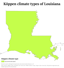
Louisiana has a humid subtropical climate (Köppen climate classification Cfa). It has long, hot, humid summers and short, mild winters. The subtropical characteristics of the state are due in large part to the influence of the Gulf of Mexico, which at its farthest point is no more than 200 miles (320 km) away.
Rain is frequent throughout the year, although the summer is slightly wetter than the rest of the year. There is a dip in precipitation in October. Southern Louisiana receives far more copious rainfall, especially during the winter months. Summers in Louisiana have high temperatures from mid-June to mid-September averaging 90 °F (32 °C) or more, and overnight lows averaging above 70 °F (22 °C).
In the summer, the extreme maximum temperature is much warmer in the north than in the south, with temperatures near the Gulf of Mexico occasionally reaching 100 °F (38 °C), although temperatures above 95 °F (35 °C) are commonplace. In northern Louisiana, the temperatures reach above 105 °F (41 °C) in the summer.
Temperatures are generally mildly warm in the winter in the southern part of the state, with highs around New Orleans, Baton Rouge, the rest of south Louisiana, and the Gulf of Mexico averaging 66 °F (19 °C). The northern part of the state is mildly cool in the winter, with highs averaging 59 °F (15 °C). The overnight lows in the winter average well above freezing throughout the state, with 46 °F (8 °C) the average near the Gulf and an average low of 37 °F (3 °C) in the winter in the northern part of the state.
Louisiana gets some cold fronts, which frequently drop the temperatures below 20 °F (−8 °C) in the northern part of the state, but almost never do so in the southern part of the state. Snow is not very common near the Gulf of Mexico, although residents in the northern parts of the state can expect one to three snowfalls per year, with the frequency increasing northwards. Louisiana's highest recorded temperature is 114 °F (46 °C) in Plain Dealing on August 10, 1936, while the coldest recorded temperature is −16 °F (−27 °C) at Minden on February 13, 1899.
Louisiana is often affected by tropical cyclones and is very vulnerable to strikes by major hurricanes, particularly the lowlands around and in the New Orleans area. The unique geography of the region, with the many bayous, marshes and inlets, can result in water damage across a wide area from major hurricanes. The area is also prone to frequent thunderstorms, especially in the summer.[23]
The entire state averages over 60 days of thunderstorms a year, more than any other state except Florida. Louisiana averages 27 tornadoes annually. The entire state is vulnerable to a tornado strike, with the extreme southern portion of the state slightly less so than the rest of the state. Tornadoes are more common from January to March in the southern part of the state, and from February through March in the northern part of the state.[23]
| Jan | Feb | Mar | Apr | May | Jun | Jul | Aug | Sept | Oct | Nov | Dec | Annual | |
|---|---|---|---|---|---|---|---|---|---|---|---|---|---|
| Shreveport[24] | 47.0 | 50.8 | 58.1 | 65.5 | 73.4 | 80.0 | 83.2 | 83.3 | 77.1 | 66.6 | 56.6 | 48.3 | 65.9 |
| Monroe[24] | 46.3 | 50.3 | 57.8 | 65.6 | 73.9 | 80.4 | 82.8 | 82.5 | 76.5 | 66.0 | 56.3 | 48.0 | 65.5 |
| Alexandria[24] | 48.5 | 52.1 | 59.3 | 66.4 | 74.5 | 80.7 | 83.2 | 83.2 | 78.0 | 68.0 | 58.6 | 50.2 | 66.9 |
| Lake Charles[25] | 51.8 | 55.0 | 61.4 | 68.1 | 75.6 | 81.1 | 82.9 | 83.0 | 78.7 | 70.1 | 61.1 | 53.8 | 68.6 |
| Lafayette[25] | 51.8 | 55.2 | 61.5 | 68.3 | 75.9 | 81.0 | 82.8 | 82.9 | 78.5 | 69.7 | 61.0 | 53.7 | 68.5 |
| Baton Rouge[26] | 51.3 | 54.6 | 61.1 | 67.6 | 75.2 | 80.7 | 82.5 | 82.5 | 78.1 | 68.9 | 60.0 | 52.9 | 68.0 |
| New Orleans[26] | 54.3 | 57.6 | 63.6 | 70.1 | 77.5 | 82.4 | 84.0 | 84.1 | 80.2 | 72.2 | 63.5 | 56.2 | 70.3 |
Hurricanes since 1950
- August 28–29, 2012, Isaac (Category 1 at landfall) hits southeast Louisiana 7 years after Katrina (2005).
- September 1, 2008, Gustav (Category 2 at landfall) made landfall along the coast near Cocodrie in southeastern Louisiana. As late as August 31 it had been projected by the National Hurricane Center that the hurricane would remain at Category 3 or above on September 1, but in the event the center of Gustav made landfall as a strong Category 2 hurricane (1 mph below Category 3), and dropped to Category 1 soon after.[27] As a result of NHC's forecasts, a massive evacuation of New Orleans took place after many residents having failed to leave for Katrina in 2005.[28] A significant number of deaths were caused by or attributed to Gustav.[29] Around 1.5 million people were without power in Louisiana on September 1.[30]
- September 24, 2005, Rita (Category 3 at landfall) struck southwestern Louisiana, flooding many parishes and cities along the coast, including Cameron Parish, Lake Charles, and other towns. The storm's winds weakened the damaged levees in New Orleans and caused renewed flooding in parts of the city.
- August 29, 2005, Katrina (Category 3 at landfall)[31] struck and devastated southeastern Louisiana, where it breached and undermined levees in New Orleans, causing 80% of the city to flood. Most people had been evacuated, but the majority of the population became homeless. The city was virtually closed until October. It is estimated that more than two million people in the Gulf region were displaced by the hurricane, and that more than 1,500 fatalities resulted in Louisiana alone. A public outcry criticized governments at the local, state, and federal levels, for lack of preparation and slowness of response. Louisiana residents relocated across the country for temporary housing, and many have not returned.
- October 3, 2002, Lili (Category 1 at landfall)
- August 1992, Andrew (Category 3 at landfall) struck south-central Louisiana. It killed four people; knocked out power to nearly 150,000 citizens; and destroyed crops worth hundreds of millions of dollars.
- August 1969, Camille (Category 5) caused a 23.4 ft (7.1 m) storm surge and killed 250 people. Although Camille officially made landfall in Mississippi and the worst damage occurred there, it also had effects in Louisiana. New Orleans remained dry, with the exception of mild rain-generated flooding in the most low-lying areas.
- September 9, 1965, Betsy (Category 3 at landfall) came ashore in Louisiana, causing massive destruction as the first hurricane in history to cause one billion dollars in damage (over ten billion in inflation-adjusted USD). The storm hit New Orleans and flooded nearly 35% of the city (including the Lower 9th Ward, Gentilly, and parts of Mid-City). The death toll in the state was 76.
- June 1957, Audrey (Category 4) devastated southwest Louisiana, destroying or severely damaging 60–80 percent of the homes and businesses from Cameron to Grand Chenier. 40,000 people were left homeless and more than 300 people in the state died.
- August 15–17, 1915: A hurricane made landfall just west of Galveston. Gales howled throughout Cameron and Vermilion Parishes and as far east as Mobile. Produced tides of 11 feet at Cameron (called Leesburg at the time), 10 feet at Grand Cheniere, and 9.5 feet at Marsh Island; Grand Isle reported water 6 feet deep across the city. The light keeper at the Sabine Pass lighthouse had to turn the lens by hand, as vibrations caused by the wave action put the clockwork out of order. At Sabine Bank, 17 miles offshore the Mouth of the Sabine, damage was noted. Damage estimates for Louisiana and Texas totaled around $50 million. <http://www.thecajuns.com/lahurricanes.htm#August_15-17th,_1915>
1915 over 300 people drowned below Montegut - 4 can be identified as white, none of the others have been identified and are assumed to be Indians. The Indian settlement was about 10 miles below Montegut, called by the Indians - Taire-bonne - is now in swamp and can only be reached by boat. This hurricane caused the survivors to move to higher ground.
Protected areas
Owing to its location and geology, the state has high biological diversity. Some vital areas, such as southwestern prairie, have experienced a loss in excess of 98 percent. The pine flatwoods are also at great risk, mostly from fire suppression and urban sprawl.[7] There is not yet a properly organized system of natural areas to represent and protect Louisiana's biological diversity. Such a system would consist of a protected system of core areas linked by biological corridors, such as Florida is planning.[32]
Louisiana contains a number of areas which are, in varying degrees, protected from human intervention.[33] In addition to National Park Service sites and areas and a United States National Forest, Louisiana operates a system of state parks, state historic sites, one state preservation area, one state forest, and many Wildlife Management Areas. The Nature Conservancy also owns and manages a set of natural areas.
One of Louisiana's largest natural areas is Kisatchie National Forest. It is some 600,000 acres in area, more than half of which is vital flatwoods vegetation, which supports many rare plant and animal species.[7] These include the Louisiana pine snake and Red-cockaded woodpecker. The system of protected cypress swamps around Lake Pontchartrain provides another large and important natural area, with southern wetland species including egrets, alligators, and sturgeon. At least 12 core areas would be needed to build a "protected areas system" for the state; these would range from southwestern prairies, to the Pearl River Floodplain in the east, to the Mississippi River alluvial swamps in the north.[7]
The Louisiana Natural and Scenic Rivers System provides a degree of protection for 48 rivers, streams and bayous in the state. It is administered by the Louisiana Department of Wildlife and Fisheries.
National Park Service
Historic or scenic areas managed, protected, or otherwise recognized by the National Park Service include:
- Atchafalaya National Heritage Area in Ascension Parish;
- Cane River National Heritage Area near Natchitoches;
- Cane River Creole National Historical Park near Natchitoches;
- Jean Lafitte National Historical Park and Preserve, headquartered in New Orleans, with units in St. Bernard Parish, Barataria (Crown Point), and Acadiana (Lafayette);
- Poverty Point National Monument at Epps, Louisiana; and
- Saline Bayou, a designated National Wild and Scenic River near Winn Parish in northern Louisiana.
US Forest Service
- Kisatchie National Forest is Louisiana's only national forest. It includes 600,000 acres in central and north Louisiana with large areas of flatwoods and longleaf pine forest.
State parks and recreational areas
Louisiana operates a system of 22 state parks, 17 state historic sites and one state preservation area.
Transportation
The Louisiana Department of Transportation and Development is the state government organization in charge of maintaining public transportation, roadways, bridges, canals, select levees, floodplain management, port facilities, commercial vehicles, and aviation which includes 69 airports.
Interstate highways |
United States highways |
The Intracoastal Waterway is an important means of transporting commercial goods such as petroleum and petroleum products, agricultural produce, building materials and manufactured goods.
In 2011, Louisiana ranked among the five deadliest states for debris/litter-caused vehicle accidents per total number of registered vehicles and population size. Figures derived from[34] the NTSHA show at least 25 persons in Louisiana were killed per year in motor vehicle collisions with non-fixed objects, including debris, dumped litter, animals and their carcasses.
History
Pre-contact history
Louisiana was inhabited by Native Americans for many millennia before the arrival of Europeans in the 16th century. During the Middle Archaic period, Louisiana was the site of the earliest mound complex in North America and one of the earliest dated, complex constructions in the Americas, the Watson Brake site near present-day Monroe. An 11-mound complex, it was built about 5400 BP (3500 BCE).[35] The Middle Archaic sites of Caney and Frenchman's Bend have also been securely dated to 5600–5000 BP, demonstrating that seasonal hunter-gatherers organized to build complex constructions in present-day northern Louisiana. The Hedgepeth Site in Lincoln Parish is more recent, dated to 5200–4500 BP.[36]
Nearly 2,000 years later, Poverty Point, the largest and best-known Late Archaic site in the state, was built. Modern-day Epps developed near it. The Poverty Point culture may have reached its peak around 1500 BCE, making it the first complex culture, and possibly the first tribal culture in North America.[37] It lasted until approximately 700 BCE.
The Poverty Point culture was followed by the Tchefuncte and Lake Cormorant cultures of the Tchula period, local manifestations of Early Woodland period. The Tchefuncte culture were the first people in Louisiana to make large amounts of pottery.[38] These cultures lasted until 200 CE. The Middle Woodland period starts in Louisiana with the Marksville culture in the southern and eastern part of the state[39] and the Fourche Maline culture in the northwestern part of the state. The Marksville culture takes its name from the Marksville Prehistoric Indian Site in Avoyelles Parish, Louisiana.
These cultures were contemporaneous with the Hopewell cultures of Ohio and Illinois, and participated in the Hopewell Exchange Network. Trade with peoples to the southwest brought the bow and arrow.[40] The first burial mounds were built at this time.[41] Political power begins to be consolidated as the first platform mounds at ritual centers are constructed for the developing hereditary political and religious leadership.[41]
By 400 CE in the southern part of the state the Late Woodland period had begun with the Baytown culture. Population increased dramatically and there is strong evidence of a growing cultural and political complexity. Many Coles Creek sites were erected over earlier Woodland period mortuary mounds. Scholars have speculated that emerging elites were symbolically and physically appropriating dead ancestors to emphasize and project their own authority.[42]
The Mississippian period in Louisiana was when Plaquemine and the Caddoan Mississippian cultures developed and extensive maize agriculture was adopted. The Plaquemine culture in the lower Mississippi River Valley in western Mississippi and eastern Louisiana began in 1200 CE and continued to about 1400 CE. Good examples of this culture are the Medora Site in West Baton Rouge Parish, Louisiana, and the Emerald Mound, Winterville and Holly Bluff sites in Mississippi.[43]
Plaquemine culture was contemporaneous with the Middle Mississippian culture represented by the primary settlement, the Cahokia site near St. Louis, Missouri. This group is considered ancestral to the Natchez and Taensa Peoples.[44]
By 1000 CE in the northwestern part of the state, the Fourche Maline culture had evolved into the Caddoan Mississippian culture. The Caddoan Mississippians covered a large territory, including what is now eastern Oklahoma, western Arkansas, northeast Texas, and northwest Louisiana. Archeological evidence has demonstrated that the cultural continuity is unbroken from prehistory to the present. The Caddo and related Caddo language speakers in prehistoric times and at first European contact were the direct ancestors of the modern Caddo Nation of Oklahoma of today.[45]
Many current place names in the state, including Atchafalaya, Natchitouches (now spelled Natchitoches), Caddo, Houma, Tangipahoa, and Avoyel (as Avoyelles), are transliterations of those used in various Native American languages.
Exploration and colonization by Europeans
The first European explorers to visit Louisiana came in 1528 when a Spanish expedition led by Panfilo de Narváez located the mouth of the Mississippi River. In 1542, Hernando de Soto's expedition skirted to the north and west of the state (encountering Caddo and Tunica groups) and then followed the Mississippi River down to the Gulf of Mexico in 1543. Spanish interest in Louisiana then faded away for a century and a half.
In the late 17th century, French and French Canadian expeditions, which included sovereign, religious and commercial aims, established a foothold on the Mississippi River and Gulf Coast. With its first settlements, France laid claim to a vast region of North America and set out to establish a commercial empire and French nation stretching from the Gulf of Mexico to Canada.
In 1682, the French explorer Robert Cavelier de La Salle named the region Louisiana to honor France's King Louis XIV. The first permanent settlement, Fort Maurepas (at what is now Ocean Springs, Mississippi, near Biloxi), was founded by Pierre Le Moyne d'Iberville, a French military officer from Canada, in 1699. By then the French had also built a small fort at the mouth of the Mississippi at a settlement they named La Balise (or La Balize), "seamark" in French. By 1721 they built a 62-foot (19 m) wooden lighthouse-type structure to guide ships on the river.[46]
A royal ordinance of 1722—following the transfer of the Illinois Country's governance from Canada to Louisiana—may have featured the broadest definition of Louisiana: all land claimed by France south of the Great Lakes between the Rocky Mountains and the Alleghenies.[47] A generation later, trade conflicts between Canada and Louisiana led to a more defined boundary between the French colonies; in 1745, Louisiana governor general Vaudreuil set the northern and eastern bounds of his domain as the Wabash valley up to the mouth of the Vermilion River (near present-day Danville, Illinois); from there, northwest to le Rocher on the Illinois River, and from there west to the mouth of the Rock River (at present day Rock Island, Illinois).[47] Thus, Vincennes and Peoria were the limit of Louisiana'a reach; the outposts at Ouiatenon (on the upper Wabash near present-day Lafayette, Indiana), Chicago, Fort Miamis (near present-day Fort Wayne, Indiana) and Prairie du Chien operated as dependencies of Canada.[47]
The settlement of Natchitoches (along the Red River in present-day northwest Louisiana) was established in 1714 by Louis Juchereau de St. Denis, making it the oldest permanent European settlement in the modern state of Louisiana. The French settlement had two purposes: to establish trade with the Spanish in Texas via the Old San Antonio Road, and to deter Spanish advances into Louisiana. The settlement soon became a flourishing river port and crossroads, giving rise to vast cotton kingdoms along the river. Over time, planters developed large plantations and built fine homes in a growing town. This became a pattern repeated in New Orleans and other places.

Louisiana's French settlements contributed to further exploration and outposts, concentrated along the banks of the Mississippi and its major tributaries, from Louisiana to as far north as the region called the Illinois Country, around present-day St. Louis, Missouri.
Initially, Mobile and then Biloxi functioned as the capital of the colony. Recognizing the importance of the Mississippi River to trade and military interests, France made New Orleans the seat of civilian and military authority south of the Great Lakes in 1722. From then until the United States acquired the territory in the Louisiana Purchase of 1803, France and Spain jockeyed for control of New Orleans and the lands west of the Mississippi.
In the 1720s, German immigrants settled along the Mississippi River, in a region referred to as the German Coast.
France ceded most of its territory to the east of the Mississippi to Great Britain in 1763, in the aftermath of Britain's victory in the Seven Years' War (generally referred to in North America as the French and Indian War). The rest of Louisiana, including the area around New Orleans and the parishes around Lake Pontchartrain, had become a colony of Spain by the Treaty of Fontainebleau (1762), although the transfer of power on either side of the river would be delayed until later in the decade.
In 1765, during Spanish rule, several thousand French-speaking refugees from the region of Acadia (now Nova Scotia, New Brunswick, and Prince Edward Island, Canada) made their way to Louisiana after having been expelled from their homelands by the British during the French and Indian War. They settled chiefly in the southwestern Louisiana region now called Acadiana. The Spanish, eager to gain more Catholic settlers, welcomed the Acadian refugees, the ancestors of Louisiana's Cajuns.
Spanish Canary Islanders, called Isleños, emigrated from the Canary Islands of Spain to Louisiana under the Spanish crown between 1778 and 1783.
In 1800, France's Napoleon Bonaparte reacquired Louisiana from Spain in the Treaty of San Ildefonso, an arrangement kept secret for two years.
Expansion of slavery
Bienville brought the first two African slaves to Louisiana in 1708, transporting them from a French colony in the West Indies. In 1709, French financier Antoine Crozat obtained a monopoly of commerce in La Louisiane, which extended from the Gulf of Mexico to what is now Illinois. "That concession allowed him to bring in a cargo of blacks from Africa every year," the British historian Hugh Thomas wrote.[48] Physical conditions, including disease, were so harsh there was high mortality among both the colonists and the slaves, resulting in continuing demand and importation of slaves.
Starting in 1719, traders began to import slaves in higher numbers; two French ships, the Du Maine and the Aurore, arrived in New Orleans carrying more than 500 black slaves coming from Africa. Previous slaves in Louisiana had been transported from French colonies in the West Indies. By the end of 1721, New Orleans counted 1256 inhabitants, of which about half were slaves.
With the growth in slavery, in 1724, the colony adopted Louis XV's "Code Noir" (Black Code) in Louisiana. Louis XIV's "Code Noir" dates to the late seventeenth century. It was nominally to protect the living and working conditions for African slaves. Historians have assessed it also as a way to keep slaves more content by granting some freedoms and protecting their families. Officials were aware of the risk of the small number of colonists in hostile territory. In keeping with Catholic principles, the Code forbade the separation of family members, especially any selling of young children away from their parents. In those years, a young person was considered an adult by the age of thirteen, and subject to sale away from the family from that age. Masters relied on slave labor for cultivation of their land and could not afford to spark off rebellions that may have turned into violence, or to lose many slaves from their running away. The fugitive slaves, called maroons, could easily hide in the backcountry of the bayous and survive in small settlements. The word "maroon" comes from the French "marron," it means feral or fugitive.
Article II of the Code Noir of 1724, required masters to provide their slaves with religious education, meaning Roman Catholicism. Sunday was to be a day of rest for slaves. On days off, slaves were expected to feed and take care of themselves. During the 1740s economic crisis in the colony, masters had trouble feeding their slaves and themselves. Giving them time off also effectively gave more power to slaves, who started cultivating their own gardens and crafting items for sale as their own property. They began to participate in the economic development of the colony while at the same time increasing independence and self-subsistence.
The Code forbade mixed marriages (article VI) but did little to protect slave women from rape by their masters, overseers or other slaves. On balance, the Code benefitted the masters but had more protections and flexibility than did the institution of slavery in the southern Thirteen Colonies.
In the late 18th century, the last Spanish governor of the Louisiana territory wrote:
Truly, it is impossible for lower Louisiana to get along without slaves" and with the use of slaves, the colony had been "making great strides toward prosperity and wealth.[49]
When the United States purchased Louisiana in 1803, it was soon accepted that enslaved Africans could be brought to Louisiana as easily as they were brought to neighboring Mississippi, though it violated U.S. law to do so.[49] Despite demands by United States Rep. James Hillhouse and by the pamphleteer Thomas Paine to enforce existing federal law against slavery in the newly acquired territory,[49] slavery prevailed because it was the source of great profits and the lowest-cost labor.
At the start of the 19th century, Louisiana was a small producer of sugar with a relatively small number of slaves, compared to Saint-Domingue and the West Indies. It soon became a major sugar producer as new settlers arrived to develop plantations. William C. C. Claiborne, Louisiana's first United States governor, said that African slave labor was needed because white laborers "cannot be had in this unhealthy climate."[50] Hugh Thomas wrote that Claiborne was unable to enforce the abolition of the African slave trade, which the US and Great Britain adopted in 1808. The United States continued to protect the domestic slave trade, including the coastwise trade, the transport of slaves by ship along the Atlantic Coast and to New Orleans and other Gulf ports.
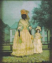
As the Deep South was developed for both cotton and sugar in the nineteenth century, demand increased for slaves. This resulted in the first half of the 19th century in a massive forced migration through the slave trade of more than one million African Americans from the Upper South, where surplus labor was sold, to the Deep South. Many traders brought slaves to New Orleans for domestic sale; by 1840 New Orleans had the largest slave market in the country, and was the third-largest city, and one of the wealthiest.
The United States adapted Louisiana law by adding parts of US or southern state laws. The Louisiana Black Code of 1806 made the cruel punishment of slaves a crime, but masters and overseers were seldom prosecuted for such acts.[51]
Haitian migration and influence
Spanish occupation of Louisiana lasted from 1769 to 1800. Beginning in the 1790s, waves of immigration took place from Saint-Domingue, following a slave rebellion that started in 1791. Over the next decade, thousands of migrants landed in Louisiana from the island, including ethnic Europeans, free people of color, and African slaves, some of the latter brought in by each free group. They greatly increased the French-speaking population in New Orleans and Louisiana, as well as the number of Africans, and the slaves reinforced African culture in the city. The process of gaining independence in Saint-Domingue was complex, but uprisings continued. In 1803, France pulled out its surviving troops from the island, having suffered the loss of two-thirds sent to the island two years before, mostly to yellow fever. In 1804, Haiti, the second republic in the western hemisphere, proclaimed its independence, achieved by slave leaders.[52]
Pierre Clément de Laussat (Governor of Louisiana, 1803) said: "Saint-Domingue was, of all our colonies in the Antilles, the one whose mentality and customs influenced Louisiana the most."[53]

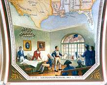
Purchase by the United States (1803)
When the United States won its independence from Great Britain in 1783, one of its major concerns was having a European power on its western boundary, and the need for unrestricted access to the Mississippi River. As American settlers pushed west, they found that the Appalachian Mountains provided a barrier to shipping goods eastward. The easiest way to ship produce was to use a flatboat to float it down the Ohio and Mississippi Rivers to the port of New Orleans, from whence goods could be put on ocean-going vessels. The problem with this route was that the Spanish owned both sides of the Mississippi below Natchez.
Napoleon's ambitions in Louisiana involved the creation of a new empire centered on the Caribbean sugar trade. By the terms of the Treaty of Amiens of 1802, Great Britain returned ownership of the islands of Martinique and Guadaloupe to the French. Napoleon looked upon Louisiana as a depot for these sugar islands, and as a buffer to U.S. settlement. In October 1801 he sent a large military force to take back Saint-Domingue, then under control of Toussaint Louverture after a slave rebellion.
When the army led by Napoleon's brother-in-law Leclerc was defeated, Napoleon decided to sell Louisiana.
Thomas Jefferson, third President of the United States, was disturbed by Napoleon's plans to re-establish French colonies in America. With the possession of New Orleans, Napoleon could close the Mississippi to U.S. commerce at any time. Jefferson authorized Robert R. Livingston, U.S. Minister to France, to negotiate for the purchase of the City of New Orleans, portions of the east bank of the Mississippi, and free navigation of the river for U.S. commerce. Livingston was authorized to pay up to $2 million.
An official transfer of Louisiana to French ownership had not yet taken place, and Napoleon's deal with the Spanish was a poorly kept secret on the frontier. On October 18, 1802, however, Juan Ventura Morales, Acting Intendant of Louisiana, made public the intention of Spain to revoke the right of deposit at New Orleans for all cargo from the United States. The closure of this vital port to the United States caused anger and consternation. Commerce in the west was virtually blockaded. Historians believe that the revocation of the right of deposit was prompted by abuses by the Americans, particularly smuggling, and not by French intrigues as was believed at the time. President Jefferson ignored public pressure for war with France, and appointed James Monroe a special envoy to Napoleon, to assist in obtaining New Orleans for the United States. Jefferson also raised the authorized expenditure to $10 million.
However, on April 11, 1803, French Foreign Minister Talleyrand surprised Livingston by asking how much the United States was prepared to pay for the entirety of Louisiana, not just New Orleans and the surrounding area (as Livingston's instructions covered). Monroe agreed with Livingston that Napoleon might withdraw this offer at any time (leaving them with no ability to obtain the desired New Orleans area), and that approval from President Jefferson might take months, so Livingston and Monroe decided to open negotiations immediately. By April 30, they closed a deal for the purchase of the entire Louisiana territory of 828,000 square miles (2,100,000 km2) for 60 million Francs (approximately $15 million).
Part of this sum, $3.5 million, was used to forgive debts owed by France to the United States.[55] The payment was made in United States bonds, which Napoleon sold at face value to the Dutch firm of Hope and Company, and the British banking house of Baring, at a discount of 87½ per each $100 unit. As a result, France received only $8,831,250 in cash for Louisiana. Dutiful English banker Alexander Baring conferred with Marbois in Paris, shuttled to the United States to pick up the bonds, took them to Britain, and returned to France with the money – which Napoleon used to wage war against Baring's own country.
When news of the purchase reached the United States, Jefferson was surprised. He had authorized the expenditure of $10 million for a port city, and instead received treaties committing the government to spend $15 million on a land package which would double the size of the country. Jefferson's political opponents in the Federalist Party argued the Louisiana purchase was a worthless desert,[56] and that the Constitution did not provide for the acquisition of new land or negotiating treaties without the consent of the Senate. What really worried the opposition was the new states which would inevitably be carved from the Louisiana territory, strengthening Western and Southern interests in Congress, and further reducing the influence of New England Federalists in national affairs. President Jefferson was an enthusiastic supporter of westward expansion, and held firm in his support for the treaty. Despite Federalist objections, the U.S. Senate ratified the Louisiana treaty on October 20, 1803.
By statute enacted on October 31, 1803, President Thomas Jefferson was authorized to take possession of the territories ceded by France and provide for initial governance.[57] A transfer ceremony was held in New Orleans on November 29, 1803. Since the Louisiana territory had never officially been turned over to the French, the Spanish took down their flag, and the French raised theirs. The following day, General James Wilkinson accepted possession of New Orleans for the United States. A similar ceremony was held in St. Louis on March 9, 1804, when a French tricolor was raised near the river, replacing the Spanish national flag. The following day, Captain Amos Stoddard of the First U.S. Artillery marched his troops into town and had the American flag run up the fort's flagpole. The Louisiana territory was officially transferred to the United States government, represented by Meriwether Lewis.
The Louisiana Territory, purchased for less than 3 cents an acre, doubled the size of the United States overnight, without a war or the loss of a single American life, and set a precedent for the purchase of territory. It opened the way for the eventual expansion of the United States across the continent to the Pacific.
Shortly after the United States took possession, the area was divided into two territories along the 33rd parallel north on March 26, 1804, thereby organizing the Territory of Orleans to the south and the District of Louisiana to the north.[58]
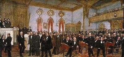
Statehood (1812)
Louisiana became the eighteenth U.S. state on April 30, 1812; since the Territory of Orleans became the State of Louisiana, the District of Louisiana was simultaneously renamed the Missouri Territory.[59] Additional land, known as the Florida Parishes, was soon annexed into the state of Louisiana on April 14, 1812.[60]
By 1840 New Orleans had the biggest slave market in the United States, which contributed greatly to the economy. It had become one of the wealthiest cities and the third largest city in the nation.[61] The ban on the African slave trade and importation of slaves had increased demand in the domestic market. During these decades after the American Revolutionary War, more than one million enslaved African Americans underwent forced migration from the Upper South to the Deep South, two thirds of them in the slave trade. Others were transported by their masters as slaveholders moved west for new lands.[62][63]
With changing agriculture in the Upper South as planters shifted from tobacco to less labor-intensive mixed agriculture, planters had excess laborers. Many sold slaves to traders to take to the Deep South. Slaves were driven by traders overland from the Upper South or transported to New Orleans and other coastal markets by ship in the coastwise slave trade. After sales in New Orleans, steamboats operating on the Mississippi transported slaves upstream to markets or plantation destinations at Natchez and Memphis.
Secession and the Civil War (1860–1865)
According to the 1860 census, 331,726 people were enslaved, nearly 47% of the state's total population of 708,002.[64] Enfranchised elite whites' strong economic interest in maintaining the slave system contributed to Louisiana's decision to secede from the Union in 1861. It followed other Southern states in seceding after the election of Abraham Lincoln as President of the United States. Louisiana's secession was announced on January 26, 1861, and it became part of the Confederate States of America.
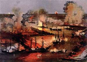
The state was quickly defeated in the Civil War, a result of Union strategy to cut the Confederacy in two by seizing the Mississippi. Federal troops captured New Orleans on April 25, 1862. Because a large part of the population had Union sympathies (or compatible commercial interests), the Federal government took the unusual step of designating the areas of Louisiana under Federal control as a state within the Union, with its own elected representatives to the U.S. Congress.
Post-Civil War (1865–1945)
Following the Civil War and emancipation of slaves, violence rose in the South as the war was carried on by paramilitary and private groups. Some ex-Confederate dominated legislatures passed Black Codes to regulate freedmen and generally refused to give them suffrage, nor to extend voting rights to African Americans who had been free before the war and had sometimes obtained education and property (as in New Orleans.) Following the Memphis Riots of 1866 and the New Orleans Riot the same year, Congress developed the Fourteenth Amendment to provide for suffrage and full citizenship for freedmen, and passed Reconstruction Act establishing military districts for those states where conditions were considered the worst, including Louisiana. It was grouped with Texas in what was administered as the Fifth Military District.
African Americans began to live as citizens with some measure of equality before the law. Both freedmen and people of color who had been free before the war began to make more advances in education, family stability and jobs. At the same time, there was tremendous social volatility in the aftermath of war, with many whites actively resisting defeat. White insurgents mobilized to enforce white supremacy, first in Ku Klux Klan chapters.
By 1877, when federal forces were withdrawn, white Democrats in Louisiana and other states had regained control of state legislatures, often by paramilitary groups suppressing black voting through intimidation and violence. Following Mississippi's example in 1890, in 1898, the white Democratic, planter-dominated legislature passed a new constitution that effectively disfranchised blacks and people of color, by requirements for voter registration, such as poll taxes, residency requirements and literacy tests, whose implementation was directed at reducing black voter registration. The effect was immediate and long lasting. In 1896, there were 130,334 black voters on the rolls and about the same number of white voters, in proportion to the state population, which was evenly divided.[65]
The state population in 1900 was 47% African-American: a total of 652,013 citizens, of whom many in New Orleans were descendants of Creoles of color, the sizeable population of free people of color who had been established long before the Civil War.[66] By 1900, two years after the new constitution, only 5,320 black voters were registered in the state. Because of disfranchisement, by 1910 there were only 730 black voters (less than 0.5 percent of eligible African-American men), despite advances in education and literacy among blacks and people of color.[67] Without being able to vote, blacks were excluded from juries and running for any political office. White Democrats had established one-party Democratic rule, which they maintained in the state for decades deep into the 20th century until Congressional passage of the 1965 Voting Rights Act provided federal enforcement of the constitutional right to vote.
In the early decades of the 20th century, thousands of African Americans left Louisiana in the Great Migration north to industrial cities for jobs and education, and to escape Jim Crow society and lynchings. The boll weevil infestation and agricultural problems had cost sharecroppers and farmers their jobs. The mechanization of agriculture also reduced the need for laborers. Beginning in the 1940s, blacks went West to California for jobs in its expanding defense industries.[68]
During some of the Great Depression, Louisiana was led by Governor Huey Long. He was elected to office on populist appeal. Though popular for his public works projects, which provided thousands of jobs to people in need, and for his programs in education and increased suffrage for poor whites, Long was criticized for his allegedly demogogic and autocratic style. He extended patronage control through every branch of Louisiana's state government. Especially controversial were his plans for wealth redistribution in the state. Long's rule ended abruptly when he was assassinated in the state capitol in 1935.
Post-World War II (1945–)
Mobilization for World War II created jobs in the state. Thousands of other workers, black and white alike, migrated to California for better jobs in its burgeoning defense industry. Many African Americans left the state in the Second Great Migration, from the 1940s through the 1960s. The mechanization of agriculture in the 1930s had sharply cut the need for laborers. They sought skilled jobs in the defense industry in California, better education for their children, and living opportunities in communities where they could vote.[69]
In the 1950s the state created new requirements for a citizenship test for voter registration. Despite opposition by the States Rights Party, downstate black voters began to increase their rate of registration, which also reflected the growth of their middle classes. Gradually black voter registration and turnout increased to 20% and more, and it was 32% in 1964, when the first civil rights legislation of the era was passed.[70] The percentage of black voters ranged widely in the state during these years, from 93.8% in Evangeline Parish to 1.7% in Tensas Parish, for instance.[71]
Patterns of Jim Crow segregation against African Americans still ruled in Louisiana in the 1960s. Because of the Great Migration of blacks to the north and west, and growth of other groups in the state, by 1960 the proportion of African Americans in Louisiana had dropped to 32%. The 1,039,207 black citizens were adversely affected by segregation and efforts at disfranchisement.[72] African Americans continued to suffer disproportionate discriminatory application of the state's voter registration rules. Because of better opportunities elsewhere, from 1965 to 1970, blacks continued to migrate from Louisiana, for a net loss of more than 37,000 people. Based on official census figures, the African American population in 1970 stood at 1,085,109, a net gain of more than 46,000 people compared to 1960. During the latter period, some people began to migrate to cities of the New South for opportunities.[73]
In August 2005, New Orleans and many other low-lying parts of the state along the Gulf of Mexico were hit by the catastrophic Hurricane Katrina. It caused widespread damage due to breaching of levees and large-scale flooding of more than 80% of the city. Officials issued warnings to evacuate the city and nearby areas, but tens of thousands of people, mostly African Americans, stayed behind, many of them stranded, and suffered through the damage of the widespread floodwaters.
In August 2016, an unnamed storm dumped trillions of gallons of rain on southern Louisiana, including the cities of Denham Springs, Baton Rouge and Lafayette, causing catastrophic flooding.[74] An estimated 110,000 homes were damaged[75] and thousands of residents were displaced.[76]
Demographics
| Historical population | |||
|---|---|---|---|
| Census | Pop. | %± | |
| 1810 | 76,556 | — | |
| 1820 | 153,407 | 100.4% | |
| 1830 | 215,739 | 40.6% | |
| 1840 | 352,411 | 63.4% | |
| 1850 | 517,762 | 46.9% | |
| 1860 | 708,002 | 36.7% | |
| 1870 | 726,915 | 2.7% | |
| 1880 | 939,946 | 29.3% | |
| 1890 | 1,118,588 | 19.0% | |
| 1900 | 1,381,625 | 23.5% | |
| 1910 | 1,656,388 | 19.9% | |
| 1920 | 1,798,509 | 8.6% | |
| 1930 | 2,000,000 | 11.2% | |
| 1940 | 2,363,516 | 18.2% | |
| 1950 | 2,683,516 | 13.5% | |
| 1960 | 3,257,022 | 21.4% | |
| 1970 | 3,641,306 | 11.8% | |
| 1980 | 4,205,900 | 15.5% | |
| 1990 | 4,219,973 | 0.3% | |
| 2000 | 4,468,976 | 5.9% | |
| 2010 | 4,533,372 | 1.4% | |
| Est. 2015 | 4,670,724 | 3.0% | |
| Source:[77] | |||
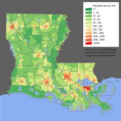
The United States Census Bureau estimates that the population of Louisiana was 4,670,724 on July 1, 2015, a 3.03% increase since the 2010 United States Census.[4] The population density of the state is 104.9 people per square mile.[78]
The center of population of Louisiana is located in Pointe Coupee Parish, in the city of New Roads.[79]
According to the 2010 United States Census, 5.4% of the population aged 5 and older spoke Spanish at home, up from 3.5% in 2000; and 4.5% spoke French (including Louisiana French and Louisiana Creole), down from 4.8% in 2000.[80][81]
Race and ethnicity
According to the US census estimates, the population of Louisiana in 2014 was:[82]
- White Americans – 63.4% (59.3% non-Hispanic white, 4.1% White Hispanic)
- Black or African American – 32.5%
- Asian – 1.8%
- Multiracial American – 1.5%
- Native American – 0.8%
- Hispanic or Latino of any race - 4.8%
The major ancestry groups of Louisiana are African American (30.4%), French (16.8%), American (9.5%), German (8.3%), Irish (7.5%), English (6.6%), Italian (4.8%) and Scottish (1.1%).[83]
As of 2011, 49.0% of Louisiana's population younger than age 1 were minorities.[84]
| Racial composition | 1990[85] | 2000[86] | 2010[87] |
|---|---|---|---|
| White | 67.3% | 63.9% | 62.6% |
| Black | 30.8% | 30.5% | 32.0% |
| Asian | 1.0% | 1.8% | 1.5% |
| Native | 0.8% | 0.8% | 0.7% |
| Native Hawaiian and other Pacific Islander | - | 0.1% | - |
| Other race | 0.5% | 0.7% | 1.5% |
| Two or more races | - | 1.1% | 1.6% |
Major cities
| | |||||||||
|---|---|---|---|---|---|---|---|---|---|
| Rank | Name | Parish | Pop. | ||||||
 New Orleans  Baton Rouge |
1 | New Orleans | Orleans | 378,715 |  Shreveport  Lafayette | ||||
| 2 | Baton Rouge | East Baton Rouge | 229,426 | ||||||
| 3 | Shreveport | Caddo | 200,327 | ||||||
| 4 | Lafayette | Lafayette | 124,276 | ||||||
| 5 | Lake Charles | Calcasieu | 74,024 | ||||||
| 6 | Kenner | Jefferson | 66,975 | ||||||
| 7 | Bossier City | Bossier | 66,333 | ||||||
| 8 | Monroe | Ouachita | 49,761 | ||||||
| 9 | Alexandria | Rapides | 48,426 | ||||||
| 10 | Houma | Terrebonne | 33,727 | ||||||
Economy
The total gross state product in 2010 for Louisiana was US$213.6 billion, placing it 24th in the nation. Its per capita personal income is $30,952, ranking 41st in the United States.[89][90]
In 2014, Louisiana was ranked as one of the most small business friendly states, based on a study drawing upon data from over 12,000 small business owners.
The state's principal agricultural products include seafood (it is the biggest producer of crawfish in the world, supplying approximately 90%), cotton, soybeans, cattle, sugarcane, poultry and eggs, dairy products, and rice. Industry generates chemical products, petroleum and coal products, processed foods and transportation equipment, and paper products. Tourism is an important element in the economy, especially in the New Orleans area.
The Port of South Louisiana, located on the Mississippi River between New Orleans and Baton Rouge, is the largest volume shipping port in the Western Hemisphere and 4th largest in the world, as well as the largest bulk cargo port in the world.[91]
New Orleans, Shreveport, and Baton Rouge are home to a thriving film industry.[92] State financial incentives since 2002 and aggressive promotion have given Louisiana the nickname "Hollywood South". Because of its distinctive culture within the United States, only Alaska is Louisiana's rival in popularity as a setting for reality television programs.[93] In late 2007 and early 2008, a 300,000-square-foot (28,000 m2) film studio was scheduled to open in Tremé, with state-of-the-art production facilities, and a film training institute.[94] Tabasco sauce, which is marketed by one of the United States' biggest producers of hot sauce, the McIlhenny Company, originated on Avery Island.[95]
Louisiana has three personal income tax brackets, ranging from 2% to 6%. The sales tax rate is 4%: a 3.97% Louisiana sales tax and a .03% Louisiana Tourism Promotion District sales tax. Political subdivisions also levy their own sales tax in addition to the state fees. The state also has a use tax, which includes 4% to be distributed by the Department of Revenue to local governments. Property taxes are assessed and collected at the local level. Louisiana is a subsidized state, receiving $1.44 from the federal government for every dollar paid in.
Tourism and culture are major players in Louisiana's economy, earning an estimated $5.2 billion per year.[96] Louisiana also hosts many important cultural events, such as the World Cultural Economic Forum, which is held annually in the fall at the New Orleans Morial Convention Center.[97]
As of September 2014, the state's unemployment rate was 5.8%.[98]
Federal subsidies and spending
Louisiana taxpayers receive more federal funding per dollar of federal taxes paid compared to the average state. Per dollar of federal tax collected in 2005, Louisiana citizens received approximately $1.78 in the way of federal spending. This ranks the state 4th highest nationally and represents a rise from 1995 when Louisiana received $1.35 per dollar of taxes in federal spending (ranked 7th nationally). Neighboring states and the amount of federal spending received per dollar of federal tax collected were: Texas ($0.94), Arkansas ($1.41), and Mississippi ($2.02). Federal spending in 2005 and subsequent years since has been exceptionally high due to the recovery from Hurricane Katrina. Tax Foundation.
Energy
Louisiana is rich in petroleum and natural gas. Petroleum and gas deposits are found in abundance both onshore and offshore in State-owned waters. In addition, vast petroleum and natural gas reserves are found offshore from Louisiana in the federally administered Outer Continental Shelf (OCS) in the Gulf of Mexico. According to the Energy Information Administration, the Gulf of Mexico OCS is the largest U.S. petroleum-producing region. Excluding the Gulf of Mexico OCS, Louisiana ranks fourth in petroleum production and is home to about 2 percent of total U.S. petroleum reserves.
Louisiana's natural gas reserves account for about 5 percent of the U.S. total. The recent discovery of the Haynesville Shale formation in parts of or all of Caddo, Bossier, Bienville, Sabine, De Soto, Red River, Sabine, and Natchitoches parishes have made it the world's fourth largest gas field with some wells initially producing over 25 million cubic feet of gas daily.[99]
Louisiana was the first site of petroleum drilling over water in the world, on Caddo Lake in the northwest corner of the state. The petroleum and gas industry, as well as its subsidiary industries such as transport and refining, have dominated Louisiana's economy since the 1940s. Beginning in 1950, Louisiana was sued several times by the U.S. Interior Department, in efforts by the federal government to strip Louisiana of its submerged land property rights. These control vast stores of reservoirs of petroleum and natural gas.
When petroleum and gas boomed in the 1970s, so did Louisiana's economy. The Louisiana economy as well as its politics of the last half-century cannot be understood without thoroughly accounting for the influence of the petroleum and gas industries. Since the 1980s, these industries' headquarters have consolidated in Houston, but many of the jobs that operate or provide logistical support to the U.S. Gulf of Mexico crude-oil-and-gas industry remained in Louisiana as of 2010.
Law and government
 |
| This article is part of a series on the politics and government of Louisiana |
|
Executive |
|
|
See also: List of United States Senators from Louisiana
|
|
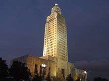
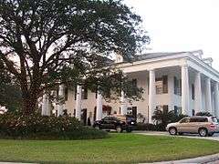
In 1849, the state moved the capital from New Orleans to Baton Rouge. Donaldsonville, Opelousas, and Shreveport have briefly served as the seat of Louisiana state government. The Louisiana State Capitol and the Louisiana Governor's Mansion are both located in Baton Rouge. The Louisiana Supreme Court, however, did not move to Baton Rouge but remains headquartered in New Orleans.
Louisiana and California (whose supreme court is seated in San Francisco) are the only two states whose high courts are not headquartered in the state capital.
The current Louisiana governor is Democrat John Bel Edwards.The current United States Senators are Republicans David Vitter and Bill Cassidy. Louisiana has six congressional districts and is represented in the U.S. House of Representatives by five Republicans and one Democrat. Louisiana had eight votes in the Electoral College for the 2012 election. It lost one House seat due to stagnant population growth in the 2010 Census.
Administrative divisions
Louisiana is divided into 64 parishes (the equivalent of counties in most other states).[100]
Most parishes have an elected government known as the Police Jury, dating from the colonial days. It is the legislative and executive government of the parish, and is elected by the voters. Its members are called Jurors, and together they elect a President as their chairman.
A more limited number of parishes operate under home rule charters, electing various forms of government. This include mayor-council, council- manager (in which the council hires a professional operating manager for the parish), and others.
Civil law
The Louisiana political and legal structure has maintained several elements from the times of French and Spanish governance. One is the use of the term "parish" (from the French: paroisse) in place of "county" for administrative subdivision. Another is the legal system of civil law based on French, German, and Spanish legal codes and ultimately Roman law, as opposed to English common law.
Louisiana's civil law system is what the majority of nations in the world use, especially in Europe and its former colonies, excluding those that derive from the British Empire. However, it is incorrect to equate the Louisiana Civil Code with the Napoleonic Code. Although the Napoleonic Code and Louisiana law draw from common legal roots, the Napoleonic Code was never in force in Louisiana, as it was enacted in 1804, after the United States had purchased and annexed Lousiana in 1803.
While the Louisiana Civil Code of 1808 has been continuously revised and updated since its enactment, it is still considered the controlling authority in the state. Differences are found between Louisianan civil law and the common law found in the other U.S. states. While some of these differences have been bridged due to the strong influence of common law tradition,[101] the civil law tradition is still deeply rooted in most aspects of Louisiana private law. Thus property, contractual, business entities structure, much of civil procedure, and family law, as well as some aspects of criminal law, are still based mostly on traditional Roman legal thinking.
Model Codes, such as the Uniform Commercial Code, which are adopted by most states within the union including Louisiana, are based on civil legal thought, which is essentially deductive, as opposed to the common law, which is inductive. In the civil law tradition, the legislative body agrees a priori on the general principles to be followed. When a set of facts are brought before a judge, he deduces the court's ruling by comparing the facts of the individual case to the law.
Marriage
In 1997, Louisiana became the first state to offer the option of a traditional marriage or a covenant marriage.[102] In a covenant marriage, the couple waives their right to a "no-fault" divorce after six months of separation, which is available in a traditional marriage. To divorce under a covenant marriage, a couple must demonstrate cause. Marriages between ascendants and descendants, and marriages between collaterals within the fourth degree (i.e., siblings, aunt and nephew, uncle and niece, first cousins) are prohibited.[103] Same-sex marriages were prohibited by statute,[104][105] but the Supreme Court declared such bans unconstitutional in 2015, in its ruling in Obergefell v. Hodges. Same-sex marriages are now performed statewide. Louisiana is a community property state.[106]
Elections
From 1898 to 1965, a period when Louisiana had effectively disfranchised most African Americans and many poor whites by provisions of a new constitution,[107] this was essentially a one-party state dominated by white Democrats. Elites had control in the early 20th century, before populist Huey Long came to power as governor.[108] In multiple acts of resistance, blacks left behind the segregation, violence and oppression of the state and moved out to seek better opportunities in northern and western industrial cities during the Great Migrations of 1910–1970, markedly reducing their proportion of population in Louisiana. The franchise for whites was expanded somewhat during these decades, but blacks remained essentially disfranchised until after the Civil Rights Movement of the mid-20th century, gaining enforcement of their constitutional rights through passage by Congress of the Voting Rights Act of 1965.
Since the 1960s, when civil rights legislation was passed under President Lyndon Johnson to protect voting and civil rights, most African Americans in the state have affiliated with the Democratic Party. In the same years, many white social conservatives have moved to support Republican Party candidates in national, gubernatorial and statewide elections. In 2004, David Vitter was the first Republican in Louisiana to be popularly elected as a U.S. Senator. The previous Republican Senator, John S. Harris, who took office in 1868 during Reconstruction, was chosen by the state legislature under the rules of the 19th century.
Louisiana is unique among U.S. states in using a system for its state and local elections similar to that of modern France. All candidates, regardless of party affiliation, run in a nonpartisan blanket primary (or "jungle primary") on Election Day. If no candidate has more than 50% of the vote, the two candidates with the highest vote totals compete in a runoff election approximately one month later. This run-off did not take into account party identification; therefore, it was not uncommon for a Democrat to be in a runoff with a fellow Democrat or a Republican to be in a runoff with a fellow Republican.
Congressional races have also been held under the jungle primary system. All other states (except Washington and California) use single-party primaries followed by a general election between party candidates, each conducted by either a plurality voting system or runoff voting, to elect Senators, Representatives, and statewide officials. Between 2008 and 2010, federal congressional elections were run under a closed primary system – limited to registered party members. However, upon the passage of House Bill 292, Louisiana again adopted a nonpartisan blanket primary for its federal congressional elections.
Louisiana has six seats in the U.S. House of Representatives, five of which are currently held by Republicans and one by a Democrat. The state lost a House seat at the end of the 112th Congress due to stagnant population growth as recorded by the 2010 United States Census. Louisiana is not classified as a "swing state" for future presidential elections, as since the late 20th century, it has regularly supported Republican candidates. The US two Senators are David Vitter (R) and Bill Cassidy (R).
Law enforcement
Louisiana's statewide police force is the Louisiana State Police. It began in 1922 with the creation of the Highway Commission. In 1927 a second branch, the Bureau of Criminal Investigations, was formed. In 1932 the State Highway Patrol was authorized to carry weapons.
On July 28, 1936 the two branches were consolidated to form the Louisiana Department of State Police; its motto was "courtesy, loyalty, service". In 1942 this office was abolished and became a division of the Department of Public Safety, called the Louisiana State Police. In 1988 the Criminal Investigation Bureau was reorganized.[109] Its troopers have statewide jurisdiction with power to enforce all laws of the state, including city and parish ordinances. Each year, they patrol over 12 million miles (20 million km) of roadway and arrest about 10,000 impaired drivers. The State Police are primarily a traffic enforcement agency, with other sections that delve into trucking safety, narcotics enforcement and gaming oversight.
The elected sheriff in each parish is the chief law enforcement officer in the parish. They are the keepers of the local parish prisons, which house felony and misdemeanor prisoners. They are the primary criminal patrol and first responder agency in all matters criminal and civil. They are also the official tax collectors in each parish.
The sheriffs are responsible for general law enforcement in their respective parishes. Orleans Parish is an exception, as the general law enforcement duties fall to the New Orleans Police Department. Before 2010 Orleans parish was the only parish to have two (2) Sheriff's Offices. Orleans Parish divided Sheriff's duties between criminal and civil, with a different elected sheriff overseeing each aspect. In 2006 a bill was passed which eventually consolidated the two sheriffs' departments into one parish Sheriff responsible for both civil and criminal matters.
In 2015, Louisiana had a higher murder rate (10.3 per 100,000) than any other state in the country for the 27th straight year. Louisiana is the only state with an annual average murder rate (13.6 per 100,000) at least twice as high as the U.S. annual average (6.6 per 100,000) during that period, according to Bureau of Justice Statistics from FBI Uniform Crime Reports. In a different kind of criminal activity, the Chicago Tribune reports that Louisiana is the most corrupt state in the United States.[110]
According to the Times Picayune, Louisiana is the prison capital of the world. Many for-profit private prisons and sheriff-owned prisons have been built and operate here. Louisiana's incarceration rate is nearly five times Iran's, 13 times China's and 20 times Germany's. Minorities are incarcerated at rates disproportionate to their share of the state's population.[111]
Judiciary
The judiciary of Louisiana is defined under the Constitution and law of Louisiana and is composed of the Louisiana Supreme Court, the Louisiana Circuit Courts of Appeal, the District Courts, the Justice of the Peace Courts, the Mayor's Courts, the City Courts, and the Parish Courts. The Chief Justice of the Louisiana Supreme Court is the chief administrator of the judiciary. Its administration is aided by the Judiciary Commission of Louisiana, the Louisiana Attorney Disciplinary Board, and the Judicial Council of the Supreme Court of Louisiana.
National Guard
Louisiana has more than 9,000 soldiers in the Louisiana Army National Guard, including the 225th Engineer Brigade and the 256th Infantry Brigade. Both these units have served overseas during the War on Terror in either Iraq, Afghanistan, or both. The Louisiana Air National Guard has over 2,000 airmen and its 159th Fighter Squadron has likewise seen overseas service in combat theaters.
Training sites in the state include Camp Beauregard near Pineville, Camp Villere near Slidell, Camp Minden near Minden, England Air Park (formerly England Air Force Base) near Alexandria, Gillis Long Center near Carville, and Jackson Barracks in New Orleans.
Education
The Louisiana Science Education Act[112] is a controversial law passed by the Louisiana Legislature on June 11, 2008 and signed into law by Governor Bobby Jindal on June 25. The act allows public school teachers to use supplemental materials in the science classroom which are critical of established science on such topics as the theory of evolution and global warming.[113][114]
Sports
Louisiana is nominally the least populous state with more than one major professional sports league franchise: the National Basketball Association's New Orleans Pelicans and the National Football League's New Orleans Saints. Louisiana has a AAA Minor League baseball team, the New Orleans Baby Cakes. The Baby Cakes are currently affiliated with the Miami Marlins. Louisiana also has a SPHL minor league hockey team, the Louisiana IceGators, who play in the city of Lafayette and are affiliated with the New York Islanders.
Louisiana has 12 collegiate NCAA Division I programs, a high number given its population. The state has no NCAA Division II teams and only two NCAA Division III teams. The LSU Tigers football team has won 11 Southeastern Conference titles, six Sugar Bowls and three national championships.
Each year New Orleans plays host to the Sugar Bowl and the New Orleans Bowl college football games, and Shreveport hosts the Independence Bowl. Also, New Orleans has hosted the Super Bowl a record seven times, was well as the BCS National Championship Game, NBA All-Star Game and NCAA Men's Division I Basketball Championship.
The Zurich Classic of New Orleans, is a PGA Tour golf tournament held since 1938. The Rock ‘n’ Roll Mardi Gras Marathon and Crescent City Classic are two road running competitions held at New Orleans.
As of 2016, Louisiana was the birthplace of the most NFL players per capita for the eighth year in a row.[115]
Culture

Louisiana is home to many, especially notable are the distinct culture of the Louisiana Creoles, typically people of color, descendants of free mixed-race families of the colonial and early statehood periods.
African culture
The French colony of La Louisiane struggled for decades to survive. Conditions were harsh, the climate and soil were unsuitable for certain crops the colonists knew, and they suffered from regional tropical diseases. Both colonists and the slaves they imported had high mortality rates. The settlers kept importing slaves, which resulted in a high proportion of native Africans from West Africa, who continued to practice their culture in new surroundings. As described by historian Gwendolyn Midlo Hall, they developed a marked Afro-Creole culture in the colonial era.[116][117]
At the turn of the 18th century and in the early 1800s, New Orleans received a major influx of white and mixed-race refugees fleeing the violence of the Haitian Revolution, many of whom brought their slaves with them. This added another infusion of African culture to the city, as more slaves in Saint-Domingue were from Africa than in the United States. They strongly influenced the African-American culture of the city in terms of dance, music and religious practices.
Louisiana Creole culture
Creole culture is an amalgamation of French, African, Spanish (and other European), and Native American cultures.[118] Creole comes from the Portuguese word crioulo; originally it referred to a colonist of European (specifically French) descent who was born in the New World, in comparison to immigrants from France.[119] The oldest Louisiana manuscript to use the word "Creole," from 1782, applied it to a slave born in the French colony.[120] But originally it referred more generally to the French colonists born in Louisiana.
Over time, there developed in the French colony a relatively large group of Creoles of Color (gens de couleur libres), who were primarily descended from African slave women and French men (later other Europeans became part of the mix, as well as some Native Americans.) Often the French would free their concubines and mixed-race children, and pass on social capital to them. They might educate sons in France, for instance, and help them enter the French Army for a career. They also settled capital or property on their mistresses and children. The free people of color gained more rights in the colony and sometimes education; they generally spoke French and were Roman Catholic. Many became artisans and property owners. Over time, the term "Creole" became associated with this class of Creoles of Color, many of whom achieved freedom long before the Civil War.
Wealthy French Creoles generally maintained town houses in New Orleans as well as houses on their large sugar plantations outside town along the Mississippi River. New Orleans had the largest population of free people of color in the region; they could find work there and created their own culture, marrying among themselves for decades.
Acadian culture
The ancestors of Cajuns immigrated from west central France to New France, where they settled in the Atlantic provinces of New Brunswick and Nova Scotia, known originally as Acadia. After the British defeated France in the French and Indian War (Seven Years' War) in 1763, France ceded its territory east of the Mississippi River to Britain. The British forcibly separated families and evicted them from Acadia because they refused to vow loyalty to the new British regime. The Acadians were deported to England, New England, and France. Some escaped the British remained in French Canada.
Others scattered, to France, Canada, Mexico, or the Falkland Islands. Many Acadian refugees settled in south Louisiana in the region around Lafayette and the LaFourche Bayou country. They developed a distinct rural culture there that was different from that of the French Creole colonists in the New Orleans area. Intermarrying with others in the area, they developed what was called Cajun music, cuisine and culture. Until the 1970s, the term "Cajun" was considered somewhat derogatory.
Isleño culture
A third distinct culture in Louisiana is that of the Isleños, descendants of Spanish Canary Islanders who migrated from the Canary Islands of Spain under the Spanish crown beginning in the mid-1770s. They developed four main communities, but many relocated to what is modern-day St. Bernard Parish. This is where the majority of the Isleño population is still concentrated. An annual festival called Fiesta celebrates the heritage of the Isleños.
St Bernard Parish has an Isleños museum, cemetery and church, as well as many street names with Spanish words and Spanish surnames from this heritage. Some members of the Isleño community still speak Spanish – with their own Canary Islander accent. Numerous Isleño identity organizations, and many members of Isleños society keep contact with the Canary Islands of Spain.
Languages
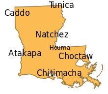
According to the 2000 census, among persons five years old and older,[121] 90.8% of Louisiana residents speak only English (99% total speak English) and 4.7% speak French at home (7% total speak French). Other minority languages are Spanish, which is spoken by 2.5% of the population, ethnic Hispanics; and Vietnamese, by 0.6%.
Historically, Native American peoples in the area at the time of European encounter were seven tribes distinguished by their languages: Caddo, Tunica, Natchez, Houma, Choctaw, Atakapa, and Chitimacha. Of these, only Caddo and Choctaw still have living native speakers, although several other tribes are working to teach and revitalize their languages. Other Native American peoples migrated into the region, escaping from European pressure from the east. Among these were Alabama, Biloxi, Koasati, and Ofo peoples.
Starting in the 1700s, French colonists began to settle along the coast and founded New Orleans. They established French culture and language institutions. They imported thousands of slaves from tribes of West Africa, who spoke several different languages. In the creolization process, the slaves developed a Louisiana Creole dialect incorporating both French and African forms, which colonists adopted to communicate with them, and which persisted beyond slavery. In the 20th century, there were still people of mixed race, particularly, who spoke Louisiana Creole French.
During the 19th century after the Louisiana Purchase by the United States, English gradually gained prominence for business and government due to the shift in population with settlement by numerous Americans who were English speakers. Many ethnic French families continued to use French in private. Slaves and some free people of color also spoke Louisiana Creole French. The State Constitution of 1812 gave English official status in legal proceedings, but use of French remained widespread. Subsequent State constitutions reflect the diminishing importance of French. The 1868 constitution, passed during the Reconstruction era before Louisiana was re-admitted to the Union, banned laws requiring the publication of legal proceedings in languages other than English. Subsequently, the legal status of French recovered somewhat, but it never regained its pre-Civil War prominence.[122]
Several unique dialects of French, Creole, and English are spoken in Louisiana. Dialects of the French language are: Colonial French and Houma French. Louisiana Creole French is the term for one of the Creole languages. Two unique dialects developed of the English language: Louisiana English, a French-influenced variety of English; and what is informally known as Yat, which resembles the New York City dialect, particularly that of historical Brooklyn. Both accents were influenced by large communities of immigrant Irish and Italians, but the Yat dialect, which developed in New Orleans, was also influenced by French and Spanish.
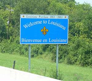
Colonial French was the dominant language of white settlers in Louisiana during the French colonial period; it was spoken primarily by the French Creoles (native-born). In addition to this dialect, the mixed-race people and slaves developed Louisiana Creole, with a base in West African languages. The limited years of Spanish rule at the end of the 18th century did not result in widespread adoption of the Spanish language. French and Louisiana Creole are still used in modern-day Louisiana, often in family gatherings. English and its associated dialects became predominant after the Louisiana Purchase of 1803, after which the area became dominated by numerous English speakers. In some regions, English was influenced by French, as seen with Louisiana English. Colonial French, although mistakenly named Cajun French by some Cajuns, has persisted alongside English.
Renewed interest in the French language in Louisiana has led to the establishment of Canadian-modeled French immersion schools, as well as bilingual signage in the historic French neighborhoods of New Orleans and Lafayette. Organizations such as CODOFIL promote use of the French language in the state.
Religion
The largest denominations by number of adherents in 2010 were the Catholic Church with 1,200,900; Southern Baptist Convention with 709,650; and the United Methodist Church with 146,848. Non-denominational Evangelical Protestant congregations had 195,903 members.[123]
As in other Southern states, the majority of Louisianians belong to various Protestant denominations, with Protestants comprising 57% of the state's adult population. Protestants are concentrated in the northern and central parts of the state and in the northern tier of the Florida Parishes. Because of French and Spanish heritage, and their descendants the Creoles, and later Irish, Italian, Portuguese and German immigrants, southern Louisiana and the greater New Orleans area are predominantly Catholic.[124]
Since Creoles were the first settlers, planters and leaders of the territory, they have traditionally been well represented in politics. For instance, most of the early governors were Creole Catholics.[125] Because Catholics still constitute a significant fraction of Louisiana's population, they have continued to be influential in state politics. As of 2008 both Senators and the Governor were Catholic. The high proportion and influence of the Catholic population makes Louisiana distinct among Southern states.[126]
Jewish communities are established in the state's larger cities, notably New Orleans and Baton Rouge.[127][128] The most significant of these is the Jewish community of the New Orleans area. In 2000, before the 2005 Hurricane Katrina, its population was about 12,000. Louisiana was among the southern states with a significant Jewish population before the 20th century; Virginia, South Carolina, and Georgia also had influential Jewish populations in some of their major cities from the 18th and 19th centuries. The earliest Jewish colonists were Sephardic Jews who immigrated with English colonists from London. Later in the 19th century, German Jews began to immigrate, followed by those from eastern Europe and the Russian Empire in the late 19th and early 20th centuries.
Prominent Jews in Louisiana's political leadership have included Whig (later Democrat) Judah P. Benjamin (1811–1884), who represented Louisiana in the U.S. Senate before the American Civil War and then became the Confederate Secretary of State; Democrat-turned-Republican Michael Hahn who was elected as governor, serving 1864-1865 when Louisiana was occupied by the Union Army, and later elected in 1884 as a US Congressman;[129] Democrat Adolph Meyer (1842–1908), Confederate Army officer who represented the state in the U.S. House from 1891 until his death in 1908; Republican Secretary of State Jay Dardenne (1954–), and Republican (Democrat before 2011) Attorney General Buddy Caldwell (1946–).
Music
See also
- Louisiana (New France)
- Index of Louisiana-related articles
- Outline of Louisiana – organized list of topics about Louisiana
References
- ↑ "New Orleans a 'ghost town' after thousands flee Gustav: mayor", AFP, Google, August 31, 2008, archived from the original on May 16, 2013
- ↑ "Expert: N.O. population at 273,000". WWL-TV. August 7, 2007. Archived from the original on September 26, 2007. Retrieved August 14, 2007.
- ↑ "Relocation". Baton rouge. Connecting U.S. Cities. May 3, 2007.
- 1 2 "Table 1. Annual Estimates of the Resident Population for the United States, Regions, States, and Puerto Rico: April 1, 2010 to July 1, 2015" (CSV). U.S. Census Bureau. December 26, 2015. Retrieved December 26, 2015.
- 1 2 "Elevations and Distances in the United States". United States Geological Survey. 2001. Archived from the original on October 15, 2011. Retrieved October 21, 2011.
- 1 2 Elevation adjusted to North American Vertical Datum of 1988.
- 1 2 3 4 5 6 Keddy, Paul A. (2008). Water, Earth, Fire: Louisiana's Natural Heritage. Philadelphia: Xlibris. p. 229. ISBN 978-1-4363-6234-4.
- ↑ Dayna Bowker Lee, "Louisiana Indians in the 21st Century", Louisiana Folklife Program, 2013
- 1 2 Louisiana Official Site on Languages, accessed August 22, 2016
- ↑ "Alexander B. Murphy, "Placing Louisiana in the Francophone World: Opportunities and Challenges", first published in ''Atlantic Studies'' Volume 5, Issue 3, 2008; Special Issue: ''New Orleans in the Atlantic World, II''," (PDF). p. 11. Retrieved April 23, 2014.
- ↑ Baker, Lea Flowers. "Louisiana Purchase". Encyclopedia of Arkansas History & Culture. Retrieved September 18, 2010.
- ↑ Spearing, D. (1995). Roadside Geology of Louisiana. Mountain Press Publishing Company, Missoula, MT. 225 pp. 5–19
- ↑ Coleman, J. M., Roberts, H. H., and Stone, G. W. (1998). "Mississippi River Delta: an overview", Journal of Coastal Research, 14, 698–716.
- ↑ Holland, W.C. 1944. "Physiographic divisions of the Quaternary lowlands of Louisiana", Proceedings of the Louisiana Academy of Sciences VIII: 10–24.
- ↑ Kniffen, F.B. and Hilliard, S.B. 1988. Louisiana: Its Land and People. Revised edition. Louisiana State University Press, Baton Rouge. p. 66-68.
- ↑ Spearing (1995), Roadside Geology, pp. 19–30
- ↑ Rivet, Ryan (Summer 2008). "Petroleum Dynamite". Tulanian. Tulane University: 20–27. Retrieved September 7, 2009.
- ↑ Keddy, Paul (2010). Wetland Ecology: Principles and Conservation. Cambridge: Cambridge University Press. p. 497. ISBN 978-0-521-51940-3.
- ↑ Ricardo A. Olea and James L Coleman., Jr. (2014), A synoptic examination of causes of land loss in southern Louisiana as they relate to the exploitation of subsurface geologic resources. Journal of Coastal Research, v. 30, no. 5, p. 1025−1044.
- ↑ Boesch, D. F., Josselyn, M. N., Mehta, A. J., Morris, J. T., Nuttle, W. K., Simenstad, C. A., and Swift, D. P. J. (1994). "Scientific assessment of coastal wetland loss, restoration and management in Louisiana", Journal of Coastal Research, Special Issue No. 20.
- ↑ Tidwell, Michael. Bayou Farewell: The Rich Life and Tragic Death of Louisiana's Cajun Coast. Vintage Departures: New York, 2003 ISBN 978-0-375-42076-4.
- ↑ https://web.archive.org/web/20070630021828/http://www.ustravelweather.com/weather-louisiana/. Archived from the original on June 30, 2007. Retrieved May 20, 2007. Missing or empty
|title=(help) - 1 2 "NOAA National Climatic Data Center.". Retrieved April 23, 2014.
- 1 2 3 "NowData – NOAA Online Weather Data". National Weather Service Forecast Office, Shreveport, LA, National Oceanic and Atmospheric Administration. Retrieved 2012-02-21.
- 1 2 "NowData – NOAA Online Weather Data". National Weather Service Forecast Office, Lake Charles, LA, National Oceanic and Atmospheric Administration. Retrieved 2012-02-21.
- 1 2 "NowData – NOAA Online Weather Data". National Weather Service Forecast Office, New Orleans/Baton Rouge, LA, National Oceanic and Atmospheric Administration. Retrieved 2012-02-21.
- ↑ Hurricane Gustav makes landfall, weakens to Category 1 storm Fox News, September 2, 2008.
- ↑ Mandatory evacuations to begin Sunday morning in New Orleans CNN, August 31, 2008.
- ↑ "Sixteen deaths connected to Gustav". KTBS. Associated Press. September 3, 2008. Archived from the original on September 8, 2008. Retrieved September 8, 2008.
- ↑ Rowland, Michael (September 2, 2008). "Louisiana cleans up after Gustav". Australian Broadcasting Corporation. Retrieved September 8, 2008.
- ↑ Stewart, Stacy (August 23, 2005). "Tropical Depression Twelve, Discussion No. 1, 5:00 p.m. EDT". National Hurricane Center. Retrieved July 25, 2007.
- ↑ Florida Greenways Commission. 1994. Report to the Governor. Creating a statewide greenways system: For people ... for wildlife ... for Florida. Florida Department of Environmental Protection, Tallahassee, FL.
- ↑ Lester, G. D., S.G. Sorensen, P. L. Faulkner, C. S. Reid and I. E. Maxit. 2005. Louisiana Comprehensive Wildlife Conservation Strategy. Louisiana Department of Wildlife and Fisheries, Baton Rouge, LA
- ↑ National Highway Traffic Safety Administration
- ↑ Amélie A. Walker, "Earliest Mound Site", Archaeology Magazine, Volume 51 Number 1, January/February 1998
- ↑ Robert W. Preucel, Stephen A. Mrozowski, ''Contemporary Archaeology in Theory: The New Pragmatism,'' John Wiley and Sons, 2010, p. 177. Books.google.com. Retrieved April 23, 2014.
- ↑ Jon L. Gibson, PhD, "Poverty Point: The First Complex Mississippi Culture", 2001, Delta Blues, accessed October 26, 2009 Archived December 7, 2013, at the Wayback Machine.
- ↑ "The Tchefuncte Site Summary" (PDF). Retrieved June 1, 2009.
- ↑ "Louisiana Prehistory-Marksville, Troyville-Coles Creek, and Caddo". Archived from the original on December 15, 2008. Retrieved February 4, 2010.
- ↑ "OAS-Oklahomas Past". Retrieved February 6, 2010.
- 1 2 "Tejas-Caddo Ancestors-Woodland Cultures". Retrieved February 6, 2010.
- ↑ Kidder, Tristram (1998). R. Barry Lewis, Charles Stout, eds. Mississippian Towns and Sacred Spaces. University of Alabama Press. ISBN 0-8173-0947-0.
- ↑ "Mississippian and Late Prehistoric Period". Archived from the original on June 7, 2008. Retrieved September 8, 2008.
- ↑ "The Plaquemine Culture, A.D 1000". Retrieved September 8, 2008.
- ↑ "Tejas-Caddo Fundamentals-Caddoan Languages and Peoples". Retrieved February 4, 2010.
- ↑ David Roth, "Louisiana Hurricane History: 18th century (1722–1800)", Tropical Weather – National Weather Service – Lake Charles, LA, 2003, accessed May 7, 2008 Archived August 5, 2009, at the Wayback Machine.
- 1 2 3 Ekberg, Carl (2000). French Roots in the Illinois Country: The Mississippi Frontier in Colonial Times. Urbana and Chicago, Ill.: University of Illinois Press. pp. 32–33. ISBN 9780252069246. Retrieved November 29, 2014.
- ↑ The Slave Trade: The Story of the Atlantic Slave Trade, 1440–1870 by Hugh Thomas. 1997: Simon and Schuster. p. 242-43
- 1 2 3 Hugh Thomas, The Slave Trade: The Story of the Atlantic Slave Trade, 1440–1870, Simon and Schuster, 1997, p. 548.
- ↑ Thomas (1997), The Slave Trade, p. 549.
- ↑ "The law of slavery – Master–slave legal relationships". Encyclopædia Britannica. Archived from the original on October 7, 2014.
- ↑ "The Slave Rebellion of 1791". Library of Congress Country Studies.
- ↑ Sieur de Bienville, "In Motion", African American Migration Experience, accessed July 22, 2012
- ↑ Saving New Orleans, Smithsonian magazine, August 2006. Retrieved February 16, 2010.
- ↑ Peter Kastor,The Nation's Crucible: The Louisiana Purchase and the Creation of America, (New Haven: Yale University Press, 2004) 40
- ↑ The American pageant: a history of the republic - Thomas A. Bailey, David M. Kennedy - Google Books. Books.google.co.uk. Retrieved April 23, 2014.
- ↑ "An Act to enable the President of the United States to take possession of the territories ceded by France to the United States, by treaty concluded at Paris, on the thirtieth day of April last; and for the temporary government thereof"
- ↑ "An Act erecting Louisiana into two territories and providing for the temporary government thereof"
- ↑ "An Act for the admission of the state of Louisiana into the Union, and to extend the laws of the United States to the said state"
- ↑ "An Act to enlarge the limits of the state of Louisiana"
- ↑ Walter Johnson, Soul by Soul: Life Inside the Antebellum Slave Market, Cambridge: Harvard University Press, 1999, p.2
- ↑ In Motion: The African-American Migration Experience- The Domestic Slave Trade, New York Public Library, Schomburg Center for Study of Black Culture, 2002, accessed April 27, 2008
- ↑ Peter Kolchin, American Slavery: 1619–1877, New York: Hill and Wang, 1994, pp. 96–98
- ↑ Historical Census Browser, 1860 US Census, University of Virginia, accessed October 31, 2007
- ↑ "Richard H. Pildes, Democracy, Anti-Democracy, and the Canon, Constitutional Commentary, Vol.17, 2000, p.12-13, Accessed 10 Mar 2008". Papers.ssrn.com. doi:10.2139/ssrn.224731. Retrieved April 23, 2014.
- ↑ Historical Census Browser, 1900 US Census, University of Virginia, accessed March 15, 2008 Archived August 23, 2007, at the Wayback Machine.
- ↑ Richard H. Pildes, "Democracy, Anti-Democracy and the Canon", Constitutional Commentary, Vol. 17, p.12, accessed March 10, 2008
- ↑ "African American Migration Experience: The Great Migration", In Motion, New York Public Library, Schomburg Center for Research in Black Culture, accessed April 24, 2008
- ↑ "African American Migration Experience: The Second Great Migration", In Motion, New York Public Library, Schomburg Center for Research in Black Culture, accessed April 24, 2008
- ↑ Debo P. Adegbile, Voting Rights in Louisiana: 1982–2006, March 2006, p. 7 Archived June 26, 2008, at the Wayback Machine., accessed March 19, 2008 Archived June 26, 2008, at the Wayback Machine.
- ↑ Edward Blum and Abigail Thernstrom, "Executive Summary", Bullock-Gaddie Expert Report on Louisiana, February 10, 2006, p.1, American Enterprise Institute, accessed March 19, 2008 Archived April 17, 2009, at the Wayback Machine.
- ↑ Historical Census Browser, 1960 US Census, University of Virginia, accessed March 15, 2008 Archived August 23, 2007, at the Wayback Machine.
- ↑ William H. Frey, "The New Great Migration: Black Americans' Return to the South, 1965–2000"; May 2004, p. 3, The Brookings Institution, accessed March 19, 2008
- ↑ Jason Samenow (August 19, 2016). "No-name storm dumped three times as much rain in Louisiana as Hurricane Katrina". Washington Post. Retrieved August 19, 2016.
- ↑ Baton Rouge Area Chamber (August 18, 2016). "BRAC's preliminary analysis of potential magnitude of flooding's impact on the Baton Rouge region" (PDF). Baton Rouge Area Chamber. Baton Rouge Area Chamber. Retrieved August 22, 2016.
- ↑ Cusick, Ashley (August 16, 2016). "This man bought 108 pounds of brisket to cook for the displaced Baton Rouge victims". The Washington Post. ISSN 0190-8286. Retrieved August 20, 2016.
- ↑ Resident Population Data. "State Characteristics: Vintage 2014". census.gov. Retrieved November 16, 2015.
- ↑ 2010 Census Data. "2010 Census Data – 2010 Census". 2010.census.gov. Archived from the original on February 15, 2012. Retrieved February 18, 2012.
- ↑ "Population and Population Centers by State – 2000". United States Census Bureau. Archived from the original on September 18, 2008. Retrieved December 5, 2008.
- ↑ American FactFinder - Results
- ↑ American FactFinder - Results
- ↑ Louisiana QuickFacts from the US Census Bureau. Quickfacts.census.gov. Retrieved on March 20, 2016.
- ↑ "2010 US Census - SOCIAL CHARACTERISTICS IN THE UNITED STATES - Louisiana". Factfinder2.census.gov. October 5, 2010. Retrieved April 23, 2014.
- ↑ Exner, Rich (June 3, 2012). "Americans under age 1 now mostly minorities, but not in Ohio: Statistical Snapshot". The Plain Dealer.
- ↑ "Historical Census Statistics on Population Totals By Race, 1790 to 1990, and By Hispanic Origin, 1970 to 1990, For The United States, Regions, Divisions, and States". Census.gov. Retrieved April 23, 2014.
- ↑ Population of Louisiana: Census 2010 and 2000 Interactive Map, Demographics, Statistics, Quick Facts
- ↑ 2010 Census Data. "2010 Census Data". Census.gov. Retrieved March 20, 2016.
- ↑ "Louisiana (USA): State, Major Cities, Towns & Places". City Population. February 19, 2011. Retrieved November 24, 2014.
- ↑ "US Government Revenue". US Government Revenue. April 6, 2014. Retrieved April 23, 2014.
- ↑ "Katrina Effect: LA Tops Nation in Income Growth". 2theadvocate.com. 2007. Archived from the original on July 7, 2011.
- ↑ linked from , accessed September 28, 2006 Archived January 7, 2010, at the Wayback Machine.
- ↑ Troeh, Eve (February 1, 2007). "Louisiana to be Southern Filmmaking Capital?". VOA News. Voice of America. Archived from the original on December 2, 2008. Retrieved December 25, 2008.
- ↑ Robertson, Campbell (May 16, 2013). "Seeking Fame in the Bayou? Get Real". The New York Times. pp. A13. Retrieved May 16, 2013.
- ↑ "New Jersey Local Jobs –". Nj.com. Retrieved April 23, 2014.
- ↑ Shevory, Kristina. "The Fiery Family," New York Times, March 31, 2007, p. B1.
- ↑ "Economy". Doa.louisiana.gov. Retrieved April 23, 2014.
- ↑ World Culture Economic Forum
- ↑ ;Bureau of Labor Statistics
- ↑ "EIA State Energy Profiles: Louisiana". June 12, 2008. Retrieved June 24, 2008.
- ↑ Native Americans from the Handbook of Texas Online
- ↑ Kinsella, Norman (1997). "A Civil Law to Common Law Dictionary" (PDF). KinsellaLaw.com. Archived (PDF) from the original on July 12, 2010. Retrieved December 7, 2010.
- ↑ "Covenant Marriage – Pros and Cons". Marriage.about.com. January 1, 2012. Retrieved February 18, 2012.
- ↑ Louisiana State Legislature
- ↑ Louisiana State Legislature
- ↑ Louisiana Civil Code §3520B
- ↑ Louisiana State Legislature
- ↑ "Reading the Fine Print: The Grandfather Clause in Louisiana". History Matters: The U.S. Survey Course on the Web. George Washington University. Retrieved October 11, 2013.
- ↑ Cashman, Sean Dennis (1991). African-Americans and the Quest for Civil Rights, 1900-1990. New York University Press. p. 8. ISBN 9780814714416.
- ↑ "Louisiana State Police - About Us - LSP History". Lsp.org. Retrieved April 23, 2014.
- ↑ Witt, Howard (March 27, 2009). "Most corrupt state: Louisiana ranked higher than Illinois". Chicago Tribune.
- ↑ Cindy Chang. "Louisiana is the world's prison capital". The Times-Picayune. Nola.com. Retrieved April 23, 2014.
- ↑ Senator Ben Nevers. "SB733". Louisiana Legislature. Retrieved June 25, 2008.
- ↑ Dvorsky, George (January 15, 2013). "How 19-year-old Zack Kopplin is making life hell for Louisiana's creationists". Richard Dawkins Foundation for Reason and Science. Archived from the original on February 25, 2013. Retrieved March 9, 2013.
- ↑ Weiss, Joanna (January 29, 2013). "Jindal's creationism problem". Boston Globe. via HighBeam Research (subscription required). Retrieved April 22, 2013.
- ↑ "Woodland Hills High School in Pittsburgh has most NFL players; California leads states; Houston leads hometowns". Usafootball.com. September 24, 2010. Retrieved April 23, 2014.
- ↑ Gwendolyn Midlo Hall, Africans in Colonial Louisiana: The Development of Afro-Creole Culture in the Eighteenth Century (1992)
- ↑ Gwendolyn Midlo Hall, comp. Afro-Louisiana History and Genealogy, 1719-1820. Database http://www.ibiblio.org/laslave/, 2003.
- ↑ "French Creole Heritage". Laheritage.org. Retrieved April 23, 2014.
- ↑ Delehanty, Randolph.New Orleans: Elegance and Decadence, Chronicle Books, 1995, pg. 14
- ↑ Kein, Sybil. Creole: The History and Legacy of Louisiana's Free People of Color, Louisiana State University Press, 2009, p. 73.
- ↑ Statistics of languages spoken in Louisiana Retrieved on June 18, 2008.
- ↑ Ward, Roger K (Summer 1997). "The French Language in Louisiana Law and Legal Education: A Requiem". Louisiana Law Review. 57 (4).
- ↑ "The Association of Religion Data Archives | State Membership Report". www.thearda.com. Retrieved November 15, 2013.
- ↑ For Louisiana's position in a larger religious context, see Bible Belt.
- ↑
 Herbermann, Charles, ed. (1913). "Louisiana". Catholic Encyclopedia. New York: Robert Appleton Company.
 - ↑ Other Southern states – such as Maryland and Texas – have longstanding indigenous Catholic populations, and Florida's largely Catholic population of Cuban emigres has been influential since the 1960s. Yet, Louisiana is still unusual or exceptional in its extent of aboriginal Catholic settlement and influence. Among states in the Deep South (discounting Florida's Panhandle and much of Texas) the historic role of Catholicism in Louisiana is unparalleled and unique. Among the states of the Union, Louisiana's unique use of the term parish (French la parouche or "la paroisse") for county is rooted in the pre-statehood role of Catholic church parishes in the administration of government.
- ↑ Isaacs, Ronald H. The Jewish Information Source Book: A Dictionary and Almanac, Northvale, NJ: Jason Aronson, Inc., 1993. p. 202.
- ↑ "Sinai Scholars Seek Students". Tulane University. January 12, 2010.
Registration is open for the spring session of the Sinai Scholars Society, Tulane chapter. The national organization provides funding for a course on Judaism each semester at more than 50 campuses nationwide.
- ↑ "Michael Hahn." KnowLA Encyclopedia of Louisiana. Ed. David Johnson. Louisiana Endowment for the Humanities, 27 Jul 2011. Web. 2 Mar. 2016, accessed 2 March 2016
Bibliography
- The Sugar Masters: Planters and Slaves in Louisiana's Cane World, 1820–1860 by Richard Follett, Louisiana State University Press, 2007. ISBN 978-0-8071-3247-0
- The Slave Trade: The Story of the Atlantic Slave Trade, 1440–1870 by Hugh Thomas. 1997: Simon and Schuster. p. 548.
- Inhuman Bondage: The Rise and Fall of Slavery in the New World by David Brion Davis 2006: Oxford University Press. ISBN 978-0-19-533944-4
- Yiannopoulos, A.N., The Civil Codes of Louisiana (reprinted from Civil Law System: Louisiana and Comparative law, A Coursebook: Texts, Cases and Materials, 3d Edition; similar to version in preface to Louisiana Civil Code, ed. by Yiannopoulos)
- Rodolfo Batiza, "The Louisiana Civil Code of 1808: Its Actual Sources and Present Relevance," 46 TUL. L. REV. 4 (1971); Rodolfo Batiza, "Sources of the Civil Code of 1808, Facts and Speculation: A Rejoinder," 46 TUL. L. REV. 628 (1972); Robert A. Pascal, Sources of the Digest of 1808: A Reply to Professor Batiza, 46 TUL. L. REV. 603 (1972); Joseph M. Sweeney, Tournament of Scholars Over the Sources of the Civil Code of 1808,46 TUL. L. REV. 585 (1972).
- The standard history of the state, though only through the Civil War, is Charles Gayarré's History of Louisiana' (various editions, culminating in 1866, 4 vols., with a posthumous and further expanded edition in 1885).
- A number of accounts by 17th- and 18th-century French explorers: Jean-Bernard Bossu, François-Marie Perrin du Lac, Pierre-François-Xavier de Charlevoix, Dumont (as published by Fr. Mascrier), Fr. Louis Hennepin, Lahontan, Louis Narcisse Baudry des Lozières, Jean-Baptiste Bénard de la Harpe, and Laval. In this group, the explorer Antoine Simon Le Page du Pratz may be the first historian of Louisiana with his Histoire de la Louisiane (3 vols., Paris, 1758; 2 vols., London, 1763)
- François Xavier Martin's History of Louisiana (2 vols., New Orleans, 1827–1829, later ed. by J. F. Condon, continued to 1861, New Orleans, 1882) is the first scholarly treatment of the subject, along with François Barbé-Marbois' Histoire de la Louisiane et de la cession de colonie par la France aux Etats-Unis (Paris, 1829; in English, Philadelphia, 1830).
- Alcée Fortier's A History of Louisiana (N.Y., 4 vols., 1904) is the most recent of the large-scale scholarly histories of the state.
- The official works of Albert Phelps and Grace King, the publications of the Louisiana Historical Society and several works on the history of New Orleans (q.v.), among them those by Henry Rightor and John Smith Kendall provide background.
External links
- Louisiana at DMOZ
- Louisiana Geographic Information Center
- Louisiana Endowment for the Humanities
- Louisiana Weather and Tides
Geology links
- Geology
- Generalized Geologic Map of Louisiana, 2008
- Generalized Geology of Louisiana (text to Generalized Geologic Map of Louisiana)
- Loess Map of Louisiana
- Other Louisiana Geological Maps
- Louisiana Geofacts
Government
- Official State of Louisiana website
- Louisiana State Databases – Annotated list of searchable databases produced by Louisiana state agencies and compiled by the Government Documents Roundtable of the American Library Association.
- Census Statistics on Louisiana
U.S. government
- Energy Profile for Louisiana
- USDA Louisiana Statistical Facts
- USGS real-time, geographic, and other scientific resources of Louisiana
- 1st district: Steve Scalise – Website
- 2nd district: Cedric Richmond – Website & Campaign Website
- 3rd district: Charles Boustany – Website
- 4th district: John C. Fleming – Website
- 5th district: Ralph Abraham – Website
- 6th district: Garret Graves - Website
News media
- The Times-Picayune major Louisiana newspaper
- WWL-TV Louisiana television station
Ecoregions
Tourism
- Official site of Louisiana tourism
- Official site of the New Orleans Convention & Tourism Bureau
- Official site of New Orleans Plantation Country tourism
-
 Geographic data related to Louisiana at OpenStreetMap

 |
|
|
| |
| |
|
| ||
| ||||
| | ||||
| Gulf of Mexico |
| Preceded by Ohio |
List of U.S. states by date of statehood Admitted on April 30, 1812 (18th) |
Succeeded by Indiana |
Coordinates: 31°N 92°W / 31°N 92°W