Mitchell Heights, West Virginia
| Mitchell Heights, West Virginia | |
|---|---|
| Town | |
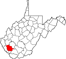
 Location of Mitchell Heights, West Virginia | |
| Coordinates: 37°54′25″N 81°58′59″W / 37.90694°N 81.98306°WCoordinates: 37°54′25″N 81°58′59″W / 37.90694°N 81.98306°W | |
| Country | United States |
| State | West Virginia |
| County | Logan |
| Area[1] | |
| • Total | 0.34 sq mi (0.88 km2) |
| • Land | 0.34 sq mi (0.88 km2) |
| • Water | 0 sq mi (0 km2) |
| Elevation | 669 ft (204 m) |
| Population (2010)[2] | |
| • Total | 323 |
| • Estimate (2012[3]) | 318 |
| • Density | 950.0/sq mi (366.8/km2) |
| Time zone | Eastern (EST) (UTC-5) |
| • Summer (DST) | EDT (UTC-4) |
| Area code(s) | 304 |
| FIPS code | 54-54892[4] |
| GNIS feature ID | 1555140[5] |
Mitchell Heights is a town in Logan County, West Virginia, United States. The population was 323 at the 2010 census.
Geography
Mitchell Heights is located at 37°54′25″N 81°58′59″W / 37.90694°N 81.98306°W (37.906889, -81.982981).[6]
According to the United States Census Bureau, the town has a total area of 0.34 square miles (0.88 km2), all of it land.[1]
Demographics
| Historical population | |||
|---|---|---|---|
| Census | Pop. | %± | |
| 1950 | 185 | — | |
| 1960 | 290 | 56.8% | |
| 1970 | 524 | 80.7% | |
| 1980 | 342 | −34.7% | |
| 1990 | 265 | −22.5% | |
| 2000 | 301 | 13.6% | |
| 2010 | 323 | 7.3% | |
| Est. 2015 | 308 | [7] | −4.6% |
2010 census
As of the census[2] of 2010, there were 323 people, 143 households, and 101 families residing in the town. The population density was 950.0 inhabitants per square mile (366.8/km2). There were 154 housing units at an average density of 452.9 per square mile (174.9/km2). The racial makeup of the town was 97.8% White, 0.3% African American, 1.5% Asian, and 0.3% from two or more races. Hispanic or Latino of any race were 0.3% of the population.
There were 143 households of which 18.9% had children under the age of 18 living with them, 57.3% were married couples living together, 11.2% had a female householder with no husband present, 2.1% had a male householder with no wife present, and 29.4% were non-families. 25.2% of all households were made up of individuals and 19.6% had someone living alone who was 65 years of age or older. The average household size was 2.26 and the average family size was 2.70.
The median age in the town was 50.2 years. 14.9% of residents were under the age of 18; 5% were between the ages of 18 and 24; 24.4% were from 25 to 44; 27.2% were from 45 to 64; and 28.5% were 65 years of age or older. The gender makeup of the town was 44.6% male and 55.4% female.
2000 census
As of the census[4] of 2000, there were 301 people, 134 households, and 99 families residing in the town. The population density was 915.2 inhabitants per square mile (352.2/km²). There were 143 housing units at an average density of 434.8 per square mile (167.3/km²). The racial makeup of the town was 97.01% White and 2.99% Asian. Hispanic or Latino of any race were 0.33% of the population.
There were 134 households out of which 19.4% had children under the age of 18 living with them, 64.9% were married couples living together, 8.2% had a female householder with no husband present, and 25.4% were non-families. 24.6% of all households were made up of individuals and 17.2% had someone living alone who was 65 years of age or older. The average household size was 2.25 and the average family size was 2.65.
In the town the population was spread out with 15.9% under the age of 18, 4.7% from 18 to 24, 21.6% from 25 to 44, 32.9% from 45 to 64, and 24.9% who were 65 years of age or older. The median age was 50 years. For every 100 females there were 78.1 males. For every 100 females age 18 and over, there were 74.5 males.
The median income for a household in the town was $52,500, and the median income for a family was $78,404. Males had a median income of $61,250 versus $33,750 for females. The per capita income for the town was $39,603. About 2.4% of families and 3.9% of the population were below the poverty line, including none of those under the age of eighteen and 1.9% of those sixty five or over.
References
- 1 2 "US Gazetteer files 2010". United States Census Bureau. Retrieved 2013-01-24.
- 1 2 "American FactFinder". United States Census Bureau. Retrieved 2013-01-24.
- ↑ "Population Estimates". United States Census Bureau. Retrieved 2013-06-26.
- 1 2 "American FactFinder". United States Census Bureau. Retrieved 2008-01-31.
- ↑ "US Board on Geographic Names". United States Geological Survey. 2007-10-25. Retrieved 2008-01-31.
- ↑ "US Gazetteer files: 2010, 2000, and 1990". United States Census Bureau. 2011-02-12. Retrieved 2011-04-23.
- ↑ "Annual Estimates of the Resident Population for Incorporated Places: April 1, 2010 to July 1, 2015". Retrieved July 2, 2016.
- ↑ "Census of Population and Housing". Census.gov. Retrieved June 4, 2015.