Glen Dale, West Virginia
| Glen Dale, West Virginia | ||
|---|---|---|
| Town | ||
| ||
| Motto: Montani Semper Liberi | ||
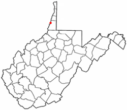 Location of Glen Dale, West Virginia | ||
| Coordinates: 39°56′55″N 80°45′18″W / 39.94861°N 80.75500°WCoordinates: 39°56′55″N 80°45′18″W / 39.94861°N 80.75500°W | ||
| Country | United States | |
| State | West Virginia | |
| County | Marshall | |
| Area[1] | ||
| • Total | 1.20 sq mi (3.11 km2) | |
| • Land | 0.85 sq mi (2.20 km2) | |
| • Water | 0.35 sq mi (0.91 km2) | |
| Elevation | 692 ft (211 m) | |
| Population (2010)[2] | ||
| • Total | 1,526 | |
| • Estimate (2012[3]) | 1,501 | |
| • Density | 1,795.3/sq mi (693.2/km2) | |
| Time zone | Eastern (EST) (UTC-5) | |
| • Summer (DST) | EDT (UTC-4) | |
| ZIP code | 26038 | |
| Area code(s) | 304/681 | |
| FIPS code | 54-31492[4] | |
| GNIS feature ID | 1560592[5] | |
Glen Dale is a city in Marshall County, West Virginia, United States, along the Ohio River. It is part of the Wheeling, West Virginia Metropolitan Statistical Area. The population was 1,526 at the 2010 census. Glen Dale was incorporated in 1924.
Geography
Glen Dale is located at 39°56′55″N 80°45′18″W / 39.94861°N 80.75500°W (39.948594, -80.754922).[6]
According to the United States Census Bureau, the city has a total area of 1.20 square miles (3.11 km2), of which 0.85 square miles (2.20 km2) is land and 0.35 square miles (0.91 km2) is water.[1]
Demographics
| Historical population | |||
|---|---|---|---|
| Census | Pop. | %± | |
| 1930 | 1,493 | — | |
| 1940 | 1,348 | −9.7% | |
| 1950 | 1,467 | 8.8% | |
| 1960 | 1,905 | 29.9% | |
| 1970 | 2,150 | 12.9% | |
| 1980 | 1,875 | −12.8% | |
| 1990 | 1,612 | −14.0% | |
| 2000 | 1,552 | −3.7% | |
| 2010 | 1,526 | −1.7% | |
| Est. 2015 | 1,464 | [7] | −4.1% |
2010 census
As of the census[2] of 2010, there were 1,526 people, 688 households and 475 families residing in the city. The population density was 1,795.3 inhabitants per square mile (693.2/km2). There were 745 housing units at an average density of 876.5 per square mile (338.4/km2). The racial makeup of the city was 97.5% White, 0.1% African American, 0.5% Native American, 0.4% Asian, 0.4% from other races, and 1.0% from two or more races. Hispanic or Latino of any race were 1.0% of the population.
There were 688 households of which 23.1% had children under the age of 18 living with them, 52.6% were married couples living together, 11.6% had a female householder with no husband present, 4.8% had a male householder with no wife present, and 31.0% were non-families. 28.1% of all households were made up of individuals and 14.5% had someone living alone who was 65 years of age or older. The average household size was 2.22 and the average family size was 2.65.
The median age in the city was 50 years. 17.1% of residents were under the age of 18; 6.7% were between the ages of 18 and 24; 19.3% were from 25 to 44; 33.8% were from 45 to 64; and 23.1% were 65 years of age or older. The gender makeup of the city was 46.9% male and 53.1% female.
2000 census
As of the census[4] of 2000, there were 1,552 people, 697 households and 469 families residing in the city. The population density was 1,940.8 per square mile (749.0/km²). There were 757 housing units at an average density of 946.6 per square mile (365.3/km²). The racial makeup of the city was 98.65% White, 1.96% African American, 0.32% Asian, 0.26% from other races, and 0.71% from two or more races. Hispanic or Latino of any race were 0.08% of the population.
There were 697 households of which 24.1% had children under the age of 18 living with them, 56.7% were married couples living together, 9.0% had a female householder with no husband present, and 32.6% were non-families. 30.4% of all households were made up of individuals and 18.7% had someone living alone who was 65 years of age or older. The average household size was 2.23 and the average family size was 2.75.
In the town the population was spread out with 19.3% under the age of 18, 5.9% from 18 to 24, 23.0% from 25 to 44, 28.1% from 45 to 64, and 23.7% who were 65 years of age or older. The median age was 46 years. For every 100 females there were 87.7 males. For every 100 females age 18 and over, there were 83.6 males.
The median income for a household in the town was $40,000, and the median income for a family was $49,306. Males had a median income of $40,352 versus $25,588 for females. The per capita income for the city was $24,409. About 5.4% of families and 6.5% of the population were below the poverty line, including 6.9% of those under age 18 and 9.6% of those age 65 or over.
History
The community was named after Glendale, the farm of a local family.[9]
Notable people
Glen Dale is the home town of:
- Brad Paisley, country music singer
- Lionel Cartwright
- Shelley Moore Capito, United States Senator
- Arch A. Moore, Jr, former Governor of West Virginia[10]
- Shelley Riley Moore, former First Lady of West Virginia[10]
- George Brett, Baseball Hall of Famer, born in Glen Dale, but his family moved when he was a small child, and he was primarily raised in Southern California.
- Jeffrey V. Kessler, West Virginia State Senator (November 1997 – present) West Virginia Senate President (January 2011 - 2015)
- Bernice E. Eddy, virologist and epidemiologist
References
- 1 2 "US Gazetteer files 2010". United States Census Bureau. Archived from the original on January 24, 2012. Retrieved January 24, 2013.
- 1 2 "American FactFinder". United States Census Bureau. Retrieved January 24, 2013.
- ↑ "Population Estimates". United States Census Bureau. Archived from the original on June 17, 2013. Retrieved 2013-06-26.
- 1 2 "American FactFinder". United States Census Bureau. Retrieved 2008-01-31.
- ↑ "US Board on Geographic Names". United States Geological Survey. 2007-10-25. Retrieved 2008-01-31.
- ↑ "US Gazetteer files: 2010, 2000, and 1990". United States Census Bureau. 2011-02-12. Retrieved 2011-04-23.
- ↑ "Annual Estimates of the Resident Population for Incorporated Places: April 1, 2010 to July 1, 2015". Retrieved July 2, 2016.
- ↑ "Census of Population and Housing". Census.gov. Archived from the original on May 11, 2015. Retrieved June 4, 2015.
- ↑ Kenny, Hamill (1945). West Virginia Place Names: Their Origin and Meaning, Including the Nomenclature of the Streams and Mountains. Piedmont, WV: The Place Name Press. p. 272.
- 1 2 "Shelley Moore". The Intelligencer & Wheeling News Register. 2014-09-14. Retrieved 2014-09-14.
External links
Municipalities and communities of Marshall County, West Virginia, United States | ||
|---|---|---|
| Cities | 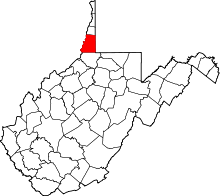 | |
| Unincorporated communities |
| |
| Ghost towns | ||
| Footnotes | ‡This populated place also has portions in an adjacent county or counties | |