Albright, West Virginia
| Albright, West Virginia | |
|---|---|
| Town | |
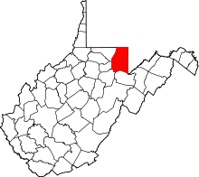
 Location in Preston County and the state of West Virginia. | |
| Coordinates: 39°29′37″N 79°38′19″W / 39.49361°N 79.63861°WCoordinates: 39°29′37″N 79°38′19″W / 39.49361°N 79.63861°W | |
| Country | United States |
| State | West Virginia |
| County | Preston |
| Government | |
| • Mayor | John Uphold |
| Area[1] | |
| • Total | 0.27 sq mi (0.70 km2) |
| • Land | 0.23 sq mi (0.60 km2) |
| • Water | 0.04 sq mi (0.10 km2) |
| Elevation | 1,211 ft (369 m) |
| Population (2010)[2] | |
| • Total | 299 |
| • Estimate (2012[3]) | 303 |
| • Density | 1,300.0/sq mi (501.9/km2) |
| Time zone | Eastern (EST) (UTC-5) |
| • Summer (DST) | EDT (UTC-4) |
| ZIP code | 26519 |
| Area code(s) | 304 |
| FIPS code | 54-00748[4] |
| GNIS feature ID | 1553704[5] |
Albright is a town and former coal town in Preston County, West Virginia, United States, along the Cheat River. The population was 299 at the 2010 census.
History
The town derives its name from David Albright, an early settler.[6]
Located near Albright is the Virginia Furnace, listed on the National Register of Historic Places in 1999.[7]
Geography
According to the United States Census Bureau, the town has a total area of 0.27 square miles (0.70 km2), of which, 0.23 square miles (0.60 km2) is land and 0.04 square miles (0.10 km2) is water.[1]
Demographics
| Historical population | |||
|---|---|---|---|
| Census | Pop. | %± | |
| 1920 | 262 | — | |
| 1930 | 343 | 30.9% | |
| 1940 | 334 | −2.6% | |
| 1950 | 396 | 18.6% | |
| 1960 | 304 | −23.2% | |
| 1970 | 319 | 4.9% | |
| 1980 | 357 | 11.9% | |
| 1990 | 195 | −45.4% | |
| 2000 | 247 | 26.7% | |
| 2010 | 299 | 21.1% | |
| Est. 2015 | 304 | [8] | 1.7% |
2010 census
At the 2010 census,[2] there were 299 people, 120 households and 79 families residing in the town. The population density was 1,300.0 inhabitants per square mile (501.9/km2). There were 128 housing units at an average density of 556.5 per square mile (214.9/km2). The racial makeup of the town was 97.3% White, 0.3% African American, 1.0% Native American, and 1.3% from two or more races.
There were 120 households of which 30.8% had children under the age of 18 living with them, 48.3% were married couples living together, 10.0% had a female householder with no husband present, 7.5% had a male householder with no wife present, and 34.2% were non-families. 30.8% of all households were made up of individuals and 11.7% had someone living alone who was 65 years of age or older. The average household size was 2.49 and the average family size was 3.09.
The median age in the town was 38.2 years. 22.4% of residents were under the age of 18; 12.1% were between the ages of 18 and 24; 24.1% were from 25 to 44; 28.4% were from 45 to 64; and 13% were 65 years of age or older. The gender makeup of the town was 47.5% male and 52.5% female.
2000 census
At the 2000 census,[4] there were 247 people, 99 households and 61 families residing in the town. The population density was 857.9 per square mile (328.9/km²). There were 113 housing units at an average density of 392.5 per square mile (150.4/km²). The racial makeup of the town was 98.79% White, 0.40% African American, and 0.81% from two or more races.
There were 99 households of which 33.3% had children under the age of 18 living with them, 46.5% were married couples living together, 9.1% had a female householder with no husband present, and 37.4% were non-families. 29.3% of all households were made up of individuals and 11.1% had someone living alone who was 65 years of age or older. The average household size was 2.49 and the average family size was 3.06.
27.9% of the population were under the age of 18, 6.1% from 18 to 24, 31.2% from 25 to 44, 23.1% from 45 to 64, and 11.7% who were 65 years of age or older. The median age was 34 years. For every 100 females there were 87.1 males. For every 100 females age 18 and over, there were 83.5 males.
The median household income was $21,389 and the median family income was $21,500. Males had a median income of $20,764 compared with $16,250 for females. The per capita income was $10,581. About 27.9% of families and 26.2% of the population were below the poverty line, including 36.6% of those under the age of eighteen and 27.3% of those sixty five or over.
Climate
The climate in this area has mild differences between highs and lows, and there is adequate rainfall year round. According to the Köppen Climate Classification system, Albright has a marine west coast climate, abbreviated "Cfb" on climate maps.[10]
References
- 1 2 "US Gazetteer files 2010". United States Census Bureau. Archived from the original on 2012-01-24. Retrieved 2013-01-24.
- 1 2 "American FactFinder". United States Census Bureau. Retrieved 2013-01-24.
- ↑ "Population Estimates". United States Census Bureau. Archived from the original on 2013-06-17. Retrieved 2013-06-26.
- 1 2 "American FactFinder". United States Census Bureau. Archived from the original on 2013-09-11. Retrieved 2008-01-31.
- ↑ "US Board on Geographic Names". United States Geological Survey. 2007-10-25. Retrieved 2008-01-31.
- ↑ Kenny, Hamill (1945). West Virginia Place Names: Their Origin and Meaning, Including the Nomenclature of the Streams and Mountains. Piedmont, WV: The Place Name Press. p. 74.
- ↑ National Park Service (2010-07-09). "National Register Information System". National Register of Historic Places. National Park Service.
- ↑ "Annual Estimates of the Resident Population for Incorporated Places: April 1, 2010 to July 1, 2015". Retrieved July 2, 2016.
- ↑ "Census of Population and Housing". Census.gov. Archived from the original on May 11, 2015. Retrieved June 4, 2015.
- ↑ Climate Summary for Albright, West Virginia