Falling Spring, West Virginia
| Renick, West Virginia | |
|---|---|
| Town | |
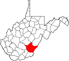
 Location of Falling Spring, West Virginia | |
| Coordinates: 37°59′28″N 80°21′19″W / 37.99111°N 80.35528°WCoordinates: 37°59′28″N 80°21′19″W / 37.99111°N 80.35528°W | |
| Country | United States |
| State | West Virginia |
| County | Greenbrier |
| Government | |
| Area[1] | |
| • Total | 0.53 sq mi (1.37 km2) |
| • Land | 0.52 sq mi (1.35 km2) |
| • Water | 0.01 sq mi (0.03 km2) |
| Elevation | 1,923 ft (586 m) |
| Population (2010)[2] | |
| • Total | 211 |
| • Estimate (2012[3]) | 212 |
| • Density | 405.8/sq mi (156.7/km2) |
| Time zone | Eastern (EST) (UTC-5) |
| • Summer (DST) | EDT (UTC-4) |
| Area code(s) | 304 |
| FIPS code | 54-26692[4] |
| GNIS feature ID | 1551093[5] |
Falling Spring is a town in Greenbrier County, West Virginia, in the United States. It is also known as Renick[5] from the name of its post office (ZIP Code 24966).[6] The population was 209 in 2014 census.
History
In 1769, Major Wm. Renick form Augusta County, Virginia settled on an entry of 1,000 acres in the northern area of Greenbrier County; an area sixteen miles north of Lewisburg known as Falling Spring (Renick).
Spring Creek Presbyterian Church
The church was established in 1783. The first pastor of the church was Rev. John McCue. Today the church is one of the three oldest churches east of the
Mississippi River. The original site of the church was in Spring Creek about two and a half miles south of the town of Renick.
The Renick High School
The school was established in 1796. In 1928 the public school system established local schools with staffed educators hence came Renick High School, now known as the Renick Jr. High School building and still sits on its original site.
Chesapeake and Ohio Railroad
The railroad was built around 1900 and passed through the center of the town along the Greenbrier River. In 1901, Pitts and Colley built a large store next to the railroad depot and many businesses followed. And the railroad is now the Greenbrier River Trail.
The Renick Bank
The Bank of Renick was established in 1909 with the Rev. J.S. Wickline as the first and only president. The bank at one time was considered one of the best banks in the Greenbrier Valley.
The Renick Post Office
The post office of Falling Spring was established in the early part of the 1800’s. The name of Falling Spring was changed to Renick in 1913 by the postal service, due to confusion with the mail service with the community of Falling Springs, Virginia.Today, the post office is still in service and delivers mail not only to the town of Renick, but to the surrounding communities of Auto and Friars Hill.
Sources: The Renick Ruritan club, Former Mayor David Ramsey
Geography
Renick is located at 37°59′28″N 80°21′19″W / 37.99111°N 80.35528°W (37.991232, -80.355182).[7]
According to the United States Census Bureau, the town has a total area of 0.53 square miles (1.37 km2), of which, 0.52 square miles (1.35 km2) is land and 0.01 square miles (0.03 km2) is water.[1]
Government
In February 1924, the town of Renick became incorporated with the first meeting of Renick Town Council and consisted of a mayor, recorder, and five council members. Since this time, the town of has always maintained a town council which meets once a month with elections held every four years for members who each serve a four-year term. At present time, the mayor of Renick is Patrick Roberts with Twila Deihl acting as recorder/treasurer and council members Melinda Workman, Lee Kidd, John Simmons, James Holmes, and Angie Lewis. The City Attorney is Charles R. "Rusty" Webb.
Climate
The climate in this area is characterized by hot, humid summers and generally mild to cool winters. According to the Köppen Climate Classification system, Renick has a humid subtropical climate, abbreviated "Cfa" on climate maps.[8]
Demographics
| Historical population | |||
|---|---|---|---|
| Census | Pop. | %± | |
| 1910 | 270 | — | |
| 1920 | 263 | −2.6% | |
| 1930 | 355 | 35.0% | |
| 1940 | 388 | 9.3% | |
| 1950 | 307 | −20.9% | |
| 1960 | 265 | −13.7% | |
| 1970 | 255 | −3.8% | |
| 1980 | 240 | −5.9% | |
| 1990 | 191 | −20.4% | |
| 2000 | 209 | 9.4% | |
| 2010 | 211 | 1.0% | |
| Est. 2015 | 210 | [9] | −0.5% |
2010 census
As of the census[2] of 2010, there were 211 people, 82 households, and 61 families residing in the town. The population density was 405.8 inhabitants per square mile (156.7/km2). There were 106 housing units at an average density of 203.8 per square mile (78.7/km2). The racial makeup of the town was 94.3% White, 0.5% African American, 0.5% Native American, 0.9% from other races, and 3.8% from two or more races. Hispanic or Latino of any race were 0.9% of the population.
There were 82 households of which 28.0% had children under the age of 18 living with them, 61.0% were married couples living together, 8.5% had a female householder with no husband present, 4.9% had a male householder with no wife present, and 25.6% were non-families. 18.3% of all households were made up of individuals and 9.8% had someone living alone who was 65 years of age or older. The average household size was 2.57 and the average family size was 2.92.
The median age in the town was 41.5 years. 22.7% of residents were under the age of 18; 8% were between the ages of 18 and 24; 24.2% were from 25 to 44; 33.2% were from 45 to 64; and 11.8% were 65 years of age or older. The gender makeup of the town was 46.0% male and 54.0% female.
2000 census
As of the census[4] of 2000, there were 209 people, 85 households, and 57 families residing in the town. The population density was 411.1 people per square mile (158.2/km²). There were 113 housing units at an average density of 222.2 per square mile (85.5/km²). The racial makeup of the town was 100.00% White. Hispanic or Latino of any race were 0.48% of the population.
There were 85 households out of which 29.4% had children under the age of 18 living with them, 57.6% were married couples living together, 5.9% had a female householder with no husband present, and 32.9% were non-families. 27.1% of all households were made up of individuals and 14.1% had someone living alone who was 65 years of age or older. The average household size was 2.46 and the average family size was 3.00.
In the town the population was spread out with 21.1% under the age of 18, 10.0% from 18 to 24, 26.8% from 25 to 44, 23.0% from 45 to 64, and 19.1% who were 65 years of age or older. The median age was 40 years. For every 100 females there were 101.0 males. For every 100 females age 18 and over, there were 108.9 males.
The median income for a household in the town was $25,469, and the median income for a family was $25,750. Males had a median income of $23,500 versus $20,000 for females. The per capita income for the town was $10,721. About 23.6% of families and 24.9% of the population were below the poverty line, including 43.1% of those under the age of eighteen and 5.1% of those sixty five or over.
References
- 1 2 "US Gazetteer files 2010". United States Census Bureau. Retrieved 2013-01-24.
- 1 2 "American FactFinder". United States Census Bureau. Retrieved 2013-01-24.
- ↑ "Population Estimates". United States Census Bureau. Retrieved 2013-06-26.
- 1 2 "American FactFinder". United States Census Bureau. Retrieved 2008-01-31.
- 1 2 U.S. Geological Survey Geographic Names Information System: Falling Spring, West Virginia
- ↑ Zip Code Lookup
- ↑ "US Gazetteer files: 2010, 2000, and 1990". United States Census Bureau. 2011-02-12. Retrieved 2011-04-23.
- ↑ Climate Summary for Falling Spring, West Virginia
- ↑ "Annual Estimates of the Resident Population for Incorporated Places: April 1, 2010 to July 1, 2015". Retrieved July 2, 2016.
- ↑ "Census of Population and Housing". Census.gov. Retrieved June 4, 2015.