Flatwoods, West Virginia
| Flatwoods, West Virginia | |
|---|---|
| Town | |
 Location of Flatwoods, West Virginia | |
| Coordinates: 38°43′17″N 80°39′11″W / 38.72139°N 80.65306°WCoordinates: 38°43′17″N 80°39′11″W / 38.72139°N 80.65306°W | |
| Country |
|
| State |
|
| County | Braxton |
| Incorporated | 1901 |
| Government[1] | |
| • Type | Faulkner Act Mayor-Council |
| • Mayor | Pamela Skelly |
| • Chief of Police | Caleb Harper |
| Area[2] | |
| • Total | 1.71 km2 (0.66 sq mi) |
| • Land | 1.71 km2 (0.66 sq mi) |
| • Water | 0 km2 (0 sq mi) |
| Elevation[3] | 326 m (1,071 ft) |
| Population (2010)[4] | |
| • Total | 277 |
| • Estimate (2012[5]) | 276 |
| • Density | 162.0/km2 (419.7/sq mi) |
| Time zone | Eastern (EST) (UTC-5) |
| • Summer (DST) | EDT (UTC-4) |
| ZIP code | 26621 |
| Area code(s) | 304 |
| FIPS code | 54-27868[6] |
| GNIS feature ID | 1539070[7] |
Flatwoods is a town in Braxton County, West Virginia, United States located about one mile from exit 67 of Interstate 79.
The area immediately around the exit is known as Sutton Lane and has been extensively developed in recent years, largely due to the community's central location within the state and easy accessibility to I-79. The area now features a convention center, Mountain Lakes Amphitheater,[8] KOA campground, driving range, outlet mall, truck stops, hotels, gas stations, and many fast food restaurants. A favorite local diner is "The Waffle Hut," which is open 24 hours a day.
The population of Flatwoods was 277 as of the 2010 census.
Although first incorporated in 1902, maps show the existence of Flatwoods as a town in 1873,[9] and a church was established by a pastor named John Clark at the community there as early as 1830.[10] The West Virginia and Pittsburgh Railroad extended a branch through Flatwoods in the late 1800s.[11] Later, the line was taken over by Baltimore and Ohio Railroad, and Flatwoods was a halfway point on the B&O Railroad's Clarksburg-Richwood branch, approximately 62.6 miles from the Clarksburg terminal, and 59.1 miles from the Richwood terminal.[12] The town also served as the origin of West Virginia & Pittsburgh Railroad's Sutton Branch.[11]
The community became nationally known for the Flatwoods monster UFO incident which occurred on September 12, 1952.
Geography
Flatwoods is located at 38°43′17″N 80°39′11″W / 38.721374°N 80.652957°W (38.721374, -80.652957).[13] According to the United States Census Bureau, the town has a total area of 0.66 square miles (1.71 km2), all of it land.[2]
Demographics
| Historical population | |||
|---|---|---|---|
| Census | Pop. | %± | |
| 1910 | 284 | — | |
| 1920 | 325 | 14.4% | |
| 1930 | 299 | −8.0% | |
| 1940 | 308 | 3.0% | |
| 1950 | 288 | −6.5% | |
| 1960 | 248 | −13.9% | |
| 1970 | 220 | −11.3% | |
| 1980 | 405 | 84.1% | |
| 1990 | 324 | −20.0% | |
| 2000 | 348 | 7.4% | |
| 2010 | 277 | −20.4% | |
| Est. 2015 | 277 | [14] | 0.0% |
2010 census
As of the census[4] of 2010, there were 277 people, 109 households, and 74 families residing in the town. The population density was 419.7 inhabitants per square mile (162.0/km2). There were 127 housing units at an average density of 192.4 per square mile (74.3/km2). The racial makeup of the town was 99.3% White, 0.4% Asian, and 0.4% from two or more races. Hispanic or Latino of any race were 0.7% of the population.
There were 109 households of which 33.0% had children under the age of 18 living with them, 50.5% were married couples living together, 13.8% had a female householder with no husband present, 3.7% had a male householder with no wife present, and 32.1% were non-families. 28.4% of all households were made up of individuals and 11% had someone living alone who was 65 years of age or older. The average household size was 2.54 and the average family size was 3.12.
The median age in the town was 41.2 years. 27.1% of residents were under the age of 18; 6.9% were between the ages of 18 and 24; 22.8% were from 25 to 44; 28.2% were from 45 to 64; and 15.2% were 65 years of age or older. The gender makeup of the town was 48.4% male and 51.6% female.
2000 census
As of the census[6] of 2000, there were 348 people, 146 households, and 102 families residing in the town. The population density was 328.7 inhabitants per square mile (126.8/km2). There were 157 housing units at an average density of 148.3 per square mile (57.2/km2). The racial makeup of the town was 97.13% White, 0.57% Asian, 0.29% Pacific Islander, and 2.01% from two or more races.
There were 146 households out of which 29.5% had children under the age of 18 living with them, 58.2% were married couples living together, 8.9% had a female householder with no husband present, and 29.5% were non-families. 26.0% of all households were made up of individuals and 13.0% had someone living alone who was 65 years of age or older. The average household size was 2.38 and the average family size was 2.89.
In the town, the population dispersal was 24.1% under the age of 18, 5.2% from 18 to 24, 29.6% from 25 to 44, 27.9% from 45 to 64, and 13.2% who were 65 years of age or older. The median age was 39 years. For every 100 females there were 94.4 males. For every 100 females age 18 and over, there were 88.6 males. The median income for a household in the town was $29,500, and the median income for a family was $35,250. Males had a median income of $30,000 versus $15,938 for females. The per capita income for the town was $18,025. About 11.4% of families and 18.0% of the population were below the poverty line, including 20.2% of those under age 18 and 8.6% of those age 65 or over.
References
- ↑ "About Us". The Town of Flatwoods. Retrieved 27 August 2015.
- 1 2 "US Gazetteer files 2010". United States Census Bureau. Archived from the original on January 24, 2012. Retrieved 2013-01-24.
- ↑ "About Us". The Town of Flatwoods. Retrieved 27 August 2015.
- 1 2 "American FactFinder". United States Census Bureau. Retrieved 2013-01-24.
- ↑ "Population Estimates". United States Census Bureau. Archived from the original on June 17, 2013. Retrieved 2013-06-26.
- 1 2 "American FactFinder". United States Census Bureau. Archived from the original on September 11, 2013. Retrieved 2008-01-31.
- ↑ "US Board on Geographic Names". United States Geological Survey. 2007-10-25. Retrieved 2008-01-31.
- ↑ "mountain lakes amphitheatre". Welcome to West Virginia. Retrieved 16 August 2015.
- ↑ "White's Toopographical, County, and District Atlas of West Virginia, Counties of Calhoun, Gilmer, Braxton, Lewis and Upshur (with Weston) 1873". David Rumsey Map Collection. Cartography Associates. Retrieved 2013-07-31.
- ↑ Sutton, John (1919). History of Braxton County and Central West Virginia. Parsons: McClain Printing Company. p. 234. ISBN 978-0870126215.
- 1 2 "West Virginia and Pittsburgh Railroad". wvrailroads.net. wvrailroads.net. Retrieved 2013-07-31.
- ↑ Fergusson, Jim. "West Virginia Railway Station Lists" (PDF). Jim Fergusson's Railway and Tramway Station Lists. Jim Fergusson. Retrieved 2013-07-31.
- ↑ "US Gazetteer files: 2010, 2000, and 1990". United States Census Bureau. 2011-02-12. Retrieved 2011-04-23.
- ↑ "Annual Estimates of the Resident Population for Incorporated Places: April 1, 2010 to July 1, 2015". Retrieved July 2, 2016.
- ↑ "Census of Population and Housing". Census.gov. Archived from the original on May 11, 2015. Retrieved June 4, 2015.
Municipalities and communities of Braxton County, West Virginia, United States | ||
|---|---|---|
| Towns | 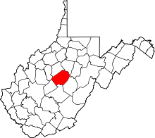 | |
| Unincorporated communities |
| |
| Ghost towns | ||
| Footnotes | ‡This populated place also has portions in an adjacent county or counties | |