Meadow Bridge, West Virginia
| Meadow Bridge, West Virginia | |
|---|---|
| Town | |
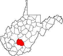
 Location of Meadowbridge, West Virginia | |
| Coordinates: 37°51′45″N 80°51′19″W / 37.86250°N 80.85528°WCoordinates: 37°51′45″N 80°51′19″W / 37.86250°N 80.85528°W | |
| Country | United States |
| State | West Virginia |
| County | Fayette |
| Area[1] | |
| • Total | 0.41 sq mi (1.06 km2) |
| • Land | 0.41 sq mi (1.06 km2) |
| • Water | 0 sq mi (0 km2) |
| Elevation | 2,431 ft (741 m) |
| Population (2010)[2] | |
| • Total | 379 |
| • Estimate (2012[3]) | 374 |
| • Density | 924.4/sq mi (356.9/km2) |
| Time zone | Eastern (EST) (UTC-5) |
| • Summer (DST) | EDT (UTC-4) |
| ZIP code | 25976 |
| Area code(s) | 304 |
| FIPS code | 54-52780[4] |
| GNIS feature ID | 1543055[5] |
Meadow Bridge is a town in Fayette County, West Virginia, United States. The population was 379 at the 2010 census.
The community took its name from a nearby bridge over Meadow Creek.[6]
Geography
Meadow Bridge is located at 37°51′45″N 80°51′19″W / 37.86250°N 80.85528°W (37.862399, -80.855169).[7]
According to the United States Census Bureau, the town has a total area of 0.41 square miles (1.06 km2), all of it land.[1]
Demographics
| Historical population | |||
|---|---|---|---|
| Census | Pop. | %± | |
| 1930 | 476 | — | |
| 1940 | 477 | 0.2% | |
| 1950 | 597 | 25.2% | |
| 1960 | 426 | −28.6% | |
| 1970 | 429 | 0.7% | |
| 1980 | 530 | 23.5% | |
| 1990 | 325 | −38.7% | |
| 2000 | 321 | −1.2% | |
| 2010 | 379 | 18.1% | |
| Est. 2015 | 362 | [8] | −4.5% |
2010 census
As of the census[2] of 2010, there were 379 people, 165 households, and 97 families residing in the town. The population density was 924.4 inhabitants per square mile (356.9/km2). There were 186 housing units at an average density of 453.7 per square mile (175.2/km2). The racial makeup of the town was 99.2% White, 0.3% Asian, 0.3% from other races, and 0.3% from two or more races. Hispanic or Latino of any race were 0.3% of the population.
There were 165 households of which 24.2% had children under the age of 18 living with them, 41.8% were married couples living together, 12.1% had a female householder with no husband present, 4.8% had a male householder with no wife present, and 41.2% were non-families. 37.6% of all households were made up of individuals and 24.9% had someone living alone who was 65 years of age or older. The average household size was 2.30 and the average family size was 3.01.
The median age in the town was 42.5 years. 22.7% of residents were under the age of 18; 6.2% were between the ages of 18 and 24; 24.8% were from 25 to 44; 23.5% were from 45 to 64; and 22.7% were 65 years of age or older. The gender makeup of the town was 47.5% male and 52.5% female.
2000 census
As of the census[4] of 2000, there were 321 people, 136 households, and 93 families residing in the town. The population density was 791.3 inhabitants per square mile (302.3/km²). There were 175 housing units at an average density of 431.4 per square mile (164.8/km²). The racial makeup of the town was 100.00% White.
There were 136 households out of which 29.4% had children under the age of 18 living with them, 47.1% were married couples living together, 18.4% had a female householder with no husband present, and 30.9% were non-families. 28.7% of all households were made up of individuals and 14.7% had someone living alone who was 65 years of age or older. The average household size was 2.36 and the average family size was 2.83.
In the town the population was spread out with 22.1% under the age of 18, 11.2% from 18 to 24, 25.9% from 25 to 44, 24.0% from 45 to 64, and 16.8% who were 65 years of age or older. The median age was 39 years. For every 100 females there were 76.4 males. For every 100 females age 18 and over, there were 83.8 males.
The median income for a household in the town was $23,194, and the median income for a family was $27,000. Males had a median income of $24,444 versus $14,625 for females. The per capita income for the town was $12,526. About 15.7% of families and 24.1% of the population were below the poverty line, including 34.5% of those under age 18 and 22.0% of those age 65 or over.
References
- 1 2 "US Gazetteer files 2010". United States Census Bureau. Retrieved 2013-01-24.
- 1 2 "American FactFinder". United States Census Bureau. Retrieved 2013-01-24.
- ↑ "Population Estimates". United States Census Bureau. Retrieved 2013-06-26.
- 1 2 "American FactFinder". United States Census Bureau. Retrieved 2008-01-31.
- ↑ "US Board on Geographic Names". United States Geological Survey. 2007-10-25. Retrieved 2008-01-31.
- ↑ Kenny, Hamill (1945). West Virginia Place Names: Their Origin and Meaning, Including the Nomenclature of the Streams and Mountains. Piedmont, WV: The Place Name Press. p. 408-409.
- ↑ "US Gazetteer files: 2010, 2000, and 1990". United States Census Bureau. 2011-02-12. Retrieved 2011-04-23.
- ↑ "Annual Estimates of the Resident Population for Incorporated Places: April 1, 2010 to July 1, 2015". Retrieved July 2, 2016.
- ↑ "Census of Population and Housing". Census.gov. Retrieved June 4, 2015.