Smithers, West Virginia
| Smithers, West Virginia | |
|---|---|
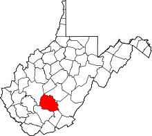
 Location of Smithers, West Virginia | |
| Coordinates: 38°10′39″N 81°18′23″W / 38.17750°N 81.30639°WCoordinates: 38°10′39″N 81°18′23″W / 38.17750°N 81.30639°W | |
| Country | United States |
| State | West Virginia |
| Counties | Fayette, Kanawha |
| Area[1] | |
| • Total | 0.50 sq mi (1.29 km2) |
| • Land | 0.50 sq mi (1.29 km2) |
| • Water | 0 sq mi (0 km2) |
| Elevation | 633 ft (193 m) |
| Population (2010)[2] | |
| • Total | 813 |
| • Estimate (2012[3]) | 808 |
| • Density | 1,626.0/sq mi (627.8/km2) |
| Time zone | Eastern (EST) (UTC-5) |
| • Summer (DST) | EDT (UTC-4) |
| ZIP code | 25186 |
| Area code(s) | 304 |
| FIPS code | 54-74740[4] |
| GNIS feature ID | 1547007[5] |
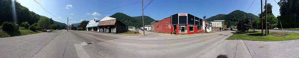
Smithers is a city in Fayette and Kanawha counties in the U.S. state of West Virginia. Located along the Kanawha River, it lies almost entirely in Fayette County. The population was 813 at the 2010 census. The city most likely takes its name from Smithers Creek.[6] The small river city is noted for having a rich cultural history related to both its coal mining and Italian-American heritages.
Geography
Smithers is located at 38°10′39″N 81°18′23″W / 38.17750°N 81.30639°W (38.177389, -81.306269),[7] along the Kanawha River at the mouth of Smithers Creek.[8]
According to the United States Census Bureau, the city has a total area of 0.50 square miles (1.29 km2), all of it land.[1]
Demographics
| Historical population | |||
|---|---|---|---|
| Census | Pop. | %± | |
| 1940 | 2,232 | — | |
| 1950 | 2,208 | −1.1% | |
| 1960 | 1,696 | −23.2% | |
| 1970 | 2,020 | 19.1% | |
| 1980 | 1,482 | −26.6% | |
| 1990 | 1,162 | −21.6% | |
| 2000 | 904 | −22.2% | |
| 2010 | 813 | −10.1% | |
| Est. 2015 | 790 | [9] | −2.8% |
2010 census
As of the census[2] of 2010, there were 813 people, 405 households, and 216 families residing in the city. The population density was 1,626.0 inhabitants per square mile (627.8/km2). There were 473 housing units at an average density of 946.0 per square mile (365.3/km2). The racial makeup of the city was 89.8% White, 8.0% African American, 0.6% Native American, and 1.6% from two or more races. Hispanic or Latino of any race were 0.7% of the population.
There were 405 households of which 20.0% had children under the age of 18 living with them, 31.1% were married couples living together, 16.5% had a female householder with no husband present, 5.7% had a male householder with no wife present, and 46.7% were non-families. 41.0% of all households were made up of individuals and 20.8% had someone living alone who was 65 years of age or older. The average household size was 2.01 and the average family size was 2.67.
The median age in the city was 49.8 years. 17.1% of residents were under the age of 18; 9.2% were between the ages of 18 and 24; 19% were from 25 to 44; 29.1% were from 45 to 64; and 25.7% were 65 years of age or older. The gender makeup of the city was 46.0% male and 54.0% female.
2000 census
As of the census[4] of 2000, there were 904 people, 450 households, and 259 families residing in the city. The population density was 1,686.9 people per square mile (646.4/km²). There were 553 housing units at an average density of 1,031.9 per square mile (395.4/km²). The racial makeup of the city was 90.15% White, 8.41% African American, 0.55% Native American, 0.11% Asian, 0.11% from other races, and 0.66% from two or more races. Hispanic or Latino of any race were 0.22% of the population.
There were 450 households out of which 21.3% had children under the age of 18 living with them, 34.7% were married couples living together, 17.3% had a female householder with no husband present, and 42.4% were non-families. 38.2% of all households were made up of individuals and 16.7% had someone living alone who was 65 years of age or older. The average household size was 2.01 and the average family size was 2.63.
The age distribution is 19.8% under the age of 18, 12.6% from 18 to 24, 23.5% from 25 to 44, 22.6% from 45 to 64, and 21.6% who were 65 years of age or older. The median age was 40 years. For every 100 females there were 90.7 males. For every 100 females age 18 and over, there were 83.1 males.
The median income for a household in the city was $20,417, and the median income for a family was $27,734. Males had a median income of $22,353 versus $18,846 for females. The per capita income for the city was $12,807. About 20.0% of families and 22.8% of the population were below the poverty line, including 33.7% of those under age 18 and 8.6% of those age 65 or over.
Education
Smithers has a combined middle school and high school, Valley High School, serving grades 6-12.
Notable people
- Bertis Downs IV, legal and managerial representative of the musical group R.E.M.[11]
- Gino Marchetti, inductee in the Pro-Football Hall of Fame.
References
- 1 2 "US Gazetteer files 2010". United States Census Bureau. Retrieved 2013-01-24.
- 1 2 "American FactFinder". United States Census Bureau. Retrieved 2013-01-24.
- ↑ "Population Estimates". United States Census Bureau. Retrieved 2013-06-26.
- 1 2 "American FactFinder". United States Census Bureau. Retrieved 2008-01-31.
- ↑ "US Board on Geographic Names". United States Geological Survey. 2007-10-25. Retrieved 2008-01-31.
- ↑ Kenny, Hamill (1945). West Virginia Place Names: Their Origin and Meaning, Including the Nomenclature of the Streams and Mountains. Piedmont, WV: The Place Name Press. p. 588.
- ↑ "US Gazetteer files: 2010, 2000, and 1990". United States Census Bureau. 2011-02-12. Retrieved 2011-04-23.
- ↑ The National Map, accessed 2013-11-26
- ↑ "Annual Estimates of the Resident Population for Incorporated Places: April 1, 2010 to July 1, 2015". Retrieved July 2, 2016.
- ↑ "Census of Population and Housing". Census.gov. Retrieved June 4, 2015.
- ↑ Barnes, M.A. (July 9, 2002). "Classic Profile: Athens Attorney Committed to Living Life With Passion". Athens Banner-Herald.