Henlawson, West Virginia
| Henlawson, West Virginia | |
|---|---|
| Census-designated place (CDP) | |
 Henlawson, West Virginia | |
| Coordinates: 37°54′08″N 81°59′17″W / 37.90222°N 81.98806°WCoordinates: 37°54′08″N 81°59′17″W / 37.90222°N 81.98806°W | |
| Country | United States |
| State | West Virginia |
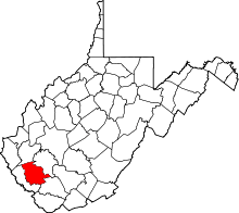
| County | Logan |
| Area[1] | |
| • Total | 0.830 sq mi (2.15 km2) |
| • Land | 0.802 sq mi (2.08 km2) |
| • Water | 0.028 sq mi (0.07 km2) |
| Elevation | 666 ft (203 m) |
| Population (2010)[2] | |
| • Total | 442 |
| • Density | 530/sq mi (210/km2) |
| Time zone | Eastern (EST) (UTC-5) |
| • Summer (DST) | EDT (UTC-4) |
| ZIP code | 25624 |
| Area code(s) | 304 & 681 |
| GNIS feature ID | 1540150[3] |
Henlawson is a census-designated place (CDP) in Logan County, West Virginia, United States. Henlawson is located on the east bank of the Guyandotte River across from Mitchell Heights. Henlawson has a post office with ZIP code 25624.[4] As of the 2010 census, its population was 442.[2]
References
- ↑ "US Gazetteer files: 2010, 2000, and 1990". United States Census Bureau. 2011-02-12. Retrieved 2011-04-23.
- 1 2 "American FactFinder". United States Census Bureau. Retrieved 2011-05-14.
- ↑ U.S. Geological Survey Geographic Names Information System: Henlawson, West Virginia
- ↑ ZIP Code Lookup
This article is issued from Wikipedia - version of the 9/4/2016. The text is available under the Creative Commons Attribution/Share Alike but additional terms may apply for the media files.