Mullens, West Virginia
| Mullens, West Virginia | |
|---|---|
| City | |
|
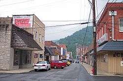
Howard Avenue in downtown Mullens in 2007 | |
 Location of Mullens, West Virginia | |
| Coordinates: 37°35′5″N 81°23′5″W / 37.58472°N 81.38472°WCoordinates: 37°35′5″N 81°23′5″W / 37.58472°N 81.38472°W | |
| Country | United States |
| State | West Virginia |
| County | Wyoming |
| Area[1] | |
| • Total | 1.85 sq mi (4.79 km2) |
| • Land | 1.80 sq mi (4.66 km2) |
| • Water | 0.05 sq mi (0.13 km2) |
| Elevation | 1,417 ft (432 m) |
| Population (2010)[2] | |
| • Total | 1,559 |
| • Estimate (2012[3]) | 1,532 |
| • Density | 866.1/sq mi (334.4/km2) |
| Time zone | Eastern (EST) (UTC-5) |
| • Summer (DST) | EDT (UTC-4) |
| ZIP code | 25882 |
| Area code(s) | 304 |
| FIPS code | 54-57148[4] |
| GNIS feature ID | 1543986[5] |
Mullens is a city in Wyoming County, West Virginia. The population was 1,559 at the 2010 census.
Located in a valley along the Guyandotte River within a mountainous region of southern West Virginia, the town was nearly destroyed by flash flooding in July 2001. While the town has attempted to redevelop with the aid of state and federal recovery money, many local businesses and residents have left the area permanently. Organizations like the Mullens-based Rural Appalachian Improvement League are working to improve conditions across the region. Mullens is also the hometown of former Los Angeles Lakers head coach Mike D'Antoni.
History


Mullens was incorporated as a town on September 17, 1912 and operated under a charter issued by the Circuit Court of Wyoming County. It was named for A. J. Mullins, who owned the land upon which the town is built. The town's original name was spelled with an "i"; a recording error accounts for the error in spelling, which was never corrected.[6] An Act of the West Virginia Legislature granting a charter to the City of Mullens was passed February 22, 1929.
The early growth of the Mullens community came with development of the lumber and coal mining industries. In the early 20th century, coal-mining manager and developer William Nelson Page of Ansted helped open the Winding Gulf Coalfield with plans for the Deepwater Railway, a new short-line railroad. When Page ran into competitive collusion by the bigger railroads which would have wrecked his project, backed by his silent partner, wealthy industrialist Henry Huttleston Rogers, the plan was expanded in a secretive and massive way to build a line all the way east to the port of Hampton Roads.
Completed in 1909, the Virginian Railway (VGN) established engine terminal and yard facilities near Mullens which employed hundreds of workers during the first half of the 20th century. The VGN was merged with the Norfolk and Western Railway (N&W) in 1959, and both later became part of the Norfolk Southern Railway (NS). A caboose museum in Mullens celebrates the history of the railroad in the region.
The Mullens Historic District was listed on the National Register of Historic Places in 1993.[7] The nearby Wyco Church was listed in 2010.[8]
Geography
Mullens is located at 37°35′5″N 81°23′5″W / 37.58472°N 81.38472°W (37.584678, -81.384736),[9] at the confluence of the Guyandotte River and the Slab Fork.[10]
According to the United States Census Bureau, the city has a total area of 1.85 square miles (4.79 km2), of which, 1.80 square miles (4.66 km2) is land and 0.05 square miles (0.13 km2) is water.[1]
Climate
The climate in this area has mild differences between highs and lows, and there is adequate rainfall year round. According to the Köppen Climate Classification system, Mullens has a marine west coast climate, abbreviated "Cfb" on climate maps.[11]
Demographics
| Historical population | |||
|---|---|---|---|
| Census | Pop. | %± | |
| 1920 | 1,425 | — | |
| 1930 | 2,356 | 65.3% | |
| 1940 | 3,026 | 28.4% | |
| 1950 | 3,470 | 14.7% | |
| 1960 | 3,544 | 2.1% | |
| 1970 | 2,967 | −16.3% | |
| 1980 | 2,919 | −1.6% | |
| 1990 | 2,006 | −31.3% | |
| 2000 | 1,769 | −11.8% | |
| 2010 | 1,559 | −11.9% | |
| Est. 2015 | 1,464 | [12] | −6.1% |
2010 census
As of the census[2] of 2010, there were 1,559 people, 682 households, and 409 families residing in the city. The population density was 866.1 inhabitants per square mile (334.4/km2). There were 837 housing units at an average density of 465.0 per square mile (179.5/km2). The racial makeup of the city was 96.5% White, 2.2% African American, 0.1% Native American, 0.2% from other races, and 1.0% from two or more races. Hispanic or Latino of any race were 0.1% of the population.
There were 682 households of which 27.7% had children under the age of 18 living with them, 45.0% were married couples living together, 9.4% had a female householder with no husband present, 5.6% had a male householder with no wife present, and 40.0% were non-families. 36.4% of all households were made up of individuals and 18% had someone living alone who was 65 years of age or older. The average household size was 2.29 and the average family size was 3.01.
The median age in the city was 41.7 years. 22.5% of residents were under the age of 18; 7.8% were between the ages of 18 and 24; 24.1% were from 25 to 44; 27.5% were from 45 to 64; and 18.2% were 65 years of age or older. The gender makeup of the city was 48.8% male and 51.2% female.
2000 census
As of the census of 2000, there were 1,769 people, 771 households, and 502 families residing in the city.[4] The population density was 927.5 people per square mile (357.6/km²). There were 904 housing units at an average density of 474.0 per square mile (182.7/km²). The racial makeup of the city was 95.03% White, 3.45% African American, 0.06% Native American, 0.51% Asian, and 0.96% from two or more races. Hispanic or Latino of any race were 0.17% of the population.
There were 771 households out of which 25.7% had children under the age of 18 living with them, 51.9% were married couples living together, 9.6% had a female householder with no husband present, and 34.8% were non-families. 32.6% of all households were made up of individuals and 19.6% had someone living alone who was 65 years of age or older. The average household size was 2.24 and the average family size was 2.83.
In the city the population was spread out with 20.0% under the age of 18, 8.4% from 18 to 24, 24.4% from 25 to 44, 25.2% from 45 to 64, and 22.0% who were 65 years of age or older. The median age was 43 years. For every 100 females there were 97.0 males. For every 100 females age 18 and over, there were 89.6 males.
The median income for a household in the city was $27,742, and the median income for a family was $37,438. Males had a median income of $32,197 versus $20,917 for females. The per capita income for the city was $17,314. About 11.9% of families and 15.4% of the population were below the poverty line, including 22.5% of those under age 18 and 9.4% of those age 65 or over.
Transportation
Highways
Notable people
- Jerome Anderson, basketball player and coach
- Christy Martin, professional female boxer, was named the best woman boxer in the world by the World Boxing Council in 1996.
- Rick Tolley, Marshall head football coach, who lost his life on November 14, 1970 along with the entire football team, coaches and fans in a devastating plane crash.
- Mike D'Antoni (born May 8, 1951 in Mullens, West Virginia) is a former basketball player and a former head coach of the NBA's New York Knicks, Phoenix Suns, & Denver Nuggets and former head coach of the Los Angeles Lakers.[14]
- Dan D'Antoni, older brother of Mike D'Antoni and current head men's basketball coach at Marshall University.
- "Hillbilly" Bart Houck, hiker, was the first person to hike the entire Great Eastern Trail, a long-distance path from Alabama to New York [15]
References
- 1 2 "US Gazetteer files 2010". United States Census Bureau. Retrieved 2013-01-24.
- 1 2 "American FactFinder". United States Census Bureau. Retrieved 2013-01-24.
- ↑ "Population Estimates". United States Census Bureau. Retrieved 2013-06-26.
- 1 2 "American FactFinder". United States Census Bureau. Retrieved 2008-01-31.
- ↑ "US Board on Geographic Names". United States Geological Survey. 2007-10-25. Retrieved 2008-01-31.
- ↑ Lewis, Lloyd D. (Aug 14, 1967). "Colorful names are found in listing of West Virginia towns". The Bryan Times. p. 5. Retrieved 6 October 2015.
- ↑ National Park Service (2009-03-13). "National Register Information System". National Register of Historic Places. National Park Service.
- ↑ "National Register of Historic Places Listings". Weekly List of Actions Taken on Properties: 3/29/10 through 4/02/10. National Park Service. 2010-04-09.
- ↑ "US Gazetteer files: 2010, 2000, and 1990". United States Census Bureau. 2011-02-12. Retrieved 2011-04-23.
- ↑ West Virginia Atlas & Gazetteer. Yarmouth, Me.: DeLorme. 1997. p. 58. ISBN 0-89933-246-3.
- ↑ Climate Summary for Mullens, West Virginia
- ↑ "Annual Estimates of the Resident Population for Incorporated Places: April 1, 2010 to July 1, 2015". Retrieved July 2, 2016.
- ↑ "Census of Population and Housing". Census.gov. Retrieved June 4, 2015.
- ↑ Beck, Howard (2008-05-11). "D'Antoni Accepts Offer to Coach Knicks". The New York Times. Retrieved 2009-05-24.
- ↑ Daddio, Jess (2013-08-01). "The Great Eastern Trail:The New A.T.". Blue Ridge Outdoors Magazine. Retrieved 2014-05-28.
External links
Municipalities and communities of Wyoming County, West Virginia, United States | ||
|---|---|---|
| City | 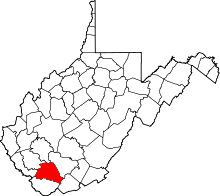 | |
| Towns | ||
| CDPs | ||
| Unincorporated communities |
| |
| Footnotes | ‡This populated place also has portions in an adjacent county or counties | |