Pine Grove, West Virginia
| Pine Grove | |
|---|---|
| Town | |
 Pine Grove Location within the state of West Virginia | |
| Coordinates: 39°33′44″N 80°40′52″W / 39.56222°N 80.68111°WCoordinates: 39°33′44″N 80°40′52″W / 39.56222°N 80.68111°W | |
| Country | United States |
| State | West Virginia |
| County | Wetzel |
| Area[1] | |
| • Total | 0.38 sq mi (0.98 km2) |
| • Land | 0.35 sq mi (0.91 km2) |
| • Water | 0.03 sq mi (0.08 km2) |
| Population (2010)[2] | |
| • Total | 552 |
| • Estimate (2012[3]) | 544 |
| • Density | 1,577.1/sq mi (608.9/km2) |
| Time zone | Eastern (EST) (UTC-5) |
| • Summer (DST) | EDT (UTC-4) |
Pine Grove is a town in Wetzel County, West Virginia, United States. The population was 552 at the 2010 census. It was so named because it was settled in a large pine thicket.
The town is one mile north of Dominion Energy's large Hastings Extraction Station, which separates natural gas into various subproducts such as butane. The Hastings plant is unique in that there are traffic signals approximately 0.75-mile away from the plant in either direction to stop traffic in case of an emergency.
The community was named for a grove of pine trees near the original town site.[4]
Pine Grove is also home to Valley High School.
Geography
Pine Grove is located at 39°33′44″N 80°40′52″W / 39.56222°N 80.68111°W (39.562255, -80.681154).[5]
According to the United States Census Bureau, the town has a total area of 0.38 square miles (0.98 km2), of which, 0.35 square miles (0.91 km2) is land and 0.03 square miles (0.08 km2) is water.[1]
Demographics
| Historical population | |||
|---|---|---|---|
| Census | Pop. | %± | |
| 1910 | 474 | — | |
| 1920 | 797 | 68.1% | |
| 1930 | 820 | 2.9% | |
| 1940 | 841 | 2.6% | |
| 1950 | 877 | 4.3% | |
| 1960 | 760 | −13.3% | |
| 1970 | 630 | −17.1% | |
| 1980 | 767 | 21.7% | |
| 1990 | 701 | −8.6% | |
| 2000 | 571 | −18.5% | |
| 2010 | 552 | −3.3% | |
| Est. 2015 | 520 | [6] | −5.8% |
2010 census
As of the census[2] of 2010, there were 552 people, 223 households, and 152 families residing in the town. The population density was 1,577.1 inhabitants per square mile (608.9/km2). There were 245 housing units at an average density of 700.0 per square mile (270.3/km2). The racial makeup of the town was 98.9% White, 0.2% Native American, 0.7% from other races, and 0.2% from two or more races. Hispanic or Latino of any race were 0.7% of the population.
There were 223 households of which 34.5% had children under the age of 18 living with them, 50.7% were married couples living together, 13.0% had a female householder with no husband present, 4.5% had a male householder with no wife present, and 31.8% were non-families. 27.4% of all households were made up of individuals and 12.5% had someone living alone who was 65 years of age or older. The average household size was 2.48 and the average family size was 2.98.
The median age in the town was 41.2 years. 23.4% of residents were under the age of 18; 10.2% were between the ages of 18 and 24; 23.1% were from 25 to 44; 31.5% were from 45 to 64; and 12% were 65 years of age or older. The gender makeup of the town was 49.1% male and 50.9% female.
2000 census
As of the census of 2000,[8] there were 571 people, 233 households, and 165 families residing in the town. The population density was 1,480.6 inhabitants per square mile (565.3/km²). There were 251 housing units at an average density of 650.8 per square mile (248.5/km²). The racial makeup of the town was 99.30% White, 0.18% Asian, and 0.53% from two or more races.
There were 233 households out of which 30.9% had children under the age of 18 living with them, 55.4% were married couples living together, 10.7% had a female householder with no husband present, and 28.8% were non-families. 24.9% of all households were made up of individuals and 12.9% had someone living alone who was 65 years of age or older. The average household size was 2.45 and the average family size was 2.90.
In the town the population was spread out with 25.0% under the age of 18, 8.8% from 18 to 24, 25.7% from 25 to 44, 25.0% from 45 to 64, and 15.4% who were 65 years of age or older. The median age was 39 years. For every 100 females there were 86.6 males. For every 100 females age 18 and over, there were 83.7 males.
The median income for a household in the town was $25,769, and the median income for a family was $30,227. Males had a median income of $36,250 versus $23,750 for females. The per capita income for the town was $13,699. About 19.5% of families and 22.6% of the population were below the poverty line, including 28.7% under the age of 18 and 4.4% ages 65 or older.
References
- 1 2 "US Gazetteer files 2010". United States Census Bureau. Archived from the original on January 24, 2012. Retrieved 2013-01-24.
- 1 2 "American FactFinder". United States Census Bureau. Retrieved 2013-01-24.
- ↑ "Population Estimates". United States Census Bureau. Archived from the original on June 17, 2013. Retrieved 2013-06-26.
- ↑ Kenny, Hamill (1945). West Virginia Place Names: Their Origin and Meaning, Including the Nomenclature of the Streams and Mountains. Piedmont, WV: The Place Name Press. p. 490.
- ↑ "US Gazetteer files: 2010, 2000, and 1990". United States Census Bureau. 2011-02-12. Retrieved 2011-04-23.
- ↑ "Annual Estimates of the Resident Population for Incorporated Places: April 1, 2010 to July 1, 2015". Retrieved July 2, 2016.
- ↑ "Census of Population and Housing". Census.gov. Archived from the original on May 11, 2015. Retrieved June 4, 2015.
- ↑ "American FactFinder". United States Census Bureau. Retrieved 2008-01-31.
Municipalities and communities of Wetzel County, West Virginia, United States | ||
|---|---|---|
| Cities | 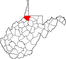 | |
| Towns | ||
| CDPs | ||
| Unincorporated communities |
| |
| Ghost towns | ||
| Footnotes | ‡This populated place also has portions in an adjacent county or counties | |