Blacksville, West Virginia
| Blacksville, West Virginia | |
|---|---|
| Town | |
|
The community's post office | |
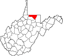
 Location of Blacksville, West Virginia | |
| Coordinates: 39°43′12″N 80°12′45″W / 39.72000°N 80.21250°WCoordinates: 39°43′12″N 80°12′45″W / 39.72000°N 80.21250°W | |
| Country | United States |
| State | West Virginia |
| County | Monongalia |
| Area[1] | |
| • Total | 0.31 sq mi (0.80 km2) |
| • Land | 0.30 sq mi (0.78 km2) |
| • Water | 0.01 sq mi (0.03 km2) |
| Elevation | 984 ft (300 m) |
| Population (2010)[2] | |
| • Total | 171 |
| • Estimate (2012[3]) | 177 |
| • Density | 570.0/sq mi (220.1/km2) |
| Time zone | Eastern (EST) (UTC-5) |
| • Summer (DST) | EDT (UTC-4) |
| ZIP code | 26521 |
| Area code(s) | 304 |
| FIPS code | 54-08092[4] |
| GNIS feature ID | 1553918[5] |

Blacksville is a town in Monongalia County, West Virginia, USA. The population was 171 at the 2010 census. It is included in the Morgantown, West Virginia Metropolitan Statistical Area.
Blacksville was founded in 1829 by David Black, and named for him.[6]
Geography
Blacksville is located at 39°43′12″N 80°12′45″W / 39.72000°N 80.21250°W (39.720036, -80.212562).[7]
According to the United States Census Bureau, the town has a total area of 0.31 square miles (0.80 km2), of which, 0.30 square miles (0.78 km2) is land and 0.01 square miles (0.03 km2) is water.[1]
Demographics
| Historical population | |||
|---|---|---|---|
| Census | Pop. | %± | |
| 1880 | 106 | — | |
| 1900 | 180 | — | |
| 1910 | 204 | 13.3% | |
| 1920 | 218 | 6.9% | |
| 1930 | 269 | 23.4% | |
| 1940 | 261 | −3.0% | |
| 1950 | 241 | −7.7% | |
| 1960 | 211 | −12.4% | |
| 1970 | 264 | 25.1% | |
| 1980 | 248 | −6.1% | |
| 1990 | 168 | −32.3% | |
| 2000 | 175 | 4.2% | |
| 2010 | 171 | −2.3% | |
| Est. 2015 | 182 | [8] | 6.4% |
2010 census
As of the census[2] of 2010, there were 171 people, 69 households, and 46 families residing in the town. The population density was 570.0 inhabitants per square mile (220.1/km2). There were 79 housing units at an average density of 263.3 per square mile (101.7/km2). The racial makeup of the town was 97.1% White and 2.9% from two or more races.
There were 69 households of which 30.4% had children under the age of 18 living with them, 44.9% were married couples living together, 14.5% had a female householder with no husband present, 7.2% had a male householder with no wife present, and 33.3% were non-families. 24.6% of all households were made up of individuals and 8.7% had someone living alone who was 65 years of age or older. The average household size was 2.48 and the average family size was 3.00.
The median age in the town was 35.2 years. 25.1% of residents were under the age of 18; 8.2% were between the ages of 18 and 24; 28.1% were from 25 to 44; 26.4% were from 45 to 64; and 12.3% were 65 years of age or older. The gender makeup of the town was 51.5% male and 48.5% female.
2000 census
As of the census[4] of 2000, there were 175 people, 69 households, and 50 families residing in the town. The population density was 576.2 inhabitants per square mile (225.2/km²). There were 84 housing units at an average density of 276.6 per square mile (108.1/km²). The racial makeup of the town was 100.00% White.
There were 69 households out of which 40.6% had children under the age of 18 living with them, 42.0% were married couples living together, 23.2% had a female householder with no husband present, and 27.5% were non-families. 23.2% of all households were made up of individuals and 14.5% had someone living alone who was 65 years of age or older. The average household size was 2.54 and the average family size was 2.98.
In the town the population was spread out with 30.9% under the age of 18, 9.1% from 18 to 24, 26.9% from 25 to 44, 18.9% from 45 to 64, and 14.3% who were 65 years of age or older. The median age was 34 years. For every 100 females there were 82.3 males. For every 100 females age 18 and over, there were 75.4 males.
The median income for a household in the town was $31,250, and the median income for a family was $36,875. Males had a median income of $29,167 versus $16,667 for females. The per capita income for the town was $13,461. About 12.5% of families and 17.0% of the population were below the poverty line, including 21.7% of those under the age of eighteen and 11.1% of those sixty five or over.
Blacksville pottery
During the mid 20th century, Blacksville was well known for its pottery, made by local residents using native clay. Edgar Richardson (b. Jollytown, PA 1903 - d. 1962) taught pottery at the local high school and his beautiful pieces, signed "E.R. - Blacksville," are still being auctioned. First Lady Eleanor Roosevelt visited Blacksville on June 28, 1938 to learn more about the "Blacksville pottery project."[10]
Notable people
- Shelia Eddy was born in Blacksville in 1995 and has been convicted of murdering Skylar Neese.
References
- 1 2 "US Gazetteer files 2010". United States Census Bureau. Archived from the original on 2012-01-24. Retrieved 2013-01-24.
- 1 2 "American FactFinder". United States Census Bureau. Retrieved 2013-01-24.
- ↑ "Population Estimates". United States Census Bureau. Archived from the original on 2013-06-17. Retrieved 2013-06-26.
- 1 2 "American FactFinder". United States Census Bureau. Archived from the original on 2013-09-11. Retrieved 2008-01-31.
- ↑ "US Board on Geographic Names". United States Geological Survey. 2007-10-25. Retrieved 2008-01-31.
- ↑ Kenny, Hamill (1945). West Virginia Place Names: Their Origin and Meaning, Including the Nomenclature of the Streams and Mountains. Piedmont, WV: The Place Name Press. p. 118.
- ↑ "US Gazetteer files: 2010, 2000, and 1990". United States Census Bureau. 2011-02-12. Retrieved 2011-04-23.
- ↑ "Annual Estimates of the Resident Population for Incorporated Places: April 1, 2010 to July 1, 2015". Retrieved July 2, 2016.
- ↑ "Census of Population and Housing". Census.gov. Archived from the original on May 11, 2015. Retrieved June 4, 2015.
- ↑ Roosevelt, Eleanor. "June 28, 1938". My Day. Retrieved 2014-07-26.