Hendricks, West Virginia
| Hendricks, West Virginia | |
|---|---|
| Town | |
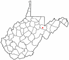 Location of Hendricks, West Virginia | |
| Coordinates: 39°4′30″N 79°37′53″W / 39.07500°N 79.63139°WCoordinates: 39°4′30″N 79°37′53″W / 39.07500°N 79.63139°W | |
| Country | United States |
| State | West Virginia |
| County | Tucker |
| Area[1] | |
| • Total | 0.34 sq mi (0.88 km2) |
| • Land | 0.34 sq mi (0.88 km2) |
| • Water | 0 sq mi (0 km2) |
| Elevation | 1,716 ft (523 m) |
| Population (2010)[2] | |
| • Total | 272 |
| • Estimate (2012[3]) | 263 |
| • Density | 800.0/sq mi (308.9/km2) |
| Time zone | Eastern (EST) (UTC-5) |
| • Summer (DST) | EDT (UTC-4) |
| ZIP code | 26271 |
| Area code(s) | 304 |
| FIPS code | 54-36460[4] |
| GNIS feature ID | 1554682[5] |
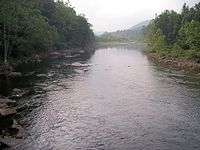
Hendricks is a town in Tucker County, West Virginia, USA. The population was 272 at the 2010 census. The Blackwater River and the Dry Fork join at Hendricks to form the Black Fork, a principal tributary of the Cheat River.[6]
History
In 1803, after three unproductive years in nearby Canaan Valley, German settler Henry Fansler (d. 1843) settled at the mouth of the Blackwater River at the present site of Hendricks. He called the settlement "Eden".[7] Hendricks was incorporated in 1894 and was named by local coal and timber magnate Henry Gassaway Davis for Vice President Thomas A. Hendricks.[8]
Geography
Hendricks is located at 39°4′30″N 79°37′53″W / 39.07500°N 79.63139°W (39.074883, -79.631399).[9]
According to the United States Census Bureau, the town has a total area of 0.34 square miles (0.88 km2), all of it land.[1]
Demographics
| Historical population | |||
|---|---|---|---|
| Census | Pop. | %± | |
| 1900 | 317 | — | |
| 1910 | 640 | 101.9% | |
| 1920 | 622 | −2.8% | |
| 1930 | 484 | −22.2% | |
| 1940 | 539 | 11.4% | |
| 1950 | 492 | −8.7% | |
| 1960 | 407 | −17.3% | |
| 1970 | 317 | −22.1% | |
| 1980 | 390 | 23.0% | |
| 1990 | 303 | −22.3% | |
| 2000 | 319 | 5.3% | |
| 2010 | 272 | −14.7% | |
| Est. 2015 | 266 | [10] | −2.2% |
2010 census
As of the census[2] of 2010, there were 272 people, 112 households, and 89 families residing in the town. The population density was 800.0 inhabitants per square mile (308.9/km2). There were 145 housing units at an average density of 426.5 per square mile (164.7/km2). The racial makeup of the town was 100.0% White.
There were 112 households of which 29.5% had children under the age of 18 living with them, 68.8% were married couples living together, 4.5% had a female householder with no husband present, 6.3% had a male householder with no wife present, and 20.5% were non-families. 17.9% of all households were made up of individuals and 11.7% had someone living alone who was 65 years of age or older. The average household size was 2.43 and the average family size was 2.72.
The median age in the town was 44.5 years. 18.4% of residents were under the age of 18; 7.7% were between the ages of 18 and 24; 24.6% were from 25 to 44; 30.9% were from 45 to 64; and 18.4% were 65 years of age or older. The gender makeup of the town was 48.9% male and 51.1% female.
2000 census
As of the census[4] of 2000, there were 319 people, 123 households, and 100 families residing in the town. The population density was 925.9 inhabitants per square mile (362.3/km²). There were 138 housing units at an average density of 400.5 per square mile (156.7/km²). The racial makeup of the town was 99.06% White, 0.31% Native American, 0.31% from other races, and 0.31% from two or more races. Hispanic or Latino of any race were 0.31% of the population.
There were 123 households out of which 34.1% had children under the age of 18 living with them, 71.5% were married couples living together, 7.3% had a female householder with no husband present, and 17.9% were non-families. 17.9% of all households were made up of individuals and 11.4% had someone living alone who was 65 years of age or older. The average household size was 2.59 and the average family size was 2.85.
In the town the population was spread out with 23.8% under the age of 18, 9.7% from 18 to 24, 20.7% from 25 to 44, 29.5% from 45 to 64, and 16.3% who were 65 years of age or older. The median age was 42 years. For every 100 females there were 100.6 males. For every 100 females age 18 and over, there were 102.5 males.
The median income for a household in the town was $26,705, and the median income for a family was $27,500. Males had a median income of $26,042 versus $17,500 for females. The per capita income for the town was $21,315. About 25.5% of families and 23.3% of the population were below the poverty line, including 33.3% of those under age 18 and 21.3% of those age 65 or over.
References
- 1 2 "US Gazetteer files 2010". United States Census Bureau. Retrieved 2013-01-24.
- 1 2 "American FactFinder". United States Census Bureau. Retrieved 2013-01-24.
- ↑ "Population Estimates". United States Census Bureau. Retrieved 2013-06-26.
- 1 2 "American FactFinder". United States Census Bureau. Retrieved 2008-01-31.
- ↑ "US Board on Geographic Names". United States Geological Survey. 2007-10-25. Retrieved 2008-01-31.
- ↑ DeLorme (1997). West Virginia Atlas & Gazetteer. Yarmouth, Maine: DeLorme. ISBN 0-89933-246-3.
- ↑ Fansler, Homer Floyd (1962), History of Tucker County, West Virginia, Parsons, West Virginia: McClain Printing Company, pg 594.
- ↑ West Virginia Blue Book. Published annually by the Clerk's Office of the West Virginia Senate.
- ↑ "US Gazetteer files: 2010, 2000, and 1990". United States Census Bureau. 2011-02-12. Retrieved 2011-04-23.
- ↑ "Annual Estimates of the Resident Population for Incorporated Places: April 1, 2010 to July 1, 2015". Retrieved July 2, 2016.
- ↑ "Census of Population and Housing". Census.gov. Retrieved June 4, 2015.
Municipalities and communities of Tucker County, West Virginia, United States | ||
|---|---|---|
| Cities | 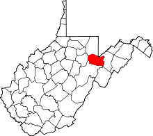 | |
| Towns | ||
| Unincorporated communities | ||
| Ghost towns | ||