Montgomery, West Virginia
| City of Montgomery | |
|---|---|
| City | |
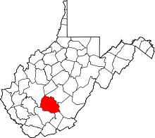
 Location in Kanawha County and state of West Virginia. | |
| Coordinates: 38°10′48″N 81°19′36″W / 38.18000°N 81.32667°WCoordinates: 38°10′48″N 81°19′36″W / 38.18000°N 81.32667°W | |
| Country |
|
| State |
|
| Counties | Fayette, Kanawha |
| Government | |
| • Mayor | Greg Ingram, elected June 14, 2016 |
| Area[1] | |
| • Total | 1.59 sq mi (4.12 km2) |
| • Land | 1.57 sq mi (4.07 km2) |
| • Water | 0.02 sq mi (0.05 km2) |
| Elevation | 636 ft (194 m) |
| Population (2010)[2] | |
| • Total | 1,638 |
| • Estimate (2012[3]) | 1,630 |
| • Density | 1,043.3/sq mi (402.8/km2) |
| Time zone | Eastern (EST) (UTC-5) |
| • Summer (DST) | EDT (UTC-4) |
| ZIP code | 25136 |
| Area code(s) | 304 |
| FIPS code | 54-55468[4] |
| GNIS feature ID | 1555154[5] |
Montgomery is a city in West Virginia, along the Kanawha River. Most of the city is in Fayette County, with the remainder in Kanawha County. The population was 1,638 at the 2010 census.
From 1876 to 1890, the town was called Coal Valley Post Office. The name then changed to Montgomery's Landing and then Coal Valley. In 1890 it was again renamed, as Cannelton. It was incorporated April 1, 1891 and the named Montgomery was settled upon, for James C. Montgomery,[6] one of the city's first settlers.
Late 19th c.growth was due to the construction of the Kanawha & Michigan Railroad across the river and the connection of the Virginian Railway at nearby Deepwater. In the early 1910s Montgomery was the shipping center for 26 different coal operations and the largest town in Fayette County at the time.[7]
Montgomery is the home of West Virginia University Institute of Technology, popularly called WVU Tech, which has been proposed to shut down after the Fall 2017 semester. The city is also home to BridgeValley Community and Technical College – Montgomery Campus.
The novel "Goodbye Miss 4th of July", written by Christopher Janus, is a biographical story of his Greek family's struggles while growing up in Montgomery. In 1988, a film version of "Goodbye Miss 4th of July" was produced by the Disney Channel.
Geography
Montgomery is located at 38°10′48″N 81°19′36″W / 38.18000°N 81.32667°W (38.179918, -81.326722).[8]
According to the United States Census Bureau, the city has a total area of 1.59 square miles (4.12 km2), of which 1.57 square miles (4.07 km2) is land and 0.02 square miles (0.05 km2) is water.[1]
Demographics
| Historical population | |||
|---|---|---|---|
| Census | Pop. | %± | |
| 1900 | 1,594 | — | |
| 1910 | 1,886 | 18.3% | |
| 1920 | 2,130 | 12.9% | |
| 1930 | 2,906 | 36.4% | |
| 1940 | 3,231 | 11.2% | |
| 1950 | 3,484 | 7.8% | |
| 1960 | 3,000 | −13.9% | |
| 1970 | 2,525 | −15.8% | |
| 1980 | 3,104 | 22.9% | |
| 1990 | 2,449 | −21.1% | |
| 2000 | 1,942 | −20.7% | |
| 2010 | 1,638 | −15.7% | |
| Est. 2015 | 1,596 | [9] | −2.6% |
2010 census
As of the census[2] of 2010, there were 1,638 people, 645 households, and 302 families residing in the city. The population density was 1,043.3 inhabitants per square mile (402.8/km2). There were 838 housing units at an average density of 533.8 per square mile (206.1/km2). The racial makeup of the city was 78.3% White, 17.4% African American, 0.5% Asian, 0.1% Pacific Islander, 0.9% from other races, and 2.8% from two or more races. Hispanic or Latino of any race were 1.8% of the population.
There were 645 households of which 20.2% had children under the age of 18 living with them, 26.0% were married couples living together, 16.1% had a female householder with no husband present, 4.7% had a male householder with no wife present, and 53.2% were non-families. 43.7% of all households were made up of individuals and 17.2% had someone living alone who was 65 years of age or older. The average household size was 1.97 and the average family size was 2.71.
The median age in the city was 30.1 years. 12.8% of residents were under the age of 18; 31.5% were between the ages of 18 and 24; 17.2% were from 25 to 44; 22.5% were from 45 to 64; and 16.1% were 65 years of age or older. The gender makeup of the city was 53.3% male and 46.7% female.
2000 census
As of the census[4] of 2000, there were 1,942 people, 725 households, and 326 families residing in the city. The population density was 1,237.5 people per square mile (477.6/km²). There were 869 housing units at an average density of 553.7 per square mile (213.7/km²). The racial makeup of the city was 76.47% White, 17.40% African American, 0.31% Native American, 3.76% Asian, 0.10% Pacific Islander, 0.46% from other races, and 1.49% from two or more races. Hispanics or Latinos of any race were 0.62% of the population.
There were 725 households out of which 17.9% had children under the age of 18 living with them, 28.6% were married couples living together, 13.7% had a female householder with no husband present, and 54.9% were non-families. 42.2% of all households were made up of individuals and 17.8% had someone living alone who was 65 years of age or older. The average household size was 2.03 and the average family size was 2.80.
The age distribution, which is strongly influenced by the presence of WVU Tech, is: 13.2% under the age of 18, 33.0% from 18 to 24, 17.9% from 25 to 44, 17.0% from 45 to 64, and 18.8% who were 65 years of age or older. The median age was 28 years. For every 100 females there were 107.9 males. For every 100 females age 18 and over, there were 111.3 males.
The median income for a household in the city was $20,606, and the median income for a family was $32,000. Males had a median income of $27,794 versus $25,139 for females. The per capita income for the city was $12,663. About 25.7% of families and 37.1% of the population were below the poverty line, including 50.4% of those under age 18 and 13.7% of those age 65 or over.
Rail transportation
The Chesapeake & Ohio Railway used to stop in Montgomery all the way up until 1890. Amtrak, the national passenger rail service, provides service to Montgomery from the Cardinal route. CSX transportation's Kanawha Subdivision also services Montgomery.[11]
References
- 1 2 "US Gazetteer files 2010". United States Census Bureau. Retrieved 2013-01-24.
- 1 2 "American FactFinder". United States Census Bureau. Retrieved 2013-01-24.
- ↑ "Population Estimates". United States Census Bureau. Retrieved 2013-06-26.
- 1 2 "American FactFinder". United States Census Bureau. Retrieved 2008-01-31.
- ↑ "US Board on Geographic Names". United States Geological Survey. 2007-10-25. Retrieved 2008-01-31.
- ↑ Kenny, Hamill (1945). West Virginia Place Names: Their Origin and Meaning, Including the Nomenclature of the Streams and Mountains. Piedmont, WV: The Place Name Press. p. 427.
- ↑ "Montgomery, West Virginia". WVExp.com. June 17, 2012. p. 1. Retrieved 2/4/13. Check date values in:
|access-date=(help) - ↑ "US Gazetteer files: 2010, 2000, and 1990". United States Census Bureau. 2011-02-12. Retrieved 2011-04-23.
- ↑ "Annual Estimates of the Resident Population for Incorporated Places: April 1, 2010 to July 1, 2015". Retrieved July 2, 2016.
- ↑ "Census of Population and Housing". Census.gov. Retrieved June 4, 2015.
- ↑ "Montgomery, West Virginia". WVExp.com. Retrieved 2/4/13. Check date values in:
|access-date=(help)