Thomas, West Virginia
| Thomas, West Virginia | |
|---|---|
| City | |
|
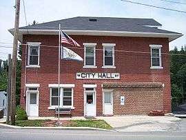
East Avenue in Thomas in 2006 | |
 Location of Thomas, West Virginia | |
| Coordinates: 39°8′53″N 79°29′50″W / 39.14806°N 79.49722°WCoordinates: 39°8′53″N 79°29′50″W / 39.14806°N 79.49722°W | |
| Country | United States |
| State | West Virginia |
| County | Tucker |
| Area[1] | |
| • Total | 4.51 sq mi (11.68 km2) |
| • Land | 4.46 sq mi (11.55 km2) |
| • Water | 0.05 sq mi (0.13 km2) |
| Elevation | 3,035 ft (925 m) |
| Population (2010)[2] | |
| • Total | 586 |
| • Estimate (2012[3]) | 567 |
| • Density | 131.4/sq mi (50.7/km2) |
| Time zone | Eastern (EST) (UTC-5) |
| • Summer (DST) | EDT (UTC-4) |
| ZIP code | 26292 |
| Area code(s) | 304 |
| FIPS code | 54-80020[4] |
| GNIS feature ID | 1555802[5] |


Thomas is a very small city and former coal town in Tucker County, West Virginia, United States. The population was 586 at the 2010 census.
History
Thomas was platted in 1884.[10] Thomas was named for Thomas Beall Davis (1828-1911), brother of Senator Henry Gassaway Davis.[11] The Davis brothers, in 1883, opened a mine near Thomas and had coal ready to ship when their railway arrived a year later. By 1892, Davis Coal and Coke was among the largest and best known coal companies in the world and employed 1,600 people. At the peak of its operations in 1915, there were nine producing mines within a mile of the company's office in Thomas.
Immigrants flocked to the area as miners, railroad laborers, or merchants. The Company employed a man named Wladyslaw Dackiewicz as an interpreter. He could speak, read, and write eight languages and his services were much in demand with the influx of immigrants.
In 1901, in less than two hours, nearly half of Thomas (83 buildings) was destroyed by a fire. The town was quickly rebuilt with fine hotels and a new opera house. The Cottrill Opera House had a saloon on the first floor which was by far the most elegant of the eight bars located on Front Street. In 1909, Front Street (also known as First Street, Main Street, and East Avenue) was laid with brick to become the first paved street in the county.
Thomas claimed the grandest railway station between Cumberland, Maryland, and Elkins, West Virginia. Built of brick in 1901. It was destroyed by a tornado in 1944.
In 1921, coke production ceased and mining operations have diminished.
The Cottrill Opera House, Davis Coal and Coke Company Administrative Building, Fairfax Stone, and Thomas Commercial Historic District are listed on the National Register of Historic Places.[12][13]
Geography
Thomas is located at 39°8′53″N 79°29′50″W / 39.14806°N 79.49722°W (39.148077, -79.497174),[14] along the North Fork of the Blackwater River.[15]
According to the United States Census Bureau, the city has a total area of 4.51 square miles (11.68 km2), of which, 4.46 square miles (11.55 km2) is land and 0.05 square miles (0.13 km2) is water.[1]
Climate
The climate in this area has mild differences between highs and lows, and there is adequate rainfall year round. According to the Köppen Climate Classification system, Thomas has a marine west coast climate, abbreviated "Cfb" on climate maps.[16]
Demographics
| Historical population | |||
|---|---|---|---|
| Census | Pop. | %± | |
| 1890 | 269 | — | |
| 1900 | 2,126 | 690.3% | |
| 1910 | 2,354 | 10.7% | |
| 1920 | 2,099 | −10.8% | |
| 1930 | 1,660 | −20.9% | |
| 1940 | 1,449 | −12.7% | |
| 1950 | 1,146 | −20.9% | |
| 1960 | 830 | −27.6% | |
| 1970 | 713 | −14.1% | |
| 1980 | 747 | 4.8% | |
| 1990 | 573 | −23.3% | |
| 2000 | 452 | −21.1% | |
| 2010 | 586 | 29.6% | |
| Est. 2015 | 565 | [17] | −3.6% |
2010 census
As of the census[2] of 2010, there were 586 people, 253 households, and 130 families residing in the city. The population density was 131.4 inhabitants per square mile (50.7/km2). There were 345 housing units at an average density of 77.4 per square mile (29.9/km2). The racial makeup of the city was 99.5% White, 0.2% Native American, and 0.3% from two or more races. Hispanic or Latino of any race were 0.3% of the population.
There were 253 households of which 17.4% had children under the age of 18 living with them, 37.2% were married couples living together, 7.9% had a female householder with no husband present, 6.3% had a male householder with no wife present, and 48.6% were non-families. 42.3% of all households were made up of individuals and 22.1% had someone living alone who was 65 years of age or older. The average household size was 1.95 and the average family size was 2.62.
The median age in the city was 56.6 years. 11.3% of residents were under the age of 18; 5.4% were between the ages of 18 and 24; 19.2% were from 25 to 44; 28.8% were from 45 to 64; and 35.2% were 65 years of age or older. The gender makeup of the city was 46.8% male and 53.2% female.
2000 census
As of the census[4] of 2000, there were 452 people, 224 households, and 127 families residing in the city. The population density was 753.6 people per square mile (290.9/km²). There were 280 housing units at an average density of 466.8 per square mile (180.2/km²). The racial makeup of the city was 98.67% White, and 1.33% from two or more races.
There were 224 households out of which 16.5% had children under the age of 18 living with them, 46.0% were married couples living together, 7.6% had a female householder with no husband present, and 42.9% were non-families. 39.7% of all households were made up of individuals and 23.7% had someone living alone who was 65 years of age or older. The average household size was 2.02 and the average family size was 2.69.
In the city the population was spread out with 15.0% under the age of 18, 5.5% from 18 to 24, 24.1% from 25 to 44, 33.8% from 45 to 64, and 21.5% who were 65 years of age or older. The median age was 48 years. For every 100 females there were 85.2 males. For every 100 females age 18 and over, there were 87.3 males.
The median income for a household in the city was $22,443, and the median income for a family was $25,417. Males had a median income of $27,188 versus $14,886 for females. The per capita income for the city was $14,918. About 13.8% of families and 13.7% of the population were below the poverty line, including 19.1% of those under age 18 and 11.5% of those age 65 or over.
References
- 1 2 "US Gazetteer files 2010". United States Census Bureau. Retrieved 2013-01-24.
- 1 2 "American FactFinder". United States Census Bureau. Retrieved 2013-01-24.
- ↑ "Population Estimates". United States Census Bureau. Retrieved 2013-06-26.
- 1 2 "American FactFinder". United States Census Bureau. Retrieved 2008-01-31.
- ↑ "US Board on Geographic Names". United States Geological Survey. 2007-10-25. Retrieved 2008-01-31.
- ↑ Nutter, T (1906). Thomas, West Virginia : History, Progress and Development. McClain Printing Company.
- ↑ Nutter, T (1906). Thomas, West Virginia : History, Progress and Development. McClain Printing Company.
- ↑ Nutter, T (1906). Thomas, West Virginia : History, Progress and Development. McClain Printing Company.
- ↑ Nutter, T (1906). Thomas, West Virginia : History, Progress and Development. McClain Printing Company.
- ↑ Capace, Nancy (1999). Encyclopedia of West Virginia. North American Book Dist LLC. p. 194. ISBN 978-0-403-09843-9.
- ↑ Kenny, Hamill (1945). West Virginia Place Names: Their Origin and Meaning, Including the Nomenclature of the Streams and Mountains. Piedmont, West Virginia: The Place Name Press. p. 624.
- ↑ National Park Service (2009-03-13). "National Register Information System". National Register of Historic Places. National Park Service.
- ↑ "National Register of Historic Places Listings". Weekly List of Actions Taken on Properties: 10/03/11 through 10/07/11. National Park Service. 2012-11-14.
- ↑ "US Gazetteer files: 2010, 2000, and 1990". United States Census Bureau. 2011-02-12. Retrieved 2011-04-23.
- ↑ DeLorme (1997). West Virginia Atlas & Gazetteer. Yarmouth, Maine: DeLorme. ISBN 0-89933-246-3.
- ↑ Climate Summary for Thomas, West Virginia
- ↑ "Annual Estimates of the Resident Population for Incorporated Places: April 1, 2010 to July 1, 2015". Retrieved July 2, 2016.
- ↑ "Census of Population and Housing". Census.gov. Retrieved June 4, 2015.
External links
| Wikimedia Commons has media related to Thomas, West Virginia. |
- Traveling 219: Thomas, WV
- Historic Thomas, West Virginia
- The West Virginia Cyclopedia: Thomas, WV
- Thomas, West Virginia: History, Progress, and Development
Municipalities and communities of Tucker County, West Virginia, United States | ||
|---|---|---|
| Cities | 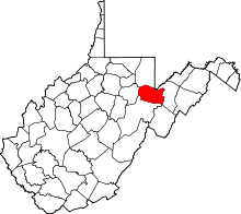 | |
| Towns | ||
| Unincorporated communities | ||
| Ghost towns | ||