Masontown, West Virginia
| Masontown, West Virginia | |
|---|---|
| Town | |
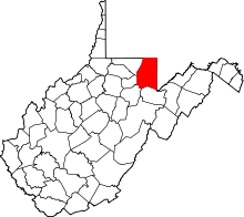
 Location in Preston County and the state of West Virginia. | |
| Coordinates: 39°33′7″N 79°48′1″W / 39.55194°N 79.80028°WCoordinates: 39°33′7″N 79°48′1″W / 39.55194°N 79.80028°W | |
| Country | United States |
| State | West Virginia |
| County | Preston |
| Area[1] | |
| • Total | 0.28 sq mi (0.73 km2) |
| • Land | 0.28 sq mi (0.73 km2) |
| • Water | 0 sq mi (0 km2) |
| Elevation | 1,801 ft (549 m) |
| Population (2010)[2] | |
| • Total | 546 |
| • Estimate (2012[3]) | 549 |
| • Density | 1,950.0/sq mi (752.9/km2) |
| Time zone | Eastern (EST) (UTC-5) |
| • Summer (DST) | EDT (UTC-4) |
| ZIP code | 26542 |
| Area code(s) | 304 |
| FIPS code | 54-52228[4] |
| GNIS feature ID | 1555063[5] |
Masontown is a town in Preston County, West Virginia, United States. The population was 546 at the 2010 census.
History
Masontown was laid out and platted in 1856.[6] The town was named after William Mason, a pioneer merchant.[7]
Located near Masontown is the Ralphsynder Decagonal Barn, listed on the National Register of Historic Places in 1985.[8]
Geography
Masontown is located at 39°33′7″N 79°48′1″W / 39.55194°N 79.80028°W (39.551821, -79.800156).[9] It has also been host to the All Good Music Festival for the past few years.
According to the United States Census Bureau, the town has a total area of 0.28 square miles (0.73 km2), all of it land.[1]
Demographics
| Historical population | |||
|---|---|---|---|
| Census | Pop. | %± | |
| 1910 | 520 | — | |
| 1920 | 831 | 59.8% | |
| 1930 | 924 | 11.2% | |
| 1940 | 869 | −6.0% | |
| 1950 | 941 | 8.3% | |
| 1960 | 841 | −10.6% | |
| 1970 | 868 | 3.2% | |
| 1980 | 1,052 | 21.2% | |
| 1990 | 737 | −29.9% | |
| 2000 | 647 | −12.2% | |
| 2010 | 546 | −15.6% | |
| Est. 2015 | 546 | [10] | 0.0% |
2010 census
As of the census[2] of 2010, there were 546 people, 255 households, and 149 families residing in the town. The population density was 1,950.0 inhabitants per square mile (752.9/km2). There were 311 housing units at an average density of 1,110.7 per square mile (428.8/km2). The racial makeup of the town was 98.5% White, 0.5% Pacific Islander, and 0.9% from two or more races. Hispanic or Latino of any race were 0.4% of the population.
There were 255 households of which 21.6% had children under the age of 18 living with them, 43.1% were married couples living together, 9.4% had a female householder with no husband present, 5.9% had a male householder with no wife present, and 41.6% were non-families. 34.5% of all households were made up of individuals and 12.1% had someone living alone who was 65 years of age or older. The average household size was 2.14 and the average family size was 2.70.
The median age in the town was 42.5 years. 17.6% of residents were under the age of 18; 6.2% were between the ages of 18 and 24; 30.3% were from 25 to 44; 27% were from 45 to 64; and 19% were 65 years of age or older. The gender makeup of the town was 48.7% male and 51.3% female.
2000 census
As of the census[4] of 2000, there were 647 people, 280 households, and 180 families residing in the town. The population density was 2,299.2 inhabitants per square mile (892.2/km²). There were 339 housing units at an average density of 1,204.7 per square mile (467.5/km²). The racial makeup of the town was 99.07% White, 0.15% African American, and 0.77% from two or more races. Hispanic or Latino of any race were 2.32% of the population.
There were 280 households out of which 23.6% had children under the age of 18 living with them, 50.7% were married couples living together, 9.6% had a female householder with no husband present, and 35.4% were non-families. 30.7% of all households were made up of individuals and 18.9% had someone living alone who was 65 years of age or older. The average household size was 2.31 and the average family size was 2.83.
In the town the population was spread out with 20.6% under the age of 18, 8.0% from 18 to 24, 27.5% from 25 to 44, 23.2% from 45 to 64, and 20.7% who were 65 years of age or older. The median age was 42 years. For every 100 females there were 88.1 males. For every 100 females age 18 and over, there were 91.1 males.
The median income for a household in the town was $22,750, and the median income for a family was $29,886. Males had a median income of $24,219 versus $21,250 for females. The per capita income for the town was $12,927. About 17.0% of families and 20.9% of the population were below the poverty line, including 40.2% of those under age 18 and 9.0% of those age 65 or over.
Education
West Preston Middle School is a small middle school located in Masontown, West Virginia, and consists of two main buildings. As of 2012, the school is 95 years old. The current principal is James Hoit. In 2015, a new middle school will be built, as the levy held in 2010 gave permission to go ahead. The school was founded in 1918, by citizens of Masontown selling pies. This school was built as Masontown High School and later consolidated with Arthurdale High School to become Valley High School, and consisted of the main building with three stories. Later, the second building was built. This was at first an elementary school, but later was combined with West Preston School to form one big high school. Later, after the construction of Preston High School, it was made into a middle school.[12]
References
- 1 2 "US Gazetteer files 2010". United States Census Bureau. Retrieved 2013-01-24.
- 1 2 "American FactFinder". United States Census Bureau. Retrieved 2013-01-24.
- ↑ "Population Estimates". United States Census Bureau. Retrieved 2013-06-26.
- 1 2 "American FactFinder". United States Census Bureau. Retrieved 2008-01-31.
- ↑ "US Board on Geographic Names". United States Geological Survey. 2007-10-25. Retrieved 2008-01-31.
- ↑ Morton, Oren Frederic; Cole, J. R. (1914). A History of Preston County, West Virginia. Journal Publishing Company. p. 273.
- ↑ Kenny, Hamill (1945). West Virginia Place Names: Their Origin and Meaning, Including the Nomenclature of the Streams and Mountains. Piedmont, WV: The Place Name Press. p. 405.
- ↑ National Park Service (2010-07-09). "National Register Information System". National Register of Historic Places. National Park Service.
- ↑ "US Gazetteer files: 2010, 2000, and 1990". United States Census Bureau. 2011-02-12. Retrieved 2011-04-23.
- ↑ "Annual Estimates of the Resident Population for Incorporated Places: April 1, 2010 to July 1, 2015". Retrieved July 2, 2016.
- ↑ "Census of Population and Housing". Census.gov. Retrieved June 4, 2015.
- ↑ West Preston Middle School