Quinwood, West Virginia
| Quinwood, West Virginia | |
|---|---|
| Town | |
|
B&M Grocery, central Quinwood | |
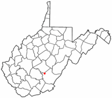 Location of Quinwood, West Virginia | |
| Coordinates: 38°3′29″N 80°42′16″W / 38.05806°N 80.70444°WCoordinates: 38°3′29″N 80°42′16″W / 38.05806°N 80.70444°W | |
| Country | United States |
| State | West Virginia |
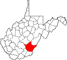
| County | Greenbrier |
| Area[1] | |
| • Total | 0.35 sq mi (0.91 km2) |
| • Land | 0.35 sq mi (0.91 km2) |
| • Water | 0 sq mi (0 km2) |
| Elevation | 3,015 ft (919 m) |
| Population (2010)[2] | |
| • Total | 290 |
| • Estimate (2012[3]) | 291 |
| • Density | 828.6/sq mi (319.9/km2) |
| Time zone | Eastern (EST) (UTC-5) |
| • Summer (DST) | EDT (UTC-4) |
| ZIP code | 25981 |
| Area code(s) | 304 |
| FIPS code | 54-66412[4] |
| GNIS feature ID | 1555428[5] |

Quinwood is a town and former coal town in Greenbrier County, West Virginia, United States. The population was 290 at the 2010 census.
The community's name is an amalgamation of the names of its proprietors Quin Morton and W. S. Wood.[6]
Geography
Quinwood is located at 38°3′29″N 80°42′16″W / 38.05806°N 80.70444°W (38.058117, -80.704334).[7]
According to the United States Census Bureau, the town has a total area of 0.35 square miles (0.91 km2), all of it land.[1]
Demographics
| Historical population | |||
|---|---|---|---|
| Census | Pop. | %± | |
| 1950 | 838 | — | |
| 1960 | 506 | −39.6% | |
| 1970 | 370 | −26.9% | |
| 1980 | 460 | 24.3% | |
| 1990 | 559 | 21.5% | |
| 2000 | 435 | −22.2% | |
| 2010 | 290 | −33.3% | |
| Est. 2015 | 288 | [8] | −0.7% |
2010 census
As of the census[2] of 2010, there were 290 people, 118 households, and 92 families residing in the town. The population density was 828.6 inhabitants per square mile (319.9/km2). There were 152 housing units at an average density of 434.3 per square mile (167.7/km2). The racial makeup of the town was 95.5% White, 1.0% African American, 0.7% Native American, 0.3% from other races, and 2.4% from two or more races. Hispanic or Latino of any race were 0.3% of the population.
There were 118 households of which 31.4% had children under the age of 18 living with them, 58.5% were married couples living together, 15.3% had a female householder with no husband present, 4.2% had a male householder with no wife present, and 22.0% were non-families. 17.8% of all households were made up of individuals and 6.7% had someone living alone who was 65 years of age or older. The average household size was 2.46 and the average family size was 2.66.
The median age in the town was 47 years. 18.3% of residents were under the age of 18; 8.2% were between the ages of 18 and 24; 21.5% were from 25 to 44; 32.5% were from 45 to 64; and 19.7% were 65 years of age or older. The gender makeup of the town was 52.4% male and 47.6% female.
2000 census
As of the census[4] of 2000, there were 435 people, 169 households, and 126 families residing in the town. The population density was 883.1 inhabitants per square mile (342.8/km²). There were 193 housing units at an average density of 391.8 per square mile (152.1/km²). The racial makeup of the town was 95.40% White, 2.53% African American, 0.23% Native American, and 1.84% from two or more races. Hispanic or Latino of any race were 0.92% of the population.
There were 169 households out of which 33.1% had children under the age of 18 living with them, 59.8% were married couples living together, 11.8% had a female householder with no husband present, and 24.9% were non-families. 21.3% of all households were made up of individuals and 9.5% had someone living alone who was 65 years of age or older. The average household size was 2.57 and the average family size was 2.98.
In the town the population was spread out with 23.9% under the age of 18, 7.6% from 18 to 24, 26.2% from 25 to 44, 23.2% from 45 to 64, and 19.1% who were 65 years of age or older. The median age was 40 years. For every 100 females there were 92.5 males. For every 100 females age 18 and over, there were 89.1 males.
The median income for a household in the town was $21,705, and the median income for a family was $24,196. Males had a median income of $25,179 versus $19,250 for females. The per capita income for the town was $11,911. About 22.9% of families and 26.9% of the population were below the poverty line, including 41.0% of those under age 18 and 18.2% of those age 65 or over.
Climate
With the elevation and location on a western facing slope, Quinwood can easily see significant amounts of snowfall when winds from the northwest carry moisture from the great lakes and ride up the mountains. This event is called orographic lift. Snowfall amounts over one foot are very common during these events. In 2012, Hurricane Sandy left 29 inches (74 cm) of snow in Quinwood.[10]
Notable people
Quinwood was the birthplace of Ralph E. Pomeroy, who received the Medal of Honor for his actions during the Korean War.
References
- 1 2 "US Gazetteer files 2010". United States Census Bureau. Archived from the original on January 24, 2012. Retrieved 2013-01-24.
- 1 2 "American FactFinder". United States Census Bureau. Retrieved 2013-01-24.
- ↑ "Population Estimates". United States Census Bureau. Archived from the original on June 17, 2013. Retrieved 2013-06-26.
- 1 2 "American FactFinder". United States Census Bureau. Archived from the original on September 11, 2013. Retrieved 2008-01-31.
- ↑ "US Board on Geographic Names". United States Geological Survey. 2007-10-25. Retrieved 2008-01-31.
- ↑ Kenny, Hamill (1945). West Virginia Place Names: Their Origin and Meaning, Including the Nomenclature of the Streams and Mountains. Piedmont, WV: The Place Name Press. p. 515.
- ↑ "US Gazetteer files: 2010, 2000, and 1990". United States Census Bureau. 2011-02-12. Retrieved 2011-04-23.
- ↑ "Annual Estimates of the Resident Population for Incorporated Places: April 1, 2010 to July 1, 2015". Retrieved July 2, 2016.
- ↑ "Census of Population and Housing". Census.gov. Archived from the original on May 11, 2015. Retrieved June 4, 2015.
- ↑ "Sandy's Snowy Side Turns Deadly".