Junior, West Virginia
| Junior, West Virginia | |
|---|---|
| Town | |
 Junior, West Virginia Location within the state of West Virginia | |
| Coordinates: 38°58′39″N 79°57′1″W / 38.97750°N 79.95028°WCoordinates: 38°58′39″N 79°57′1″W / 38.97750°N 79.95028°W | |
| Country | United States |
| State | West Virginia |
| County | Barbour |
| Area[1] | |
| • Total | 0.33 sq mi (0.85 km2) |
| • Land | 0.31 sq mi (0.80 km2) |
| • Water | 0.02 sq mi (0.05 km2) |
| Elevation | 1,745 ft (532 m) |
| Population (2010)[2] | |
| • Total | 520 |
| • Estimate (2012[3]) | 513 |
| • Density | 1,677.4/sq mi (647.6/km2) |
| Time zone | Eastern (EST) (UTC-5) |
| • Summer (DST) | EDT (UTC-4) |
| ZIP code | 26275 |
| Area code(s) | 304 |
| FIPS code | 54-42244[4] |
| GNIS feature ID | 1554837[5] |
Junior is a town in Barbour County, West Virginia in the USA, along the Tygart Valley River. The population was 520 at the 2010 census.
Geography
Junior is located at 38°58′39″N 79°57′1″W / 38.97750°N 79.95028°W (38.977379, -79.950300).[6]
According to the United States Census Bureau, the town has a total area of 0.33 square miles (0.85 km2), of which, 0.31 square miles (0.80 km2) is land and 0.02 square miles (0.05 km2) is water.[1]
Demographics
| Historical population | |||
|---|---|---|---|
| Census | Pop. | %± | |
| 1900 | 335 | — | |
| 1910 | 435 | 29.9% | |
| 1920 | 593 | 36.3% | |
| 1930 | 560 | −5.6% | |
| 1940 | 533 | −4.8% | |
| 1950 | 729 | 36.8% | |
| 1960 | 552 | −24.3% | |
| 1970 | 513 | −7.1% | |
| 1980 | 591 | 15.2% | |
| 1990 | 542 | −8.3% | |
| 2000 | 450 | −17.0% | |
| 2010 | 520 | 15.6% | |
| Est. 2015 | 503 | [7] | −3.3% |
2010 census
As of the census[2] of 2010, there were 520 people, 197 households, and 147 families residing in the town. The population density was 1,677.4 inhabitants per square mile (647.6/km2). There were 233 housing units at an average density of 751.6 per square mile (290.2/km2). The racial makeup of the town was 99.2% White, 0.4% African American, 0.2% from other races, and 0.2% from two or more races. Hispanic or Latino of any race were 0.6% of the population.
There were 197 households of which 44.7% had children under the age of 18 living with them, 50.8% were married couples living together, 14.7% had a female householder with no husband present, 9.1% had a male householder with no wife present, and 25.4% were non-families. 21.3% of all households were made up of individuals and 11.6% had someone living alone who was 65 years of age or older. The average household size was 2.64 and the average family size was 3.03.
The median age in the town was 34.8 years. 27.9% of residents were under the age of 18; 8.5% were between the ages of 18 and 24; 26.5% were from 25 to 44; 24.5% were from 45 to 64; and 12.5% were 65 years of age or older. The gender makeup of the town was 49.6% male and 50.4% female.
2000 census
As of the census[4] of 2000, there were 450 people, 178 households, and 134 families residing in the town. The population density was 1,510.8 inhabitants per square mile (579.2/km²). There were 202 housing units at an average density of 678.2 per square mile (260.0/km²). The racial makeup of the town was 98.89% White, and 1.11% from two or more races. Hispanic or Latino of any race were 0.44% of the population.
There were 178 households out of which 35.4% had children under the age of 18 living with them, 55.1% were married couples living together, 15.2% had a female householder with no husband present, and 24.7% were non-families. 22.5% of all households were made up of individuals and 10.7% had someone living alone who was 65 years of age or older. The average household size was 2.53 and the average family size was 2.96.
In the town the population was spread out with 26.0% under the age of 18, 8.2% from 18 to 24, 27.1% from 25 to 44, 25.1% from 45 to 64, and 13.6% who were 65 years of age or older. The median age was 36 years. For every 100 females there were 99.1 males. For every 100 females age 18 and over, there were 97.0 males.
The median income for a household in the town was $20,536, and the median income for a family was $26,250. Males had a median income of $21,875 versus $15,875 for females. The per capita income for the town was $10,279. About 20.3% of families and 24.5% of the population were below the poverty line, including 39.8% of those under age 18 and 20.0% of those age 65 or over.
History
The community was named after the son of Henry Gassaway Davis, a U.S. Senator and coal magnate.[9]
References
- 1 2 "US Gazetteer files 2010". United States Census Bureau. Retrieved 2013-01-24.
- 1 2 "American FactFinder". United States Census Bureau. Retrieved 2013-01-24.
- ↑ "Population Estimates". United States Census Bureau. Retrieved 2013-06-26.
- 1 2 "American FactFinder". United States Census Bureau. Retrieved 2008-01-31.
- ↑ "US Board on Geographic Names". United States Geological Survey. 2007-10-25. Retrieved 2008-01-31.
- ↑ "US Gazetteer files: 2010, 2000, and 1990". United States Census Bureau. 2011-02-12. Retrieved 2011-04-23.
- ↑ "Annual Estimates of the Resident Population for Incorporated Places: April 1, 2010 to July 1, 2015". Retrieved July 2, 2016.
- ↑ "Census of Population and Housing". Census.gov. Retrieved June 4, 2015.
- ↑ Kenny, Hamill (1945). West Virginia Place Names: Their Origin and Meaning, Including the Nomenclature of the Streams and Mountains. Piedmont, WV: The Place Name Press. p. 339.
External links
Municipalities and communities of Barbour County, West Virginia, United States | ||
|---|---|---|
| City | 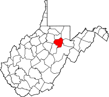 | |
| Magisterial districts |
| |
| Towns | ||
| CDPs | ||
| Unincorporated communities |
| |