Nitro, West Virginia
| City of Nitro | |
|---|---|
| City | |
| Motto: Living Memorial to World War I | |
 Location in Kanawha County and state of West Virginia. | |
| Coordinates: 38°24′55″N 81°49′52″W / 38.41528°N 81.83111°WCoordinates: 38°24′55″N 81°49′52″W / 38.41528°N 81.83111°W | |
| Country |
|
| State |
|
| Counties | Kanawha, Putnam |
| Government | |
| • Type | Municipal Government |
| • Mayor | Dave Casebolt |
| • Treasurer | John Young |
| Area[1] | |
| • Total | 4.67 sq mi (12.10 km2) |
| • Land | 4.28 sq mi (11.09 km2) |
| • Water | 0.39 sq mi (1.01 km2) |
| Elevation | 594 ft (181 m) |
| Population (2010)[2] | |
| • Total | 7,178 |
| • Estimate (2014)[3] | 6,837 |
| • Density | 1,677.1/sq mi (647.5/km2) |
| Time zone | Eastern (EST) (UTC-5) |
| • Summer (DST) | EDT (UTC-4) |
| ZIP code | 25143 |
| Area code(s) | 304/681 |
| FIPS code | 54-59068 |
| GNIS feature ID | 1555228[4] |
| Website | http://www.cityofnitro.org/ |
| (Official site is undergoing a complete redesign, which may limit access. The sites redesign is expected to be complete by November 2012.) | |
Nitro is a city in Kanawha and Putnam counties in the State of West Virginia, along the Kanawha River. The population was 7,178 at the 2010 census. Nitro is a part of the Huntington-Ashland, WV-KY-OH, Metropolitan Statistical Area (MSA). As of the 2010 census, the MSA had a population of 287,702. New definitions from February 28, 2013 placed the population at 363,000.[5]
Nitro was incorporated in 1932 by Circuit Court.
City name origin
The name Nitro derives from nitrocellulose, the main ingredient in gunpowder.[6] The Nitro area was to be the American ammunition production facility during World War I. Daniel C. Jackling "supervised the construction and operation" of the plant, which by the time of the armistice "was producing one hundred thousand pounds of high explosives per day."[7]
Its name was selected by the United States government because of the establishment there, during World War I, of a large federal plant for the manufacture of explosives. The city is known as "a Living Memorial to World War I."
Notable people
Famous people with ties to the town:
- Major League Baseball player Lew Burdette was born in Nitro in 1926.
- Country singer Kathy Mattea, who grew up in nearby Cross Lanes, is a graduate of Nitro High School.
- J. R. House, who played for several MLB teams in the early 2000s, was a record-setting quarterback at Nitro High from 1996 through 1998.
- Actor Clark Gable worked at "Explosive Plant C" in Nitro in 1918
- Major League Baseball, Hall of Famer, Harold "Pie" Traynor, worked at "Explosive Plant C" in Nitro in 1918.
Geography
Nitro is located at 38°24′55″N 81°49′52″W / 38.41528°N 81.83111°W (38.415281, -81.831249),[8] primarily in Kanawha County.
According to the United States Census Bureau, the city has a total area of 4.67 square miles (12.10 km2), of which, 4.28 square miles (11.09 km2) is land and 0.39 square miles (1.01 km2) is water.[1]
Demographics
| Historical population | |||
|---|---|---|---|
| Census | Pop. | %± | |
| 1940 | 2,983 | — | |
| 1950 | 3,314 | 11.1% | |
| 1960 | 6,894 | 108.0% | |
| 1970 | 8,019 | 16.3% | |
| 1980 | 8,074 | 0.7% | |
| 1990 | 6,851 | −15.1% | |
| 2000 | 6,824 | −0.4% | |
| 2010 | 7,178 | 5.2% | |
| Est. 2015 | 6,763 | [9] | −5.8% |
| U.S. Decennial Census[10] 2014 Estimate[3] | |||
2010 census
As of the census[2] of 2010, there were 7,178 people, 3,250 households, and 1,914 families residing in the city. The population density was 1,677.1 inhabitants per square mile (647.5/km2). There were 3,507 housing units at an average density of 819.4 per square mile (316.4/km2). The racial makeup of the city was 94.7% White, 2.3% African American, 0.5% Native American, 0.6% Asian, 0.6% from other races, and 1.4% from two or more races. Hispanic or Latino of any race were 1.6% of the population.
There were 3,250 households of which 25.9% had children under the age of 18 living with them, 41.4% were married couples living together, 12.8% had a female householder with no husband present, 4.8% had a male householder with no wife present, and 41.1% were non-families. 33.9% of all households were made up of individuals and 12.8% had someone living alone who was 65 years of age or older. The average household size was 2.21 and the average family size was 2.82.
The median age in the city was 40.5 years. 20.4% of residents were under the age of 18; 7.4% were between the ages of 18 and 24; 27.2% were from 25 to 44; 27.7% were from 45 to 64; and 17.3% were 65 years of age or older. The gender makeup of the city was 47.9% male and 52.1% female.
2000 census
As of the census of 2000, there were 6,824 people, 3,015 households, and 1,935 families residing in the city. The population density was 1,821.2 people per square mile (702.6/km²). There were 3,217 housing units at an average density of 858.6 per square mile (331.2/km²). The racial makeup of the city was 96.64% White, 1.63% African American, 0.25% Native American, 0.25% Asian, 0.40% from other races, and 0.84% from two or more races. Hispanic or Latino of any race were 0.54% of the population.
There were 3,015 households out of which 23.9% had children under the age of 18 living with them, 47.3% were married couples living together, 12.7% had a female householder with no husband present, and 35.8% were non-families. 30.7% of all households were made up of individuals and 13.9% had someone living alone who was 65 years of age or older. The average household size was 2.26 and the average family size was 2.80.
The age distribution was 20.1% under the age of 18, 8.8% from 18 to 24, 26.4% from 25 to 44, 26.1% from 45 to 64, and 18.7% who were 65 years of age or older. The median age was 41 years. For every 100 females there were 89.7 males. For every 100 females age 18 and over, there were 87.0 males.
The median income for a household in the city was $32,389, and the median income for a family was $41,367. Males had a median income of $30,086 versus $21,932 for females. The per capita income for the city was $17,453. About 7.3% of families and 10.7% of the population were below the poverty line, including 12.5% of those under age 18 and 14.0% of those age 65 or over.
Education
The city's public school students do not all attend the same schools, because West Virginia school districts are divided strictly along county lines, without regard to city boundaries.
Kanawha County residents are served by the following schools in the city:
- Nitro Elementary School (public)
- Nitro High School (public)
There is no public middle school in Nitro on either side of the county line, nor is there any public school within the Putnam County portion of the city. Middle school students in Kanawha County must bus to Andrew Jackson Middle School in Cross Lanes. Putnam County students must bus to Rock Branch Elementary, Poca Middle, and Poca High.
Environment
The reach of the Kanawha River Valley between Belle and Nitro is known locally as the “Chemical Valley,” which, at its peak in the late 1950s and early 1960s, was the leading producer of chemicals in the world (Henry, 1974). During World War I the government built an $80 million complex in Nitro to manufacture explosives and chemicals for the war effort.
The site was located on an 1,800-acre (7.3 km2) cow pasture on the Kanawha River on the flat river valley floodplain. The facility had just been placed in operation when the war ended in November 1918. The first shipment of powder was also the last. Local authorities then sought various chemical companies to occupy the facility which had excellent infrastructure in utilities, transportation and new housing for workers. It was hoped that the former gunpowder complex would become a major chemical manufacturing center, especially for the emerging dye industry in the U.S. that relied on coal and coke by-products as feedstock.
The Kanawha River and water in the adjacent alluvium have been adversely affected by industrial activities (Messinger, 1997).[11]
The chemical manufacturing history of Nitro resulted in environmental impairment, including the Fike/Artel Chemical Site (EPA ID: WVD047989207), which is on the National Priorities List Superfund. The 12-acre (49,000 m2) site was placed on the EPA National Priorities List in 1983. The site is a former World War I chemical munitions plant at which subsequent chemical manufacturing, reclamation and disposal was allegedly conducted.
The Solutia Inc. Nitro Plant, located on the east bank of the Kanawha River approximately one-half mile north of the City of Nitro in Putnam County, is being investigated through the RCRA program. From 1918 to 1921, the facility manufactured explosives including “nitro-powder” to support World War I. When explosives manufacturing processes ceased, the facility was purchased and used for a variety of industries. RCRA Corrective Action activities at this facility are being conducted under the direction of EPA Region 3 and the West Virginia Department of Environmental Protection.[12]
Other RCRA Corrective Action facilities include Great Lakes Chemicals Company (formerly FMC Corporation) [13] and Union Carbide Corp. - PTO (a subsidiary of The Dow Chemical Company).[14]
Due to manufacturing activities, Nitro becoming known was for a distinctive chemical smell—especially in the area of the I-64 bridge. However, the recent shift away from manufacturing in the region has significantly reduced air pollution issues.
Agent Orange
In February 2012, Monsanto agreed to settle a case covering Dioxin contamination around a plant in Nitro that had made Agent Orange. Monsanto agreed to pay up to $9 million for cleanup of affected homes, $84 million for medical monitoring of people affected, and the community's legal fees.[15][16]
Scientific Research Activities
In 2001 Clonaid operated a lab in Nitro that was tied to the Raelians. It was located inside a rented room within a former high school. The FDA said that the equipment in lab was state-of-the-art and had been bought by a former West Virginia state legislator Mark Hunt.[17]
References
- 1 2 "US Gazetteer files 2010". United States Census Bureau. Retrieved 2013-01-24.
- 1 2 "American FactFinder". United States Census Bureau. Retrieved 2013-01-24.
- 1 2 "Population Estimates". United States Census Bureau. Retrieved June 19, 2015.
- ↑ "US Board on Geographic Names". United States Geological Survey. 2007-10-25. Retrieved 2008-01-31.
- ↑ "Population statistics" (PDF).
- ↑ Wintz, William. Nitro, The World War 1 Boom Town. South Charleston, WV: Jalamap Publications, 1985
- ↑ Charles Caldwell Hawley (2014). A Kennecott Story. The University of Utah Press. pp. 97–98.
- ↑ "US Gazetteer files: 2010, 2000, and 1990". United States Census Bureau. 2011-02-12. Retrieved 2011-04-23.
- ↑ "Annual Estimates of the Resident Population for Incorporated Places: April 1, 2010 to July 1, 2015". Retrieved July 2, 2016.
- ↑ United States Census Bureau. "Census of Population and Housing". Archived from the original on May 11, 2015. Retrieved August 27, 2013.
- ↑ http://pubs.usgs.gov/wri/wri004020/pdf/wri00-4020.pdf
- ↑ Region 3 GPRA Baseline RCRA Corrective Action Facility, http://www.epa.gov/reg3wcmd/ca/wv/pdf/wvd039990965.pdf
- ↑ Region 3 GRPA Baseline RCRA Corrective Action Facility, http://www.epa.gov/reg3wcmd/ca/wv/pdf/wvd005005087.pdf
- ↑ Microsoft Word - wvd000739722.doc
- ↑ Kaskey, Jack (February 24, 2012). "Monsanto Settles West Virginia Lawsuits Over Nitro Plant". Bloomburg. Retrieved 26 February 2015.
- ↑ Ward, Ken (22 Nov 2013). "Supreme Court affirms Monsanto pollution settlement in Nitro". Charleston Gazette-Mail. Retrieved 30 August 2015.
- ↑ For Clonaid, a Trail of Unproven Claims, New York Times. Retrieved 11 October 2007.
External links

Municipalities and communities of Putnam County, West Virginia, United States | ||
|---|---|---|
| Cities | 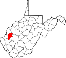 | |
| Towns | ||
| CDPs | ||
| Other localities |
| |
| Footnotes | ‡This populated place also has portions in an adjacent county or counties | |