Ripley, West Virginia
| Ripley, West Virginia | |
|---|---|
| City | |
|
North Court Street in downtown Ripley in 2007 | |
 Location of Ripley, West Virginia | |
| Coordinates: 38°49′16″N 81°42′51″W / 38.82111°N 81.71417°WCoordinates: 38°49′16″N 81°42′51″W / 38.82111°N 81.71417°W | |
| Country |
|
| State |
|
| County | Jackson |
| Government | |
| • Type | City Council/Mayor |
| • Mayor | Carolyn L. Rader |
| Area[1] | |
| • Total | 3.28 sq mi (8.50 km2) |
| • Land | 3.17 sq mi (8.21 km2) |
| • Water | 0.11 sq mi (0.28 km2) |
| Elevation | 614 ft (187 m) |
| Population (2010)[2] | |
| • Total | 3,252 |
| • Estimate (2012[3]) | 3,251 |
| • Density | 1,025.9/sq mi (396.1/km2) |
| Time zone | Eastern (EST) (UTC-5) |
| • Summer (DST) | EDT (UTC-4) |
| ZIP code | 25271 |
| Area code(s) | 304 |
| FIPS code | 54-68596[4] |
| GNIS feature ID | 1545757[5] |

Ripley is a city in and the county seat of Jackson County, West Virginia, United States.[6] The population was 3,252 at the 2010 census.
History
Ripley was originally owned and settled by William, John, and Lewis Rodgers. They received a grant of 400 acres (1.6 km2) in 1768 where "Sycamore Creek joins Big Mill Creek" (the current site of Ripley). The land was later sold to Jacob (and Ann) Starcher, most probably in 1803. Jacob Starcher erected a grist mill in 1824 and laid out the town in 1830, naming it in honor of Harry Ripley, a young minister who was to be married, but drowned in Big Mill Creek, about one and a half miles north of the town, shortly before the ceremony took place.[7][8]
When Jackson County was formed in 1831, the residents of the county could not decide where to locate the county seat. The people who lived along the Ohio River near the Ravenswood settlement favored that location. The people who lived farther inland objected. The Virginia General Assembly appointed an independent commission to make the final decision which selected Ripley. In 1832, the Starchers donated 8 acres (32,000 m2) of land to the county, 2 acres (8,100 m2) for the location of the county courthouse and jail, and six for the general use of the new county (a public school and a cemetery were later located on the land). The town was chartered by the Virginia General Assembly in 1832.[7][8]
During the Civil War, Ripley remained under control of the Union except for a brief incursion by Confederate General Albert G. Jenkins in September 1862.
The last public hanging in West Virginia took place in Ripley in 1897, when John Morgan was hanged for murder; the spectacle prompted the West Virginia Legislature to ban public executions soon after.[9][10]
In 1990, the Ravenswood Aluminum Corporation locked out its 1,700 workers, most living in Ravenswood, at least a third had lived in Ripley at the time. The workers went on strike and eventually were let back in 1993.
In 2008, former president Bill Clinton gave a speech at the fire station on behalf of his wife Hillary Clinton during her campaign for the Democratic nomination for President.
Geography
Ripley is located at 38°49′16″N 81°42′51″W / 38.82111°N 81.71417°W (38.821078, -81.714264),[11] along Mill Creek.[12]
According to the United States Census Bureau, the city has a total area of 3.28 square miles (8.50 km2), of which, 3.17 square miles (8.21 km2) is land and 0.11 square miles (0.28 km2) is water.[1]
Demographics
| Historical population | |||
|---|---|---|---|
| Census | Pop. | %± | |
| 1870 | 226 | — | |
| 1880 | 425 | 88.1% | |
| 1890 | 417 | −1.9% | |
| 1900 | 579 | 38.8% | |
| 1910 | 591 | 2.1% | |
| 1920 | 580 | −1.9% | |
| 1930 | 669 | 15.3% | |
| 1940 | 759 | 13.5% | |
| 1950 | 1,813 | 138.9% | |
| 1960 | 2,756 | 52.0% | |
| 1970 | 3,244 | 17.7% | |
| 1980 | 3,464 | 6.8% | |
| 1990 | 3,023 | −12.7% | |
| 2000 | 3,263 | 7.9% | |
| 2010 | 3,252 | −0.3% | |
| Est. 2015 | 3,255 | [13] | 0.1% |


2010 census
As of the census[2] of 2010, there were 3,252 people, 1,476 households, and 854 families residing in the city. The population density was 1,025.9 inhabitants per square mile (396.1/km2). There were 1,614 housing units at an average density of 509.1 per square mile (196.6/km2). The racial makeup of the city was 98.2% White, 0.2% African American, 0.4% Asian, 0.3% from other races, and 0.9% from two or more races. Hispanic or Latino of any race were 0.5% of the population.
There were 1,476 households of which 24.7% had children under the age of 18 living with them, 42.8% were married couples living together, 11.8% had a female householder with no husband present, 3.3% had a male householder with no wife present, and 42.1% were non-families. 39.2% of all households were made up of individuals and 19.2% had someone living alone who was 65 years of age or older. The average household size was 2.12 and the average family size was 2.81.
The median age in the city was 46.1 years. 19.7% of residents were under the age of 18; 7.4% were between the ages of 18 and 24; 21.7% were from 25 to 44; 26.2% were from 45 to 64; and 25% were 65 years of age or older. The gender makeup of the city was 44.6% male and 55.4% female.
2000 census
As of the census[4] of 2000, there were 3,263 people, 1,423 households, and 893 families residing in the city. The population density was 1,056.3 people per square mile (407.7/km²). There were 1,543 housing units at an average density of 499.5 per square mile (192.8/km²). The racial makeup of the city was 98.22% White, 0.06% African American, 0.06% Native American, 0.21% Asian, 0.37% from other races, and 1.07% from two or more races. Hispanic or Latino of any race were 0.64% of the population.
There were 1,423 households out of which 23.9% had children under the age of 18 living with them, 49.5% were married couples living together, 11.1% had a female householder with no husband present, and 37.2% were non-families. 34.4% of all households were made up of individuals and 18.3% had someone living alone who was 65 years of age or older. The average household size was 2.17 and the average family size was 2.78.
In the city the population was spread out with 19.2% under the age of 18, 8.3% from 18 to 24, 22.6% from 25 to 44, 24.0% from 45 to 64, and 25.8% who were 65 years of age or older. The median age was 45 years. For every 100 females there were 79.8 males. For every 100 females age 18 and over, there were 73.4 males.
The median income for a household in the city was $25,861, and the median income for a family was $37,027. Males had a median income of $29,531 versus $20,881 for females. The per capita income for the city was $15,451. About 12.1% of families and 16.4% of the population were below the poverty line, including 21.5% of those under age 18 and 9.9% of those age 65 or over.
Fourth of July celebration
Ripley claims to host the "Biggest Small Town Fourth of July Celebration" in the nation.[15] On July 4, 2002, then President George W. Bush gave a public speech at the town's courthouse.[16]
Education
Ripley is served by the Jackson County School District. Schools located in Ripley are:
- Ripley High School (grades 9 through 12)
- Ripley Middle School (grades 6 through 8)
- Ripley Elementary School (grades PreK through 5)
- Fairplain Elementary School (grades PreK through 5)
- Jackson County Center of West Virginia University at Parkersburg
Media
Radio
- WVRP (90.7 FM)-- Public Radio
- WCEF (98.3 FM)-- Country
Notable people
- Dee Caperton- Miss West Virginia 1964
- Kane Davis - Major League Baseball pitcher[17]
- Charles C. Lanham - West Virginia State Senator and businessman, was born in Ripley.[18]
- Warren Miller - U.S. Representative from West Virginia[19]
References
- 1 2 "US Gazetteer files 2010". United States Census Bureau. Retrieved 2013-01-24.
- 1 2 "American FactFinder". United States Census Bureau. Retrieved 2013-01-24.
- ↑ "Population Estimates". United States Census Bureau. Retrieved 2013-06-26.
- 1 2 "American FactFinder". United States Census Bureau. Retrieved 2008-01-31.
- ↑ "US Board on Geographic Names". United States Geological Survey. 2007-10-25. Retrieved 2008-01-31.
- ↑ "Find a County". National Association of Counties. Retrieved 2011-06-07.
- 1 2 O'Brien, Winnifred E. 1979. Early Settlers and their Contributions to Jackson County and its County Seat Ripley, West Virginia. Ripley: Jackson County Public Library.
- 1 2 Jackson County Historical Society. 1982. The Emergence of Jackson County and of Ripley, Its Seat of Justice. Jackson County Historical Society: Ripley, WV.
- ↑ West Virginia Blue Book. This hanging is said to have taken place at the now located Ripley High School. Published annually by the Clerk's Office of the West Virginia Senate.
- ↑ Flesher Bolovan, Carolyn (2006). "Ripley". In Ken Sullivan (ed.). The West Virginia Encyclopedia. Charleston, W.Va.: West Virginia Humanities Council. p. 618. ISBN 0-9778498-0-5.
- ↑ "US Gazetteer files: 2010, 2000, and 1990". United States Census Bureau. 2011-02-12. Retrieved 2011-04-23.
- ↑ West Virginia Atlas & Gazetteer. Yarmouth, Me.: DeLorme. 1997. p. 33. ISBN 0-89933-246-3.
- ↑ "Annual Estimates of the Resident Population for Incorporated Places: April 1, 2010 to July 1, 2015". Retrieved July 2, 2016.
- ↑ "Census of Population and Housing". Census.gov. Retrieved June 4, 2015.
- ↑ "Ripley Fourth of July".
- ↑ White House press release, July 4, 2002
- ↑ "Kane Davis Stats". Baseball Almanac. Retrieved December 21, 2012.
- ↑ Charles C. Lanham-obituary
- ↑ "MILLER, Warren, (1847 - 1920)". Biographical Directory of the United States Congress. Retrieved December 21, 2012.
External links
- Ripley Main Street project
- Jackson County School District
- https://www.facebook.com/pages/Jackson-County-Courthouse/142371649144335
Municipalities and communities of Jackson County, West Virginia, United States | ||
|---|---|---|
| Cities | 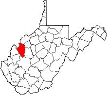 | |
| Unincorporated communities |
| |
| Ghost towns | ||
| Footnotes | ‡This populated place also has portions in an adjacent county or counties | |