Stollings, West Virginia
| Stollings, West Virginia | |
|---|---|
| Census-designated place (CDP) | |
 Stollings, West Virginia | |
| Coordinates: 37°50′15″N 81°57′52″W / 37.83750°N 81.96444°WCoordinates: 37°50′15″N 81°57′52″W / 37.83750°N 81.96444°W | |
| Country | United States |
| State | West Virginia |
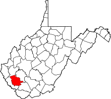
| County | Logan |
| Area[1] | |
| • Total | 0.384 sq mi (0.99 km2) |
| • Land | 0.359 sq mi (0.93 km2) |
| • Water | 0.025 sq mi (0.06 km2) |
| Elevation | 673 ft (205 m) |
| Population (2010)[2] | |
| • Total | 316 |
| • Density | 820/sq mi (320/km2) |
| Time zone | Eastern (EST) (UTC-5) |
| • Summer (DST) | EDT (UTC-4) |
| ZIP code | 25646 |
| Area code(s) | 304 & 681 |
| GNIS feature ID | 1547442[3] |
Stollings is a census-designated place (CDP) in Logan County, West Virginia, United States. Stollings is located on the Guyandotte River at the junction of West Virginia Route 10 and West Virginia Route 17, 1.5 miles (2.4 km) east-southeast of Logan. Stollings has a post office with ZIP code 25646.[4] As of the 2010 census, its population was 316.[2]
References
- ↑ "US Gazetteer files: 2010, 2000, and 1990". United States Census Bureau. 2011-02-12. Retrieved 2011-04-23.
- 1 2 "American FactFinder". United States Census Bureau. Retrieved 2011-05-14.
- ↑ U.S. Geological Survey Geographic Names Information System: Stollings, West Virginia
- ↑ ZIP Code Lookup
This article is issued from Wikipedia - version of the 9/4/2016. The text is available under the Creative Commons Attribution/Share Alike but additional terms may apply for the media files.