Logan, West Virginia
| Logan, West Virginia | |
|---|---|
| City | |
|
Logan in 1974 | |
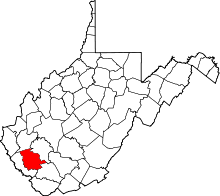
 Location of Logan, West Virginia | |
| Coordinates: 37°50′54″N 81°59′16″W / 37.84833°N 81.98778°WCoordinates: 37°50′54″N 81°59′16″W / 37.84833°N 81.98778°W | |
| Country | United States |
| State | West Virginia |
| County | Logan |
| Government | |
| • Mayor | Serafino Nolletti |
| Area[1] | |
| • Total | 1.24 sq mi (3.21 km2) |
| • Land | 1.15 sq mi (2.98 km2) |
| • Water | 0.09 sq mi (0.23 km2) |
| Elevation | 679 ft (207 m) |
| Population (2010)[2] | |
| • Total | 1,779 |
| • Estimate (2012[3]) | 1,739 |
| • Density | 1,547.0/sq mi (597.3/km2) |
| Time zone | Eastern (EST) (UTC-5) |
| • Summer (DST) | EDT (UTC-4) |
| ZIP code | 25601 |
| Area code(s) | 304 |
| FIPS code | 54-48148[4] |
| GNIS feature ID | 1542310[5] |

Logan is a city in Logan County, West Virginia, United States, along the Guyandotte River. The population was 1,779 at the 2010 census. It is the county seat of Logan County.[6]
History
The Chafin House, was listed on the National Register of Historic Places in 1994.[7]
Geography
Logan is located at the confluence of the Guyandotte River and Island Creek.[8]
According to the United States Census Bureau, the city has a total area of 1.24 square miles (3.21 km2), of which 1.15 square miles (2.98 km2) is land and 0.09 square miles (0.23 km2) is water.[1]
Climate
| Climate data for Logan, West Virginia | |||||||||||||
|---|---|---|---|---|---|---|---|---|---|---|---|---|---|
| Month | Jan | Feb | Mar | Apr | May | Jun | Jul | Aug | Sep | Oct | Nov | Dec | Year |
| Record high °F (°C) | 81 (27) |
81 (27) |
91 (33) |
95 (35) |
96 (36) |
105 (41) |
104 (40) |
102 (39) |
103 (39) |
96 (36) |
87 (31) |
78 (26) |
105 (41) |
| Average high °F (°C) | 44 (7) |
49 (9) |
59 (15) |
70 (21) |
78 (26) |
85 (29) |
88 (31) |
88 (31) |
81 (27) |
69 (21) |
58 (14) |
46 (8) |
67.9 (19.9) |
| Daily mean °F (°C) | 35 (2) |
39 (4) |
47 (8) |
57 (14) |
65 (18) |
74 (23) |
77 (25) |
77 (25) |
70 (21) |
57 (14) |
47 (8) |
38 (3) |
56.9 (13.8) |
| Average low °F (°C) | 25 (−4) |
28 (−2) |
34 (1) |
43 (6) |
52 (11) |
62 (17) |
66 (19) |
65 (18) |
58 (14) |
45 (7) |
36 (2) |
29 (−2) |
45.3 (7.3) |
| Record low °F (°C) | −15 (−26) |
−8 (−22) |
−2 (−19) |
19 (−7) |
29 (−2) |
35 (2) |
46 (8) |
44 (7) |
34 (1) |
18 (−8) |
7 (−14) |
−8 (−22) |
−15 (−26) |
| Average precipitation inches (mm) | 3.2 (81) |
3.4 (86) |
3.8 (97) |
3.9 (99) |
5.2 (132) |
4.8 (122) |
5.3 (135) |
3.7 (94) |
3.3 (84) |
3.0 (76) |
3.3 (84) |
3.7 (94) |
46.6 (1,184) |
| Source: [9] | |||||||||||||
Demographics
| Historical population | |||
|---|---|---|---|
| Census | Pop. | %± | |
| 1900 | 444 | — | |
| 1910 | 1,640 | 269.4% | |
| 1920 | 2,998 | 82.8% | |
| 1930 | 4,396 | 46.6% | |
| 1940 | 5,166 | 17.5% | |
| 1950 | 5,079 | −1.7% | |
| 1960 | 4,185 | −17.6% | |
| 1970 | 3,311 | −20.9% | |
| 1980 | 3,029 | −8.5% | |
| 1990 | 2,206 | −27.2% | |
| 2000 | 1,630 | −26.1% | |
| 2010 | 1,779 | 9.1% | |
| Est. 2015 | 1,649 | [10] | −7.3% |
2010 census
As of the census[2] of 2010, there were 1,779 people, 808 households, and 469 families residing in the city. The population density was 1,547.0 inhabitants per square mile (597.3/km2). There were 1,016 housing units at an average density of 883.5 per square mile (341.1/km2). The racial makeup of the city was 91.6% White, 5.2% African American, 0.3% Native American, 0.7% Asian, 0.2% from other races, and 2.0% from two or more races. Hispanic or Latino of any race were 2.0% of the population.
There were 808 households of which 26.4% had children under the age of 18 living with them, 36.8% were married couples living together, 15.7% had a female householder with no husband present, 5.6% had a male householder with no wife present, and 42.0% were non-families. 37.0% of all households were made up of individuals and 13.6% had someone living alone who was 65 years of age or older. The average household size was 2.20 and the average family size was 2.85.
The median age in the city was 40.4 years. 20.2% of residents were under the age of 18; 9.4% were between the ages of 18 and 24; 26.3% were from 25 to 44; 28.1% were from 45 to 64; and 15.8% were 65 years of age or older. The gender makeup of the city was 47.4% male and 52.6% female.
2000 census
As of the census[4] of 2000, there were 1,630 people, 750 households, and 423 families residing in the city. The population density was 1,403.5 people per square mile (542.5/km²). There were 965 housing units at an average density of 830.9 per square mile (321.2/km²). The racial makeup of the city was 92.52% White, 4.79% African American, 0.31% Native American, 0.61% Asian, 0.06% from other races, and 1.72% from two or more races. Hispanic or Latino of any race were 0.80% of the population.
There were 750 households out of which 20.9% had children under the age of 18 living with them, 38.3% were married couples living together, 13.2% had a female householder with no husband present, and 43.6% were non-families. 40.7% of all households were made up of individuals and 18.9% had someone living alone who was 65 years of age or older. The average household size was 2.08 and the average family size was 2.78.
In the city the population was spread out with 16.8% under the age of 18, 8.5% from 18 to 24, 26.2% from 25 to 44, 26.7% from 45 to 64, and 21.8% who were 65 years of age or older. The median age was 44 years. For every 100 females there were 82.3 males. For every 100 females age 18 and over, there were 79.1 males.
The median income for a household in the city was $22,623, and the median income for a family was $26,354. Males had a median income of $26,350 versus $19,167 for females. The per capita income for the city was $15,913. About 18.2% of families and 20.7% of the population were below the poverty line, including 29.0% of those under age 18 and 9.7% of those age 65 or over.
.jpg)
Services
Education
Logan is served by the Logan High School, grades 9-12.[12][13]
Media
- The Logan Banner,[14] a daily newspaper. It no longer publishes on Saturdays.
- WVOW, a local CBS radio affiliate.
Notable people
- Michael Ammar, magician.[15]
- Shane Burton, retired defensive tackle for four NFL teams.[16]
- Don Chafin, former Sheriff of Logan County.
- Joanne Dru, film and television actress.
- Danny Godby, baseball player.
- William Anderson "Devil Anse" Hatfield, leader of the Hatfield Clan during the famous Hatfield-McCoy feud.
- Frankie Zoly Molnar, recipient of Congressional Medal of Honor for his actions in the Vietnam War.
- Landau Eugene Murphy, Jr., traditional pop singer and winner in the sixth season of America's Got Talent.
- Lea Ann Parsley, Winter Olympics skeleton racing silver medalist.
- Mamie Thurman, murder victim.
- Reuben Lindsay Walker, Confederate general.
See also
References
- 1 2 "US Gazetteer files 2010". United States Census Bureau. Retrieved 2013-01-24.
- 1 2 "American FactFinder". United States Census Bureau. Retrieved 2013-01-24.
- ↑ "Population Estimates". United States Census Bureau. Retrieved 2013-06-26.
- 1 2 "American FactFinder". United States Census Bureau. Retrieved 2008-01-31.
- ↑ "US Board on Geographic Names". United States Geological Survey. 2007-10-25. Retrieved 2008-01-31.
- ↑ "Find a County". National Association of Counties. Retrieved 2011-06-07.
- ↑ National Park Service (2009-03-13). "National Register Information System". National Register of Historic Places. National Park Service.
- ↑ West Virginia Atlas & Gazetteer. Yarmouth, Me.: DeLorme. 1997. p. 51. ISBN 0-89933-246-3.
- ↑ "Logan, WV (25601) Monthly weather forecast". Weather Channel. Retrieved 11 September 2016.
- ↑ "Annual Estimates of the Resident Population for Incorporated Places: April 1, 2010 to July 1, 2015". Retrieved July 2, 2016.
- ↑ "Census of Population and Housing". Census.gov. Retrieved June 4, 2015.
- ↑ http://www.usnews.com/education/best-high-schools/west-virginia/districts/logan-county-schools/logan-senior-high-school-21379
- ↑ "Chapmanville Regional High School -".
- ↑ "Logan Banner, Logan WV - www.loganbanner.com".
- ↑ Omar, Aref (October 28, 2007). "Get cool with magic". New Straits Times. Media Prima. Retrieved November 25, 2012 – via HighBeam. (subscription required (help)).
- ↑ "Shane Burton". NFL.com. Retrieved July 16, 2014.