Harrisville, West Virginia
| Harrisville, West Virginia | |
|---|---|
| Town | |
|
Main Street in Harrisville in 2007 | |
 Location of Harrisville, West Virginia | |
| Coordinates: 39°12′36″N 81°3′3″W / 39.21000°N 81.05083°WCoordinates: 39°12′36″N 81°3′3″W / 39.21000°N 81.05083°W | |
| Country | United States |
| State | West Virginia |
| County | Ritchie |
| Area[1] | |
| • Total | 1.59 sq mi (4.12 km2) |
| • Land | 1.58 sq mi (4.09 km2) |
| • Water | 0.01 sq mi (0.03 km2) |
| Elevation | 856 ft (261 m) |
| Population (2010)[2] | |
| • Total | 1,876 |
| • Estimate (2012[3]) | 1,831 |
| • Density | 1,187.3/sq mi (458.4/km2) |
| Time zone | Eastern (EST) (UTC-5) |
| • Summer (DST) | EDT (UTC-4) |
| ZIP code | 26362 |
| Area code(s) | 304 |
| FIPS code | 54-35428[4] |
| GNIS feature ID | 1540017[5] |

Harrisville is a town in Ritchie County, West Virginia, USA. The population was 1,876 at the 2010 census. It is the county seat of Ritchie County.[6] The town is home to historic Berdine's Five and Dime.
History
Some say the town was named for Gen. Thomas Harris,[7] while others believe it was named after John Maley Harris, an early settler.[8]
The Harrisville Historic District, Harrisville Grade School, and the Ritchie County Courthouse are listed on the National Register of Historic Places.[9][10]
Geography
Harrisville is located at 39°12′36″N 81°3′3″W / 39.21000°N 81.05083°W (39.209866, -81.050917).[11]
According to the United States Census Bureau, the town has a total area of 1.59 square miles (4.12 km2), of which, 1.58 square miles (4.09 km2) is land and 0.01 square miles (0.03 km2) is water.[1]
Demographics
| Historical population | |||
|---|---|---|---|
| Census | Pop. | %± | |
| 1870 | 140 | — | |
| 1880 | 221 | 57.9% | |
| 1890 | 361 | 63.3% | |
| 1900 | 472 | 30.7% | |
| 1910 | 608 | 28.8% | |
| 1920 | 1,036 | 70.4% | |
| 1930 | 1,192 | 15.1% | |
| 1940 | 1,338 | 12.2% | |
| 1950 | 1,387 | 3.7% | |
| 1960 | 1,428 | 3.0% | |
| 1970 | 1,464 | 2.5% | |
| 1980 | 1,673 | 14.3% | |
| 1990 | 1,839 | 9.9% | |
| 2000 | 1,842 | 0.2% | |
| 2010 | 1,876 | 1.8% | |
| Est. 2015 | 1,775 | [12] | −5.4% |
2010 census
As of the census[2] of 2010, there were 1,876 people, 787 households, and 496 families residing in the town. The population density was 1,187.3 inhabitants per square mile (458.4/km2). There were 917 housing units at an average density of 580.4 per square mile (224.1/km2). The racial makeup of the town was 98.6% White, 0.3% African American, 0.1% Native American, 0.3% Asian, 0.2% from other races, and 0.6% from two or more races. Hispanic or Latino of any race were 0.7% of the population.
There were 787 households of which 29.2% had children under the age of 18 living with them, 48.0% were married couples living together, 10.9% had a female householder with no husband present, 4.1% had a male householder with no wife present, and 37.0% were non-families. 32.9% of all households were made up of individuals and 13.2% had someone living alone who was 65 years of age or older. The average household size was 2.25 and the average family size was 2.81.
The median age in the town was 44.8 years. 21.3% of residents were under the age of 18; 5.7% were between the ages of 18 and 24; 23.3% were from 25 to 44; 28.1% were from 45 to 64; and 21.6% were 65 years of age or older. The gender makeup of the town was 46.2% male and 53.8% female.
2000 census
As of the census[4] of 2000, there were 1,842 people, 780 households, and 516 families residing in the town. The population density was 1,120.0 inhabitants per square mile (433.7/km²). There were 889 housing units at an average density of 540.6 per square mile (209.3/km²). The racial makeup of the town was 98.59% White, 0.05% African American, 0.05% Native American, 0.22% Asian, 0.33% from other races, and 0.76% from two or more races. Hispanic or Latino of any race were 0.76% of the population.

There were 780 households out of which 27.1% had children under the age of 18 living with them, 51.3% were married couples living together, 11.2% had a female householder with no husband present, and 33.8% were non-families. 30.6% of all households were made up of individuals and 15.6% had someone living alone who was 65 years of age or older. The average household size was 2.26 and the average family size was 2.80.
In the town the population was spread out with 20.3% under the age of 18, 7.4% from 18 to 24, 29.3% from 25 to 44, 23.8% from 45 to 64, and 19.3% who were 65 years of age or older. The median age was 40 years. For every 100 females there were 90.7 males. For every 100 females age 18 and over, there were 86.5 males.
The median income for a household in the town was $28,750, and the median income for a family was $38,083. Males had a median income of $27,200 versus $20,040 for females. The per capita income for the town was $15,158. About 17.5% of families and 22.4% of the population were below the poverty line, including 31.6% of those under age 18 and 15.2% of those age 65 or over.
References
- 1 2 "US Gazetteer files 2010". United States Census Bureau. Retrieved 2013-01-24.
- 1 2 "American FactFinder". United States Census Bureau. Retrieved 2013-01-24.
- ↑ "Population Estimates". United States Census Bureau. Retrieved 2013-06-26.
- 1 2 "American FactFinder". United States Census Bureau. Retrieved 2008-01-31.
- ↑ "US Board on Geographic Names". United States Geological Survey. 2007-10-25. Retrieved 2008-01-31.
- ↑ "Find a County". National Association of Counties. Retrieved 2011-06-07.
- ↑ Gannett, Henry (1905). The Origin of Certain Place Names in the United States. Govt. Print. Off. p. 151.
- ↑ Kenny, Hamill (1945). West Virginia Place Names: Their Origin and Meaning, Including the Nomenclature of the Streams and Mountains. Piedmont, WV: The Place Name Press. p. 299.
- ↑ National Park Service (2010-07-09). "National Register Information System". National Register of Historic Places. National Park Service.
- ↑ "National Register of Historic Places Listings". Weekly List of Actions Taken on Properties: 8/15/11 through 8/19/11. National Park Service. 2011-08-26.
- ↑ "US Gazetteer files: 2010, 2000, and 1990". United States Census Bureau. 2011-02-12. Retrieved 2011-04-23.
- ↑ "Annual Estimates of the Resident Population for Incorporated Places: April 1, 2010 to July 1, 2015". Retrieved July 2, 2016.
- ↑ "Census of Population and Housing". Census.gov. Retrieved June 4, 2015.
Municipalities and communities of Ritchie County, West Virginia, United States | ||
|---|---|---|
| City | 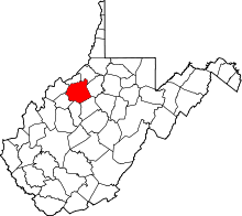 | |
| Towns | ||
| Unincorporated communities |
| |
| Ghost towns | ||
| Footnotes | ‡This populated place also has portions in an adjacent county or counties | |