Ceredo, West Virginia
| Ceredo, West Virginia | |
|---|---|
| Town | |
|
Looking east along U.S. Route 60 from C Street | |
 Location of Ceredo, West Virginia | |
| Coordinates: 38°23′36″N 82°33′37″W / 38.39333°N 82.56028°WCoordinates: 38°23′36″N 82°33′37″W / 38.39333°N 82.56028°W | |
| Country | United States |
| State | West Virginia |
| County | Wayne |
| Area[1] | |
| • Total | 2.26 sq mi (5.85 km2) |
| • Land | 1.53 sq mi (3.96 km2) |
| • Water | 0.73 sq mi (1.89 km2) |
| Elevation | 551 ft (168 m) |
| Population (2010)[2] | |
| • Total | 1,450 |
| • Estimate (2012[3]) | 1,412 |
| • Density | 947.7/sq mi (365.9/km2) |
| Time zone | Eastern (EST) (UTC-5) |
| • Summer (DST) | EDT (UTC-4) |
| ZIP code | 25507 |
| Area code(s) | 304 |
| FIPS code | 54-14308[4] |
| GNIS feature ID | 1537176[5] |
| Website | www.townofceredowv.com |


Ceredo is a city in Wayne County, West Virginia, United States, along the Ohio River. The population was 1,450 at the 2010 census. Ceredo is a part of the Huntington-Ashland, WV-KY-OH Metropolitan Statistical Area (MSA). As of the 2000 census, the MSA had a population of 288,649.
The city is also near the location of the Southern Airways Flight 932 aviation disaster. On November 14, 1970, a McDonnell Douglas DC-9 airplane carrying the Marshall University football team crashed on a hillside on approach to the Tri-State Airport, killing all on board. A movie about the tragedy, We Are Marshall, was released in 2006.
History
Ceredo was so named by its founder because of the bountiful harvest of corn upon the site. The name is derived from Ceres, the goddess of corn and harvest.[6]
New England Congregationalists founded Ceredo to demonstrate the superiority of an economic system not based on slave labor. Eli Thayer, an abolitionist congressman from Massachusetts, believed that bringing abolitionists like himself into southern states could ultimately bring about the end of slavery. While some welcomed the newcomers, several area newspapers published opinions against this "invasion." The newspaper of nearby Ashland, Kentucky, however, supported this move. By 1857, the city was fully established with a newspaper of its own and several industries.
With John Brown's raid at Harpers Ferry in 1859 and the outbreak of the Civil War in 1861, the situation for this abolitionist colony appeared bleak. Its purpose to bring about the peaceful end of slavery over, several residents volunteered for pro-Union regiments.
The Cabell Huntington Hospital was listed on the National Register of Historic Places in 1983.[7]
Geography
Ceredo is located at 38°23′36″N 82°33′37″W / 38.39333°N 82.56028°W (38.393406, -82.560246).[8]
According to the United States Census Bureau, the city has a total area of 2.26 square miles (5.85 km2), of which, 1.53 square miles (3.96 km2) is land and 0.73 square miles (1.89 km2) is water.[1]
Demographics
| Historical population | |||
|---|---|---|---|
| Census | Pop. | %± | |
| 1880 | 462 | — | |
| 1890 | 923 | 99.8% | |
| 1900 | 1,279 | 38.6% | |
| 1910 | 1,215 | −5.0% | |
| 1920 | 1,110 | −8.6% | |
| 1930 | 1,164 | 4.9% | |
| 1940 | 1,212 | 4.1% | |
| 1950 | 1,399 | 15.4% | |
| 1960 | 1,387 | −0.9% | |
| 1970 | 1,583 | 14.1% | |
| 1980 | 2,255 | 42.5% | |
| 1990 | 1,916 | −15.0% | |
| 2000 | 1,675 | −12.6% | |
| 2010 | 1,450 | −13.4% | |
| Est. 2015 | 1,388 | [9] | −4.3% |
| Source: [10] | |||
2010 census
As of the census[2] of 2010, there were 1,450 people, 638 households, and 378 families residing in the city. The population density was 947.7 inhabitants per square mile (365.9/km2). There were 718 housing units at an average density of 469.3 per square mile (181.2/km2). The racial makeup of the city was 98.2% White, 0.1% African American, 0.3% Native American, 0.1% Asian, 0.1% from other races, and 1.2% from two or more races. Hispanic or Latino of any race were 0.8% of the population.
There were 638 households of which 20.7% had children under the age of 18 living with them, 40.9% were married couples living together, 12.4% had a female householder with no husband present, 6.0% had a male householder with no wife present, and 40.8% were non-families. 37.0% of all households were made up of individuals and 19.6% had someone living alone who was 65 years of age or older. The average household size was 2.07 and the average family size was 2.64.
The median age in the city was 48.9 years. 16.1% of residents were under the age of 18; 10.5% were between the ages of 18 and 24; 19.1% were from 25 to 44; 27.7% were from 45 to 64; and 26.6% were 65 years of age or older. The gender makeup of the city was 42.6% male and 57.4% female.
2000 census
As of the census[4] of 2000, there were 1,675 people, 821 households, and 466 families residing in the city. The population density was 1,246.5 people per square mile (482.6/km²). There were 888 housing units at an average density of 660.8 per square mile (255.9/km²). The racial makeup of the city was 97.73% White, 0.06% Native American, 0.78% Asian, 0.12% Pacific Islander, 0.30% from other races, and 1.01% from two or more races. Hispanic or Latino of any race were 0.90% of the population.
There were 821 households out of which 19.0% had children under the age of 18 living with them, 43.8% were married couples living together, 10.5% had a female householder with no husband present, and 43.2% were non-families. 41.0% of all households were made up of individuals and 23.6% had someone living alone who was 65 years of age or older. The average household size was 2.01 and the average family size was 2.69.
In the city the population was spread out with 17.9% under the age of 18, 7.7% from 18 to 24, 22.7% from 25 to 44, 25.6% from 45 to 64, and 26.1% who were 65 years of age or older. The median age was 46 years. For every 100 females there were 73.0 males. For every 100 females age 18 and over, there were 68.6 males.
The median income for a household in the city was $24,323, and the median income for a family was $33,700. Males had a median income of $30,735 versus $21,615 for females. The per capita income for the city was $14,733. About 10.4% of families and 15.0% of the population were below the poverty line, including 9.0% of those under age 18 and 13.6% of those age 65 or over.
Climate
The climate in this area is characterized by hot, humid summers and generally mild to cool winters. According to the Köppen Climate Classification system, Ceredo has a humid subtropical climate, abbreviated "Cfa" on climate maps.[11]
Notable people
- Dagmar, TV star of the 1950s lived in Ceredo in the 1990s
- Charles B. Hoard, businessman and Member of the United States House of Representatives
- Beau Smith, comic book writer, publicist, columnist
- Eli Thayer, Member of the United States House of Representatives and founder of Ceredo
- James Dixon Williams, Hollywood movie pioneer and co-founder of First National Pictures was born in Ceredo about 1877
See also
References
- 1 2 "US Gazetteer files 2010". United States Census Bureau. Archived from the original on 2012-01-24. Retrieved 2013-01-24.
- 1 2 "American FactFinder". United States Census Bureau. Retrieved 2013-01-24.
- ↑ "Population Estimates". United States Census Bureau. Archived from the original on 2013-06-17. Retrieved 2013-06-26.
- 1 2 "American FactFinder". United States Census Bureau. Archived from the original on 2013-09-11. Retrieved 2008-01-31.
- ↑ "US Board on Geographic Names". United States Geological Survey. 2007-10-25. Retrieved 2008-01-31.
- ↑ Gannett, Henry (1905). The Origin of Certain Place Names in the United States. Govt. Print. Off. p. 74.
- ↑ National Park Service (2009-03-13). "National Register Information System". National Register of Historic Places. National Park Service.
- ↑ "US Gazetteer files: 2010, 2000, and 1990". United States Census Bureau. 2011-02-12. Retrieved 2011-04-23.
- ↑ "Annual Estimates of the Resident Population for Incorporated Places: April 1, 2010 to July 1, 2015". Retrieved July 2, 2016.
- ↑ "Census of Population and Housing". U.S. Census Bureau. Retrieved 3 June 2015.
- ↑ Climate Summary for Ceredo, West Virginia
External links
Municipalities and communities of Wayne County, West Virginia, United States | ||
|---|---|---|
| Cities | 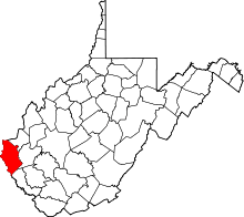 | |
| Towns | ||
| CDPs | ||
| Unincorporated communities |
| |
| Footnotes | ‡This populated place also has portions in an adjacent county or counties | |
| Principal cities | 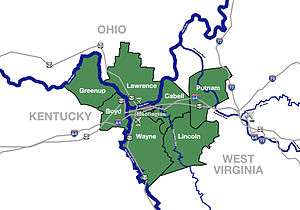 | |
|---|---|---|
| Municipalities with population over 5,000 | ||
| Municipalities with population 1,000–5,000 | ||
| Municipalities with population under 1,000 | ||
| West Virginia counties | ||
| Kentucky counties | ||
| Ohio counties | ||