Prosperidad, Agusan del Sur
| Prosperidad | ||
|---|---|---|
| Municipality | ||
|
Naliyagan Plaza at the Capitol grounds in Barangay Patin-ay | ||
| ||
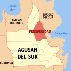 Location within Agusan del Sur province | ||
.svg.png) Prosperidad Location within the Philippines | ||
| Coordinates: 8°37′N 125°55′E / 8.61°N 125.92°ECoordinates: 8°37′N 125°55′E / 8.61°N 125.92°E | ||
| Country | Philippines | |
| Region | Caraga (Region XIII) | |
| Province | Agusan del Sur | |
| District | 1st District, Agusan del Sur | |
| Founded | January 1, 1970 | |
| Barangays | 32 (see Barangays) | |
| Government [1] | ||
| • Type | Sangguniang Bayan | |
| • Mayor | Albin D. Magdamit | |
| Area[2] | ||
| • Total | 505.15 km2 (195.04 sq mi) | |
| Population (2015 census)[3] | ||
| • Total | 82,631 | |
| • Density | 160/km2 (420/sq mi) | |
| • Voter (2016)[4] | 42,121 | |
| Time zone | PST (UTC+8) | |
| ZIP code | 8500 | |
| IDD : area code | +63 (0)85 | |
| Income class | 1st class | |
| PSGC | 160306000 | |
| Website |
www | |


Prosperidad, officially the Municipality of Prosperidad (Filipino: Bayan ng Prosperidad), is the capital municipality of the province of Agusan del Sur in the Caraga (Region XIII) of the Philippines. The population was 82,631 at the 2015 census.[3] In the 2016 election, it had 42,121 registered voters.[4] Prosperidad was created on June 18, 1960 through Republic Act No. 2650.[5]
Prosperidad is the venue of the Naliyagan Festival, an annual event celebrated by the entire province of Agusan del Sur.
History and etymology
Prior to the Spanish Colonial Period, a Manobo settlement thrived at the junction of the Sianib and Gibong River. This settlement was known to the natives as Culilay.
During the Spanish Colonial Period, the missionaries discovered the settlement and soon began the Christianization of the Manobos. The natives were given Christian names and the settlement was renamed from Culilay to San Juan.
At the start of the American Period, San Juan was again renamed Las Navas but the name was short-lived as the place underwent another change in name – from Las Navas to Prosperidad derived from the word Prospero or "progressive" as the place experienced growth and prosperity during the time of American Governor Zapanta who coined the name.
Geography
Prosperidad is located at 8°37′N 125°55′E / 8.61°N 125.92°E.
According to the Philippine Statistics Authority, the municipality has a land area of 505.15 square kilometres (195.04 sq mi)[2] constituting 5.06% of the 9,989.52-square-kilometre- (3,856.98 sq mi) total area of Agusan del Sur.
Barangays
Prosperidad is politically subdivided into 32 barangays.[6]
| PSGC | Barangay | Population | ±% p.a. | ||
|---|---|---|---|---|---|
| 2015[3] | 2010[7] | ||||
| 160306001 | Aurora | 3.9% | 3,251 | 2,999 | +1.55% |
| 160306002 | Awa | 2.3% | 1,888 | 1,802 | +0.89% |
| 160306003 | Azpetia | 2.2% | 1,850 | 1,708 | +1.53% |
| 160306006 | La Caridad | 2.1% | 1,769 | 1,591 | +2.04% |
| 160306033 | La Perian | 1.0% | 835 | 762 | +1.76% |
| 160306034 | La Purisima | 2.8% | 2,276 | 2,224 | +0.44% |
| 160306007 | La Suerte | 2.1% | 1,772 | 1,490 | +3.36% |
| 160306008 | La Union | 2.2% | 1,853 | 1,509 | +3.99% |
| 160306009 | Las Navas | 2.2% | 1,785 | 1,535 | +2.91% |
| 160306010 | Libertad | 1.2% | 985 | 816 | +3.65% |
| 160306011 | Los Arcos | 3.2% | 2,606 | 2,324 | +2.20% |
| 160306012 | Lucena | 4.2% | 3,511 | 3,400 | +0.61% |
| 160306013 | Mabuhay | 2.4% | 2,013 | 1,938 | +0.73% |
| 160306014 | Magsaysay | 2.8% | 2,339 | 1,944 | +3.58% |
| 160306015 | Mapaga | 1.9% | 1,558 | 1,394 | +2.14% |
| 160306017 | Napo | 1.2% | 953 | 984 | −0.61% |
| 160306016 | New Maug | 1.8% | 1,480 | 1,460 | +0.26% |
| 160306018 | Patin-ay | 10.3% | 8,505 | 7,562 | +2.26% |
| 160306004 | Poblacion (BahBah) | 15.4% | 12,731 | 12,180 | +0.85% |
| 160306020 | Salimbogaon | 1.0% | 790 | 790 | 0.00% |
| 160306021 | Salvacion | 3.2% | 2,659 | 2,315 | +2.67% |
| 160306022 | San Joaquin | 2.1% | 1,720 | 1,484 | +2.85% |
| 160306023 | San Jose | 3.1% | 2,579 | 2,436 | +1.09% |
| 160306024 | San Lorenzo | 1.6% | 1,310 | 1,483 | −2.33% |
| 160306025 | San Martin | 2.9% | 2,379 | 1,929 | +4.07% |
| 160306026 | San Pedro | 1.0% | 851 | 1,395 | −8.98% |
| 160306027 | San Rafael | 2.4% | 1,973 | 1,918 | +0.54% |
| 160306035 | San Roque | 1.3% | 1,093 | 719 | +8.30% |
| 160306029 | San Salvador | 1.9% | 1,567 | 1,522 | +0.56% |
| 160306030 | San Vicente | 4.5% | 3,728 | 3,444 | +1.52% |
| 160306031 | Santa Irene | 7.4% | 6,148 | 5,899 | +0.79% |
| 160306032 | Santa Maria | 2.3% | 1,874 | 1,672 | +2.20% |
| Total | 82,631 | 76,628 | +1.45% | ||
Demographics
| Population census of Prosperidad | |||||||||||||||||||||||||
|---|---|---|---|---|---|---|---|---|---|---|---|---|---|---|---|---|---|---|---|---|---|---|---|---|---|
|
| ||||||||||||||||||||||||
| Source: PSA[3][7][8] | |||||||||||||||||||||||||
In the 2015 census, Prosperidad had a population of 82,631.[3] The population density was 160 inhabitants per square kilometre (410/sq mi).
In the 2016 election, it had 42,121 registered voters.[4]
Education
A satellite campus of the Philippine Normal University is located in Poblacion in Prosperidad (popularly known as Bah-Bah) which was established in 1968.

References
- ↑ "Municipality". Quezon City, Philippines: Department of the Interior and Local Government. Retrieved 31 May 2013.
- 1 2 "Province: Agusan del Sur". PSGC Interactive. Makati City, Philippines: Philippine Statistics Authority. Retrieved 28 October 2016.
- 1 2 3 4 5 "CARAGA". Census of Population (2015): Total Population by Province, City, Municipality and Barangay (Report). PSA. Retrieved 20 June 2016.
- 1 2 3 "2016 National and Local Elections Statistics". Commission on Elections. 2016.
- ↑ "Republic Act No. 2650; An Act Creating the Municipality of Prosperidad in the Province of Agusan". The Corpus Juris. 18 June 1960. Archived from the original on 18 October 2016. Retrieved 18 October 2016.
- ↑ "Municipal: Prosperidad, Agusan del Sur". PSGC Interactive. Quezon City, Philippines: Philippine Statistics Authority. Retrieved 8 January 2016.
- 1 2 "CARAGA". Census of Population and Housing (2010): Total Population by Province, City, Municipality and Barangay (Report). NSO. Retrieved 29 June 2016.
- ↑ "CARAGA". Census of Population (1995, 2000 and 2007): Total Population by Province, City and Municipality (Report). NSO. Archived from the original on 11 November 2011.
External links
| Wikimedia Commons has media related to Prosperidad, Agusan del Sur. |
 |
Bayugan | |
San Miguel, Surigao del Sur | |
| Esperanza | |
Marihatag, Surigao del Sur San Agustin, Surigao del Sur Lianga, Surigao del Sur | ||
| ||||
| | ||||
| San Francisco | Barobo, Surigao del Sur |
Prosperidad (capital) | |
| Municipalities | |
| Component city | |
