Virac, Catanduanes
| Virac | ||
|---|---|---|
| Municipality | ||
| ||
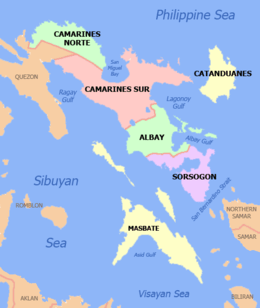
 Location in the province of Catanduanes | ||
.svg.png) Virac Location within the Philippines | ||
| Coordinates: 13°35′N 124°14′E / 13.583°N 124.233°ECoordinates: 13°35′N 124°14′E / 13.583°N 124.233°E | ||
| Country | Philippines | |
| Region | Bicol (Region V) | |
| Province | Catanduanes | |
| District | Lone district | |
| Founded | Year 1775 | |
| Barangays | 63 | |
| Government[1] | ||
| • Mayor | Samuel Laynes | |
| Area[2] | ||
| • Total | 152.40 km2 (58.84 sq mi) | |
| Population (2010)[3] | ||
| • Total | 66,951 | |
| • Density | 440/km2 (1,100/sq mi) | |
| Time zone | PST (UTC+8) | |
| Zip Code | 4800 | |
| Dialing code | 52 | |


Virac is a first class municipality in the province of Catanduanes, Philippines. It is the capital municipality of the province and the most populous and fifth largest in land area.[4] According to the 2010 census, it has a population of 66,951 persons.[3]
Etymology
It has been said that Virac is a derivation of the word “Vidak” while others claim it is a contraction of the Spanish version of the word burac, meaning flower. A priest is on a quest for more information about the natives. Pointing to a tree, he asked what it was called and the natives replied, “Burac.” Thereupon, the priest made his first notation on his book of information “burac”.
History
Pre-Spanish period
Civilization first touched the island province of Catanduanes in the thirteenth century, with the arrival of the scions of ten Bornean datus who were then traversing through the islets of the Philippine Archipelago. By the middle of the fourteenth century, organized communities could be seen throughout Catanduanes – a consequence of the rapid development of Southeastern Luzon initiated by the Malay settlers.
Virac, the capital town of the island province of Catanduanes, started its primitive annals in pre-Spanish times when tribal chieftain Lumibao, scion of Datu Dumaguil who came to the Philippines with the 10 Bornean datus and his wife Milbigan settled near Vidak spring and founded the first civilized settlement with a score of servant followers and their wives.
Spanish period
It was the Spanish Conquistadores Juan de Salcedo who first brought Spanish galleons to the waters of Catanduanes in 1573. His purpose then was to capture and punish pirates who carried on their nefarious trade in Camarines Sur, Sorsogon and Western Catanduanes. His galleon returned a few weeks later – this time, his mission was to spread the Catholic faith.
While at bay, the port guard saw smoke rising from the mountain Eli. After dropping anchor, the Spaniards tracked down footprints from the shore which reached a sitio called Vidak. They eventually came upon a large kaingin in Timbean, situated between the barangays of Danicop and Calatagan.
The chieftain of the village had his hut built a little above a spring which still exists today. There was a reception hall conveniently shaded by a tree known as sambong. This tree eventually served as the guidon to the couple’s place.
It is said that the Spaniards could not approach the hut of the chieftain because of three huge fierce-looking dogs and several guards who had their spears drawn toward the foreigners. However, the Spaniards determined to succeed in their mission, returned the threatening acts of the natives with gesture of friendship.
A piece of “onchita” was offered to the chieftain as a gift; but this was rejected by the chieftain when his wife said “we have many pieces of gold in our kingdom”. A silver piece was next offered, but this was similarly rejected by the chieftain and his wife. Reaching for some refined sugar, the Spaniards let the natives taste the sweetness of the substance. The chieftain’s wife like the taste. Thus begun the “sweet” relation between the natives and the Spaniards.
Soon after the first encounters, the Spaniards started giving the natives provisions not found in the chieftain’s hut, such as more sugar and clothing. After the seed of friendship had taken roots, the Spaniards began spreading their message of Christianity. Lumibao was baptized as Jose and Milbigan as Maria. Their son who lived at the bank of Macacao was converted into Christianity with the name of Mariano.
It is unfortunate that records regarding the Christianization of Virac were lost due to vandalism of Moros. The history of this capital town began to be accurately recorded only from the year 1755.
Moro raids
Catanduanes was not spared from the adventurous and plunderous raids of the Moros from Mindanao. But knowing the strength of the coastal batteries of the Virac harbor, the vintas divided into groups and landed at various places or points farther from the range of the coastal batteries. Some landed at Cadaculaan and others way out to points east and west of Virac.
Don Matias Soliman, a famous Moro fighter, engaged in battle and killed a Moro Datu named Mohammed Abu after a bloody encounter in sitio Hopog of Barrio Sto. Domingo, Virac. He was aided by the swift-handed and hoarse voiced Don Alipio Alejandro alias Paas.
The non-Christian invaders were superior in arms and number until Don Alipio, with an exotic force, turned the tide. The Moros could not move further, hence, they retreated in defeat.
On the eastern end of Virac, the Moros succeeded in gaining a beach-head in Catanduanes and from there, attacked the town from the east. The Cabeza de Barangay of Francia, Don Pedro Tolentino alias Pantino, lost no time in giving their all against the enemy. This was the first time the people of Virac totally and successfully resisted an organized invasion.
American occupation
A few months after Emilio Aguinaldo, the first president of the First Philippine Republic took his oath of allegiance to America after losing in the Philippine-American War, a battleship dropped anchor in Virac. The American soldiers were on a mission to expedite the surrender of the local Revolutionists or Katipuneros. Not eager to relinquish their hard-fought freedom, the Katipuneros refused to recognize the sovereignty of the United States and fled to the mountains.
In the later part of 1898, when Don Leon Reyes was the incumbent Capitan Municipal [town mayor] of Virac, the revolutionary troops who refused American Administration, came down from the mountains to rally for the common cause. Don Leon Reyes readily welcomed the revolutionists and financed their cause in fighting the Americans. This state of affairs was tactfully handled by the Capitan who spent almost all of his fortunes for the cause. For his patriotic zeal, he was manacled, chained and sentenced to hard labor by the Americans in 1901.
The American occupation ended in 1934 before the establishment of the Philippine Commonwealth in 1935.
Japanese Invasion
Catanduanes was not spared by the forces of the Kamakura Regiment. Airborne planes were cited at the southern portion of Virac in the morning of December 12, 1941, while vessels dropped anchor near Nagngangang Buaya Point, Cabugao Bay. At 9:30 in the morning of said day, towns were totally evacuated. Bombs were soon strategically dropped.
Later, garrisons were established in town and the municipal building was also used as a garrison. No school was regularly opened during the Japanese Occupation. Guerrilla organizations came and went.
Liberation
The Liberation of Catanduanes took place in what is now the municipal building and the Virac Parish Church area. On February 8, 1945, the battle started at Km. 4 at Brgy. Calatagan at about 12 noon, and ended with the Filipino soldiers of the 5th, 51st, 52nd, 53rd, 55th, 56th and 57th Infantry Division of the Philippine Commonwealth Army and recognized guerrillas taking full control of the Japanese barracks.
On April 20, 1945, Florencio Tacorda, the only three-term Municipal President, some two and a half decades before the war, was designated mayor of Virac. He served for six months and twenty-five days during the Philippine Civil Affairs Unit regime.
Pre and Martial Law Era
From 1958-1970, Salvador Surtida took over followed by Jorge Arcilla from 1970-1986, two of the longest reigning local executives in the history of Virac. This period witnessed the ascendancy to national prominence of the Alberto brothers, Juan, Jose and Vicente, who doubtlessly brought progress and influenced the massive physical transformation of the municipality when Salvador Surtida and Jorge Arcilla were mayors. Foremost among the many infrastructure projects were the Catanduanes State Colleges and the Eastern Bicol Medical Center which placed Virac in the map as a major educational and health center in the Bicol Region.
The growth of Virac in terms of governance peaked in 1972. From the original 34 barangays in 1960, Virac was able to establish 29 new communities to upgrade to the present composition of 63 barangays. The declaration of martial law on September 21, 1972, despite the alleged rampant atrocities, had, by and large, no ill effects on the lives of the constituency, who by nature are peace-loving and law-abiding citizens.
EDSA Revolution and Beyond
The EDSA Revolution in1986 which toppled down the more than two decades of Marcos regime had a domino effect on the political structure of Virac. The replacement of the elected officials by appointed officials was in accordance with the Freedom Constitution which predominated during the revolutionary government from 1986 to1992. Rodulfo Sarmiento, a doctor by profession held the reins of the municipal government.
The early nineties and onward saw the alternate changing of guard at the helm of local governance between Rodulfo Sarmiento and Jose "Cito" Alberto II, the son of Congressman Jose Alberto. The operation of the ferry boat which facilitates the transfer of goods and services from the Bicol mainland to Virac ushered in the vibrance in trade and commerce as manifested by the modern unseen before but now dotting the commercial centers and the bee-line of private and public conveyances plying the streets. Growing political maturity has been apparent in barangay affairs operation and so with the swell in the number of non-government organizations which is an indication of growing people empowerment.
With the advent of the third millennium came the resurgence of the physical face lift of Virac as more public structures have been erected and upgraded during the second "tour of duty" of incumbent Mayor Jose "Cito" Alberto.
Geography
The municipality of Virac occupies the southern tip of the island province. It has a total land area of 18,778.4 hectares. Of its total, 9,359.15 hectares or 49.84% is forestland while 9,419.25 hectares are classified as alienable and disposable.
Almost half of the area is rugged and mountainous, with hills and plains dotted with marshy land, rocky jutting cliffs and crags.
The town is bounded on the east and south by the Pacific Ocean, on the north by high and green mountain ranges of San Miguel, and on the west by the gently rolling hills of San Andres.[4]
Climate
Virac has a Type II climate. It has no dry season and an average precipitation of between 2,500-3,000 mm/annually.
Virac's position in the middle of the typhoon belt means that it is heavily affected by typhoons from July to October. The region's dependence on agriculture means that economic development has always been hampered by these weather disturbances.[5]
Barangays
The growth of Virac in terms of governance peaked in 1972. From the original 34 barangays in 1960, Virac established 29 new communities to increase the number of barangays to the present 63 barangays.
|
|
Demographics
| Population census of Virac | ||
|---|---|---|
| Year | Pop. | ±% p.a. |
| 1990 | 45,523 | — |
| 1995 | 49,912 | +1.74% |
| 2000 | 57,067 | +2.91% |
| 2007 | 64,554 | +1.71% |
| 2010 | 66,951 | +1.34% |
| Source: National Statistics Office[3][6] | ||
Religion
Catholicism is a deeply rooted institution in this town with 98% of the people embracing the faith. Virac is the seat of an independent diocese of Catanduanes with Bishop Manolo Delos Santos, D.D., at the helm. The town was once a vicarship of Caceres and later, the Diocese of Legazpi. The patron of the town is the Immaculate Concepcion with the feast day celebrated on December 8.[5]
Economy
The economy of Virac is sustained primarily by agriculture - the farming of rice, corn, bananas and root crops. The production of copra and abaca also provide additional income for the people. Its annual income in 1979 was a little more than P980,000.00 and the projected income for 1990 is more than a million pesos. Fishing is also an essential industry, together with mining and lumber. Lately, some home industries have been established while other sources of income are business and employment from the government and private sectors.
This capital town has a total land area of 0.30 hectares devoted to industrial undertakings with the exception of the unused 11.2 hectares in Palnab classified as industrial area in the 1978 Official Land Use Plan and the 20-hectare declared site of the proposed Provincial Agro-Industrial Center at Casoocan. Manufacturing and processing activities are dominated by micro-industry enterprises. Of the existing industries, furniture making, being primarily wood-based, faces the gravest threat of extinction due to global concern for forest protection and conservation.
Rice is the single biggest monocrop culture planted in an aggregate area of 1,019 hectares which is about thirty three percent of the total lowland agricultural land area. Three hundred seventy five hectares are devoted to vegetables production. Upland farms are essentially utilized for cash crops such as abaca, tubers and coconut. Vegetables and other food crops are raised in the low lands on mostly seasonal basis.
For 2011, annual harvests approximate 7,849 MT of palay, 3.00 MT of vegetables, 59.75 MT of corn, 7.98 MT of root crops, 1.6 MT of legumes and other perennial crops 5.445MT. Unprocessed abaca fiber and copra represent the major export products.
In 2012, Virac's locally generated income reached Php32.6 million, with total income (including IRA) at Php117.9 million.
The five major income sources
- Services
- Agriculture
- Tourism
- Cottage Industry
- Manufacturing
Potential Investment Areas
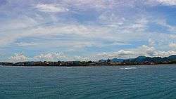
Tourism Virac’s tourist attractions are mainly located on its southern coastal district where clean white beaches and isolated coves are found. Of late, miniature beach resorts are mushrooming along the coastal road of San Vicente area which become favorite hang-outs of local tourists at night because of their proximity to the poblacion. Coral formations which are mostly undisturbed, offer numerous entertainment possibilities for snorkeling and skin diving. Surfing is largely seasonal. The caves and coves promise a wealth of experience for spelunkers. To the daring and the adventurous, Virac’s numerous mountain trails represent a thrilling challenge for mountain climbing.
Three hotels and several pension houses provide the lodging needs of Virac’s transients. Four tourist-rated resorts are in operation and aptly located to cater to the requirements of their clientele. The proposal of establishing a center of wellness at the heart of the poblacion of Virac as part of the tourism package of the province is a welcome development.
Industry Manufacturing and processing are dominated by micro industry enterprises whose capital is P150,000 and below. Food processing, iron and metal craft and handicraft comprise the micro industries. Concrete products manufacturing and furniture making ventures consist of the cottage industries with investments of P150,000 to P1.5M. Wood furniture making is on twilight due to the ban of cutting trees. On the other hand, there is a recurring interest in reviving the rattancraft in lieu of the wood ban.
Two (2) ice plants servicing the fishing industry of the province and the only (1) exporter engaged in costume jewelry respectively, are classified as small scale industries with capitalization ranging from P1.5M to P5M. Three construction companies will fall under medium industries. On the other hand, large scale industries are yet to be established in the municipality.
The opening of Jollibee food chain augurs well for the municipality which aspires to be a major investment destination in the Bicol region. Its presence is an indication of the investors’ confidence in the viability of economic returns of their investments in the island province particularly in the capital town. Mercury, a multi-national drug distributor and retailer will likewise soon operate in Virac. This is a manifestation that the promotional efforts plus business-friendly policies espoused by local functionaries have somehow borne fruits.
Transportation The Provincial Circumferential Road Project has brought about the expansion of concrete road network connecting municipalities notwithstanding the upgrading of inter-barangay connectivity being pursued by the local government and the Office of the Congressional District. This primarily contributed in the increase in the volume of motor vehicles plying Virac to other municipalities and vice versa thereby improved mobility and accessibility aside from providing comfort to the riding public. The swell in the mode of transport presses the LGU in taking the lead to establish a Provincial Integrated Transport Terminal to rationalize the movement of goods and people.
Agriculture Major agricultural facilities in the province are based in Virac which include the Catanduanes State University, one of the two tertiary schools in Catanduanes which offers agriculture and fishery courses, Catanduanes Agricultural Research and Extension Station, FIDA Abaca Tissue Laboratory, Virac Breeding Station, DA-RFTC, and PCA Coconut Nursery. Agricultural credit facilities are extended by 3 commercial banks and one rural bank available in the municipality with the Land Bank of the Philippines as the premier farmers’ bank.
The municipality of Virac devotes 8,832.63 hectares which represents 47.04% of the total land area for agricultural endeavors. Of the total productive agricultural land, 1,405.6066 hectares are utilized for rice production. The municipality has yet to experience rice sufficiency in spite of the new rice technology introduced to local farmers. Deficit in rice production is primarily attributed to dearth of irrigation facilities.
Abaca and coconut have 1,225 and 2,955.58 hectares respectively. However, coconut and abaca production may take some time to recover from the devastation of typhoon “Reming” that recently ravaged the municipality in November 2006. The balance of 598 hectares of the agricultural land area is allotted to other crops.
Transport
Airport

Virac Airport. Daily flights to and from Manila are provided by 1 airline - Cebu Pacific. There is no direct flight to or from Cebu even though it is serviced by Cebu Pacific. A connecting flight has to be made to Manila in between. Flight time to Manila takes less than an hour.
Land transport
- From Manila, Air Conditioned and ordinary Buses from Cubao, Quezon City travels daily to Virac, Catanduanes via Tabaco port which takes 9 to 12 hours depending on the bus' itinerary. RORO ships plies daily from Tabaco, Albay to Catanduanes via San Andres Port or Virac Port.c.[7]
- Traveling within Virac or to other destinations in the province are by local buses, jeepneys, tricycles or by pedicabs.
Virac Seaport
Daily Ferry services bridge Catanduanes, from the Port of Virac and Port of San Andres, to the main island of Luzon, via Tabaco Seaport in Tabaco City, Albay. Several ferry companies offer trips at different hours of the day between the two ports, which normally takes about three and a half hours.[8]
Tourism
Beaches
Popular beaches around town are:
- Mamangal Beach, located in Mamangal, a small sitio adjacent to Brgy. Balite, Virac, was developed by the local government, with pavilion and sheds for the beach goers.
- Twin Rock Beach Resort, located in Brgy. Igang, Virac. One of the most visited Beach resort.
- Johnny's Beach Resort is located in Brgy. Balite.
- Monte Carlo Inn & Resort is located in Brgy. San Vicente in Virac.
- Roadside Resort and Restaurant is also in Brgy. San Vicente in Virac.
Amenia Beach Resort, Erickson Resort, Balin Resort, Monte Cielo are located at Palawig
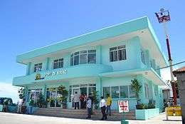
Institutions

- The Provincial Capitol building is an edifice that is the pride of Bicolandia and can also be considered as an alternative tourist destination in the town proper because of its admirable landscape, mini-forest, orchidarium, plaza and spacious playground.
- The Juan M. Alberto Memorial Building and Theatre promoting the image of Catandunganon’s art and culture.
- Imelda Boulevard, is a replica of Roxas Boulevard of Manila.
- The Eastern Bicol Medical Center with its modern facilities and equipment.
- The Catanduanes State University which caters to the educational needs of the province.
- The Police Barracks and officers quarters.
- The Virac Athletic Complex, considered to be one of the best in the whole country.
- The Virac Youth Center Mall
- The Catanduanes National High School.
- The Calatagan High School.
- The Virac Central Elementary School
- The Virac Pilot Elementary School
- The Juan M. Alberto Memorial Elementary School
- The San Vicente Elementary School
- The Museo de Catanduanes in the old capitol Building
References
- ↑ "Municipalities". Quezon City, Philippines: Department of the Interior and Local Government. Retrieved 20 January 2013.
- ↑ "Province: Catanduanes". PSGC Interactive. Makati City, Philippines: National Statistical Coordination Board. Retrieved 20 January 2013.
- 1 2 3 4 5 "Total Population by Province, City, Municipality and Barangay: as of May 1, 2010" (PDF). 2010 Census of Population and Housing. National Statistics Office. Retrieved 20 January 2013.
- 1 2 "Virac". Philippine Department of Tourism. Retrieved on 2010-06-28.
- 1 2 "Virac/Catanduanes". Diocese of Virac web page. Retrieved on 2010-06-26.
- ↑ "Province of Catanduanes". Municipality Population Data. LWUA Research Division. Retrieved 24 July 2013.
- ↑ "Bus Ride to Virac, Catanduanes". Planet Virac. Retrieved on 2010-06-28.
- ↑ "Transportation - Ferry Service to Virac". Planet Virac. Retrieved on 2010-06-28.
External links
| Wikimedia Commons has media related to Virac, Catanduanes. |
- Official website of Virac
- Virac / Bicolano Radio Stations Online
- Philippine Standard Geographic Code listing for Virac
- Philippine Census Information
- 2007 Local Elections
 |
Caramoran | San Miguel | | |
| San Andres | |
Bato | ||
| ||||
| | ||||
| Lagonoy Gulf |