Esperanza, Agusan del Sur
| Esperanza | ||
|---|---|---|
| Municipality | ||
|
Esperanza Bridge | ||
| ||
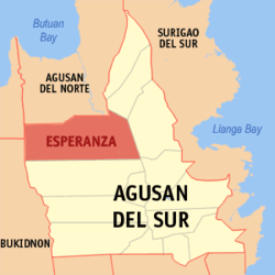 Location within Agusan del Sur province | ||
.svg.png) Esperanza Location within the Philippines | ||
| Coordinates: 8°41′N 125°39′E / 8.68°N 125.65°ECoordinates: 8°41′N 125°39′E / 8.68°N 125.65°E | ||
| Country | Philippines | |
| Region | Caraga (Region XIII) | |
| Province | Agusan del Sur | |
| District | 1st district of Agusan del Sur | |
| Founded | 1921 | |
| Barangays | 47 (see Barangays) | |
| Government [1] | ||
| • Type | Sangguniang Bayan | |
| • Mayor | Deo S. Manpatilan | |
| Area[2] | ||
| • Total | 1,355.48 km2 (523.35 sq mi) | |
| Population (2015 census)[3] | ||
| • Total | 54,801 | |
| • Density | 40/km2 (100/sq mi) | |
| • Voter (2016)[4] | 27,752 | |
| Time zone | PST (UTC+8) | |
| ZIP code | 8513 | |
| IDD : area code | +63 (0)85 | |
| Income class | 1st class | |
| PSGC | 160303000 | |
| Website |
www | |


Esperanza, officially the Municipality of Esperanza (Filipino: Bayan ng Esperanza), is a municipality in the province of Agusan del Sur in the Caraga (Region XIII) of the Philippines. The population was 54,801 at the 2015 census.[3] In the 2016 election, it had 27,752 registered voters.[4]
Geography
Esperanza is located at 8°41′N 125°39′E / 8.68°N 125.65°E.
According to the Philippine Statistics Authority, the municipality has a land area of 1,355.48 square kilometres (523.35 sq mi)[2] constituting 13.57% of the 9,989.52-square-kilometre- (3,856.98 sq mi) total area of Agusan del Sur.
Barangays
Esperanza is politically subdivided into 47 barangays.[5]
| PSGC | Barangay | Population | ±% p.a. | ||
|---|---|---|---|---|---|
| 2015[3] | 2010[6] | ||||
| 160303031 | Agsabu | 1.5% | 812 | 612 | +5.53% |
| 160303032 | Aguinaldo | 1.0% | 540 | 523 | +0.61% |
| 160303001 | Anolingan | 3.0% | 1,649 | 1,567 | +0.98% |
| 160303002 | Bakingking | 0.9% | 496 | 462 | +1.36% |
| 160303033 | Balubo | 1.5% | 816 | 930 | −2.46% |
| 160303003 | Bentahon | 2.0% | 1,084 | 956 | +2.42% |
| 160303004 | Bunaguit | 2.2% | 1,192 | 1,253 | −0.95% |
| 160303006 | Catmonon | 3.2% | 1,733 | 1,654 | +0.89% |
| 160303034 | Cebulan | 0.8% | 432 | 316 | +6.13% |
| 160303007 | Concordia | 1.7% | 935 | 779 | +3.54% |
| 160303035 | Crossing Luna | 2.5% | 1,381 | 1,250 | +1.92% |
| 160303036 | Cubo | 1.6% | 877 | 776 | +2.36% |
| 160303008 | Dakutan | 6.2% | 3,391 | 3,271 | +0.69% |
| 160303009 | Duangan | 2.9% | 1,610 | 1,596 | +0.17% |
| 160303011 | Guadalupe | 7.4% | 4,046 | 3,854 | +0.93% |
| 160303037 | Guibonon | 0.9% | 502 | 737 | −7.05% |
| 160303012 | Hawilian | 4.3% | 2,358 | 2,147 | +1.80% |
| 160303038 | Kalabuan | 0.5% | 283 | 343 | −3.59% |
| 160303039 | Kinamaybay | 1.2% | 683 | 654 | +0.83% |
| 160303013 | Labao | 1.7% | 930 | 721 | +4.97% |
| 160303040 | Langag | 2.2% | 1,197 | 1,084 | +1.91% |
| 160303014 | Maasin | 2.0% | 1,091 | 1,079 | +0.21% |
| 160303010 | Mac-Arthur | 0.4% | 200 | 195 | +0.48% |
| 160303015 | Mahagcot | 1.5% | 841 | 833 | +0.18% |
| 160303041 | Maliwanag | 0.5% | 296 | 163 | +12.03% |
| 160303016 | Milagros | 2.1% | 1,172 | 1,145 | +0.44% |
| 160303017 | Nato | 3.2% | 1,732 | 1,639 | +1.06% |
| 160303042 | New Gingoog | 0.9% | 495 | 420 | +3.18% |
| 160303043 | Odiong | 1.1% | 622 | 545 | +2.55% |
| 160303018 | Oro | 3.5% | 1,922 | 1,536 | +4.36% |
| 160303044 | Piglawigan | 3.4% | 1,882 | 1,623 | +2.86% |
| 160303019 | Poblacion | 8.7% | 4,778 | 4,907 | −0.51% |
| 160303020 | Remedios | 2.6% | 1,447 | 1,665 | −2.64% |
| 160303021 | Salug | 2.3% | 1,238 | 1,262 | −0.36% |
| 160303045 | San Isidro | 0.7% | 385 | 358 | +1.39% |
| 160303046 | San Jose | 0.3% | 150 | 151 | −0.13% |
| 160303022 | San Toribio | 4.4% | 2,424 | 2,218 | +1.71% |
| 160303047 | San Vicente | 1.4% | 765 | 578 | +5.48% |
| 160303023 | Santa Fe | 3.6% | 1,990 | 1,698 | +3.07% |
| 160303024 | Segunda | 0.5% | 293 | 314 | −1.31% |
| 160303048 | Sinakungan | 0.8% | 464 | 485 | −0.84% |
| 160303026 | Tagabase | 1.5% | 827 | 780 | +1.12% |
| 160303027 | Taganahaw | 0.7% | 382 | 376 | +0.30% |
| 160303028 | Tagbalili | 1.0% | 546 | 632 | −2.75% |
| 160303029 | Tahina | 1.4% | 769 | 742 | +0.68% |
| 160303030 | Tandang Sora | 1.4% | 768 | 732 | +0.92% |
| 160303049 | Valentina | 0.7% | 375 | 336 | +2.11% |
| Total | 54,801 | 51,897 | +1.04% | ||
Demographics
| Population census of Esperanza | |||||||||||||||||||||||||
|---|---|---|---|---|---|---|---|---|---|---|---|---|---|---|---|---|---|---|---|---|---|---|---|---|---|
|
| ||||||||||||||||||||||||
| Source: PSA[3][6][7] | |||||||||||||||||||||||||
In the 2015 census, Esperanza had a population of 54,801.[3] The population density was 40 inhabitants per square kilometre (100/sq mi).
In the 2016 election, it had 27,752 registered voters.[4]
The Golden Tara
In July 1917, a flood and storm swept through Agusan del Sur in Barangay Cubo of Esperanza. After the storm, a Manobo woman named Bilay Ocampo was on the banks of the muddy Wawa River where she eventually found a figure where it washed up from the river. The 21-karat gold figure dating to around 850 to 950 C.E. weighs 4 pounds (1.8 kg) and depicts a woman sitting in the lotus position in Buddhism, is ornamented with jewelry on her body, and wears a headdress. This figure turned out to be a representation of the Bodhisattva Tara. Now known as the "Golden Tara", after its discovery, it was handed to the former Deputy Governor Bias Baclagon then it was passed to the Agusan Coconut Company, because of a debt. It was then being sold and was purchased for ₱4,000 by the wife of American Governor-General Leonard Wood, Faye Cooper-Cole, who was the curator of Chicago Field Museum’s Southeast Asian department. They then donated the Golden Tara to the Field Museum in Chicago, Illinois, United States where it is currently held in the Grainger Hall of Gems. Dr. H. Otley Beyer, known as the father of Philippine Archaeology and Anthropology, tried to encourage the government to buy the artifact however all attempts failed due to lack of funds.[8]
Another historical claim has it that when Bilay Ocampo found the Golden Tara, she decided to keep it as a doll. However she was told to give it over to Baclagon because they believed it was a diwata. Because of this, it was previously called Buwawan ni Baclagon or Ginto ni Baclagon (both translates to "Gold of Baclagon"). However, according to Bilay’s granddaughter, Constancia, the Golden Tara wasn’t handed over but it was stolen from her grandmother. The question of the validity of the purchase of the Golden Tara and whether it was acquired legally if it was in fact originally stolen from Bilay remains a debate of history.[8]
The Golden Tara remains exhibited in the Grainger Hall of Chicago Field Museum (now known as the Field Museum of Natural History) up to the present time and reports has it that the Philippine government has plans to continue its negotiations in re-acquiring the figure.[8]
According to UP scholar Dr. Juan Francisco, he described the golden statue as, "One of the most spectacular discoveries in the Philippine archaeological history."[8]
References
- ↑ "Municipality". Quezon City, Philippines: Department of the Interior and Local Government. Retrieved 31 May 2013.
- 1 2 "Province: Agusan del Sur". PSGC Interactive. Makati City, Philippines: Philippine Statistics Authority. Retrieved 28 October 2016.
- 1 2 3 4 5 "CARAGA". Census of Population (2015): Total Population by Province, City, Municipality and Barangay (Report). PSA. Retrieved 20 June 2016.
- 1 2 3 "2016 National and Local Elections Statistics". Commission on Elections. 2016.
- ↑ "Municipal: Esperanza, Agusan del Sur". PSGC Interactive. Quezon City, Philippines: Philippine Statistics Authority. Retrieved 8 January 2016.
- 1 2 "CARAGA". Census of Population and Housing (2010): Total Population by Province, City, Municipality and Barangay (Report). NSO. Retrieved 29 June 2016.
- ↑ "CARAGA". Census of Population (1995, 2000 and 2007): Total Population by Province, City and Municipality (Report). NSO. Archived from the original on 11 November 2011.
- 1 2 3 4 Golden Tara - The Official Website of the Provincial Government of Agusan del Sur.
 |
Claveria, Misamis Oriental | Las Nieves, Agusan del Norte | Bayugan | |
| |
Prosperidad | |||
| ||||
| | ||||
| Impasugong, Bukidnon | San Luis | San Francisco |
Prosperidad (capital) | |
| Municipalities | |
| Component city | |