San Francisco, Agusan del Sur
| San Francisco | ||
|---|---|---|
| Municipality | ||
|
San Francisco - Montage | ||
| ||
| Nickname(s): "The Commercial Capital of Agusan del Sur" | ||
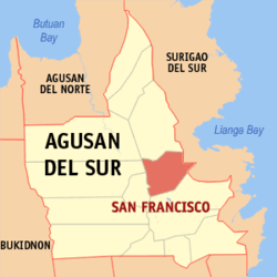 Location within Agusan del Sur province | ||
.svg.png) San Francisco Location within the Philippines | ||
| Coordinates: 8°31′N 125°59′E / 8.51°N 125.98°ECoordinates: 8°31′N 125°59′E / 8.51°N 125.98°E | ||
| Country | Philippines | |
| Region | Caraga (Region XIII) | |
| Province | Agusan del Sur | |
| District | 2nd district of Agusan del Sur | |
| Established | June 21, 1959 | |
| Barangays | 27 (see Barangays) | |
| Government [1] | ||
| • Type | Sangguniang Bayan | |
| • Mayor | Jenny Diesto de Asis (National Unity) | |
| • Vice Mayor | Agusani Ananoria (National Unity) | |
| Area[2] | ||
| • Total | 392.53 km2 (151.56 sq mi) | |
| Population (2015 census)[3] | ||
| • Total | 74,542 | |
| • Density | 190/km2 (490/sq mi) | |
| • Voter (2016)[4] | 42,740 | |
| Time zone | PST (UTC+8) | |
| ZIP code | 8501 | |
| IDD : area code | +63 (0)85 | |
| Income class | 1st class | |
| PSGC | 160308000 | |
| Website |
www | |

San Francisco, officially the Municipality of San Francisco (Filipino: Bayan ng San Francisco), is a municipality in the province of Agusan del Sur in the Caraga (Region XIII) of the Philippines. The population was 74,542 at the 2015 census.[3] In the 2016 election, it had 42,740 registered voters.[4]
In 2013, San Francisco topped first as the "Most Competitive Municipality in the Philippines" according to the National Competitiveness Council (NCC) from out of the 163 first-class municipalities covered by their index.[5]
The protected area of the Agusan Marsh Wildlife Sanctuary can also be reached in San Francisco thru the Barangays Caimpugan and New Visayas.
History
The birth of San Francisco is associated with the history of Agusan and Surigao del Sur. Before San Francisco became a municipality, it was part of the District of Gibong, which was then governed by Deputy Governor Francisco Cataylo. During this period, the district comprised the barrios of Santa Ana, Caimpugan, Ebro, Borbon, La Caridad, Prosperidad, Azpetea and Los Arcos, with Santa Ana the seat of government. Like other barrios, Santa Ana comprised several sitios, including Sitio Hagpa, which was the site of the present day San Francisco. Hagpa was coined from a Manobo word for "swampy" as the sitio was a small village nestled along the Adlayan River and inhabited by Manobo tribes.
The opening of the Province of Agusan del Sur to most parts of Mindanao came during the government of President Ramon Magsaysay who ordered the first road survey to be conducted by the Department of Highway in 1952. In early 1954, road construction began paving the way for the institution of public land subdivision and the in-migration of different local tribes and settlers from the various provinces of Mindanao, Visayas and Luzon.
Hagpa was later renamed San Francisco in honor of Deputy District Governor Francisco Cataylo. In early 1955, the first local government was established as San Francisco was created as a Municipal District. Francisca Tesoro Samson was appointed as the first Municipal District Mayor by then Provincial Governor Felixberto Dagani. In June 21, 1959, through Republic Act No. 2518, San Francisco was officially created into a regular municipality of the Province of Agusan.[6] In the same year, the first local officials of the municipality were elected with the Atty. Paquito Fuentes as the first elected municipal mayor, who served for three consecutive terms of office. He was succeeded by his vice mayor, Cresencio Ausmolo who stayed in office by operation of law during the latter half-portion of his last term.
Eight years after its creation as a regular municipality, on June 17, 1967, through Republic Act No. 4979, the Province of Agusan was divided into the Provinces of Agusan del Norte and Agusan del Sur, in which San Francisco was part of the latter.[7] The continued growth of Agusan del Sur also saw the development of the municipality of San Francisco. Its growing population later paved the way for the creation of the municipality of Rosario through Republic Act No. 5760 approved by President Diosdado Macapagal on June 21, 1969, just two years after the creation of Agusan del Sur. As a result, the several barrios of San Francisco including Bayugan III, Wasi-an, Santa Cruz, Cabawan, Cabantao, Marfil and Tagbayagan were incorporated in the newly created municipality.[8] The barrios of Buenasuerte, Caimpogan, Pasta, Lapinigan, Ebro, New Visayas, Bayugan II, Borbon, Tagapua, Pisaan, Santa Ana, Hubang, Alegria, San Isidro, Das-agan, Ladgadan, Lucac, Bitan-agan and Poblacion consisting of five barrios as stated in PD No. 86 dated December 31, 1972 remained to form part of the 39,253-hectare Municipality of San Francisco. The barrios of Rizal, Ormaca, Mate and Karaos were later created and added to form final 27 barangays of the present day San Francisco.
Geography
San Francisco is located at 8°31′N 125°59′E / 8.51°N 125.98°E.
According to the Philippine Statistics Authority, the municipality has a land area of 392.53 square kilometres (151.56 sq mi)[2] constituting 3.93% of the 9,989.52-square-kilometre- (3,856.98 sq mi) total area of Agusan del Sur.
Barangays
San Francisco is politically subdivided into 27 barangays.[9]
| PSGC | Barangay | Population | ±% p.a. | ||
|---|---|---|---|---|---|
| 2015[3] | 2010[10] | ||||
| 160308001 | Alegria | 9.8% | 7,310 | 6,053 | +3.66% |
| 160308015 | Barangay 1 (Poblacion) | 7.9% | 5,902 | 4,741 | +4.26% |
| 160308016 | Barangay 2 (Poblacion) | 3.4% | 2,506 | 2,993 | −3.32% |
| 160308017 | Barangay 3 (Poblacion) | 4.9% | 3,642 | 3,315 | +1.81% |
| 160308018 | Barangay 4 (Poblacion) | 3.9% | 2,939 | 3,250 | −1.90% |
| 160308019 | Barangay 5 (Poblacion) | 7.0% | 5,239 | 4,926 | +1.18% |
| 160308002 | Bayugan 2 | 6.2% | 4,644 | 4,896 | −1.00% |
| 160308025 | Bitan-agan | 1.4% | 1,046 | 1,079 | −0.59% |
| 160308003 | Borbon | 3.8% | 2,850 | 2,696 | +1.06% |
| 160308026 | Buenasuerte | 2.1% | 1,566 | 1,766 | −2.26% |
| 160308005 | Caimpugan | 2.1% | 1,590 | 1,751 | −1.82% |
| 160308027 | Das-agan | 2.4% | 1,824 | 1,803 | +0.22% |
| 160308006 | Ebro | 1.8% | 1,325 | 1,496 | −2.28% |
| 160308007 | Hubang | 4.2% | 3,166 | 2,659 | +3.38% |
| 160308028 | Karaus | 4.2% | 3,148 | 2,686 | +3.07% |
| 160308029 | Ladgadan | 1.3% | 981 | 992 | −0.21% |
| 160308008 | Lapinigan | 6.9% | 5,150 | 4,627 | +2.06% |
| 160308009 | Lucac | 1.7% | 1,294 | 966 | +5.72% |
| 160308010 | Mate | 2.0% | 1,497 | 1,616 | −1.45% |
| 160308011 | New Visayas | 1.8% | 1,334 | 1,735 | −4.88% |
| 160308030 | Ormaca | 1.1% | 805 | 793 | +0.29% |
| 160308012 | Pasta | 4.1% | 3,061 | 3,429 | −2.14% |
| 160308013 | Pisa-an | 4.6% | 3,429 | 2,611 | +5.33% |
| 160308020 | Rizal | 1.2% | 904 | 1,331 | −7.10% |
| 160308021 | San Isidro | 5.0% | 3,737 | 3,089 | +3.69% |
| 160308022 | Santa Ana | 1.7% | 1,256 | 1,283 | −0.40% |
| 160308024 | Tagapua | 3.2% | 2,397 | 2,404 | −0.06% |
| Total | 74,542 | 70,986 | +0.94% | ||
Demographics
| Population census of San Francisco | |||||||||||||||||||||||||
|---|---|---|---|---|---|---|---|---|---|---|---|---|---|---|---|---|---|---|---|---|---|---|---|---|---|
|
| ||||||||||||||||||||||||
| Source: PSA[3][10][11] | |||||||||||||||||||||||||
In the 2015 census, San Francisco had a population of 74,542.[3] The population density was 190 inhabitants per square kilometre (490/sq mi).
In the 2016 election, it had 42,740 registered voters.[4]
Economy
San Francisco is the "Commercial Capital of ADS", serving as the primary commercial and service center in the province of Agusan del Sur. Situated within the crossroad leading to other production centers in the region, San Francisco will serve as the primary distribution point of goods and people for the province. The presence of malls, hotels, health institutions, inland resorts, colleges, private/public national, provincial and local offices, restaurants, banks, communication and transportation facilities makes San Francisco the training convention center of the province and a favored place for visitors to stay. Mount Magdiwata adds ambiance to the area.
Education
List of public and private educational institutions:
- Agusan del Sur National High School
- Alegria Elementary School
- AMA Computer College
- Bayugan 2 Elementary School
- Bukidnon State University (San Francisco - Satellite Campus)
- D.O Plaza National High School
- Divine Mercy Play School (Preschool & Kindergarten)
- Karaos Elementary School
- Lapinigan National High School
- Light and Life Christian Learning Center (Pre-school & Elementary)
- Mount Carmel College (Kindergarten, Elementary, High School & College)
- Pisaan Elementary School
- Saint Francis Xavier College
- San Francisco Colleges (High School & College)
- San Francisco Pilot Central Elementary School (Kindergarten & Elementary)
- San Francisco SDA Elementary School (Kindergarten & Elementary)
- San Francisco SPED Learning Center
- San Francisco West Central Elementary School (Kindergarten & Elementary)
- San Isidro Elementary School
- Southway College of Technology
- STI College
- Tagapua Elementary School
References
- ↑ "Municipality". Quezon City, Philippines: Department of the Interior and Local Government. Retrieved 31 May 2013.
- 1 2 "Province: Agusan del Sur". PSGC Interactive. Makati City, Philippines: Philippine Statistics Authority. Retrieved 28 October 2016.
- 1 2 3 4 5 "CARAGA". Census of Population (2015): Total Population by Province, City, Municipality and Barangay (Report). PSA. Retrieved 20 June 2016.
- 1 2 3 "2016 National and Local Elections Statistics". Commission on Elections. 2016.
- ↑ Desiderio, Louella D. (31 July 2013). "CDO tops list of Phl's most competitive cities". The Philippine Star. Archived from the original on 30 January 2016. Retrieved 18 October 2016.
Out of the 163 first-class municipalities covered by the index, Luz said the municipality of San Francisco in Agusan del Sur clinched the top spot.
- ↑ "Republic Act No. 2518 - an Act Creating the Municipality of San Francisco, Province of Agusan". Chan Robles Virtual Law Library. 21 June 1959. Archived from the original on 25 September 2013. Retrieved 18 October 2016.
- ↑ "Republic Act No. 4979; An Act Creating the Provinces of Agusan del Norte and Agusan del Sur". Official Gazette of the Republic of the Philippines. 17 June 1967. Archived from the original on 13 October 2016. Retrieved 18 October 2016.
- ↑ "Republic Act No. 5760; An Act Creating the Municipality of Rosario in the Province of Agusan". The Corpus Juris. 21 June 1969. Archived from the original on 18 October 2016. Retrieved 18 October 2016.
- ↑ "Municipal: San Francisco, Agusan del Sur". PSGC Interactive. Quezon City, Philippines: Philippine Statistics Authority. Retrieved 8 January 2016.
- 1 2 "CARAGA". Census of Population and Housing (2010): Total Population by Province, City, Municipality and Barangay (Report). NSO. Retrieved 29 June 2016.
- ↑ "CARAGA". Census of Population (1995, 2000 and 2007): Total Population by Province, City and Municipality (Report). NSO. Archived from the original on 11 November 2011.
External links
| Wikimedia Commons has media related to San Francisco, Agusan del Sur. |
 |
Esperanza | Prosperidad | Barobo, Surigao del Sur | |
| San Luis Talacogon |
|
Tagbina, Surigao del Sur | ||
| ||||
| | ||||
| Rosario |
Prosperidad (capital) | |
| Municipalities | |
| Component city | |