Lianga, Surigao del Sur
| Lianga | |
|---|---|
| Municipality | |
|
Kansilad Beach Resort in Lianga | |
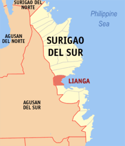 Map of Surigao del Sur with Lianga highlighted | |
.svg.png) Lianga Location within the Philippines | |
| Coordinates: 08°38′N 126°06′E / 8.633°N 126.100°ECoordinates: 08°38′N 126°06′E / 8.633°N 126.100°E | |
| Country | Philippines |
| Region | Caraga (Region XIII) |
| Province | Surigao del Sur |
| District | 1st district of Surigao del Sur |
| Founded | October 17, 1919 |
| Barangays | 13 |
| Government[1] | |
| • Mayor | Kid Pedrozo |
| Area[2] | |
| • Total | 161.12 km2 (62.21 sq mi) |
| Population (2010)[3] | |
| • Total | 28,905 |
| • Density | 180/km2 (460/sq mi) |
| Time zone | PST (UTC+8) |
| ZIP code | 8307 |
| Dialing code | +63 (0)86 |
| Income class | 4th |

Lianga is a fourth class municipality in the province of Surigao del Sur, Philippines. According to the 2010 census, it has a population of 28,905 people.[3]
Etymology and legends
About a couple of centuries ago, along the bountiful bay facing the bluish sea of the Pacific Ocean was a place like those in fairy tales. the white beaches were traversed by two rivers, one in the south and the other in the north. A little distance from the shoreline, the landscape started to the rise until it reached its peak at the west which is one of the ranges of the enchanted Mount Diwata. The place was thickly forested, blanketed with big trees, varieties of wild flowers aerial plants and vines. On the ground, wild animals of different species roam around the area. White colorful birds and other winged creatures flit from tree to tree. Nature's Music like chirping of birds, humming of bees and other wood land insects intermingling with the sound of roaring waves could be heard from the distance. This truly translates the feeling of being born free with nature. the place was breathtaking to behold. Indeed, it was Paradise where nature remained undisturbed.
Then men settled along the cove near river in the south. It was said that these early inhabitants were the Manobos who were ruled by a Chieftain (Datu). Their clothes were made of woven abaca fiber and adorned themselves with multi-colored beads. Land and water resources were abundant, hence they love to hunt in the forest, gather shells along the shores and fish in the rivers. there was peace and harmony among the early inhabitants. They were happy and contended. Later however, as their tribes increased their descendants thought of moving to surrounding areas, so there was rivalry as to who will own choice pieces of land. Whenever disputes overland ownership and quarrel among themselves occurred, it was settled in a duel alongside the river in the North. Whoever won was proclaimed a "Daugan" o "Mananaog" by the Chieftain (Datu). The place became popular, hence the river was named Pananag-an.
People going to the other side of the river have to wade across it slowly as the current was swift, it always took them such time to reach the other side of the river and they often say to themselves "Langan Pagtabok" of "Malangan Kita" (It delays to cross or we will be delayed). One day, as the old folks claimed, a foreigner passed by the place. After having crossed the river, he asked the people the name of the place. Thinking that the stranger was asking what they were doing, they answered "Langan pagtabok". The foreigner heard "Langan" and thought it was the name of the place, then people started calling the whole settlement "Langan". Later, with he influence of the Spanish "Li" alphabet, Langan was pronounced "Liangan". As generations passed, the final "N" in Llangan was dropped and the "Ll" sound was changed to "Li", hence says that is how Lianga got its name.[4]
History
Lianga is one of the oldest towns of the province of Surigao del Sur by virtue of Executive Order No. 27 on October 17, 1919. The municipality of Lianga is centrally located in the province of Surigao del Sur. It is situated along the Lianga Bay facing the Pacific Ocean and cradled by its shorelines and the Diwata Mountains. Its latitude is 30 and longitude is within 12635 and is bounded on the North by Municipality of San Agustin, on the South by the Municipality of Barobo, on the West by province of Agusan del Sur and the East lies the Pacific Ocean. It is 90.0 kilometers to the south of Tandag City, the Capital of the Province, 237 kilometers from the City of Davao, 121 kilometers from the Butuan City and 16 kilometers from Prosperidad, the Capital Town of Agusan del Sur (via Lianga–Los Arcos Road).
In the history of CARAGA Region, Lianga was part of the encomienda way back in 1655 under the command of Sergeant Martin Sanchez dela Cuesta. this encomienda covered Palaso (Cantilan). Tandag as its capital, Tago, Marihatag and Lianga. From 1904 to 1936, the Head of the Town was called President, per record obtained, the first elected President of Lianga was Cornelio Layno, whose two-year term covered the period from 1904 to 1906. The first elected Mayor was Otilio Navarro who served from 1937 to 1940. From then on, there were seven (7) elected Mayors of Lianga from 1941 up to the present. Within these periods, two became Mayors by succession, another two by appointment.
Almost half a century ago, the territorial land area of Lianga was vast, considering the fact that the present municipalities of San Agustin, Marihatag and Barobo were once a part of Lianga. The births of these three municipalities were the results of political subdivisions authored by the political leaders of the undivided Surigao. San Agustin formerly called (Oteiza) was the first daughter municipality of Lianga created under Executive Order No. 445 in 1951, during the Presidency of then Elpidio Quirino. The Governor of Surigao that time was late Vicente L. Pimentel. Four years later, the Municipality of Marihatag was created under Republic Act No. 1261 on June 10, 1955. As the population of Lianga increased, it was not spared from further political subdivision. The Electorate in the southern barrios of Lianga moved for the creation of another municipality, called the Municipality of Barobo as the seat of the Municipal government. The creation of the Municipality of Barobo was made through Executive Order no. 407 and 2786 on October 24, 1960. Of the three municipalities created from the municipality of Lianga, Marihatag has the largest land area. It is sad to note that among these four municipalities formerly referred to as the "BLOM" Area (for Barobo, Lianga, Oteiza, and Marihatag) Lianga, the mother municipality has the smallest land area with only 15,000 hectares.
Significant development in Lianga has been noted since 1960 with the creation of Surigao del Sur as a Province (Republic Act 2786). It was more evident in the 70's to 80's when the coastal barangay of Diatagon [Jiatagon] became the hub of socio–economic activities with the Lianga Bay Logging Company Incorporated [LBLCI] which was a rich source of income. The town of Lianga, too that time started to gain a breakthrough not only in the infrastructure projects such as roads and government buildings but also in income derived from taxes especially from forest products utilized by the wood processing plant of LBLCI. Barangay Saint Christine has become the minor urban center and Lianga was classified as the influence center of the satellite municipalities of San Agustin, Marihatag, and Barobo.
Lianga is relatively urbanized area where 13,830 or 55.30% of the total population live in three urban centers of Barangays Poblacion, Saint Christine, and Diatagon [Jiatagon] and 11,175 or 44.70% lives in the remaining rural barangay with a municipal population density equivalent to 98.70% person/km2. The economic situation in the municipality poses great challenges to its leader and people. Its economy remains predominantly agricultural. It is gifted by its geographic location but is not adequately blessed by nature with substantial endowment necessary to propel itself into a developing economy. The major crop is Coconut, covering an area of 4,236 hectares. Rice ranks second with an area of 1,890 hectares. Other crops are Corn, Banana, and Abaca. The Poblacion and Barangay Diatagon [Jiatagon] are the trading centers with most of the commodities coming from Davao, Butuan, and Surigao. The poor road condition limits the economic activities in the area.[4]
Barangays

Lianga is politically subdivided into 13 barangays.[2]
- Anibongan
- Ban-as
- Banahao
- Baucawe
- Diatagon [Jiatagon] (also has a large Mercado)
- Ganayon
- Liatimco
- Manyayay [which also contains Exemeria]
- Payasan
- Poblacion
- Saint Christine
- San Isidro
- San Pedro
Demographics
| Population census of Lianga | ||
|---|---|---|
| Year | Pop. | ±% p.a. |
| 1990 | 24,908 | — |
| 1995 | 25,005 | +0.07% |
| 2000 | 25,014 | +0.01% |
| 2007 | 27,006 | +1.06% |
| 2010 | 28,905 | +2.50% |
| Source: National Statistics Office[3] | ||
References
- ↑ "Official City/Municipal 2013 Election Results". Intramuros, Manila, Philippines: Commission on Elections (COMELEC). 1 July 2013. Retrieved 5 September 2013.
- 1 2 "Province: SURIGAO DEL SUR". PSGC Interactive. Makati City, Philippines: National Statistical Coordination Board. Retrieved 1 April 2014.
- 1 2 3 "Total Population by Province, City, Municipality and Barangay: as of May 1, 2010" (PDF). 2010 Census of Population and Housing. National Statistics Office. Retrieved 1 April 2014.
- 1 2 Souvenir Program Great Jubilee Year Celebration 2000
External links
| Wikimedia Commons has media related to Lianga. |
- Philippine Standard Geographic Code
- Philippine Census Information
- Local Governance Performance Management System
 |
San Agustin | | ||
| Prosperidad, Agusan del Sur | |
Lianga Bay (Philippine Sea) | ||
| ||||
| | ||||
| Barobo |
Tandag (capital) | |
| Municipalities | |
| Component cities | |