Mindanao
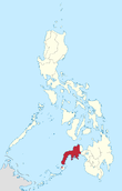
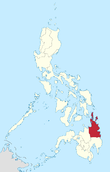
 Mindanao mainland in red; its associated islands in maroon | |
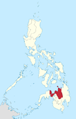
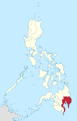
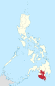
.svg.png) Mindanao Location within the Philippines | |
| Geography | |
|---|---|
| Location | Southeast Asia |
| Coordinates | 8°00′N 125°00′E / 8.000°N 125.000°ECoordinates: 8°00′N 125°00′E / 8.000°N 125.000°E |
| Archipelago | Philippines |
| Adjacent bodies of water | |
| Major islands | |
| Area | 104,530 km2 (40,360 sq mi) |
| Area rank | 19th |
| Highest elevation | 3,144 m (10,315 ft) |
| Highest point | Mount Apo |
| Administration | |
| Regions | |
| Provinces |
List
|
| Largest settlement | Davao City (pop. 1,632,991) |
| Demographics | |
| Demonym | Mindanaoans |
| Population | 21,968,174 (Mindanao island group) (2010)[1] |
| Pop. density | 243 /km2 (629 /sq mi) |
| Ethnic groups |
List
|
Mindanao (![]() i/mɪndəˈnaʊ/; Tagalog pronunciation: [minˈdɐnaw]) is the second largest and southernmost major island in the Philippines. It is also the name of one of the three island groups in the country (the other two being Luzon and the Visayas), consisting of the island of Mindanao and smaller outlying islands. Davao City is the largest city in Mindanao. As of the 2010 census, the island's population itself is 20,281,545 people, while the Mindanao island group has 21,968,174 inhabitants. Davao City is the most populous in Mindanao as 1,632,991 population, and the 2nd is Zamboanga City as 861,799 population, the 3rd is Cagayan de Oro City as 675,950 population, and followed by General Santos City as 594,446 population as of 2015 census.[1]
i/mɪndəˈnaʊ/; Tagalog pronunciation: [minˈdɐnaw]) is the second largest and southernmost major island in the Philippines. It is also the name of one of the three island groups in the country (the other two being Luzon and the Visayas), consisting of the island of Mindanao and smaller outlying islands. Davao City is the largest city in Mindanao. As of the 2010 census, the island's population itself is 20,281,545 people, while the Mindanao island group has 21,968,174 inhabitants. Davao City is the most populous in Mindanao as 1,632,991 population, and the 2nd is Zamboanga City as 861,799 population, the 3rd is Cagayan de Oro City as 675,950 population, and followed by General Santos City as 594,446 population as of 2015 census.[1]
Parts of south-western Mindanao island group, particularly the provinces of Maguindanao, Basilan, Lanao del Sur, Sulu, and Tawi-Tawi (part of the Autonomous Region of Muslim Mindanao (ARMM)), are home to a sizeable Muslim population, making the island group, along with Palawan, the only area of the Philippines with a significant Muslim presence. The island has seen a communist insurgency as well as armed Moro separatist movements.

Mindanao is considered the food basket of the Philippines.[2] Eight of the top 10 agri-commodities exported from the Philippines come from here. Mindanao is also dubbed with the moniker as The Philippines' Land of Promise.[3]
History
Mindanao is named after the Maguindanaons who constituted the largest Sultanate historically, and evidence from maps made during the 17th and 18th centuries suggests that the name was used to refer to the island by the powerful natives at the time. Evidence of human occupation dates back tens of thousands of years. In prehistoric times the Negrito people arrived. Sometime around 1500 BC, Austronesian peoples spread throughout the Philippines and far beyond. Native people of the Maluku Islands refer the island as Maluku Besar (Great Moluccas).
Mindanao Island is also a sacred home of Paramata Bantogen, Mabaning Gandamatu and Daranda Mabagani the Meranaw native people from Kiaranda a Ragat a Tiongcopa Layagen before Islamic Da wah, the largest non-Muslim tribe, and the Subanon Tribe ; the aborigine of the Zamboanga Peninsula’s Zamboanga del Norte, Zamboanga del Sur, Zamboanga Sibugay, Island of Basilan, and northern provinces of Misamis Occidental, Lanao del Norte, and Misamis Oriental.
Neolithic and Bronze Age
The Subanon are believed to have established themselves on Mindanao Island during the Neolithic Era, or New Stone Age, the period in the development of human technology beginning around 10,000 BC according to the ASPRO chronology (between 4,500 and 2,000 BC).[4] The evidence of old stone tools in Zamboanga del Norte may indicate a late Neolithic presence. Burial jars, both earthen and glazed, as well as Chinese celadons, have been found in caves, together with shell bracelets, beads, and gold ornaments. Many of the ceramic objects are from the Yuan and Ming periods. Evidently, there was a long history of trade between the Subanon and the Chinese long before the latter’s contact with Islam.
Hindu-Buddhist era
In the Classic epoch of Philippine history (900AD onwards), the people of Mindanao were heavily exposed to Hindu and Buddhist influence and beliefs from Indonesia and Borneo. Indianized abugida scripts such as Kawi and Baybayin had been introduced through Sulawesi and Java, and the cultural icons of the sarong (known as malong or patadyong), the pudong turban, silk, and batik and ikat weaving and dyeing methods introduced. Artifacts found from this era include the Golden kinnara, Golden Tara, and the Ganesh pendant. These cultural traits passed through Mindanao into the Visayas and Luzon, lost or heavily modified in these areas after the Spanish arrival in the 16th century.

In coastal areas, the Hindu-Buddhist cultural revolution was strongest, whereas in interior parts, influences were indigenized into local animist beliefs and customs and appeared more subtly.
The Darangen epic of the Maranao people hearten back to this era as the most compete local version of the Ramayana. The Maguindanao at this time also had strong Hindu beliefs, evidenced by the Ladya Lawana (Rajah Ravana) epic saga that survives to the modern day, albeit highly islamized from the 17th century onwards,
The Rajahnate of Butuan, a fully-Hindu kingdom mentioned in Chinese records as a vassal state in the 10th century AD, was concentrated along the northeastern coast of the island around Butuan.[5]
Coming of Islam
The coming of Islam happened in the 14th century. The first mosque in the Philippines was built in the mid-14th century in the town of Simunul.[5] The Philippine sultanates of Sulu and Maguindanao were subsequently established in the 15th and 16th centuries, respectively from Hindu-Buddhist Rajahnates. In the late 16th to early 17th centuries, the first contact with Spain occurred. By this time, Islam was well established in Mindanao and had started influencing groups on the big islands of the Visayas such as Cebu and as far north as Bohol and present-day Manila on the island of Luzon.[5] Manila itself once was Muslim when the Sultanate of Brunei annexed it.[6]

Spanish arrival
Upon the Spaniards' arrival to the Philippines, they were dismayed to find such a strong Muslim presence on the island, having just expelled the Moors from Spain after centuries of fighting under the Reconquista. In fact, the name Moros (the Spanish word for "Moors") was given to the Muslim inhabitants by the Spanish.[5][7] Caesarea Caroli was the name given by Villalobos to the island of Mindanao when he reached the sea near it. This was named after Charles V of the Holy Roman Empire (and I of Spain).
Spain was forced to abandon Zamboanga in Mindanao temporarily and to withdraw its soldiers to Manila in 1662 after the Chinese under Koxinga threatened to invade the Spanish Philippines.
Modern history
After the Spanish–American War, the Americans fought numerous battles against the citizens of the island, including those of the Moro people who started fighting with the colonizers of the Philippines since the start of the Spanish colonization. At the start of World War II, Japanese forces defeated Gen. William F. Sharp's forces, including Gen. Guy O. Fort's 81st Division, after a battle which started at Malabang, near in Gandamatu Macadar, Lanao, on 29 April 1942, and ended near Ganassi, Lanao, on 10 May 1942.[8] However, Filipino soldiers and local guerrilla fighters were active until liberation at the conclusion of the Battle of Mindanao.
The native Moro Muslims and Lumads were supplanted by first the Spanish then American colonization programs, with Christians, settlers and converts alike, taking control of key areas and disrupting the natives' administrative structures and control over resources. The Americans chose Christians to become officials of settler-populated townships instead of Lumads and Muslims. Due to the activities of the settlers, including logging, the environment has suffered significant damage. However, as with the rest of the world at the turn of the 20th century, this is inevitable nevertheless because of industrialization.[9]
The Americans continued the colonization program on Mindanao started by Spain for foreign agricultural companies and Christian settlers against the natives of Mindanao, in order to secure the area with a Christian presence and help the American military assert control over the area once it was conquered.[10] Europeans and Japanese were suggested as potential immigrants along with Filipino Christians by the American General Wood.[11]

Davao in Mindanao had a sizable population of Japanese immigrants who acted as a fifth column, welcoming the Japanese invaders during World War II. These Japanese were hated by the Moros and disliked by the Chinese.[12][13] The Moros were judged as "fully capable of dealing with Japanese fifth columnists and invaders alike."[14] The Moros were to fight the Japanese invaders when they landed at Davao on Mindanao.[15][16][17][18][19][20] The Japanese went back to their ships at night to sleep since the Moros struck so much fear into them, even though the Moros were outnumbered by the Japanese.[21][22][23][24][25][26][27]
A large portion of Mindanao's population consisted of native Moro Muslims to the west and Lumads to the east at the start of the 20th century, but the colonization of Mindanao by the American and Philippine governments made Christianity the religion of around 70-75% of the population through settling and mass conversions initiated by Spain, with the American colonial government giving the land titles to Christian colonists.[28] Media compared the American conquest of the west from the Native Americans to the Filipino conquest and settlement of Mindanao from the Muslims, the Philippine government, Philippine military and Filipino militias used extremely violent tactics against natives to support the settlers.[29]
The Americans used their control over property and land laws to let American corporations and Christian settlers take over native resources and land and depriving them of self-governance after eliminating the sovereignty of the Moro Sultanates in the west, and ignoring Moro requests for their own independence, with the Philippine government continuing the colonization program after independence leading to a big number of Filipino settlers, consisting mostly of Ilokanos, Cebuanos, and Illongos, streaming into Moro territories in western and central portions of Mindanao, and thus led to native Moros making moves for independence and armed struggle against the Philippines.[30] The natives, especially those who refused to convert to Christianity, became victims of land-grabs by the migrants who were promised big and fertile lands by the government.[31][32]
Massive settlement by Filipino Christian colonists continued after independence was granted and rule passed to Christian Filipinos from the Americans, and land disputes the Christian settlers had with the Muslim and tribal natives broke out in violence; eventually the colonization, along with the Jabidah massacre, led to the formation of the Moro National Liberation Front and Moro armed insurgency against Philippine rule.[33][34] Because of this strife between the two groups, The Philippine government encouraged Filipino Christians in Mindanao to form militias called Ilaga to counter resistances by the Moros. The Ilaga engaged in massacres and atrocities and were responsible for Manili massacre of 65 Moro Muslim civilians in a Mosque on June 1971.
After decades of “low intensity conflict” in Maguindanao between 1976 and 2000, President Estrada’s “All Out War” strategy declared in 2000 led to the displacement of more than 930,000 individuals. The decade that followed has been marked by a cycle of violence and resumption of peace talks between the government and the Moro Islamic Liberation Front that sought to establish an independent Islamic state in Maguindanao. The fighting led to several periods of mass population displacement at the very latest even until the term of President Gloria Macapagal Arroyo displacing another 150,000 individuals mostly of Moro & Lumad communities[35]
Between 2000 and 2010, four out of ten households (41%) reported having experienced displacement: 29% reported displacement caused by armed groups’ movements, 9% identified ridos (blood feuds), and 9% identified other causes, such as economic displacement (3%) or natural disasters (2%). Armed groups’ movements were by far the most frequent cause of displacement and also the most damageable. Some provinces were more affected than others, mostly of the Moro as they are the most active in resistance to what they perceived to be an extension of Spanish colonialism now perpetuated by the hands of the Philippine Government. Areas that suffered most damage and displacement are Maguindanao (82%), Lanao del Norte (48%) and Lanao del Sur (47%). Other forms of violence have also been prevalent. For example, in Maguindanao, 45% of the total population reported the destruction of their home. Other forms of violence reported in that province include the destruction of goods (37%), being attacked by someone with a weapon (20%), witness looting (32%), and witness killing (16%).[36]
A number of livelihood intervention projects, from organisations such as USAID and the Emergency Livelihood Assistance Program (ELAP), have been beneficial in the reconstruction of those areas affected by constant battles in the Autonomous Region of Muslim Mindanao.[37]
Geography
Mindanao is the second largest island in the Philippines at 104,630 square kilometers, and is the eighth most populous island in the world. The island of Mindanao is larger than 125 countries worldwide, including the Netherlands, South Korea, Austria, Portugal, Czech Republic, Hungary, and Ireland. The island is mountainous, and is home to Mount Apo, the highest mountain in the country. Mindanao is surrounded by 4 seas: the Sulu Sea to the west,[38] the Philippine Sea to the east, and the Celebes Sea to the south, and the Mindanao Sea to the north. Of all the islands of the Philippines, Mindanao shows the greatest variety of physiographic development. High, rugged, faulted mountains; almost isolated volcanic peaks; high rolling plateaus; and broad, level, swampy plains are found there.
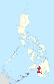
The Mindanao island group is an arbitrary grouping of islands in southern Philippines which comprises the Mindanao mainland, the Sulu Archipelago to the southwest, consisting of the major islands of Basilan, Sulu, and Tawi-tawi, plus the outlying islands of Camiguin, Dinagat, Siargao, and Samal in other areas.
The mountains of Mindanao can be conveniently grouped into ten ranges, including both complex structural mountains and volcanoes. The structural mountains on the extreme eastern and western portions of the island show broad exposures of Mesozoic rock with ultrabasic rocks at the surface in many places along the east coast. Other parts of the island consists mainly of Cenozoic and Quaternary volcanic or sedimentary rocks.
Paralleling the east coast, from Bilas Point in Surigao del Norte to Cape Agustin in southeast Davao, is a range of complex mountains known in their northern portion as the Diwata Mountains. This range is low and rolling in its central portion. A proposed road connecting Bislig on the east coast with the Agusan River would pass through a 16 kilometres (9.9 mi) broad saddle across the mountains at a maximum elevation of less than 250 metres (820 ft), while the existing east-west road from Lianga, 30 miles (48 km) north of Bislig, reaches a maximum elevation of only 450 metres (1,480 ft). The Diwata Mountains, north of these low points, are considerably higher and more rugged, reaching an elevation of 2,012 metres (6,601 ft) in Mount Hilong-Hilong, 17 miles (27 km) along the eastern portion of Cabadbaran City. The southern portion of this east coast range is broader and even more rugged than the northern section. In eastern Davao, several peaks rise above 2,600 metres (8,500 ft) and one mountain rises to 2,910 metres (9,550 ft).

The east-facing coastal regions of Davao and Surigao del Sur are marked by a series of small coastal lowlands separated from each other by rugged forelands which extend to the water’s edge. Offshore are numerous coral reefs and tiny islets. This remote and forbidding coast is made doubly difficult to access during the months from October to March by the heavy surf driven before the northeast trade winds. A few miles offshore is found the Mindanao or Philippine Deep. This ocean trench, reaching measured depths of 34,696 feet (10,575 m), is the third deepest trench, (after the Mariana Trench and Tonga Trench) on the earth’s surface.
A second north-south range extends along the western borders of the Agusan (del Norte and del Sur) and Davao provinces from Camiguin Island in the north to Tinaca Point in the south. This range is mainly structural in origin, but it also contains at least three active volcano peaks. In the central and northern portions of this range, there are several peaks between 2,000 and 2,600 metres (6,600 and 8,500 ft), and here the belt of mountains is about 30 miles (48 km) across. West of Davao City are two inactive volcanoes: Mount Talomo at 2,893 metres (9,491 ft) and Mount Apo at 2,964 metres (9,724 ft), which is the highest point in the Philippines and dominates the skyline. South of Mount Apo, this central mountain belt is somewhat lower than it is to the north, with peaks averaging only 1,100 to 1,800 metres (3,600 to 5,900 ft).
In Western Mindanao, a range of complex structural mountains forms the long, hand-like Zamboanga Peninsula. These mountains, reaching heights of only 1,200 meters (3,900 feet), are not as high as the other structural belts in Mindanao. In addition, there are several places in the Zamboanga Mountains where small inter-mountain basins have been created, with some potential for future agricultural development. The northeastern end of this range is marked by the twin peaks of the now extinct volcano, Mount Malindang, which rise behind Ozamis City to a height of 2,425 metres (7,956 ft). Mount Dapia is the highest mountain in the Zamboanga Peninsula, reaching a height of 2,617 meters (8,586 feet). Meanwhile, Batorampon Point is the highest mountain of the southernmost end of the peninsula, reaching a height of only 1,335 meters (4,380 feet); it is located in the boundary of Zamboanga City.
A series of volcanic mountains is found near Lake Lanao in a broad arc through Lanao del Sur, northern Cotabato and western Bukidnon provinces. At least six of the twenty odd peaks in this area are active and several are very impressive as they stand in semi-isolation. The Butig Peaks, with their four crater lakes, are easily seen from Cotabato. Mount Ragang, an active volcano cone reaching 2,815 metres (9,236 ft), is the most isolated, while the greatest height is reached by Mount Kitanglad at 2,889 metres (9,478 ft).

In southwestern Cotabato, still another range of volcanic mountains is found, this time paralleling the coast. These mountains have a maximum extent of 110 miles (180 km) from northwest to southeast and measure some 30 miles (48 km) across. One of the well-known mountains here is Mount Parker, whose almost circular crater lake measures a mile and a quarter in diameter and lies 300 metres (980 ft) below its 2,040 metres (6,690 ft) summit. Mount Matutum is a protected area and is considered as one of the major landmarks of South Cotabato Province.
A second important physiographic division of Mindanao is the series of upland plateaus in Bukidnon and Lanao del Sur provinces. These plateaus are rather extensive and almost surround several volcanoes in this area. The plateaus are made up of basaltic lava flows interbedded with ash and volcanic tuff. Near their edges, the plateaus are cut by deep canyons, and at several points spectacular waterfalls drop to the narrow coastal plain. These falls hold considerable promise for development of hydroelectric energy. Indeed, one such site at Maria Cristina Falls has already become a major producer. Because the rolling plateaus lie at an elevation averaging 700 meters above sea level, they offer relief from the often oppressive heat of the coastal lowlands. Lake Lanao occupies the major portion of one such plateau in Lanao del Sur. This largest lake on Mindanao and second in the country is roughly triangular in shape with an 18-mile (29 km)-long base. Having a surface at 780 meters above sea level, and being rimmed on the east, south and west by series of peaks reaching 2,300 meters, the lake provides a scenic grandeur and pleasant temperature seldom equaled in the country. Marawi City, at the northern tip of the lake, is bisected by the Agus River, which feeds the Maria Cristina Falls.
Another of Mindanao’s spectacular waterfall sites is located in Malabang, 15 miles (24 km) south of Lake Lanao. Here the Jose Abad Santos Falls present one of the nation’s scenic wonders at the gateway to a 200-hectare national park development.
The Limunsudan Falls, with an approximate height of 800 ft (240 m), is the highest waterfalls in the Philippines; it is located at Iligan City.
Mindanao contains two large inland lowland areas, the valleys of the Agusan and Mindanao rivers in Agusan and Cotabato Provinces, respectively. There is some indication that the Agusan Valley occupies a broad syncline between the central mountains and the east-coast mountains. This valley measures 110 miles (180 km) from south to north and varies from 20 to 30 miles (32 to 48 km) in width. 35 miles (56 km) north of the head of Davao Gulf lies the watershed between the Agusan and the tributaries of the Libuganon River, which flows to the Gulf. The elevation of this divide is well under 200 metres (660 ft), indicating the almost continuous nature of the lowland from the Mindanao Sea on the north to the Davao Gulf.
The Rio Grande de Mindanao and its main tributaries, the Catisan and the Pulangi, form a valley with a maximum length of 120 miles (190 km) and a width which varies from 12 miles (19 km) at the river mouth to about 60 miles (97 km) in central Cotabato. The southern extensions of this Cotabato Valley extend uninterrupted across a 350 metres (1,150 ft) watershed from Illana Bay on the northwest to Sarangani Bay on the southeast.
Other lowlands of a coastal nature are to be found in various parts of Mindanao. Many of these are tiny isolated pockets, as along the northwest coast of Zamboanga. In other areas such as the Davao Plain, these coastal lowlands are as much as 16 kilometres (9.9 mi) wide and several times that length.
From Dipolog City eastward along the northern coast of Mindanao almost to Butuan City extends a rolling coastal plain of varying width. In Misamis Occidental, the now dormant Mount Malindang has created a lowland averaging 13 kilometres (8.1 mi) in width. Shallow Panquil Bay divides this province from Lanao del Norte, and is bordered by low-lying, poorly drained lowlands and extensive mangroves. In Misamis Oriental, the plain is narrower and in places almost pinched out by rugged forelands which reach to the sea. East of Cagayan de Oro, a rugged peninsula extends well into the Mindanao Sea.
Administrative divisions
The island is covered by 6 administrative regions,[39] 22 provinces, and 30 cities (27 provinces and 33 cities if associated islands are included).
| Location | Region (designation) |
Population (2010)[1] |
Area[lower-roman 1][40][41] | Density | Regional center |
|
|---|---|---|---|---|---|---|
 |
Zamboanga Peninsula (Region IX) |
3,407,353 (3.7%) |
17,056.73 km2 (6,585.64 sq mi) |
200/km2 (520/sq mi) |
Pagadian City | |
 |
Northern Mindanao (Region X) |
4,297,323 (4.7%) |
20,496.02 km2 (7,913.56 sq mi) |
210/km2 (540/sq mi) |
Cagayan de Oro City | |
 |
Davao Region (Region XI) |
4,468,563 (4.8%) |
20,357.42 km2 (7,860.04 sq mi) |
220/km2 (570/sq mi) |
Davao City | |
 |
Soccsksargen (Region XII) |
4,109,571 (4.5%) |
22,513.30 km2 (8,692.43 sq mi) |
180/km2 (470/sq mi) |
Koronadal | |
 |
Caraga (Region XIII) |
2,429,224 (2.6%) |
21,478.35 km2 (8,292.84 sq mi) |
110/km2 (280/sq mi) |
Butuan | |
 |
Autonomous Region in Muslim Mindanao (ARMM) |
3,256,140 (3.5%) |
33,511.42 km2 (12,938.83 sq mi) |
97/km2 (250/sq mi) |
Cotabato City[lower-roman 6] | 5
|
| Region | 2010 census | Area | Density | Regional center | Component LGUs | |
| ||||||
Culture

Mindanao is the most culturally diverse island in the Philippines where people of different languages, tribes and races meet. As the Moro and Lumad alliance provided an effective resistance to Spanish rule, Mindanao became a melting pot of different cultures, it creates a more distinct culture which is not present in other island groups in the country. Mindanao has been the seat of three great Sultanates namely the Sultanate of Sulu, the Sultanate of Lanao and the Sultanate of Maguindanao, a Rajahnate (The Rajahnate of Butuan) along with the most hispanized city in Asia, the strategic Zamboanga City (A city that speaks Chavacano, a creole of Mexican-Spanish). A considerable number of Buddhist and Taoist temples and the indigenous tribes known as Lumad people which makes it more diverse.
Today, Cebuano is spoken by the majority of people in Mindanao. Cebuano is generally the lingua franca in many regions, except for the ARMM, Zamboanga City, parts of Soccsksargen and the northeast tip of Mindanao . English and Tagalog are also widely understood and spoken among the people, with English important in business and the academia. Hiligaynon/Ilonggo is widely spoken in South Cotabato, Sultan Kudarat and a large part of North Cotabato, as well as scattered areas around the island. English is also widely spoken.
The Spanish-based creole, Zamboangueño Chavacano is the main language spoken in Zamboanga City and Basilan, scatteredly spoken around Zamboanga del Sur, Zamboanga del Norte, Zamboanga Sibugay, parts of Sulu and Tawi-Tawi. The Zamboangueño dialect is one of the six dialects of Chavacano language (spoken by a distinct Ethnolinguistic group, the Zamboangueños). Other spoken dialects of Chavacano language are the following: Cotabateño in Cotabato City and Castellano Abakay/Davaoeño in Davao Region.
Christians, concentrated in Northern, Southern and Eastern Mindanao, form the majority, with 63% of the population; Muslims, concentrated in the ARMM with varying numbers around the rest of Mindanao, forms 32% the population meanwhile the remaining 5% are those of the Lumads. The native Maguindanaon and other native Moro or Lumad groups of Mindanao have a culture that is different from the main culture of the Philippines.
Religion

More than 70% of the population of Mindanao adhere to Christianity. Roman Catholicism is the largest single religious affiliation at 60.9 percent of the total household population. Islam comprises 20.44%, while a figure as high as 40% has been cited.[42] Muslims were formerly the majority until the influx of Christian Filipino settlers in the 20th century.[42] Other religions are as follows: Evangelical (5.34%), Aglipayan (2.16%), Iglesia ni Cristo (1.66%), and Seventh Day Adventist (1.65%).[43]
Energy
Many areas in Mindanao suffer rotating 12-hour blackouts due to the island’s woefully inadequate power supply. The island is forecast to continue suffering from a 200-megawatt power deficit until 2015, when the private sector begins to operate new capacity. Aboitiz Equity Ventures, a publicly listed holdings company, has committed to supplying 1,200 megawatts through a coal-fired plant on the border of Davao City and Davao del Sur that is slated for operation by 2018.[44] The Agus-Pulangui hydropower complex, which supplies more than half of Mindanao’s power supply, is currently producing only 635 megawatts of its 982 megawatts capacity due to the heavy siltation of the rivers that power the complex. Zamboanga City, an urbanised center in southwest Mindanao, is expected to begin experience daily three-hour brownouts due to the National Power Corporation’s decision to reduce power supply in the city by 10 megawatts.[45] The Manila Electric Company (Meralco), the largest power distributor in the Philippines, and Global Business Power Corp (GBPC), also a major provider, have announced plans to enter Mindanao for the first time to establish solutions for the power problems within the island.[45]
See also
- Mindanao Development Authority
- Caesarea Karoli
- Geography of the Philippines
- Rido, blood feuds
- Bangsamoro Republik
- Kingdom of Butuan
- Moro people
- Islam in the Philippines
- Lumad
- Majapahit
- Srivijaya
- Sultanate of Sulu
- Sultanate of Maguindanao
- Regions of the Philippines
- Provinces of the Philippines
- 2006 Central Mindanao bombings
- July 2009 Mindanao bombings
References
- 1 2 3 "Population and Annual Growth Rates for The Philippines and Its Regions, Provinces, and Highly Urbanized Cities" (PDF). 2010 Census and Housing Population. National Statistics Office. Retrieved 15 August 2014.
- ↑ http://www.economist.com/news/asia/21674840-struggling-violence-and-investment-mindanao-fruits-peace
- ↑ Calderon, Justin (22 April 2013). "Unearthed gem". Inside Investor. Retrieved 29 April 2013.
- ↑ Subanon Territories "The History of Subanon since the Neolithic Era or Stone Age". Retrieved 2013-11-08.
- 1 2 3 4 Koerner, Brendan I. (28 January 2005). "How Islam got to the Philippines". Slate. Retrieved 4 October 2009.
- ↑ "Pusat Sejarah Brunei" (in Malay). Government of Brunei Darussalam. Retrieved 3 March 2014.
- ↑ Federspiel, Howard M. "Islam and Muslims in the Southern Territories of the Philippine Islands during the American Colonial Period (1898 to 1946)". Journal of Southeast Asian Studies. 29: 340. doi:10.1017/s0022463400007487. Retrieved 11 August 2015.
- ↑ Childress, C., 2003, "Wendell Fertig's Fictional 'Autobiography': a Critical Review of They Fought Alone", Bulletin of the American Historical Collection, Vol. 31, No. 1 (123)
- ↑ Hiromitsu Umehara; Germelino M. Bautista (2004). Communities at the Margins: Reflections on Social, Economic, and Environmental Change in the Philippines. Ateneo University Press. pp. 22–. ISBN 978-971-550-464-5.
- ↑ Jennifer Conroy Franco (2001). Elections and Democratization in the Philippines. Taylor & Francis. pp. 221–. ISBN 978-0-8153-3734-8.
- ↑ Dphrepaulezz, Omar H. (6 May 2013). "The Right Sort of White Men": General Leonard Wood and the U.S. Army in the Southern Philippines, 1898-1906 (Doctoral Dissertations). p. 125. Retrieved 11 August 2015.
- ↑ Curtis 1942, p. 4.
- ↑ CURTIS 1942, p. 4.
- ↑ "80 Japanese Troop Ships Are Sighted Off Luzon" 1941, p. 7.
- ↑ AP 1941, p. 1.
- ↑ "SITUATION AT DAVAO OBSCURE AS JAPS LAND" 1941, p. 2.
- ↑ "THE JAPS SWARM AT DAVAO BUT THE SITUATION OBSCURE" 1941, p. 3.
- ↑ "Six Japanese Bombers In New Raid On Manila" 1941, p. 13.
- ↑ THE NEW YORK TIMES 1941, p. 1.
- ↑ "Large Force Is Attacking" 1941, p. 58.
- ↑ LEE 1942, p. 8.
- ↑ LEE 1942, p. 1.
- ↑ LEE 1942, p. 7.
- ↑ LEE 1942, p. 9.
- ↑ Lee 1942, p. 2.
- ↑ Lee 1942, p. 25.
- ↑ Lee 1942, p. 4.
- ↑ Human Rights Watch (Organization) (1992). Bad Blood: Militia Abuses in Mindanao, the Philippines. Human Rights Watch. pp. 17–. ISBN 978-1-56432-060-5.
- ↑ Human Rights Watch (Organization) (1992). Bad Blood: Militia Abuses in Mindanao, the Philippines. Human Rights Watch. pp. 18–. ISBN 978-1-56432-060-5.
- ↑ Kamlian, Jamail A. (October 20, 2012). "Who are the Moro people?". Philippine Daily Inquirer. Retrieved 29 June 2015.
- ↑ http://newsinfo.inquirer.net/681384/moro-doctors-try-to-heal-suffering
- ↑ http://opinion.inquirer.net/83325/historical-truth-and-bangsamoro-autonomy
- ↑ Colin Mackerras; Foundation Professor in the School of Asian and International Studies Colin Mackerras (2 September 2003). Ethnicity in Asia. Routledge. pp. 143–. ISBN 978-1-134-51517-2.
- ↑ Colin Mackerras (18 June 2004). Ethnicity in Asia. Taylor & Francis. pp. 143–. ISBN 978-0-203-38046-8.
- ↑ Norwegian Refugee Council (2009). Cycle of conflict and neglect: Mindanao’s displacement and protection crisis.
- ↑ Vinck, Patrick; Bell, Ed (2011). Violent conflicts and displacement in Central Mindanao: Challenges for recovery and development. World Bank Group and World Food Programme. Pdf.
- ↑ Santillan, Karina R. (January 2015). "Livelihoods for women in Mindanao: A post-conflict reconstruction approach". Asian Journal of Women's Studies. Taylor and Francis. 21 (1): 19–39. doi:10.1080/12259276.2015.1029232.
- ↑ C.Michael Hogan. 2011. Sulu Sea. Encyclopedia of Earth. Eds. P. Saundry & C.J.Cleveland. Washington DC
- ↑ List of Regions in the Philippines
- ↑ "PSGC Interactive; List of Provinces". Philippine Statistics Authority. Retrieved 3 April 2016.
- ↑ "PSGC Interactive; List of Cities". Philippine Statistics Authority. Retrieved 7 April 2016.
- 1 2 William Case (24 Apr 2015). Case, William, ed. Routledge Handbook of Southeast Asian Democratization. Routledge. p. 172. ISBN 9781317380061.
- ↑ "Mindanao Comprised About 24 Percent of the Philippines' Total Population". Philippine Statistics Authority. 8 June 2005.
- ↑ Calderon, Justin (12 March 2013). "Mindanao to face higher power prices". Inside Investor. Retrieved 13 March 2013.
- 1 2 "Mindanao power problem close to solution". Investvine. 30 January 2013. Retrieved 11 February 2013.
External links
| Wikivoyage has a travel guide for Mindanao. |
| Look up mindanao in Wiktionary, the free dictionary. |
| Wikimedia Commons has media related to Mindanao. |
| Wikisource has the text of The New Student's Reference Work article Mindanao. |
 Geographic data related to Mindanao at OpenStreetMap
- Mindanao News
- Online Mindanao
- Violent Conflicts and Displacement in Central Mindanao: Challenges for recovery and development

