San Benito, Surigao del Norte
| San Benito | |
|---|---|
| Municipality | |
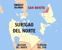 Map of Surigao del Norte with San Benito highlighted | |
.svg.png) San Benito Location within the Philippines | |
| Coordinates: 09°57′N 126°01′E / 9.950°N 126.017°ECoordinates: 09°57′N 126°01′E / 9.950°N 126.017°E | |
| Country | Philippines |
| Region | Caraga (Region XIII) |
| Province | Surigao del Norte |
| Congr. district | 1st district of Surigao del Norte |
| Barangays | 6 |
| Government[1] | |
| • Mayor | Rushford Pingal Dedumo |
| Area[2] | |
| • Total | 45.63 km2 (17.62 sq mi) |
| Population (2010)[3] | |
| • Total | 5,505 |
| • Density | 120/km2 (310/sq mi) |
| Time zone | PST (UTC+8) |
| ZIP code | 8423 |
| Dialing code | 86 |
San Benito is a sixth class municipality on Siargao Island in the province of Surigao del Norte, Philippines. According to the 2010 census, it has a population of 5,505 people.[3]
Barangays
San Benito is politically subdivided into 6 barangays.[2]
- Bongdo
- Maribojoc
- Nuevo Campo
- San Juan
- Santa Cruz (Pob.)
- Talisay (Pob.)
Demographics
| Population census of San Benito | ||
|---|---|---|
| Year | Pop. | ±% p.a. |
| 1990 | 4,315 | — |
| 1995 | 4,498 | +0.78% |
| 2000 | 4,750 | +1.18% |
| 2007 | 5,275 | +1.46% |
| 2010 | 5,505 | +1.57% |
| Source: National Statistics Office[3][4] | ||
References
- ↑ "Official City/Municipal 2013 Election Results". Intramuros, Manila, Philippines: Commission on Elections (COMELEC). 1 July 2013. Retrieved 29 August 2013.
- 1 2 "Province: Surigao del Norte". PSGC Interactive. Makati City, Philippines: National Statistical Coordination Board. Retrieved 29 August 2013.
- 1 2 3 "Total Population by Province, City, Municipality and Barangay: as of May 1, 2010" (PDF). 2010 Census of Population and Housing. National Statistics Office. Retrieved 29 August 2013.
- ↑ "Province of Surigao Del Norte". Municipality Population Data. LWUA Research Division. Retrieved 29 August 2013.
External links
- Philippine Standard Geographic Code
- Philippine Census Information
- Local Governance Performance Management System
 |
Santa Monica | | ||
| Dinagat Sound | |
San Isidro | ||
| ||||
| | ||||
| Del Carmen |
Surigao City (capital) | |
| Municipalities | |
| Component city | |
This article is issued from Wikipedia - version of the 7/8/2016. The text is available under the Creative Commons Attribution/Share Alike but additional terms may apply for the media files.