Bongao, Tawi-Tawi
| Bongao | |
|---|---|
| Municipality | |
| Municipality of Bongao | |
_Hospital_Ship_USNS_Mercy_(T-AH_19)_is_anchored_off_of_the_coast_of_Tawi_Tawi_(cropped).jpg) | |
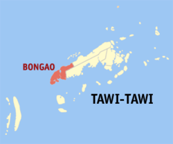 Map of Tawi-Tawi with Bongao highlighted | |
.svg.png) Bongao Location within the Philippines | |
| Coordinates: 05°02′N 119°46′E / 5.033°N 119.767°ECoordinates: 05°02′N 119°46′E / 5.033°N 119.767°E | |
| Country | Philippines |
| Region | Autonomous Region in Muslim Mindanao (ARMM) |
| Province | Tawi-Tawi |
| District | Lone district of Tawi-Tawi |
| Barangays | 35 |
| Government[1] | |
| • Mayor | Jasper Shia Que |
| Population (2015)[2] | |
| • Total | 100,527 |
| Time zone | PST (UTC+8) |
| ZIP code | 7500 |
| Dialing code | +63 (0)68 |
| Income class | 2nd |
Bongao is a second income class municipality and the de facto capital of the province of Tawi-Tawi, Philippines. According to the 2010 census, it has a population of 100,527 people.[2]
The municipality's territory includes Bongao Island (where the poblacion is located), Sanga-Sanga Island, Pababag Island, as well as the western end of Tawitawi Island.
With an area of around 350 square kilometers, it's possible for Bongao to become a component city in the years to come.
Barangays
Bongao is politically subdivided into 35 barangays.[2]
- Ipil
- Kamagong
- Karungdong
- Lakit Lakit
- Lamion
- Lapid Lapid
- Lato Lato
- Luuk Pandan
- Luuk Tulay
- Malassa
- Mandulan
- Masantong
- Montay Montay
- Pababag
- Pagasinan
- Pahut
- Pakias
- Paniongan
- Pasiagan
- Bongao Poblacion
- Sanga-Sanga
- Silubog
- Simandagit
- Sumangat
- Tarawakan
- Tongsinah
- Tubig Basag
- Ungus-ungus
- Lagasan
- Nalil
- Pagatpat
- Pag-asa
- Tubig Tanah
- Tubig-Boh
- Tubig-Mampallam
History
Before the armed rebellion of the MNLF in the early 1970s, Bongao was merely a backwater village ruled by the prominent noble Halun family, who used to own about three-quarters of the island. The capital of the province was Batu-Batu (in Panglima Sugala) in the mainland situated in a cove with deep waters suited for anchors of the Philippine Navy. At the height of the armed rebellion and fearing that the provincial capitol might be overrun, the government transferred it to Bongao. The white-washed, Taj Mahal-inspired provincial capitol building is located on a hill overlooking the bay and the whole town to the North of the Island against the backdrop of Mount Kabugan and the famous Bud Bongao (Bongao Peak).
The transfer of the seat of government ushered the rapid development of the island as the southernmost center of commerce and trade. Suddenly, the population swelled as individuals (and their families) who are in government service moved to the town.
Demographics
| Population census of Bongao | ||
|---|---|---|
| Year | Pop. | ±% p.a. |
| 1990 | 37,932 | — |
| 1995 | 46,672 | +3.96% |
| 2000 | 58,174 | +4.84% |
| 2007 | 95,055 | +7.01% |
| 2010 | 79,362 | −6.36% |
| Source: National Statistics Office[2] | ||
_Hospital_Ship_USNS_Mercy_(T-AH_19)_is_anchored_off_of_the_coast_of_Tawi_Tawi.jpg)
Culture
Today, Bongao is a minuscule cosmopolitan site that is becoming a model of multicultural society. In downtown Bongao, there are mosques for the majority Muslim population, a Catholic church, a church for Protestant inhabitants, a Chinese temple, a church for the Iglesia ni Cristo, a church of the Seventh-Day Adventist and a Baptist church. There is also a local congregation of Jesus is Lord (JIL) of one-time presidential aspirant Pastor Eddie Villanueva.
Economy
The main thoroughfare is Datu Halun Street, where the Town Hall is situated. Poblacion is the commercial hub. Most of the businesses here are owned by local people. Due to its relative peace and order situation, recent migrant Chinese from Zamboanga have also open business.
Banks operating in Bongao include Land Bank of the Philippines, Philippine National Bank, and Allied Banking Corporation. Quedancor, a government owned investment company, has recently opened business.
The Midway Plaza Mall, a new 2-storey retail center, is the first shopping mall in Tawi-tawi (and the whole of ARMM) opened in April 2010.
Education
Bongao is home to the Mindanao State University - Tawi-Tawi College of Technology and Oceanography (MSU-TCTO), Tawi-Tawi State Agricultural College (TSAC), Mahardika Institute of Technology (MITI), Abubakar Learning Center Foundation College (ACLC), Tawi-Tawi School of Midwifery (TSF). The first two are government owned state colleges, while the last three are privately owned.
There are several secondary high schools in Tawi-Tawi such as the MSU TCTO - Science High School, MSU TCTO Preparatory High School, Tawi-Tawi School of Arts and Trade, Notre Dame of Bongao, and Tawi-Tawi School of Fisheries (TTSF).
References
- ↑ "Official City/Municipal 2013 Election Results". Intramuros, Manila, Philippines: Commission on Elections (COMELEC). 1 July 2013. Retrieved 5 September 2013.
- 1 2 3 4 "Total Population by Province, City, Municipality and Barangay: as of May 1, 2010" (PDF). 2010 Census of Population and Housing. National Statistics Office. Archived from the original (PDF) on 2 April 2016. Retrieved 1 September 2014.
External links
| Wikimedia Commons has media related to Bongao, Tawi-Tawi. |
 |
Sulu Sea | Languyan | | |
| |
|
Panglima Sugala | ||
| ||||
| | ||||
| Sibutu / Sibutu Passage | Simunul |
Bongao (capital) | |
| Municipalities | |
