Worthington, Kentucky
| Worthington, Kentucky | |
|---|---|
| City | |
 Location of Worthington, Kentucky | |
| Coordinates: 38°33′2″N 82°44′5″W / 38.55056°N 82.73472°WCoordinates: 38°33′2″N 82°44′5″W / 38.55056°N 82.73472°W | |
| Country | United States |
| State | Kentucky |
| County | Greenup |
| Incorporated | February 5, 1920 |
| Named for | a local landowner |
| Government | |
| • Type | Mayor-Council |
| • Mayor | Tim Stapleton |
| Area | |
| • Total | 1.2 sq mi (3.1 km2) |
| • Land | 1.2 sq mi (3.0 km2) |
| • Water | 0.0 sq mi (0.1 km2) |
| Elevation | 561 ft (171 m) |
| Population (2000) | |
| • Total | 1,673 |
| • Density | 1,427.1/sq mi (551.0/km2) |
| Time zone | Eastern (EST) (UTC-5) |
| • Summer (DST) | EDT (UTC-4) |
| ZIP code | 41183 |
| Area code(s) | 606 |
| FIPS code | 21-84864 |
| GNIS feature ID | 0507152 |
| Website | worthington-ky.com |
Worthington is a home rule-class city[1] on the south bank of the Ohio River in Greenup County, Kentucky, in the United States. The population was 1,609 as of the 2010 U.S. census.
Worthington is a part of the Huntington-Ashland-Ironton metropolitan area. As of the 2000 U.S. census, this MSA had a population of 288,649.
History
The site of the present city was once owned by Abraham Buford, who sold the land to the Means and Russell Iron Company. This company sold the land to W.J. Wortington,[2] who was William O. Bradley's lieutenant governor from 1895-1899.[3] After his death, the property was given to his daughters, who founded the present town and named it for their father.[2]
Worthington was incorporated as a city by the Kentucky General Assembly on February 5, 1920.[4]
Geography
Worthington is located at 38°33′2″N 82°44′5″W / 38.55056°N 82.73472°W (38.550616, -82.734694).[5]
According to the United States Census Bureau, the city has a total area of 1.2 square miles (3.1 km2), of which 1.2 square miles (3.1 km2) is land and 0.04 square miles (0.10 km2) (2.50%) is water.
Demographics
| Historical population | |||
|---|---|---|---|
| Census | Pop. | %± | |
| 1930 | 843 | — | |
| 1940 | 918 | 8.9% | |
| 1950 | 695 | −24.3% | |
| 1960 | 1,235 | 77.7% | |
| 1970 | 1,364 | 10.4% | |
| 1980 | 1,948 | 42.8% | |
| 1990 | 1,751 | −10.1% | |
| 2000 | 1,673 | −4.5% | |
| 2010 | 1,609 | −3.8% | |
| Est. 2015 | 1,577 | [6] | −2.0% |
As of the census[8] of 2000, there were 1,673 people, 663 households, and 519 families residing in the city. The population density was 1,427.1 people per square mile (552.1/km²). There were 698 housing units at an average density of 595.4 per square mile (230.3/km²). The racial makeup of the city was 98.74% White, 0.06% African American, 0.06% Asian, 0.36% from other races, and 0.78% from two or more races. Hispanic or Latino of any race were 0.78% of the population.
There were 663 households out of which 31.5% had children under the age of 18 living with them, 62.9% were married couples living together, 12.1% had a female householder with no husband present, and 21.6% were non-families. 19.6% of all households were made up of individuals and 10.9% had someone living alone who was 65 years of age or older. The average household size was 2.52 and the average family size was 2.86.
In the city the population was spread out with 23.3% under the age of 18, 7.7% from 18 to 24, 26.7% from 25 to 44, 27.4% from 45 to 64, and 15.0% who were 65 years of age or older. The median age was 41 years. For every 100 females there were 91.0 males. For every 100 females age 18 and over, there were 85.1 males.
The median income for a household in the city was $34,875, and the median income for a family was $39,737. Males had a median income of $35,324 versus $19,643 for females. The per capita income for the city was $19,239. About 7.8% of families and 9.3% of the population were below the poverty line, including 12.8% of those under age 18 and 6.2% of those age 65 or over.
Education

The city sits within the Raceland-Worthington Independent School District, which also includes the neighboring city of Raceland. One school, Worthington Elementary School, is located in the city. The designated high school is Raceland-Worthington High School in Raceland.
Ashland Regional Airport
Located in Worthington, and named for nearby Ashland, the Ashland Regional Airport was once used extensively by the oil manufacturing company Ashland Inc. before the company's corporate headquarters was moved from Russell to Covington. Currently, the airport serves local charter and private aircraft. Recently, community events, such as car and air shows, have also taken place at the airport.

The current day Ohio River backwater called the Gravel Pit was a sand and pea gravel quarry from the 1930s until the construction of the Greenup Locks and Dam in 1962.
Notable people
- Corporal John W. Collier, Medal of Honor recipient for his service during the Korean War
See also
References
- ↑ "Summary and Reference Guide to House Bill 331 City Classification Reform" (PDF). Kentucky League of Cities. Retrieved December 30, 2014.
- 1 2 Rennick, Robert M. (1988). "Place Names". Kentucky Place Names. Lexington, Kentucky: The University Press of Kentucky. ISBN 0-8131-0179-4. Accessed 23 Apr 2010.
- ↑ "Index to Politicians: Worthington". The Political Graveyard. Retrieved 2007-03-06.
- ↑ Commonwealth of Kentucky. Office of the Secretary of State. Land Office. "Worthington, Kentucky". Accessed 23 Apr 2010.
- ↑ "US Gazetteer files: 2010, 2000, and 1990". United States Census Bureau. 2011-02-12. Retrieved 2011-04-23.
- ↑ "Annual Estimates of the Resident Population for Incorporated Places: April 1, 2010 to July 1, 2015". Retrieved July 2, 2016.
- ↑ "Census of Population and Housing". Census.gov. Retrieved June 4, 2015.
- ↑ "American FactFinder". United States Census Bureau. Retrieved 2008-01-31.
External links
Municipalities and communities of Greenup County, Kentucky, United States | ||
|---|---|---|
| Cities | 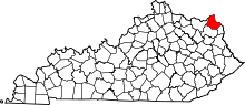 | |
| Unincorporated communities | ||
| Principal cities | 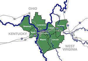 | |
|---|---|---|
| Municipalities with population over 5,000 | ||
| Municipalities with population 1,000–5,000 | ||
| Municipalities with population under 1,000 | ||
| West Virginia counties | ||
| Kentucky counties | ||
| Ohio counties | ||
