Jackson, Kentucky
| Jackson, Kentucky | |
|---|---|
| City | |
|
Breathitt County Courthouse in Jackson | |
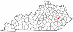 Location of Jackson, Kentucky | |
| Coordinates: 37°33′11″N 83°23′18″W / 37.55306°N 83.38833°WCoordinates: 37°33′11″N 83°23′18″W / 37.55306°N 83.38833°W | |
| Country | United States |
| State | Kentucky |
| County | Breathitt |
| Established | 1839 |
| Incorporated | 1845 |
| Reïncorporated | 1890 |
| Named for | Pres. Andrew Jackson |
| Area | |
| • Total | 2.7 sq mi (6.9 km2) |
| • Land | 2.5 sq mi (6.5 km2) |
| • Water | 0.2 sq mi (0.4 km2) |
| Elevation | 774 ft (236 m) |
| Population (2010) | |
| • Total | 2,231 |
| • Density | 889/sq mi (343.4/km2) |
| Time zone | Eastern (EST) (UTC-5) |
| • Summer (DST) | EDT (UTC-4) |
| ZIP codes | 41307, 41339 |
| Area code(s) | 606 |
| FIPS code | 21-39952 |
| GNIS feature ID | 0495097 |

Jackson is a home rule-class city[1] in Breathitt County, Kentucky, in the United States. It is the seat of its county. The population was 2,231 according to the 2010 U.S. census.[2]
It was the home of the Jackson Academy, which became Lees College.
History
Upon the creation of Breathitt County in 1839, local landowner Simon Cockrell Sr. donated 10 acres (4.0 ha) to serve as its seat of government. The community was originally known as Breathitt, Breathitt Town, or Breathitt Court House after the county, but upon its incorporation as a city by the state legislature in 1843,[3] it was renamed Jackson to honor the recently deceased former president Andrew Jackson.[4][5]
Local feuds led the national press to publish stories about Jackson and "Bloody Breathitt": state troops were dispatched twice in the 1870s and again in 1903 – after the assassination of U.S. Commissioner James B. Marcum on the courthouse steps[6] – to restore order.[5]
The Kentucky Union Railroad reached the city in 1891, and Jackson boomed until the L&N continued the line on to Hazard in 1912. A fire on Halloween, 1913, burned down much of the town.[5]
Geography
Jackson is located at 37°33′11″N 83°23′18″W / 37.55306°N 83.38833°W (37.553012, -83.388249).[7] The city is nestled in the heart of the Cumberland Plateau of the Appalachian Mountains, with the downtown located on the north bank of the North Fork of the Kentucky River. To limit flooding, the Kentucky River was redirected in 1963 by way of a small cut-through through the mountain, and its former channel, a river meander, was left behind as Panbowl Lake, now a prime attraction for fishermen.[5]
According to the United States Census Bureau, Jackson has a total area of 2.7 square miles (6.9 km2), of which 2.5 square miles (6.5 km2) is land and 0.15 square miles (0.4 km2), or 6.11%, is water.[2]
Climate
The climate in this area is characterized by relatively moderate temperatures and evenly distributed precipitation throughout the year. The Köppen climate classification places the city in the humid subtropical zone, which is abbreviated as Cfa.[8] The normal monthly mean temperature ranges from 34.9 °F (1.6 °C) in January to 75.4 °F (24.1 °C) in July. On average, there are 17 days where temperatures remain at or below freezing and 15 days with highs at or above 90 °F (32 °C) per year. In addition, although the area falls under USDA hardiness zone 6b,[9] the record longest streak without 0 °F (−18 °C) lows occurred from February 6, 1996 to January 15, 2009 (12 years, 344 days).[10] The highest recorded temperature was 104 °F (40 °C) on June 29, 2012, and the lowest recorded temperature was −18 °F (−28 °C) on January 19, 1994 and January 20 and 21, 1985.[10]
Precipitation averages 48.3 inches (1,230 mm) annually, falling on an average 144 days, and the wettest month by normal rainfall is May.[11] Normal winter snowfall is 23.5 inches (60 cm),[11] though, as is typical in areas in the humid subtropical zone, snow cover does not remain for long, as there is an average of only 18 days with at least 1 inch (2.5 cm) of snow cover.[11]
| Climate data for Jackson, Kentucky (Julian Carroll Airport), 1981–2010 normals, extremes 1981–present | |||||||||||||
|---|---|---|---|---|---|---|---|---|---|---|---|---|---|
| Month | Jan | Feb | Mar | Apr | May | Jun | Jul | Aug | Sep | Oct | Nov | Dec | Year |
| Record high °F (°C) | 78 (26) |
79 (26) |
87 (31) |
92 (33) |
91 (33) |
104 (40) |
101 (38) |
101 (38) |
96 (36) |
89 (32) |
82 (28) |
79 (26) |
104 (40) |
| Average high °F (°C) | 43.1 (6.2) |
47.7 (8.7) |
57.5 (14.2) |
68.0 (20) |
74.6 (23.7) |
81.6 (27.6) |
84.6 (29.2) |
84.1 (28.9) |
78.0 (25.6) |
68.1 (20.1) |
57.3 (14.1) |
46.0 (7.8) |
65.9 (18.8) |
| Average low °F (°C) | 26.8 (−2.9) |
29.9 (−1.2) |
37.3 (2.9) |
46.7 (8.2) |
54.7 (12.6) |
62.5 (16.9) |
66.1 (18.9) |
65.0 (18.3) |
58.2 (14.6) |
48.0 (8.9) |
39.4 (4.1) |
30.2 (−1) |
47.1 (8.4) |
| Record low °F (°C) | −18 (−28) |
−8 (−22) |
7 (−14) |
20 (−7) |
32 (0) |
44 (7) |
52 (11) |
45 (7) |
34 (1) |
26 (−3) |
13 (−11) |
−13 (−25) |
−18 (−28) |
| Average precipitation inches (mm) | 3.61 (91.7) |
3.75 (95.3) |
4.12 (104.6) |
3.83 (97.3) |
5.20 (132.1) |
4.70 (119.4) |
4.65 (118.1) |
3.69 (93.7) |
3.46 (87.9) |
3.19 (81) |
3.96 (100.6) |
4.18 (106.2) |
48.34 (1,227.9) |
| Average snowfall inches (cm) | 7.1 (18) |
7.0 (17.8) |
2.9 (7.4) |
1.0 (2.5) |
0 (0) |
0 (0) |
0 (0) |
0 (0) |
0 (0) |
0.1 (0.3) |
0.5 (1.3) |
4.9 (12.4) |
23.5 (59.7) |
| Average precipitation days (≥ 0.01 in) | 14.1 | 13.1 | 14.0 | 12.4 | 13.8 | 12.3 | 12.4 | 9.6 | 8.4 | 8.8 | 11.5 | 14.0 | 144.4 |
| Average snowy days (≥ 0.1 in) | 6.5 | 5.1 | 2.7 | 0.5 | 0 | 0 | 0 | 0 | 0 | 0.1 | 0.8 | 5.1 | 20.8 |
| Source: NOAA[10][11] | |||||||||||||
Demographics
| Historical population | |||
|---|---|---|---|
| Census | Pop. | %± | |
| 1870 | 54 | — | |
| 1880 | 88 | 63.0% | |
| 1900 | 941 | — | |
| 1910 | 1,346 | 43.0% | |
| 1920 | 1,503 | 11.7% | |
| 1930 | 2,109 | 40.3% | |
| 1940 | 2,099 | −0.5% | |
| 1950 | 1,978 | −5.8% | |
| 1960 | 1,852 | −6.4% | |
| 1970 | 1,887 | 1.9% | |
| 1980 | 2,651 | 40.5% | |
| 1990 | 2,466 | −7.0% | |
| 2000 | 2,490 | 1.0% | |
| 2010 | 2,231 | −10.4% | |
| Est. 2015 | 2,152 | [12] | −3.5% |
As of the census[14] of 2000, there were 2,490 people, 1,005 households, and 661 families residing in the city. The population density was 935.4 people per square mile (361.4/km²). There were 1,111 housing units at an average density of 417.4 per square mile (161.3/km²). The racial makeup of the city was 98.19% White, 0.56% African American, 0.64% Asian, 0.12% from other races, and 0.48% from two or more races. Hispanic or Latino of any race were 0.48% of the population.
There were 1,005 households out of which 28.9% had children under the age of 18 living with them, 44.4% were married couples living together, 18.2% had a female householder with no husband present, and 34.2% were non-families. 31.4% of all households were made up of individuals and 12.3% had someone living alone who was 65 years of age or older. The average household size was 2.28 and the average family size was 2.85.
In the city the population was spread out with 20.2% under the age of 18, 12.0% from 18 to 24, 26.4% from 25 to 44, 24.9% from 45 to 64, and 16.5% who were 65 years of age or older. The median age was 40 years. For every 100 females there were 79.1 males. For every 100 females age 18 and over, there were 76.0 males.
The median income for a household in the city was $25,272, and the median income for a family was $33,036. Males had a median income of $33,523 versus $25,179 for females. The per capita income for the city was $13,532. About 21.9% of families and 26.7% of the population were below the poverty line, including 35.3% of those under age 18 and 18.8% of those age 65 or over.
Transportation
Kentucky Routes within the city
 KY 15 The highway goes north to Campton and the Bert T. Combs Mountain Parkway and south to Hazard and the Hal Rogers Parkway. It is the main artery into the city and, currently, it is being relocated and changed to four lanes around and inside the city. It has been locally named (within the county) as the Breathitt County Veterans Highway.
 KY 30 The highway goes east to Salyersville and west to Booneville. It merges with KY 15 (at the present time) throughout most of the city. The west end is known, locally, as Booneville Road.
 KY 52 The highway's eastern terminus starts in the city of Jackson at the intersection with KY 30 and heads west towards Beattyville. It is locally known as Beattyville Road.
 KY 205 The highway goes north to Mountain Parkway by way of Lee City in Wolfe County and eventually to West Liberty in Morgan County. The highway's southern terminus starts at the intersection of KY 15. Recently, an old section of KY 15 was annexed to the highway, and it is possible, once more of the re-routed KY 15 is finished, that it could annex more of the old KY 15 sections.
 KY 1812 -Not a Primary State Highway - The highway goes north to Campton and south to intersect and end near the KY 15 and KY 30 junction in Jackson. In the north, it connects with KY 205 and follows it until it intersects with the new section of KY 15; it follows KY 15 for a mile and then splits only to intersects KY 15 in Jackson once more; it then breaks away only to connect (partially) with Main Street and then heads south. It is part of what was once the original KY 15 when it was built in 1925. It can be a winding and curvy road in many places with a few hairpin turns as well. It is known locally by different names depending on which road it intersects or what section. i.e. Old Quicksand Rd., Broadway, College Ave, Brown St., Main Street, Washington Ave., Panbowl Rd., and so on.
Airports
- Julian Carroll Airport - (JKL for FAA, none for IATA) - A publicly owned airport off KY 30. It is home to the National Weather Service Forecast Office that oversees most of the eastern part of the state.
Railroads
- CSX is a freight and minerals only line that goes north to Beattyville and eventually to Winchester and south to Hazard. Before CSX owned the line, it was part of the L& N Railway as a passenger and freight line. Before that, it was owned by the defunct Lexington and Eastern Railway Company as a passenger and freight line. The old Jackson Depot and Freight Station located in the South Jackson section on Armory Drive was torn down in the late 1980s.
Education
Jackson Independent Schools
- Jackson City School – Elementary, middle and high school combined.
Breathitt County Schools
- Lyndon B. Johnson Elementary (LBJ) - located in Jackson
- Rousseau Elementary - closed in 2013 was located in Rousseau
- Marie Roberts - Caney Elementary - located in Lost Creek
- Highland - Turner Elementary - located in Canoe
- Eugene Sebastian Middle School - located in Jackson
- Breathitt County High School - located in Jackson
Private schools
- Oakdale Christian Academy - located in Oakdale
- Riverside Christian Academy - located in Lost Creek
- Mount Carmel Elementary and High School - located in Vancleve
Vocational
- Breathitt County Area Technology Center - On the campus of Breathitt County High School; the vocational school serves both Breathitt County Schools and Jackson Independent Schools.
Post-secondary
- Hazard Community and Technical College, Lees College Campus
- Morehead State University at Jackson - Breathitt County Skills Center
- Kentucky Mountain Bible College - located in Vancleve
Educational Centers
- Breathitt County Museum - currently located in the Senior Citizens Center on the second floor. Through the use of grant money the defunct Breathitt County Jail has been partially renovated to host the museum, but is yet to be completed.
- Breathitt County Public Library - located on College Avenue in Jackson, the library provides many programs for the citizens.
Festivals
The city of Jackson and Breathitt County are host to many local festivals.
In Jackson:
- Breathitt County Honey Festival - takes place annually (since 1978) during the Labor Day Weekend. It begins on the Thursday before Labor Day and runs through Labor Day.
- Breathitt County Heritage Festival - A recently formed (2005) festival that originally occurred annually on the first weekend of October, and now takes place in conjunction with the July 4th celebration with "Pig Out in the Park."[15]
- Pig Out in the Park/Independence Day Celebration - Held at Douthitt Park; July 4 celebration
- Downtown Christmas - Parade and festivities held around the first weekend of December.
Other festivals that occur outside the city but in Breathitt County:
- Morris Fork Crafts Fair, one of the oldest fairs in the area
- The Crockettsville Charity Concert and Ride, hosted by the band Halfway to Hazard (Unfortunately, this event has not occurred the last couple years and the hosts announced in 2016 they will secure a new venue for this concert and trail ride in the future.)[16]
Notable people
- Jeffrey Reddick, screenwriter
- Willie Sandlin, Medal of Honor recipient for his service during World War I
- Sturgill Simpson, country singer
References
- ↑ "Summary and Reference Guide to House Bill 331 City Classification Reform" (PDF). Kentucky League of Cities. Retrieved December 30, 2014.
- 1 2 "Geographic Identifiers: 2010 Demographic Profile Data (G001): Jackson city, Kentucky". U.S. Census Bureau, American Factfinder. Retrieved November 22, 2013.
- ↑ Commonwealth of Kentucky. Office of the Secretary of State. Land Office. "Jackson, Kentucky". Accessed 1 Aug 2013.
- ↑ Rennick, Robert. Kentucky Place Names, p. 151. University Press of Kentucky (Lexington), 1987. Accessed 1 Aug 2013.
- 1 2 3 4 The Kentucky Encyclopedia, p. 459. "Jackson". University Press of Kentucky (Lexington), 1992. Accessed 1 Aug 2013.
- ↑ http://www.breathittcounty.com/Marcum1.html
- ↑ "US Gazetteer files: 2010, 2000, and 1990". United States Census Bureau. 2011-02-12. Retrieved 2011-04-23.
- ↑ Climate Summary for Jackson, Kentucky
- ↑ United States Department of Agriculture. United States National Arboretum. USDA Plant Hardiness Zone Map [Retrieved 2015-02-19].
- 1 2 3 "NowData - NOAA Online Weather Data". National Oceanic and Atmospheric Administration. Retrieved 2015-02-27.
- 1 2 3 4 "Station Name: KY JACKSON". National Oceanic and Atmospheric Administration. Retrieved 2015-02-27.
- ↑ "Annual Estimates of the Resident Population for Incorporated Places: April 1, 2010 to July 1, 2015". Retrieved July 2, 2016.
- ↑ "Census of Population and Housing". Census.gov. Archived from the original on May 11, 2015. Retrieved June 4, 2015.
- ↑ "American FactFinder". United States Census Bureau. Archived from the original on September 11, 2013. Retrieved 2008-01-31.
- ↑ http://www.breathittcounty.org/index.php?option=com_content&view=article&id=72&Itemid=54
- ↑ http://www.wymt.com/content/news/Vandalism-partly-to-blame-for-cancellation-of-Crockettsville-concert-trail-ride-383899961.html
External links
Municipalities and communities of Breathitt County, Kentucky, United States | ||
|---|---|---|
| City | 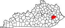 | |
| Unincorporated communities | ||
