Booneville, Kentucky
| Booneville, Kentucky | |
|---|---|
| City | |
|
Central Booneville, with the courthouse to the right | |
 Location of Booneville, Kentucky | |
| Coordinates: 37°28′29″N 83°40′36″W / 37.47472°N 83.67667°WCoordinates: 37°28′29″N 83°40′36″W / 37.47472°N 83.67667°W | |
| Country | United States |
| State | Kentucky |
| County | Owsley |
| Incorporated | March 1, 1847 |
| Government | |
| • Type | City Commission |
| • Mayor | Charles E. Long |
| Area | |
| • Total | 0.6 sq mi (1.6 km2) |
| • Land | 0.6 sq mi (1.6 km2) |
| • Water | 0.0 sq mi (0.0 km2) |
| Elevation | 709 ft (216 m) |
| Population (2010) | |
| • Total | 81 |
| • Density | 135.0/sq mi (50.7/km2) |
| Time zone | Eastern (EST) (UTC-5) |
| • Summer (DST) | EDT (UTC-4) |
| ZIP code | 41314 |
| Area code(s) | 606 |
| FIPS code | 21-08614 |
| GNIS feature ID | 0510852 |
| Website | City of Booneville |

Booneville is a 6th-class city in Owsley County, Kentucky, in the United States. The population was 81 at the 2010 census. It is the county seat of Owsley County.[1] It is located at the junction of Kentucky Route 11 and Kentucky Route 30 on the South Fork of the Kentucky River.
The town was originally named Moore's Station after its chief landowner. It was renamed Boone's Station and then Booneville in honor of the American frontiersman, Daniel Boone.[2] The town, consisting at the time of little more than a temporary log courthouse, became the county seat when Owsley County was formed on May 20, 1844. From this, the settlement was also sometimes known as Owsley Court House around this time. It was formally incorporated as a city by the state assembly on March 1, 1847.[2] During the Civil War, Booneville was a crossroads for various Union and Confederate regiments, and was threatened by Confederate guerrillas, but avoided the destruction that befell some other county seats of Kentucky during the war.
Geography
Booneville is located at 37°28′29″N 83°40′36″W / 37.47472°N 83.67667°W (37.474841, -83.676791).[3]
According to the United States Census Bureau, the city has a total area of 0.6 square miles (1.6 km2), all land.
Demographics
| Historical population | |||
|---|---|---|---|
| Census | Pop. | %± | |
| 1860 | 121 | — | |
| 1870 | 111 | −8.3% | |
| 1880 | 201 | 81.1% | |
| 1900 | 251 | — | |
| 1910 | 236 | −6.0% | |
| 1920 | 243 | 3.0% | |
| 1930 | 250 | 2.9% | |
| 1940 | 283 | 13.2% | |
| 1950 | 165 | −41.7% | |
| 1960 | 143 | −13.3% | |
| 1970 | 126 | −11.9% | |
| 1980 | 191 | 51.6% | |
| 1990 | 232 | 21.5% | |
| 2000 | 111 | −52.2% | |
| 2010 | 81 | −27.0% | |
| Est. 2015 | 76 | [4] | −6.2% |
As of the 2010 United States Census, there were 81 people residing in the city. The racial makeup of the city was 100.0% White.
As of the census[6] of 2000, there were 111 people, 50 households, and 36 families residing in the city. The population density was 176.2 people per square mile (68.0/km²). There were 56 housing units at an average density of 88.9 per square mile (34.3/km²). The racial makeup of the city was 99.10% White, and 0.90% from two or more races.
There were 50 households out of which 26.0% had children under the age of 18 living with them, 60.0% were married couples living together, 12.0% had a female householder with no husband present, and 28.0% were non-families. 28.0% of all households were made up of individuals and 16.0% had someone living alone who was 65 years of age or older. The average household size was 2.22 and the average family size was 2.67.
In the city the population was spread out with 18.9% under the age of 18, 6.3% from 18 to 24, 24.3% from 25 to 44, 29.7% from 45 to 64, and 20.7% who were 65 years of age or older. The median age was 45 years. For every 100 females there were 91.4 males. For every 100 females age 18 and over, there were 95.7 males.
The median income for a household in the city was $15,833, and the median income for a family was $17,500. Males had a median income of $36,250 versus $31,250 for females. The per capita income for the city was $8,252. There were 40.0% of families and 57.6% of the population living below the poverty line, including 92.7% of under eighteen and 11.8% of those over 64.
Government and politics
The current mayor of Booneville is Charles E. Long. In office since 1959, Long is (as of April 2016) the longest-serving mayor in the country, and one of the longest-serving public officials in US history.[7]
Historic sites
- Moyers Building, added October 29, 1982.[8]
See also
References
- ↑ "Find a County". National Association of Counties. Archived from the original on 2011-05-31. Retrieved 2011-06-07.
- 1 2 Commonwealth of Kentucky. Office of the Secretary of State: Land Office. "Boonesville, Kentucky Archived February 19, 2014, at the Wayback Machine.". Accessed 22 Jul 2013.
- ↑ "US Gazetteer files: 2010, 2000, and 1990". United States Census Bureau. 2011-02-12. Retrieved 2011-04-23.
- ↑ "Annual Estimates of the Resident Population for Incorporated Places: April 1, 2010 to July 1, 2015". Retrieved July 2, 2016.
- ↑ "Census of Population and Housing". Census.gov. Archived from the original on May 11, 2015. Retrieved June 4, 2015.
- ↑ "American FactFinder". United States Census Bureau. Archived from the original on 2013-09-11. Retrieved 2008-01-31.
- ↑ Tribute To Mayor Charles Long, Booneville, Kentucky
- ↑ http://focus.nps.gov/pdfhost/docs/NRHP/Text/82001575.pdf
External links
Municipalities and communities of Owsley County, Kentucky, United States | ||
|---|---|---|
| City | 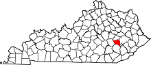 | |
| Unincorporated communities |
| |
