Knox County, Kentucky
| Knox County, Kentucky | |
|---|---|
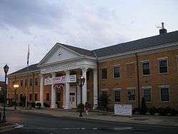 Knox County courthouse in Barbourville | |
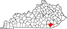 Location in the U.S. state of Kentucky | |
 Kentucky's location in the U.S. | |
| Founded | December 19, 1799 |
| Named for | Henry Knox |
| Seat | Barbourville |
| Largest city | Barbourville |
| Area | |
| • Total | 388 sq mi (1,005 km2) |
| • Land | 386 sq mi (1,000 km2) |
| • Water | 1.5 sq mi (4 km2), 0.4% |
| Population | |
| • (2010) | 31,883 |
| • Density | 83/sq mi (32/km²) |
| Congressional district | 5th |
| Time zone | Eastern: UTC-5/-4 |
| Website |
www |
Knox County is a county located near the southeastern corner of the U.S. state of Kentucky. As of the 2010 census, the population was 31,883.[1] Its county seat is Barbourville.[2] The county is named for General Henry Knox.
Knox County is included in the London, KY Micropolitan Statistical Area.
It is one of the few coal-producing counties in Kentucky not to experience massive population loss.
History
Knox County was formed on December 19, 1799, from portions of Lincoln County.[3] It was named for Henry Knox, a general and the first United States Secretary of War.[4]
The Civil War Battle of Barbourville was fought on September 19, 1861, between 800 Confederate soldiers from General Felix Zollicoffer's command and 300 Union troops who attempted to defend the Union's Camp Dick Robinson. The Union men tore up the planks on the bridge in an attempt to keep the Confederates from crossing, but the more numerous Confederates succeeded anyway. They destroyed the camp and seized the arms and equipment it contained.
The present courthouse, completed in 1964, is the fifth courthouse to serve the county.[5]
Geography
According to the U.S. Census Bureau, the county has a total area of 388 square miles (1,000 km2), of which 386 square miles (1,000 km2) is land and 1.5 square miles (3.9 km2) (0.4%) is water.[6]
Adjacent counties
- Clay County (northeast)
- Bell County (southeast)
- Whitley County (southwest)
- Laurel County (northwest)
Demographics
| Historical population | |||
|---|---|---|---|
| Census | Pop. | %± | |
| 1810 | 5,875 | — | |
| 1820 | 3,661 | −37.7% | |
| 1830 | 4,315 | 17.9% | |
| 1840 | 5,722 | 32.6% | |
| 1850 | 7,050 | 23.2% | |
| 1860 | 7,707 | 9.3% | |
| 1870 | 8,294 | 7.6% | |
| 1880 | 10,587 | 27.6% | |
| 1890 | 13,762 | 30.0% | |
| 1900 | 17,372 | 26.2% | |
| 1910 | 22,116 | 27.3% | |
| 1920 | 24,172 | 9.3% | |
| 1930 | 26,266 | 8.7% | |
| 1940 | 31,029 | 18.1% | |
| 1950 | 30,409 | −2.0% | |
| 1960 | 25,258 | −16.9% | |
| 1970 | 23,689 | −6.2% | |
| 1980 | 30,239 | 27.6% | |
| 1990 | 29,676 | −1.9% | |
| 2000 | 31,795 | 7.1% | |
| 2010 | 31,883 | 0.3% | |
| Est. 2015 | 31,730 | [7] | −0.5% |
| U.S. Decennial Census[8] 1790-1960[9] 1900-1990[10] 1990-2000[11] 2010-2013[1] | |||
As of the census[12] of 2000, there were 31,795 people, 12,416 households, and 8,939 families residing in the county. The population density was 82 per square mile (32/km2). There were 13,999 housing units at an average density of 36 per square mile (14/km2). The racial makeup of the county was 97.84% White, 0.82% Black or African American, 0.25% Native American, 0.17% Asian, 0.02% Pacific Islander, 0.08% from other races, and 0.82% from two or more races. 0.57% of the population were Hispanic or Latino of any race.
There were 12,416 households out of which 34.40% had children under the age of 18 living with them, 54.30% were married couples living together, 13.60% had a female householder with no husband present, and 28.00% were non-families. 25.70% of all households were made up of individuals and 10.60% had someone living alone who was 65 years of age or older. The average household size was 2.51 and the average family size was 3.01.
In the county the population was spread out with 26.20% under the age of 18, 9.70% from 18 to 24, 28.10% from 25 to 44, 23.20% from 45 to 64, and 12.80% who were 65 years of age or older. The median age was 35 years. For every 100 females there were 92.90 males. For every 100 females age 18 and over, there were 88.70 males.
The median income for a household in the county was $18,294, and the median income for a family was $23,136. Males had a median income of $24,833 versus $18,390 for females. The per capita income for the county was $10,660. About 29.60% of families and 34.80% of the population were below the poverty line, including 42.40% of those under age 18 and 28.90% of those age 65 or over.
Politics
| Year | Republican | Democrat |
|---|---|---|
| 2016 | 82.29% 9,885 | 14.66% 1,761 |
| 2012 | 76.28% 8,467 | 22.38% 2,484 |
| 2008 | 71.56% 8,150 | 26.99% 3,074 |
| 2004 | 67.41% 8,108 | 31.78% 3,822 |
| 2000 | 61.13% 6,058 | 37.24% 3,690 |
Education
K–12
Three public school districts serve the county:
- Knox County Public Schools serves the entire county, including the cities of Barbourville and Corbin. The following are schools are funded by the Knox County Public School District (grades served in parentheses):
- Central Elementary (PS–6)
- Dewitt Elementary (PS–6)
- Flat Lick Elementary (PS–6)
- Girdler Elementary (PS–6)
- G.R. Hampton Elementary (PS–6)
- Jesse D. Lay Elementary (PS–6)
- Lynn Camp Elementary (PS–6)
- Knox County Middle School (7–8)
- Lynn Camp High School (7–12)
- Knox Appalachian School (5–12)
- Knox Central High School (9–12)
- Knox County Learning Academy (9–12)
- Barbourville Independent School District serves the city of Barbourville at a single campus with elementary and high school sections (PS–12).
- Corbin Independent School District serves the entire city of Corbin, making it one of the few districts in Kentucky whose boundaries cross county lines. The following are schools are funded by the Corbin Independent School School District (grades served in parentheses):
- Corbin Primary School (K–2)
- Corbin Elementary (3–4)
- Corbin Intermediate (5–6)
- Corbin Middle School (7–8)
- Corbin High School (9–12)
Higher education
Union College, a small Methodist-affiliated liberal arts college, is located in Barbourville.
Communities
- Artemus
- Barbourville (county seat)
- Corbin – (partly in Whitley County)
- Flatlick
- Gray
- North Corbin
- Woodbine
See also
References
- 1 2 "State & County QuickFacts". United States Census Bureau. Retrieved March 8, 2014.
- ↑ "Find a County". National Association of Counties. Retrieved 2011-06-07.
- ↑ "Knox County". The Kentucky Encyclopedia. 2000. Retrieved August 22, 2014.
- ↑ The Register of the Kentucky State Historical Society, Volume 1. Kentucky State Historical Society. 1903. p. 35.
- ↑ Hogan, Roseann Reinemuth (1992). Kentucky Ancestry: A Guide to Genealogical and Historical Research. Ancestry Publishing. p. 264. Retrieved 26 July 2013.
- ↑ "2010 Census Gazetteer Files". United States Census Bureau. August 22, 2012. Retrieved August 17, 2014.
- ↑ "County Totals Dataset: Population, Population Change and Estimated Components of Population Change: April 1, 2010 to July 1, 2015". Retrieved July 2, 2016.
- ↑ "U.S. Decennial Census". United States Census Bureau. Retrieved August 17, 2014.
- ↑ "Historical Census Browser". University of Virginia Library. Retrieved August 17, 2014.
- ↑ "Population of Counties by Decennial Census: 1900 to 1990". United States Census Bureau. Retrieved August 17, 2014.
- ↑ "Census 2000 PHC-T-4. Ranking Tables for Counties: 1990 and 2000" (PDF). United States Census Bureau. Retrieved August 17, 2014.
- ↑ "American FactFinder". United States Census Bureau. Retrieved 2008-01-31.
- ↑ "Dave Leip's Atlas of U.S. Presidential Elections". Retrieved 2016-05-08.
External links
- The Kentucky Highlands Project
- Bradley, Erwin S., Union College: A History, 1889-1954, Written in Commemoration of the Seventy-Fifth Anniversary of Its Founding (Barbourville, KY: Union College, 1954). Available online at: thttp://www.archive.org/details/unioncollege18791954brad
- Decker, Elmer, "Knox County Kentucky History," manuscript by a local attorney during the 1930s and 1940s, containing much in the way of raw historical facts as well as documents, available online on the Bell County [KY] Public Libraries website www.bellcountypubliclibraries.org/crm/ky/knox/decker.html
- Fetterman, John, Stinking Creek: The Portrait of a Small Mountain Community in Appalachia (E. P. Dutton, 1967; reprint, Plume, 1970). Also available online on the Bell County [KY] Public Libraries website. See: http://www.bellcountypubliclibraries.org/crm/ky/knox/Doc1.html
- Marigold, W. Gordon and Erwin S. Bradley, Union College, 1879-1979 (Barbourville, KY: Union College, 1979).
- Mills, Michael C., Barbourville and Knox County. Arcadia Publishing (August 2, 2000). Also available online at: http://www.arcadiapublishing.com/mm5/merchant.mvc?Screen=VPROD&Product_Code=9780738505855
- Mitchell, Charles Reed, ed., History and Families, Knox County, Kentucky, 1799-1994. With a History of Knox County, Kentucky by William Sherman Oxendine, Charles Reed Mitchell, and Ron Rosenstiel (Paducah, KY: Turner Pub. Co., 1994).
- Warren, King Solomon, History of Knox County, Kentucky (Barbourville, KY: Daniel Boone Festival, 1976).
Municipalities and communities of Knox County, Kentucky, United States | ||
|---|---|---|
| Cities | | |
| CDPs | ||
| Other unincorporated communities | ||
| Ghost towns | ||
| Footnotes | ‡This populated place also has portions in an adjacent county | |

Coordinates: 36°53′N 83°51′W / 36.89°N 83.85°W