Harrison County, Kentucky
| Harrison County, Kentucky | |
|---|---|
 Harrison County Courthouse in Cynthiana | |
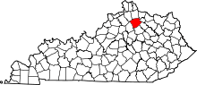 Location in the U.S. state of Kentucky | |
 Kentucky's location in the U.S. | |
| Founded | December 21, 1793 |
| Named for | Benjamin Harrison |
| Seat | Cynthiana |
| Largest city | Cynthiana |
| Area | |
| • Total | 310 sq mi (803 km2) |
| • Land | 306 sq mi (793 km2) |
| • Water | 3.5 sq mi (9 km2), 1.1% |
| Population | |
| • (2010) | 18,846 |
| • Density | 62/sq mi (24/km²) |
| Congressional districts | 4th, 6th |
| Time zone | Eastern: UTC-5/-4 |
| Website |
www />fiscalcourt |
Harrison County is a county located in the U.S. state of Kentucky. As of the 2010 census, the population was 18,846.[1] Its county seat is Cynthiana.[2] The county was founded in 1793 and named for Colonel Benjamin Harrison, an advocate for Kentucky statehood, framer of the Kentucky Constitution, and Kentucky legislator.
History
Harrison County was formed on December 21, 1793 from portions of Bourbon and Scott Counties.[3] Harrison was the 17th Kentucky county in order of formation.[4] It was named after Colonel Benjamin Harrison, an early settler in the area.[5] The First Battle of Cynthiana was on July 17, 1862, part of Col. John Hunt Morgan's First Kentucky Raid. Morgan's Last Kentucky Raid included on June 11–12, 1864 the Civil War Second Battle of Cynthiana which was fought near Keller's Bridge and the later site of Battle Grove Cemetery. On the first day, Confederate General John Hunt Morgan and his 1,200 Kentucky cavalrymen captured the town, making prisoners of its Union garrison and the entire 171st Ohio Infantry Regiment. Despite being low on ammunition, Morgan chose to stay and fight the enemy forces he knew were on their way. Union General Stephen G. Burbridge and his 2,400 cavalry and mounted infantry attacked him the next morning, driving the outnumbered Confederates from the town and freeing the prisoners.[6]
Geography
According to the U.S. Census Bureau, the county has a total area of 310 square miles (800 km2), of which 306 square miles (790 km2) is land and 3.5 square miles (9.1 km2) (1.1%) is water.[7]
Major highways
Adjacent counties
- Pendleton County (north)
- Bracken County (northeast)
- Robertson County (northeast)
- Nicholas County (southeast)
- Bourbon County (southeast)
- Scott County (southwest)
- Grant County (northwest)
Demographics
| Historical population | |||
|---|---|---|---|
| Census | Pop. | %± | |
| 1800 | 4,350 | — | |
| 1810 | 7,752 | 78.2% | |
| 1820 | 12,278 | 58.4% | |
| 1830 | 13,234 | 7.8% | |
| 1840 | 12,472 | −5.8% | |
| 1850 | 13,064 | 4.7% | |
| 1860 | 13,779 | 5.5% | |
| 1870 | 12,993 | −5.7% | |
| 1880 | 16,504 | 27.0% | |
| 1890 | 16,914 | 2.5% | |
| 1900 | 18,570 | 9.8% | |
| 1910 | 16,873 | −9.1% | |
| 1920 | 15,798 | −6.4% | |
| 1930 | 14,859 | −5.9% | |
| 1940 | 15,124 | 1.8% | |
| 1950 | 13,736 | −9.2% | |
| 1960 | 13,704 | −0.2% | |
| 1970 | 14,158 | 3.3% | |
| 1980 | 15,166 | 7.1% | |
| 1990 | 16,248 | 7.1% | |
| 2000 | 17,983 | 10.7% | |
| 2010 | 18,846 | 4.8% | |
| Est. 2015 | 18,763 | [8] | −0.4% |
| U.S. Decennial Census[9] 1790-1960[10] 1900-1990[11] 1990-2000[12] 2010-2013[1] | |||
As of the census[13] of 2000, there were 17,983 people, 7,012 households, and 5,062 families residing in the county. The population density was 58 per square mile (22/km2). There were 7,660 housing units at an average density of 25 per square mile (9.7/km2). The racial makeup of the county was 95.65% White, 2.52% Black or African American, 0.28% Native American, 0.13% Asian, 0.02% Pacific Islander, 0.63% from other races, and 0.77% from two or more races. 1.15% of the population were Hispanic or Latino of any race.
There were 7,012 households out of which 33.50% had children under the age of 18 living with them, 58.00% were married couples living together, 10.30% had a female householder with no husband present, and 27.80% were non-families. 24.00% of all households were made up of individuals and 11.20% had someone living alone who was 65 years of age or older. The average household size was 2.53 and the average family size was 2.99.
In the county the population was spread out with 25.00% under the age of 18, 8.20% from 18 to 24, 29.80% from 25 to 44, 23.60% from 45 to 64, and 13.40% who were 65 years of age or older. The median age was 37 years. For every 100 females there were 95.00 males. For every 100 females age 18 and over, there were 92.50 males.
The median income for a household in the county was $36,210, and the median income for a family was $42,065. Males had a median income of $31,045 versus $23,268 for females. The per capita income for the county was $17,478. About 9.40% of families and 12.00% of the population were below the poverty line, including 15.80% of those under age 18 and 10.70% of those age 65 or over.
Communities
Cities
Unincorporated communities
See also
- List of counties in Kentucky
- National Register of Historic Places listings in Harrison County, Kentucky
Further reading
- Kentucky Rebel Town: The Civil War Battles of Cynthiana and Harrison County by William A. Penn, 2016, University Press of Kentucky
References
- 1 2 "State & County QuickFacts". United States Census Bureau. Retrieved March 8, 2014.
- ↑ "Find a County". National Association of Counties. Retrieved 2011-06-07.
- ↑ "Harrison County". The Kentucky Encyclopedia. 2000. Retrieved August 22, 2014.
- ↑ Collins, Lewis (1882). Collins' Historical Sketches of Kentucky: History of Kentucky, Volume 2. Collins & Company. p. 26.
- ↑ Rennick, Robert M. (1987). Kentucky Place Names. University Press of Kentucky. p. 132. Retrieved 2013-04-28.
- ↑ Penn, William A. (2016). Kentucky Rebel Town: Civil War Battles of Cynthiana and Harrison County. Lexington, Ky.: U. Press of Kentucky. p. 105, 175, 193, 205. ISBN 9780813167718.
- ↑ "2010 Census Gazetteer Files". United States Census Bureau. August 22, 2012. Retrieved August 16, 2014.
- ↑ "County Totals Dataset: Population, Population Change and Estimated Components of Population Change: April 1, 2010 to July 1, 2015". Retrieved July 2, 2016.
- ↑ "U.S. Decennial Census". United States Census Bureau. Retrieved August 16, 2014.
- ↑ "Historical Census Browser". University of Virginia Library. Retrieved August 16, 2014.
- ↑ "Population of Counties by Decennial Census: 1900 to 1990". United States Census Bureau. Retrieved August 16, 2014.
- ↑ "Census 2000 PHC-T-4. Ranking Tables for Counties: 1990 and 2000" (PDF). United States Census Bureau. Retrieved August 16, 2014.
- ↑ "American FactFinder". United States Census Bureau. Retrieved 2008-01-31.
Municipalities and communities of Harrison County, Kentucky, United States | ||
|---|---|---|
| Cities | | |
| Unincorporated communities | ||
| Footnotes | ‡This populated place also has portions in an adjacent county or counties | |

Coordinates: 38°26′N 84°20′W / 38.44°N 84.33°W