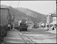
Evarts, Kentucky
| Evarts, Kentucky | |
|---|---|
| City | |
|
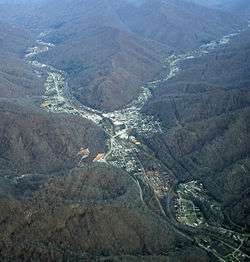
Evarts from the air | |
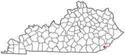 Location of Evarts, Kentucky | |
| Coordinates: 36°51′50″N 83°11′39″W / 36.86389°N 83.19417°WCoordinates: 36°51′50″N 83°11′39″W / 36.86389°N 83.19417°W | |
| Country | United States |
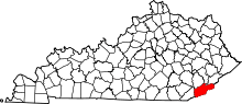
| State | Kentucky |
| County | Harlan |
| Incorporated | 1921 |
| Government | |
| • Type | Mayor-Council |
| • Mayor | Eddie Manning |
| Area | |
| • Total | 0.6 sq mi (1.6 km2) |
| • Land | 0.6 sq mi (1.6 km2) |
| • Water | 0.0 sq mi (0.0 km2) |
| Elevation | 1,575 ft (480 m) |
| Population (2000) | |
| • Total | 1,101 |
| • Density | 1,828.0/sq mi (705.8/km2) |
| Time zone | Eastern (EST) (UTC-5) |
| • Summer (DST) | EDT (UTC-4) |
| ZIP code | 40828 |
| Area code(s) | 606 |
| FIPS code | 21-25606 |
| GNIS feature ID | 0491839 |
| Website | evartskentucky.com |
Evarts is a 5th-class city in Harlan County, Kentucky, in the United States. The post office was opened on February 9, 1855, and named for one of the area's pioneer families.[1] The city was formally incorporated by the state assembly in 1921.[2] The population was 1,101 at the 2000 census and was 962 at the 2010 Census.
Geography
According to the United States Census Bureau, the city has a total area of 0.6 square miles (1.6 km2), all of it land.
Education
The city of Evarts is served by Harlan County Public Schools.[3] Most children residing in the city attend:
- Evarts Elementary School
- Black Mountain Elementary School
- Harlan County High School
Government
Evarts is controlled by a mayor-council form of government. The city's current mayor is Eddie Manning.[4] Previous mayor, Burl Fee, died on September 7, 2011.[5] Current members of the city council are: Jackie Renfro, Kevin Couch, Mike Napier, Charlie Couch, Shelly Shackleford, and Larry Caudill.[4] The representative body of the city is the city council.
Demographics
| Historical population | |||
|---|---|---|---|
| Census | Pop. | %± | |
| 1920 | 502 | — | |
| 1930 | 1,438 | 186.5% | |
| 1940 | 1,642 | 14.2% | |
| 1950 | 1,937 | 18.0% | |
| 1960 | 1,473 | −24.0% | |
| 1970 | 1,182 | −19.8% | |
| 1980 | 1,234 | 4.4% | |
| 1990 | 1,063 | −13.9% | |
| 2000 | 1,101 | 3.6% | |
| 2010 | 962 | −12.6% | |
| Est. 2015 | 925 | [6] | −3.8% |
As of the census[8] of 2000, there were 1,101 people, 428 households, and 299 families residing in the city. The population density was 1,828.0 people per square mile (708.5/km²). There were 490 housing units at an average density of 813.6 per square mile (315.3/km²). The racial makeup of the city was 94.91% White, 2.82% African American, 0.09% Native American, 0.09% Asian, 0.45% from other races, and 1.63% from two or more races. Hispanic or Latino of any race were 0.64% of the population.
There were 428 households out of which 31.1% had children under the age of 18 living with them, 50.7% were married couples living together, 15.9% had a female householder with no husband present, and 30.1% were non-families. 26.9% of all households were made up of individuals and 13.6% had someone living alone who was 65 years of age or older. The average household size was 2.57 and the average family size was 3.13.
In the city the population was spread out with 28.4% under the age of 18, 7.8% from 18 to 24, 26.4% from 25 to 44, 23.7% from 45 to 64, and 13.6% who were 65 years of age or older. The median age was 36 years. For every 100 females there were 92.1 males. For every 100 females age 18 and over, there were 85.0 males.
The median income for a household in the city was $17,963, and the median income for a family was $22,159. Males had a median income of $26,125 versus $18,125 for females. The per capita income for the city was $12,657. About 31.3% of families and 37.3% of the population were below the poverty line, including 52.7% of those under age 18 and 23.1% of those age 65 or over.
See also
References
- ↑ Rennick, Robert M. (1987). Kentucky Place Names. University Press of Kentucky. p. 96. Retrieved 2013-04-28.
- ↑ Commonwealth of Kentucky. Office of the Secretary of State. Land Office. "Evarts, Kentucky". Accessed 25 Jul 2013.
- ↑ Harlan County Public Schools - list of schools Retrieved on 2010-06-21
- 1 2 http://www.evartskentucky.com/about.html
- ↑ http://harlanobits.net/obituaries/burl-fee
- ↑ "Annual Estimates of the Resident Population for Incorporated Places: April 1, 2010 to July 1, 2015". Retrieved July 2, 2016.
- ↑ "Census of Population and Housing". Census.gov. Archived from the original on May 11, 2015. Retrieved June 4, 2015.
- ↑ "American FactFinder". United States Census Bureau. Archived from the original on September 11, 2013. Retrieved 2008-01-31.