Pippa Passes, Kentucky
| Pippa Passes, Kentucky | |
|---|---|
| City | |
|
Buildings on the Alice Lloyd campus | |
| Nickname(s): Caney, Caney Creek | |
 Location of Pippa Passes, Kentucky | |
| Coordinates: 37°20′5″N 82°52′32″W / 37.33472°N 82.87556°WCoordinates: 37°20′5″N 82°52′32″W / 37.33472°N 82.87556°W | |
| Country | United States |
| State | Kentucky |
| County | Knott |
| Incorporated | 1983[1] |
| Named for | a Robert Browning poem |
| Area | |
| • Total | 0.5 sq mi (1.4 km2) |
| • Land | 0.5 sq mi (1.4 km2) |
| • Water | 0.0 sq mi (0.0 km2) |
| Elevation | 991 ft (302 m) |
| Population (2010) | |
| • Total | 533 |
| • Density | 1,064.0/sq mi (380.0/km2) |
| Time zone | Eastern (EST) (UTC-5) |
| • Summer (DST) | EDT (UTC-4) |
| ZIP code | 41844 |
| Area code(s) | 606 |
| FIPS code | 21-61374 |
| GNIS feature ID | 0500757 |

Pippa Passes is a 6th-class city located along Caney Creek in Knott County, Kentucky, United States. Its formal name was chosen to honor benefactors of Alice Lloyd College but, after more than a century, its inhabitants still refer to the community as Caney or Caney Creek. The population was 533 at the time of the year 2010 U.S. Census.
History
The settlement was long known as "Caney" or "Caney Creek" when Alice Lloyd arrived from Boston in 1916. She solicited funds for the erection of a local post office and the establishment of Caney Creek Junior College, which were opened in 1917 and 1923 respectively. A donation from the Browning Society led to the post office's being named after Robert Browning's Pippa Passes, a verse drama which coined the phrase "God's in His heaven, all's right with the world".[2] (The U.S. Postal Service's preference for monogrammatic names meant, however, that the office was known as Pippapass until 1955.)[3]
The city of Pippa Passes was incorporated by the state assembly on July 1, 1983, and it is now governed by a mayor and city council.[4] As of 2009, the mayor is Scott Cornett, who is also baseball coach for the college.[5] The local police department operates as a combined unit with the college's security organization.[4]
Geography
Pippa Passes is at 37°20′5″N 82°52′32″W / 37.33472°N 82.87556°W (37.334629, -82.875490).[6] According to the United States Census Bureau, the city has a total area of 0.5 square miles (1.3 km2), all land.
Demographics
| Historical population | |||
|---|---|---|---|
| Census | Pop. | %± | |
| 1990 | 195 | — | |
| 2000 | 297 | 52.3% | |
| 2010 | 533 | 79.5% | |
| Est. 2015 | 643 | [7] | 20.6% |
As of the census[9] of 2000, there were 297 people, 48 households, and 30 families residing in the city. The population density was 557.3 per square mile (216.4/km²). There were 50 housing units at an average density of 93.8 per square mile (36.4/km²). The racial makeup of the city was 97.31% White, 0.34% African American, 0.34% Native American, 1.68% Asian, and 0.34% from two or more races.
There were 48 households out of which 39.6% had children under the age of 18 living with them, 60.4% were married couples living together, 2.1% had a female householder with no husband present, and 37.5% were non-families. 37.5% of all households were made up of individuals and 4.2% had someone living alone who was 65 years of age or older. The average household size was 2.54 and the average family size was 3.47.
In the city the population was spread out with 13.8% under the age of 18, 62.0% from 18 to 24, 12.8% from 25 to 44, 8.8% from 45 to 64, and 2.7% who were 65 years of age or older. The median age was 21 years. For every 100 females there were 24.3 males. For every 100 females age 18 and over, there were 17.4 males.
The median income for a household in the city was $36,250, and the median income for a family was $73,250. Males had a median income of $38,625 versus $25,500 for females. The per capita income for the city was $10,780. About 3.1% of families and 12.3% of the population were below the poverty line, including 28.6% of those under the age of eighteen and none of those sixty five or over.
References
- ↑ Commonwealth of Kentucky. Office of the Secretary of State. Land Office. "Pippa Passes, Kentucky". Accessed 27 September 2013.
- ↑ Rundquist, Thomas J. (1 August 2000). Substitute Teacher Survival Activities Vol 1. Nova Media Inc. p. 46. ISBN 978-1-884239-51-9.
- ↑ Rennick, Robert. Kentucky Place Names, p. 236. University Press of Kentucky (Lexington), 1987. Accessed 1 Aug 2013.
- 1 2 Alice Lloyd College. "Campus Safety". Accessed 27 June 2009.
- ↑ Kentucky League of Cities. "Pippa Passes". Accessed 30 March 2009.
- ↑ "US Gazetteer files: 2010, 2000, and 1990". United States Census Bureau. 2011-02-12. Retrieved 2011-04-23.
- ↑ "Annual Estimates of the Resident Population for Incorporated Places: April 1, 2010 to July 1, 2015". Retrieved July 2, 2016.
- ↑ "Census of Population and Housing". Census.gov. Archived from the original on May 11, 2015. Retrieved June 4, 2015.
- ↑ "American FactFinder". United States Census Bureau. Retrieved 2008-01-31.
Municipalities and communities of Knott County, Kentucky, United States | ||
|---|---|---|
| Cities | 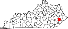 | |
| Unincorporated communities | ||