Scott County, Kentucky
| Scott County, Kentucky | |
|---|---|
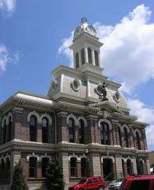 Scott County courthouse in Georgetown | |
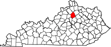 Location in the U.S. state of Kentucky | |
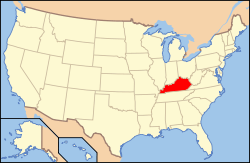 Kentucky's location in the U.S. | |
| Founded | 1792 |
| Named for | Charles Scott |
| Seat | Georgetown |
| Largest city | Georgetown |
| Area | |
| • Total | 285 sq mi (738 km2) |
| • Land | 282 sq mi (730 km2) |
| • Water | 3.7 sq mi (10 km2), 1.3% |
| Population (est.) | |
| • (2015) | 52,420 |
| • Density | 167/sq mi (64/km²) |
| Congressional district | 6th |
| Time zone | Eastern: UTC-5/-4 |
| Website |
www |
Scott is a county located in the U.S. state of Kentucky. As of the 2010 census, the population was 47,173.[1] Its county seat is Georgetown.[2]
Scott County is part of the Lexington–Fayette, KY Metropolitan Statistical Area.
History
Scott County was explored as early as 1774. One of the early settlers was John McClelland of Pennsylvania. The area became subject to hostile Indian attacks, and was abandoned by 1777.
In 1783, Robert Johnson established the first permanent settlement at Johnson's Station. In 1786, Maryland Catholics established the second parish in Kentucky at St. Francis, Kentucky.
Scott County was established in 1792 from land given by Woodford County.[3] It was one of the first counties created after Statehood. It was named for Revolutionary War hero, Gen. Charles Scott, who led the Kentucky Militia at the disastrous Battle of the Wabash in 1791.[4] Gen. Scott went on to the 1794 victory at the Battle of Fallen Timbers, and served as Governor from 1808 - 1812.
In 1825, the Choctaw Nation established the Choctaw Academy at Blue Spring in the county. They operated the school for Choctaw boys until 1842, when it closed. They transferred the staff and records to the Choctaw Nation, Indian Territory, where they had removed in the 1830s. There they founded the Spencer Academy in 1844 as the school for Choctaw boys and also founded a school for girls. Later in the nineteenth century, they accepted Baptist missionaries to found the Armstrong Academy.
On November 18, 1861, Scott County native George W. Johnson was elected provisional Confederate governor of Kentucky. In the American Civil War, Scott County furnished the Union army with 118 soldiers and the Confederacy with approximately 1,000.[5]
Scott County is a moist county, meaning that it is a dry country with a wet city (Georgetown) located within it.[6]
Geography
According to the U.S. Census Bureau, the county has a total area of 285 square miles (740 km2), of which 282 square miles (730 km2) is land and 3.7 square miles (9.6 km2) (1.3%) is water.[7]
Adjacent counties
- Grant County (north)
- Harrison County (northeast)
- Bourbon County (east)
- Fayette County (southeast)
- Woodford County (southwest)
- Franklin County (west)
- Owen County (northwest)
Demographics
| Historical population | |||
|---|---|---|---|
| Census | Pop. | %± | |
| 1800 | 8,007 | — | |
| 1810 | 12,419 | 55.1% | |
| 1820 | 14,219 | 14.5% | |
| 1830 | 14,677 | 3.2% | |
| 1840 | 13,668 | −6.9% | |
| 1850 | 14,946 | 9.4% | |
| 1860 | 14,417 | −3.5% | |
| 1870 | 11,607 | −19.5% | |
| 1880 | 14,965 | 28.9% | |
| 1890 | 16,546 | 10.6% | |
| 1900 | 18,076 | 9.2% | |
| 1910 | 16,956 | −6.2% | |
| 1920 | 15,318 | −9.7% | |
| 1930 | 14,400 | −6.0% | |
| 1940 | 14,314 | −0.6% | |
| 1950 | 15,141 | 5.8% | |
| 1960 | 15,376 | 1.6% | |
| 1970 | 17,948 | 16.7% | |
| 1980 | 21,813 | 21.5% | |
| 1990 | 23,867 | 9.4% | |
| 2000 | 33,061 | 38.5% | |
| 2010 | 47,173 | 42.7% | |
| Est. 2015 | 52,420 | [8] | 11.1% |
| U.S. Decennial Census[9] 1790-1960[10] 1900-1990[11] 1990-2000[12] 2010-2014[1] | |||
As of the census[13] of 2000, there were 33,061 people, 12,110 households, and 8,985 families residing in the county. The population density was 116 per square mile (45/km2). There were 12,977 housing units at an average density of 46 per square mile (18/km2). The racial makeup of the county was 91.94% White, 5.35% Black or African American, 0.26% Native American, 0.50% Asian, 0.01% Pacific Islander, 0.82% from other races, and 1.13% from two or more races. 1.61% of the population were Hispanic or Latino of any race.
There were 12,110 households out of which 38.50% had children under the age of 18 living with them, 58.80% were married couples living together, 11.50% had a female householder with no husband present, and 25.80% were non-families. 21.00% of all households were made up of individuals and 7.00% had someone living alone who was 65 years of age or older. The average household size was 2.61 and the average family size was 3.01.
In the county the population was spread out with 26.30% under the age of 18, 11.80% from 18 to 24, 32.60% from 25 to 44, 20.40% from 45 to 64, and 8.90% who were 65 years of age or older. The median age was 32 years. For every 100 females there were 95.80 males. For every 100 females age 18 and over, there were 90.70 males.
The median income for a household in the county was $47,081, and the median income for a family was $54,117. Males had a median income of $40,604 versus $25,767 for females. The per capita income for the county was $21,490. About 7.30% of families and 8.80% of the population were below the poverty line, including 11.00% of those under age 18 and 12.10% of those age 65 or over.
Communities
- Corinth
- Georgetown (county seat)
- Sadieville
- Stamping Ground
Notable people
- James C. C. Black - U.S. Representative from Georgia. Born in Stamping Ground.
- J. Campbell Cantrill - politician, U.S. Representative from Kentucky.
- Daniel Cook - First Attorney General of Illinois.
- Basil Duke - Confederate General, took part in Morgan's Raid. Brother-in-law of John Hunt Morgan.
- William H. Hatch - politician, U.S. Representative from Missouri.
- Henry P. Haun - politician, U.S. Senator from California.
- George W. Johnson - politician, 1st Confederate Governor of Kentucky, mortally wounded at the Battle of Shiloh.
- John T. Johnson - politician, U.S. Representative from Kentucky, brother of Richard M. Johnson.
- Richard M. Johnson - politician, Vice-President of the United States 1837-43.
- Tom L. Johnson - U.S. Representative from Ohio 1891-95, Mayor of Cleveland 1901-1909.
- John M. Palmer - Civil War general, Governor of Illinois 1869-1873, National Democratic Party presidential candidate 1896.
- James F. Robinson - politician, 22nd Governor of Kentucky. Was the federal governor during the Civil War. Cardome in Georgetown was his family home.
- John M. Robinson - politician, United States Senator from Illinois.
- Robert Ward Johnson - U.S. and Confederate senator from Arkansas. Nephew of Richard M. Johnson.
- Gustavus W. Smith - General in the Confederate Army during the Civil War, Confederate Secretary of War in 1862.
- Junius Ward - 19th century horseman and plantation owner, founder of Ward Hall.
- Edith Summers Kelley - Canadian author, wrote Weeds (1923), novel about "an artistic tomboy in the rural hills of Kentucky, who struggles unsuccessfully to overcome the oppressive roles assigned to her as a woman"[14]
See also
External links
References
- 1 2 "State & County QuickFacts". United States Census Bureau. Retrieved August 20, 2014.
- ↑ "Find a County". National Association of Counties. Retrieved 2011-06-07.
- ↑ Collins, Lewis (1882). Collins' Historical Sketches of Kentucky: History of Kentucky, Volume 2. Collins & Company. p. 26.
- ↑ The Register of the Kentucky State Historical Society, Volume 1. Kentucky State Historical Society. 1903. p. 37.
- ↑ http://www.scottky.com
- ↑ http://www.kentucky.com/news/local/counties/scott-county/article44370282.html
- ↑ "2010 Census Gazetteer Files". United States Census Bureau. August 22, 2012. Retrieved August 20, 2014.
- ↑ "County Totals Dataset: Population, Population Change and Estimated Components of Population Change: April 1, 2010 to July 1, 2015". Retrieved July 2, 2016.
- ↑ "U.S. Decennial Census". United States Census Bureau. Retrieved August 20, 2014.
- ↑ "Historical Census Browser". University of Virginia Library. Retrieved August 20, 2014.
- ↑ "Population of Counties by Decennial Census: 1900 to 1990". United States Census Bureau. Retrieved August 20, 2014.
- ↑ "Census 2000 PHC-T-4. Ranking Tables for Counties: 1990 and 2000" (PDF). United States Census Bureau. Retrieved April 2, 2015.
- ↑ "American FactFinder". United States Census Bureau. Retrieved 2008-01-31.
- ↑ Ballard, Sandra (2003). Listen Here: Women Writing in Appalachia. Lexington, KY: University Press of Kentucky. p. 320. ISBN 978-0-8131-9066-2.
Municipalities and communities of Scott County, Kentucky, United States | ||
|---|---|---|
| Cities | | |
| Other localities |
| |
| Footnotes | ‡This populated place also has portions in an adjacent county or counties | |
| Central city |  | |
|---|---|---|
| Municipalities with population over 10,000 | ||
| Municipalities with population 5,000-10,000 | ||
| Municipalities with population under 5,000 | ||
| Counties | ||

Coordinates: 38°18′N 84°35′W / 38.30°N 84.58°W